The Peralta Stone Maps, Real Maps to Lost Gold Mines or Cruel Hoax?

Do you think the Peralta stone maps are genuine, or fake?


  • Total voters
    121
G'morning Hiker join us in the patio for hot coffee? Most of the hunters are there. Unfortunately I must agree with you on the rock. Blow it up some 400% and it is apparent that it is a natural occurrence.

Most make the mistake of concentrating upon the immediate vicinity of a mark etc., but one has to view the overall pattern for small fractures, fissures, faults, stress cracks, colorations, etc., for a continuation of the entire pattern. In other words do not look at just the supposed mark or whatever, but the entire background.

I would say that about 99 9/10 of the pictures of marks, animals, figures, crosses, etc., posted in TN are natural. A sort of a glorified series of Rorschach charts.

Don Jose de La Mancha ( el kill joy just trying to help)
 

Don Jose,

You are correct. Over the years, I have seen many crosses, faces, hearts......etc.

On Wayne's cross, I noticed another straight line lower down on the cross. It's almost an exact parallel to the upper cross bar.

Take care,

Joe
 

Wayne I think Toms map copy was part of the holly stone issue

Never did see that gal at the shindig, did we.
Didn't hear any more about the purple rocks, either.
Got all built up....only to be let down again.
 

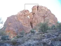
that rock face (center right in photo) how big is that?
could it be rolled over?
natch:
I can't make out any "faces", but if it's a rock or boulder of reasonable size, it can probably be rolled over.

" Unfortunately I must agree with you on the rock. Blow it up some 400% and it is apparent that it is a natural occurrence. "

Don Jose:
Au contrair, oh "kill joy" wannabe.
I haven't found it to be "unfortunate" at all.
Even at 400% of the real deal.
Perhaps it is so for those who assume the stones represent a top-down view of the peaks and passes, canyons and drainages of a mountain range, interspersed with coded man-made markings showing the relative locations of valuable mines once worked by Spanish or Mexican peons.Especially for those who believe they incorporate some form of `kings code` or other fanciful directions to treasure vaults or "depositories".
While there may actually be some item or items of value to be found within the boundaries shown, there is nothing on the stones themselves to indicate what it may be,if anything at all, or where it might be concealed. Or any mark which identifies the artist.

.... So what do we make of that ? ....

"I would say that about 99 9/10 of the pictures of marks, animals, figures, crosses, etc., posted in TN are natural. A sort of a glorified series of Rorschach charts."

"You are correct. Over the years, I have seen many crosses, faces, hearts......etc. "


Joe&Joe:
Been saying the same for years. And I would think that most who have followed our conversations would agree. I also suspect whoever it was who made those stones took note as well. He didn't have to make his own marks...or very few.

Regards:Wayne
 

Last edited:
Here's a shot of a small part of the area where many of my ( stone map ) photos were taken.
From a position which I believe to be at the lower-left corner of the bottom trail map, this is what is visible.
The white cross in my previous photo is located on the flat area above the three boulders, but not visible from this position.
There is, however, a bracketed cross which is visible above the boulder with the two vertical lines.
Although in this photo it seems to be facing the wrong way, it is at a slight angle as is the marking on the map stone.
The reverse side of the bottom trail map has the three letters "DON", but they are upside-down when the map stone is upright.
This positions the "D" opposite the "marker" with the two vertical lines. Was this done on purpose ?
Does the other large "D"-shaped boulder have some connection to the "D" of the "DON" ?

Regards:SH.
 

Attachments

  • 100_1112 cr.png
    100_1112 cr.png
    426.4 KB · Views: 259
Another which shows the "MEX" from the Priest Stone, and likely the "1" and the "hole" as positioned on the upper Trail map.
This particular hole also seems to match, due to other markings not visible in this crop, the location of the hole which can be seen in the "Bumper Photo", but not in the lower Trail Stone at the museum.
The "Priest " in the field also happens to be facing what is in this photo.
I also spent some time standing on the rocks over the "MEX", looking for something beginning with an "S".
Because of the "SONORA" on the Priest Stone, which is above the "MEX", and because the small "S" and "M" on the Horse Map under "DEL RIO" also match this location in the field.
This is what I found.
I don't know if it says Sonora...but the "S" is easy to see in this photo.And it's in the exact position shown on the H/S, relative to the "M".

Regards:SH.
 

Attachments

  • 100_1164cr.png
    100_1164cr.png
    422.3 KB · Views: 303
  • Sonora cr.png
    Sonora cr.png
    305.2 KB · Views: 241
Last edited:
There are many faces in the rocks.
But it's unusual to find them in pairs.
The one on the right looks down on Tom Kollenborn's "monumented trail".
The other does as well,but also looks towards a view similar to that on the Map Cross.
More than a few have noticed these views, and included this area in their search.


two faces.pngSC view.png

Regards:SH.
 

Last edited:
A closer look at the one on the right.
 

Attachments

  • Tom K indian head2.png
    Tom K indian head2.png
    370 KB · Views: 239
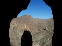
Just below the face(s) in the previous shot, is a cluster of shallow caves and a natural arch.
This photo is a view through the arch, and a few will recognize the background I'm sure.
Down to the right is a large spire of rock, of which an old photo has been published previously by Roger N.
Peters Canyon Needle

Regards:SH.

100_1270sm.png
 

Last edited:
G'morning Wayne, coffee? You posted --> e&Joe:
Been saying the same for years. And I would think that most who have followed our conversations would agree. I also suspect whoever it was who made those stones took note as well. He didn't have to make his own marks...or very few
**********************

I thoroughly agree Wayne, the map maker could easily take advantage of perceived natural occurrences for his map.


Don Jose de La Mancha
 

G'morning Wayne, not wanting to be a kill joy, but I will suggest a few possibilities of that being a natural occurrence .

If you notice the area above is a natural catch basin for rain. The exit flow is directly above your point of interest. As the water flows through the area it apparently picks up a load of dark minerals, and as it exits out over the cliff, some apparently follows a faulting to the left, hence depositing a wide film of the dark mineral vertically over your suspected area. As it flows down over the cliff , some is deposited in what ever faulting or cracks forming interesting designs, especially any horizontal fissures or cracks, of which there are various.

In any event, whether man or nature made, it could serve as an excellent point of reference on a map.


Don Jose de La Mancha


Sheesh Wayne, you do have some interesting pictures. The shadow looking through the hole, is extremely interesting. The tip of the shadow could indicate a further sign or point, depending upon time of day and day of the year.

Don Jose de La Mancha


Last cave photo looks like a gun sight reversed. The two knobs on the of the mountain is the rear sight.
Or the 2 knobs look like pointy boobs of a woman laying on the mountain top.
Guess it depends what your thinking about at the time
Remember Wayne there is nothing else to do up there in the far north.
 

The only pointy things I pay much heed to out there, are the ones I have to pull from my old carcass.
And if it's a gunsite, I'm probably looking at the wrong end.
 

G'morning Wayne, not wanting to be a kill joy, but I will suggest a few possibilities of that being a natural occurrence .

If you notice the area above is a natural catch basin for rain. The exit flow is directly above your point of interest. As the water flows through the area it apparently picks up a load of dark minerals, and as it exits out over the cliff, some apparently follows a faulting to the left, hence depositing a wide film of the dark mineral vertically over your suspected area. As it flows down over the cliff , some is deposited in what ever faulting or cracks forming interesting designs, especially any horizontal fissures or cracks, of which there are various.

In any event, whether man or nature made, it could serve as an excellent point of reference on a map.


Don Jose de La Mancha

Hardly a kill joy RT., when your astute observations duplicate my own.
While it's possible for some of the things I have found to have undergone some form of modification, it seems more likely that the majority of the markings on the Stone Maps and Crosses are the man-made versions of what can be seen in the area.

Regards:SH.
 

Last edited:
G'morning Wayne, Strong trail coffee this morning. (*****), You posted a very accurate and pertinant point --> " seems more likely that the majority of the markings on the Stone Maps and Crosses are the man-made versions of what can be seen in the area. "

Don Jose de La Mancha
 

Hi my friend, I can see some markings but I'm not sure if they are real.remember that erosion. Can make markings lighter.look at the picture with the large black spot on the cliff. Now just to the right there is a heart that is gigantic and the tip points down to the big gap between giant boulder.there are bushes or a tree there.look behind the tree it looks like a black line marking in you can see like the left top corner of of a rectangle.
Also always look at trees on the hill areas that tree is really dark green which tells me there is a good source of water.now look at the left top curve of the heart it looks like two large numbers marked in black a 4 and an 8.take care
 

The Peralta Mine/lost Dutchmen Mine found by MoonGod
In 2001, my Father and I travel from the Peralta’s Priest rock formation (1) that faces East South, I traveled in this direction than I climb over a boulder that’s on the trail that curves to the right, (I can’t go around the boulder because of the rocky terrain on the right side that drop at a shape angle and full of bushes which make it a very dangerous terrain) and continues to travel down at a right flank angle to the face of the rock you can see were the stairway where and since they been chiseled off you now have to climb on you (my) belly up to the entrance of the Cave/ Peralta Aztec treasure storage house I been there 3 times 2001,03,05).

I Joe M. Munoz, been sharing w/Phil Reinheardt since Jan or Feb 2012 by phone and email the location to the peralta 1847 mine and my notes to the meaning of the stone maps. since 10/1/12 he's been looking for the mine, than on 12/5/12 He has comfirmed my location to the site of the 1847 mine.

I am looking for Partners w/funds if ur interested please contact me @ [email protected]
 

Top Member Reactions

Users who are viewing this thread

Back
Top