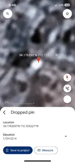
Map Dowsing Request For Large Gold Mining Claim

Found it on their website called "Tongue Nugget" weight 2 lbs.
 

Got some action 1st map between Stanton Cemetary and Stanton. Multiple places on 2nd (might be I checked more on it).
 

Got some action 1st map between Stanton Cemetary and Stanton. Multiple places on 2nd (might be I checked more on it).
The 2nd map is a close up of my claim. You can also see the patented “Lucky Johnnie & Katie” claim just West of my 120 acres. That guy has a mineshaft that produces well and supposedly goes under the northern part of my claim
 

The 2nd map is a close up of my claim. You can also see the patented “Lucky Johnnie & Katie” claim just West of my 120 acres. That guy has a mineshaft that produces well and supposedly goes under the northern part of my claim
Here’s the official map or plat from Yavapai County that shows the patented claims, I’ve circled the general area of my 120 acre unpatented claim
IMG_4208.jpeg
 

I got tired of marking spots 2nd map, so had to stop. Probably will need to zoom in more for the important places.

IMG_4168-claim_LDMA_1.jpg
 

Map dowse didn't include checking for mine shafts (but could). Normally I will use white to mark them.
 

On a quick check, picked up either a shaft or digging west of yellow bottom area, east near top.
 

I got tired of marking spots 2nd map, so had to stop. Probably will need to zoom in more for the important places.

View attachment 2159399
Wow Red, holy cow! I’m going to cross reference your hits with a topo map and geological report and see what matches up with what’s already been discovered and/or drilled. This is a great start and if something comes of it through sampling and testing, we can work it out. I’ll be sure to compensate you.
 

On a quick check, picked up either a shaft or digging west of yellow bottom area, east near top.
Any idea if the hits you marked yellow on the map are gold ore veins or nuggets or any other mineral? The claim was tied up for over 40 years without any development or production. It was just used as a piece of land for LDMA club members to go metal detecting on. I know there is a Tungsten occurrence on the claim that was documented and dug on but not worked extensively.

Also, there are some old threads about some guy who was pulling out pounds and pounds of incredibly rich galena ore somewhere on the east boundary of the claim or just over the east boundary into the next claim. He wasn’t supposed to be there but nobody stopped him for years. I’d like to find where he was digging
 

Last edited:
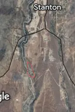
The last time I was there, heading past Stanton towards the Hassayampa I stopped and dowsed down toward Antelope creek, using Gold, I signaled 1 strong target down in the creek. Someone was drywashing near my target, so I planned to return, but haven't made it yet. I marked in red, where I dowsed it. The area is large boulders, I assume I signaled a boulder, rather than an ore vein. I didn't turn and dowse towards rich hill..
 

Attachments

  • Screenshot_20240717_222238_Gallery.jpg
    Screenshot_20240717_222238_Gallery.jpg
    87.4 KB · Views: 14
The last time I was there, heading past Stanton towards the Hassayampa I stopped and dowsed down toward Antelope creek, using Gold, I signaled 1 strong target down in the creek. Someone was drywashing near my target, so I planned to return, but haven't made it yet. I marked in red, where I dowsed it. The area is large boulders, I assume I signaled a boulder, rather than an ore vein. I didn't turn and dowse towards rich hill..
Yeah that’s still relatively pretty far away from my claim. I don’t have access to any land on the alluvial delta south of stanton or weaver/octave
 

On a quick check, picked up either a shaft or digging west of yellow bottom area, east near top.
Any idea if the hits you marked yellow on the map are gold ore veins or nuggets or any other mineral? The claim was tied up for over 40 years without any development or production. It was just used as a piece of land for LDMA club members to go metal detecting on. I know there is a Tungsten occurrence on the claim that was documented and dug on but not worked extensively.

Also, there are some old threads about some guy who was pulling out pounds and pounds of incredibly rich galena ore somewhere on the east boundary of the claim or just over the east boundary into the next claim. He wasn’t supposed to be there but nobody stopped him for years. I’d like to find where he was digging


On gold claims, normally I will start checking for veins and deeper alluvial deposits, which are marked by yellow or gold squares/rectangles. Circles represent an alluvial search more focused on surface deposits but can be deeper. If searching for other minerals the color will be red. That could be squares/rectangle or solid filled circles. White solid filled circles or squares for deep hole excavations and shafts.

Once at a LDMA outing in the report, one of the members said, "there's been no gold in Antelope Creek since the gold rush days". The guy in charge of outings tried really hard and finally found a picker. I probably need to get in much closer for a good alluvia surface dowse. Then much of the gold could be in rocks, you would just need to check it out.
 

Last edited:
It might be old diggings, a shaft (if there is one) should be shown on old topo maps.

IMG_4168-claim_LDMA_2.jpg
 

I pick the white color from the red end of color pallette, some browsers may show a slight tint.
 

Check this out, definitely some gold between top right corner and bottom left corner of the square.

IMG_4148-LDMA-B1.jpg
 

s more alluvial, going to stop so not too many places marked.

IMG_4148-LDMA-B2.jpg
 

not yet at least…
that’s about to change as of tonight 😈

The 2nd map is a close up of my claim. You can also see the patented “Lucky Johnnie & Katie” claim just West of my 120 acres. That guy has a mineshaft that produces well and supposedly goes under the northern part of my claim
 

Attachments

  • IMG_5996.png
    IMG_5996.png
    782.7 KB · Views: 10
  • IMG_5993.png
    IMG_5993.png
    763.7 KB · Views: 8
  • IMG_5995.png
    IMG_5995.png
    699.2 KB · Views: 9
  • IMG_5992.png
    IMG_5992.png
    697.9 KB · Views: 9
  • IMG_5994.png
    IMG_5994.png
    749.1 KB · Views: 10
  • IMG_5993.png
    IMG_5993.png
    763.7 KB · Views: 10
  • IMG_5992.png
    IMG_5992.png
    697.9 KB · Views: 11
  • IMG_5991.png
    IMG_5991.png
    676.6 KB · Views: 10

Top Member Reactions

Users who are viewing this thread

Back
Top