Blindbowman
Bronze Member
- Joined
- Aug 15, 2007
- Messages
- 2,068
- Reaction score
- 1,005
- Golden Thread
- 0
- Primary Interest:
- All Treasure Hunting
JackH said:EE THr said:Joe---
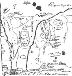
I know you posted your map, and it was plain as day. Except it was too small to see much except the trail alignment (for me, anyway), which looked exact.
And you said in the text that certain other stuff matched up, but I couldn't really see the landmarks matching the squiggles on the map. And I saw the lines you drew, but I didn't catch-on that they represented lines between the holes, and I didn't really try to figure it out, again because the map was small. So I just took your word for it.
So, as it stands right now, the figures and marks on the trail maps don't seem to match anything I've ever seen on a map. It just looks like a bunch of, like I said, squiggles. I mean the creeks or canyons seem to go West to East, even. But they actually mostly go Northernly-ish to Southernly-ish, except for Tortilla Creek.
But I did have a couple things right! I said that you had the trail matched up. And I said that if a few landmarks could be identified, then some sense might be made of it. And you said the holes matched, so that could qualify as my "few landmarks" reckoning. Heh-heh.
I'm glad it came up though, because I don't think I've heard that detailed a version of step-by-step how you came to realize what it represented. So thanks for that.
Have a good one,
Don

Don,
Most all those little squiggles are only there to confuse the holder, unless you have deeper knowledge. I have purposely left out 2 references so that those who are 'Locked On' will find them for themselves, and conclude that it is Red Mountain.......Jack
sorry jack ,wrong answer ..


 I have studied and followed every piece of information on Jacob Waltz for many years. I have read every book you can think of and been intrigued about this legend since I was about 6.


