Gentlemen,
I will be happy to show anyone who makes it to the Rendezvous, how exact the Stone Maps are. If you can read a topographic map, and still think the western end of the mountains is not where the maps are drawn from, you may have a vision problem.
You can surmise that they may show another location all you want, but I only ask that you show me such a match. That seems reasonable to me, but then nothing reasonable is ever applied to the maps.
The Priest/Horse map is very suspect, in my mind. In addition to the fact that they publicly came out of the woodwork.......after the fact, so to speak, but the "R" that you speak of seems to be done in the same manner as the zero's that were added by Travis, suggesting that it may have been added after the original carving was done.
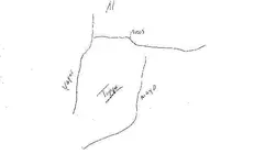
While the Stone Maps may have some kind of convoluted code, pointing out real treasure/mine location(s), they are still a simple topographic map. They were drawn from high points in the mountains, but the map showing the trail into the mountains and over the
loftiest ridge was drawn from Superstition Peak.
Any code has to be worked from the trail maps. Nothing else is logical. Why create a map of the western end of the range, if the object of interest is somewhere else, not showing or having anything to do with the topography of the maps.

That just gets a bit too convoluted for this poor mind to grasp.
Take care,
Joe Ribaudo


")
