markmar,
I am the first to admit I am terrible with treasure maps and leave their interpretations up to those who know what they are doing like yourself.
The thing that struck me about the Das Luca / Jean Paul Gagne Jesuit map(s) was the lower right hand corner. An arrow points directly to Queen Creek and that exact place where the arrow points is the place on Queen Creek where Travis Tumlinson found the "Peralta" Stone Maps. So in my mind the Peralta Stone Maps and this Jesuit Map has to be somehow related. Hewitt canyon is marked on the Jesuit Map and this was a starting point for searches by Travis Tumlinson and Clarence Mitchell.
Hewitt Canyon, Rogers canyon and Roger's trough didn't come into existence until about 1874. All three are marked on the Jesuit Map so we can accurately date the Jesuit Map(s) as being 1870's vintage or a little later.
The $100,000 dollar question is which maps came first, Stone Maps or Jesuit Maps or did they both originate at the same time?
I would guess that the Jesuit Maps were drawn after the Peralta Stone Maps but for what purpose I'm not certain. Again I am a poor authority on treasure maps of any form. I would be one of the last people to ask my opinion.
View attachment 1486954
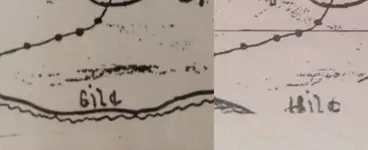
Jesuit Treasure map segment showing Queen Creek with the arrow (in RED) pointing to the place where the Peralta Stone Maps were discovered. Hewitt Canyon and the Rogers area also marked on the Jesuit Map.
Matthew


") "A horse is a horse of course of course...And no one can talk to a horse of course
"A horse is a horse of course of course...And no one can talk to a horse of course "
"

.webp")

