The "Peralta" Stone Maps --- On Their Own

Springfield,
Your posts are always well written and intelligent. Yes, they would have followed the Salt at constant risk. The trail from Zuni must have already been old when the first Europeans followed it. As an escape route ahead of an American invasion, it seems practical.


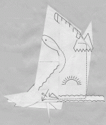
The horse, in this system of treasure symbols, represents a "journey". This might be a physical or even a spiritual journey, or both. The journey from Santa Fe to the Superstitions, the journey that may or may not support somehikers theory, I believe begins at Nuestra Senora de la Asuncion de Zia. There is more than the obvious connection to this place and the person who carved the stone.


"The mission at Zia is dedicated to Nuestra Senora de la Asuncion (a celebration of the Assumption to Heaven of the mother of Jesus). The convento was operational early on, for it was there, in 1614, that the excommunicated governer Peralta was kept imprioned by Fray Estevan de Perea."


H. Koening


Last edited:
Hal

I believe the route from Santae Fe was in El Camino Real de Tierra Adentro and turn to Tucson in Apache Pass Trail ...
Marius

That's viable and also a well-known route. The biggest downside would have been the Apaches. The Zuni may have been volatile and moody, but the Apaches west of the Rio Grande in the Gila headwaters country were outright murderous, especially towards Mexicans - all the time.

Another point: by this late date (1846/47), it seems to me we would have heard some account of such a significant well-armed passage. No mention of it in Santa Fe, Chihuahua, Apache or Zuni lore, even US military accounts, that I know of. Seems like somebody would have commented. This makes the trip questionable in my mind, but possible.
 

Hal:

I was not surprised when I saw the photo you posted a few days ago, and I expected a few would pay a visit to the area NW of the Tortilla Heart once I had posted that shot. I myself, intend to do some more looking around up there when I get a chance. I'd like to see the volcanic vent mentioned in the report, which I didn't know about two years ago. I posted another clenched fist, almost identical but smaller, a few years ago. As a Mayan glyph, this depiction of a closed fish is a sign of ownership, and a "name" glyph of the owner usually was included.
If it were to appear on a map, with the same appearance and alignment, I would certainly be looking for other matching details in the immediate area.
There is at least one other old mission in New Mexico with horses on it's facade.The mission at San Felipe Pueblo has them as well.May be more modern additions, though.Horses were more important, and sometimes incorporated in religious art. Although I know none of these were the model for the Stone Map Horse, I can't say the maker did not have them in mind at the time.

San Felipe

View attachment san felipe.bmp

Fresco Canyon is probably one which is cooler, with plenty of shade and good water...or...it's the one with the "fresco(s)" or a mural of some kind. Several have been suggested, including Fish Creek Canyon, the lower area of which is rather pleasant to travel through.

"Your theory regarding "who" is supported to some degree with published maps, markmar makes an important point. But your discovery location (and I am only guessing) seems to contradict these same maps. How do you reconcile that? I am not saying that you are wrong, only that this needs to be explained. That is, if the assumption is correct and if you feel inclined to do so. "

For my area, "El Norte Del Rio" is descriptive enough.
It's north of the Gila, a demarcation line when the stone maps were crafted, and well known to the maker, IMO.
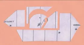
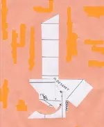
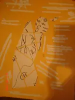
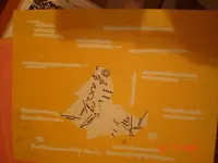
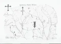
My own determination is that there is no river, or even any creek shown upon the stones.None of the lines represent canyons, and only a couple of individual markings, unconnected to other lines, may represent major landmarks.There doesn't appear to be any direct connection or correlation to any other published map which I can find, so there simply are contradictions for me.
Insofar as pareidolia....shadow signs and other illusions are concerned. Nothing in the field requires anything more than daylight to see.
While the details I've posted in my photos may require a high degree of visual acuity, not to mention a bit of hiking and climbing to see,
they do not depend upon season,solar angle,celestial knowledge, or even time of day.

Many of the "detail" photos I have posted recently are crops of very small parts of larger high res photos which include most of the area shown on the stones.
In some cases they have been things I hadn't noticed when I shot the original at distance, but show up when I zoom in on the photo at the places where these details are carved into the stones.
That is why they appear so pixilated. Where and when I can I will post better shots, including additional photos taken from other positions.
Keeping in mind that the stones are two-dimensional depictions of a three dimensional area, along with the possibility that time has altered them to some degree,there may be some differences in what we see today, compared to what the maker could see in his day.


Regards:SH
 

somehiker,
Actually, my comments about pareidolia were not directed at you, which is why I spaced it in the post. The concern I have with what you are presenting is the resolution of your images, images which are critical to your theory. What you are describing is just not obvious enough in the photographs to make a judgement call. For me.

As I have said before, everything is open to interpretation. Even my post about the Zia Mission needs to be questioned. Here, Peralta is imprisoned in Sandia Pueblo:

"Knowing the influence of the church, Peralta was unwilling to trust most of the colonists. So, he gathered only a few supporters, and in August 1613, he made a desperate attempt to reach Mexico City. Word of the governor’s flight reached Friar Ordóñez at Santo Domingo, and shortly after midnight on August 11, Ordóñez and his party left in pursuit of the governor. Peralta and his party had not gone far when, on the night of August 12, Ordóñez and his party overtook them. Ordóñez arrested the governor and imprisoned him at Sandia. The Governor of New Mexico was held in chains for eight months with little hope of being liberated."

New Mexico Office of the State Historian : A Colony in Transition 1580-1625
 

Your theory regarding "who" is supported to some degree with published maps, markmar makes an important point. But your discovery location (and I am only guessing) seems to contradict these same maps. How do you reconcile that? I am not saying that you are wrong, only that this needs to be explained. That is, if the assumption is correct and if you feel inclined to do so.

Your photographs are obviously too pixel-ed to form a conclusion either way. I am looking forward to one that leaves little room for doubt.

markmar,
What do you feel are the similarities in these maps by the three families? Thanks?
How would one have traveled from Santa Fe to Queens Creek in 1846? Which route?

Pareidolia... I have seen quite a few amazing examples of it in the Superstitions. One beautiful 60' tall carving of a Confucius like figure. But when the light shifts, the figure suddenly transforms back into a simple rock formation. In the canyons, this effect seems intensified by heat.

Here is a funny example of a fist overlooking Tortilla Flat.


Somehiker,

I have spent most of the day trying to determine the best way to explain your discovery location. I decided to add a few comments to what Hal had written above. The heart insert is cracked for a reason and I have a lightning bolt next to my heart at the R-rock. The caches within the depository area are protected by death traps as these symbols do attest.

We (my team) know that the group that designed the stone maps were not Mexicans and the Spanish were intentionally led away from the depository area. These people never cached anything where signs and symbols are present. We use a term describing this type of a discovery location as a "gopher cache." They intentionally left a number of gopher caches in the depository area to discourage folks from trying to steal their treasures. From our experiences they do have a small token cache for the finder if he lives to tell about it. IMHO you may be looking at such a cache.

I am in no way discouraging your intent to take down the wall for this is what they want you to do. I felt it was my duty to give you a "heads up" and at least let you know to be on your toes and be very aware of your environment. When you decide to undertake this project take at least four others with you that you can leave at some distance away from the work area. These people love to use explosives that will explode when the pressure is taken off of the firing mechanism. I have a good friend in Oklahoma who has a detector that can look in the ground and identify what type of explosives if any would be in the area. His services are expensive and we have used him on two gold and three silver stashes (KGC) here in Arizona. They are all rigged with kegs of gunpowder. We walked away from these targets for the time being but not because of the explosives.

Everybody... listen to me. Death is to be expected in this profession and I cannot stress this point enough. Some of you know certain individuals who have dealt with this very issue. Chuck Kenworthy wrote a book about death traps and had some of his own personal experiences during his search for treasure. Dying of thirst in the desert is a horrible way to go. Explosions will take you by surprise, its over in a split second.

Somehiker,

You are onto something, no doubt about it.

Good luck,

Ellie Baba
 

Wayne,

"My own determination is that there is no river, or even any creek shown upon the stones.None of the lines represent canyons, and only a couple of individual markings, unconnected to other lines, may represent major landmarks."

I assume you are not referring to the trail maps here, only the horse/priest stone.:dontknow:

Take care,

Joe
 

That's viable and also a well-known route. The biggest downside would have been the Apaches. The Zuni may have been volatile and moody, but the Apaches west of the Rio Grande in the Gila headwaters country were outright murderous, especially towards Mexicans - all the time.

Another point: by this late date (1846/47), it seems to me we would have heard some account of such a significant well-armed passage. No mention of it in Santa Fe, Chihuahua, Apache or Zuni lore, even US military accounts, that I know of. Seems like somebody would have commented. This makes the trip questionable in my mind, but possible.

I don't mind if Joe has any corrections to offer, as he has studied the Apache to a greater degree than I.
But I'm not sure that there would be any account of such a group passing through their territory, or even occupying an area within the sups for a period of time.
Two reasons come to mind.
That they were nomadic hunter gatherers, which means they would have had to be in the same area, at the same time as the caravan, and in sufficient numbers to have represented a real threat.Although they often "gathered" through raiding other tribes, spanish settlements and travellers, they also could be "bought off" through gifts or other forms of trade, especially if they were outnumbered and outgunned. Such episodes were less likely to be remembered or recorded IMHO.
So they may have slipped through unnoticed, or with so little fanfare that very few even knew they had passed.

Secondly, that once across the Salt River they could have entered an area within the sups where, with some care, even the Yavapai may not have known they were there, or were willing to leave them be, if they did know.

Regards:SH.
 

Last edited:
No need to worry about Wayne he can take care of himself. He has a safety net in Mesa just in case. Hal, Wayne's landmarks are on the money. Trust me on that one.
 

I don't mind if Joe has any corrections to offer, as he has studied the Apache to a greater degree than I.
But I'm not sure that there would be any account of such a group passing through their territory, or even occupying an area within the sups for a period of time.
Two reasons come to mind.
That they were nomadic hunter gatherers, which means they would have had to be in the same area, at the same time as the caravan, and in sufficient numbers to have represented a real threat.Although they often "gathered" through raiding other tribes, spanish settlements and travellers, they also could be "bought off" through gifts or other forms of trade, especially if they were outnumbered and outgunned. Such episodes were less likely to be remembered or recorded IMHO.
So they may have slipped through unnoticed, or with so little fanfare that very few even knew they had passed.

Secondly, that once across the Salt River they could have entered an area within the sups where, with some care, even the Yavapai may not have known they were there, or were willing to leave them be, if they did know.

Regards:SH.

Wayne,

In the era we are talking about, it is unlikely that the Apache were ever gathered inside the Superstitions in any sizable force.

The real question for me, is why you have avoided my question.

"I assume you are not referring to the trail maps here, only the horse/priest stone."
dontknow.gif


One other thing......I am not a big believer in "death traps", especially in the Supe's. Not saying it's not possible, just unlikely. On the other hand the entire range is a death trap.

Take care,

Joe
 

Last edited:
Wait'll ya see what's next Frank.
Won't need any toys, from the looks of things.
These guys were pretty smart, and inventive.
But what they made evidently couldn't last forever.
For me, it's gonna be a looong wait.

Best:Wayne
 

Wayne,

"My own determination is that there is no river, or even any creek shown upon the stones.None of the lines represent canyons, and only a couple of individual markings, unconnected to other lines, may represent major landmarks."

I assume you are not referring to the trail maps here, only the horse/priest stone.:dontknow:

Take care,

Joe

Been off site reading the news for a bit...no attempt to avoid your question.
Answer:
Wrong assumption,Joe.
I AM sharing my understanding of all FOUR pieces,including the Trail Stones.

"One other thing......I am not a big believer in "death traps", especially in the Supe's. Not saying it's not possible, just unlikely. On the other hand the entire range is a death trap."

Neither am I, but extra caution would be wise.
Like slow and careful, especially with regard to the way any rocks are piled or possibly balanced.
And respirator and latex gloves under leather gloves,etc. in case of arsenic powders.


Regards:Wayne
 

Last edited:
A Pyramid has 5 sides..........The fifth one is invisible. More code


All of these maps are designed to disassemble by drawing an X or a triangle thru them as one traces along key points to position the first cutting lines. Like money plates. Carbon stick and tracing paper. One would have to be sitting right on the mine for them to make any sense otherwise.
 

Attachments

  • FromtheLakesShoretotheKingsPeak.jpg
    FromtheLakesShoretotheKingsPeak.jpg
    27.3 KB · Views: 99
  • CrystalsbeforetheKingsPeak.jpg
    CrystalsbeforetheKingsPeak.jpg
    38.1 KB · Views: 108
  • Docu. St. 050.jpg
    Docu. St. 050.jpg
    264.1 KB · Views: 104
  • Docu. St. 052.jpg
    Docu. St. 052.jpg
    255.8 KB · Views: 121
  • Finally Assembly.jpg
    Finally Assembly.jpg
    23.7 KB · Views: 118
  • DragonsLair.gif
    DragonsLair.gif
    258.9 KB · Views: 105
  • DragonsLairStage2.gif
    DragonsLairStage2.gif
    215.7 KB · Views: 119
  • TheKnightinChrist.gif
    TheKnightinChrist.gif
    194.8 KB · Views: 103
  • TheKnightedOneStage2.gif
    TheKnightedOneStage2.gif
    245.2 KB · Views: 100
  • PADRES.jpg
    PADRES.jpg
    15.5 KB · Views: 132
  • PonyExpressSite.jpg
    PonyExpressSite.jpg
    78.8 KB · Views: 113
Last edited:
EB:

" I am in no way discouraging your intent to take down the wall for this is what they want you to do. I felt it was my duty to give you a "heads up" and at least let you know to be on your toes and be very aware of your environment. When you decide to undertake this project take at least four others with you that you can leave at some distance away from the work area."

Have no intention of breaking or blasting my way in to that hole.
Got a long close-up look at it last trip, and looking through the small holes at the top could see that the plug is thick.I couldn't see beyond, so I don't know what's there, if anything.
Neat thing was most of the rocks used have the pointed end outward, as though the wall was built by someone on the inside.
There's another opening I could see about 200 ft. away, on the opposite end of the same formation.
Might be the back door, cause it's up about 30 ft. higher, in the near side of a narrow cut, full of brush and cactus.
Gonna have to check it out.

Not too worried about kegs of gunpowder. But I keep my eyes open anyhow.
If I ever come across anything like that, I'll be sure to get some pics before I disarm it.:laughing7:
So far, nothing I have found had any protection other than being out of sight.

Regards:SH.
 

I have Ishmael Jones SD2000GPM with a 25" NF coil. Was his personal unit One nice cool day I may drive over and search the spots where it is said the stones were found. Who knows what may turn up. I know it's been searched a zillion times I'm sure. But not with the Jones.
I treat these things as I would a crime scene. Start a point A first.
 

It's a good place for arrowhead prospecting.
You might find a musket ball or two, if there was a skirmish there.
Check the dirt piles around the excavations....I can send you the co-ords if I can remember where I put them. Or Paul may still have them.
Whoever did the digging may have missed something. Especially at the holes along the bank.
I'll PM you something else to check out, when I have a chance tomorrow morning sometime.

Best:Wayne
 

Wayne I'm thinking something bigger. I'm good up to 12 ft with the unit. Something in Storms account interest me. Just maybe. Perhaps we can take a jaunt over there next time your out. At least it's flat.
 

Top Member Reactions

Users who are viewing this thread

Back
Top