Video 4 - The Peralta Stone Maps with Frank Augustine

My thoughts are, its a bad defensive position generally and especially for a covert activity. Works for hostile Indians, bushwhackers, modern era marauders, even nosey neighbors. The newer the era the better the equipment to view one's activity. If the objective is to secretly bury maps its logical you would want to do that as concealed from view as possible. Is it not true that you can be viewed for miles at this spot? If you spend hours digging a hole and burying objects its logical that anyone viewing that activity will wait for you to leave and immediately go dig up the objects if for nothing more than curiosity. Assuming they don't overpower you and kill you in the process as would have been likely in the early 1800s.

Just my thoughts, but if the objective is to hid something one would pick a concealed spot out of view.

My comments aren't to cut off discussion. Quite the contrary. I'd like to be convinced this spot has some redeeming feature that makes it the logical spot to bury the maps that would have insured their concealment and provided easily recognizable landmarks for others to follow and recover the relics. I'm just not seeing it..........yet.

Well put, along this line of thought was why I was earlier asking if the place they were allegedly buried was on the most direct route to safely escape the Superstition range if you were being pursued by people with hostile intentions since it seemed to be in such a wide open area.
 

That spot is next to the main drainage on the east side of the Superstitions. Hewitt Canyon road follows that drainage from Rodgers. You can still drive a wash into Hewitt Canyon. At one time that was the road. I drove it with Tom K a few days ago. So if your escaping down into and following Queen Creek out you come to the stone map site. From that view it's on top of a hill. You don't worry about them washing away in a flood. Queen Creek the main drainage on that side of the mountains does flood often. On reason you don't drive back there if there is a threat of rain.
 

My thoughts are, its a bad defensive position generally and especially for a covert activity. Works for hostile Indians, bushwhackers, modern era marauders, even nosey neighbors. The newer the era the better the equipment to view one's activity. If the objective is to secretly bury maps its logical you would want to do that as concealed from view as possible. Is it not true that you can be viewed for miles at this spot? If you spend hours digging a hole and burying objects its logical that anyone viewing that activity will wait for you to leave and immediately go dig up the objects if for nothing more than curiosity. Assuming they don't overpower you and kill you in the process as would have been likely in the early 1800s.

Just my thoughts, but if the objective is to hid something one would pick a concealed spot out of view.

My comments aren't to cut off discussion. Quite the contrary. I'd like to be convinced this spot has some redeeming feature that makes it the logical spot to bury the maps that would have insured their concealment and provided easily recognizable landmarks for others to follow and recover the relics. I'm just not seeing it..........yet.

I think the hallmark of first-rate research is foremost the ability to avoid falling into the assumption trap, the ability to see things, to draw connections, and most importantly the ability to adjust your theory or conclusion based on new evidence, a new line of thinking, or being presented with another perspective that sheds new light on something you've looked at, over and over again.

That being said, there are a number of assumptions being made about this site, that it is a deliberate burial site. Exactly what proves this? We are told that Travis stumbled upon this site. Exactly what proves this? If you look at his family history, his grandfather, "Peg Leg," and especially where he came from, you'll realize it was far from accident that Travis "stumbled" upon this area.

Along this line of thinking, just because most people refer to those artifacts by a particular name, refer to a specific century, or a specific group of people does not mean any of those are not general assumptions.
 

For the last week at least Frank,Ryan,Bill, and who knows who else has been out in that area digging,filming,walking around, tromping down brush,ect.
Not one person has called the law, or stopped and asked why or what they are doing.
So,it is easy to not be seen in the brush in broad daylight,or people just do not care just as they would have in the 1800,s.
Just an observation. I could go out there and dig all day and nobody would care or say anything.
If I where even seen. Just something to think about.
 

I went here and I hope it was correct.

Same place I went years ago.

Did you guys try a hammer and chisel or pick to see if the rock was easy to break in those holes?

Excellent work my Vid's were thrown together for immediate release but your right the first area is unfamiliar as it was not the correct area. Sometimes getting lost has benefits like the sign I found and the sandstone blocks.


View attachment 1171371 View attachment 1171381


Bill,

The areas you have squared off are def. the location where we filmed and the area that corresponds with the Tumlinson legend (for most people). I put a map of the area in this thread, along with a google earth image.
 

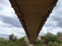
That's not true I was pulled over for being there once and told I could not park on the highway. I never dug there I didn't even have my Metal Detector or pick, shovel, etc. Everything I found was just like Travis with my eyes. One thing I did notice though is the road bed goes down quite a ways before the bridge so they moved about twenty or so feet of earth down right before the bridge or that thing would have been very high.

I don't know whether it would have an impact on the story the highway crew dug it up or not but it was a lot of excavation for the road bed.


For the last week at least Frank,Ryan,Bill, and who knows who else has been out in that area digging,filming,walking around, tromping down brush,ect.
Not one person has called the law, or stopped and asked why or what they are doing.
So,it is easy to not be seen in the brush in broad daylight,or people just do not care just as they would have in the 1800,s.
Just an observation. I could go out there and dig all day and nobody would care or say anything.
If I where even seen. Just something to think about.

I was confronted by a couple of guys on horseback who lease the property! They were very friendly and did not complain.
 

For the last week at least Frank,Ryan,Bill, and who knows who else has been out in that area digging,filming,walking around, tromping down brush,ect.
Not one person has called the law, or stopped and asked why or what they are doing.
So,it is easy to not be seen in the brush in broad daylight,or people just do not care just as they would have in the 1800,s.
Just an observation. I could go out there and dig all day and nobody would care or say anything.
If I where even seen. Just something to think about.

That's a valid observation Matt.
The area all along the top of the bank is sloped downward, making it difficult to see anyone gathered around the two deep holes to be seen from anywhere except out in the creek bed or on the opposite side of the creek. Even then it would be difficult to see what they would have been doing, because of the brush and mesquite etc.
Even out on the flatter area...towards the junction, it would be near impossible to see someone else unless you were within a hundred yards or so. And depending on the "when", the vegetation may have been different in the 1940's/1840's/1740's. A group camped out there could maintain security (during the day at least) by posting a sentry on the high hill just to the east.

Regards:SH.
 

Okay, This story has circulated on different forums but doesn't seem to get much traction. I've hesitated to bring it up here because I don't have a lot of detail to support or reject the story. Perhaps some of the locals who have access to the archives of the Phoenix Gazette can shed some light on the accuracy or lack there of on this story.

Supposedly in an article in the Phoenix Gazette circa 1880-1881 (unsure on exact year) there is mention of a Ramon Grijalva, a native of Altar, Mexico who then lived in Phoenix having made a trip back home to Altar Sonora. On his return to Phoenix he brought back stones (more than one, exact number unknown) with map carvings. The telling of the story implies the stones were recovered in Mexico but does not actually say that. Could have been brought back from anywhere. There is supposedly a follow up story in the 1930's where a Garcia Grijalva attributes the Ramon stones to the Peralta family.

Could these have been what we know as the Peralta Stone Maps??? Don't know. What became of these stones??? Don't know. Could Travis Tumlinson have acquired these stones from the Grijalva family? Don't know.
What is interesting is Ramon Grijalva (at least someone with that same name) was a neighbor and contemporary of Jacob Waltz. So I'm lead to believe, Ramon actually had a residence on a portion of the Waltz land. There was also a Gabrial Peralta living on Waltz land. There was inter-marriage between the Grijalva and Peralta families. Ancestry.com confirms this.

What are you guys thoughts on this story???
 

The Stones map leads to the Montezuma Mine in New Mexico...PERIOD!
 

Okay, This story has circulated on different forums but doesn't seem to get much traction. I've hesitated to bring it up here because I don't have a lot of detail to support or reject the story. Perhaps some of the locals who have access to the archives of the Phoenix Gazette can shed some light on the accuracy or lack there of on this story.

Supposedly in an article in the Phoenix Gazette circa 1880-1881 (unsure on exact year) there is mention of a Ramon Grijalva, a native of Altar, Mexico who then lived in Phoenix having made a trip back home to Altar Sonora. On his return to Phoenix he brought back stones (more than one, exact number unknown) with map carvings. The telling of the story implies the stones were recovered in Mexico but does not actually say that. Could have been brought back from anywhere. There is supposedly a follow up story in the 1930's where a Garcia Grijalva attributes the Ramon stones to the Peralta family.

Could these have been what we know as the Peralta Stone Maps??? Don't know. What became of these stones??? Don't know. Could Travis Tumlinson have acquired these stones from the Grijalva family? Don't know.

What is interesting is Ramon Grijalva (at least someone with that same name) was a neighbor and contemporary of Jacob Waltz. So I'm lead to believe, Ramon actually had a residence on a portion of the Waltz land. There was also a Gabrial Peralta living on Waltz land. There was inter-marriage between the Grijalva and Peralta families. Ancestry.com confirms this.

What are you guys thoughts on this story???

Hopefully someone can post the actual newspaper stories so we can discuss it - I'd rather see the full article before getting too into it
 

You where parked illegally on the highway. You drew suspicion immediately.
If you had pulled over into a more un-suspicious spot, or taken one of the 2 tracks from Camino veijo into the area, no one would have cared.
Nobody stopped Frank,Ryan, or myself.
I have been going in and out of all the washes in the QV, Superior area, with my wife, since I bought my first MD. Never have had anyone say anything.
Once, I had a NFS employee wave at me and my wife as we where driving out of a wash with my Md and some buckets of dirt.
All he did was wave. He was not coming out of that air conditioned jeep to even see what we where up to.
You where just in the wrong place at the wrong time.
But, you are correct in the fact that you where confronted.

That's not true I was pulled over for being there once and told I could not park on the highway. I never dug there I didn't even have my Metal Detector or pick, shovel, etc. Everything I found was just like Travis with my eyes. One thing I did notice though is the road bed goes down quite a ways before the bridge so they moved about twenty or so feet of earth down right before the bridge or that thing would have been very high.

I don't know whether it would have an impact on the story the highway crew dug it up or not but it was a lot of excavation for the road bed.
 

Yes, they where making sure you where all right.
Not to many people walking around the desert in this heat right now.
Except for us people where the heat and sun have already affected our brains.

I was confronted by a couple of guys on horseback who lease the property! They were very friendly and did not complain.
 

Okay, This story has circulated on different forums but doesn't seem to get much traction. I've hesitated to bring it up here because I don't have a lot of detail to support or reject the story. Perhaps some of the locals who have access to the archives of the Phoenix Gazette can shed some light on the accuracy or lack there of on this story.

Supposedly in an article in the Phoenix Gazette circa 1880-1881 (unsure on exact year) there is mention of a Ramon Grijalva, a native of Altar, Mexico who then lived in Phoenix having made a trip back home to Altar Sonora. On his return to Phoenix he brought back stones (more than one, exact number unknown) with map carvings. The telling of the story implies the stones were recovered in Mexico but does not actually say that. Could have been brought back from anywhere. There is supposedly a follow up story in the 1930's where a Garcia Grijalva attributes the Ramon stones to the Peralta family.

Greg Davis has a copy of the short article about Grijalva and the "stones" he was supposed to have brought back.

If you PM him, he would probably send it to you or post it here if he feels inclined.
 

Hopefully someone can post the actual newspaper stories so we can discuss it - I'd rather see the full article before getting too into it

Me Too Cubfan. The earliest on-line archive for the Phoenix Gazette is 1965. No help there. Its going to take someone physically going to where these newspaper records are archived and rolling film for 1880 and 1881 and the later article in 1930s to find. That's assuming an article does exist. Any locals interested in taking on this job? I'll pay a reasonable fee if someone has research credentials.

I didn't post who "supposedly" has copies of this. If I told you guys, your head would explode. I know mine did <g>.

Lynda
 

I will see where the articles would be at if they are close to where I work possibly I can.
I cant find a physical address yet.I will keep looking or call around on Monday
 

Last edited:
Started work on video 6 this evening - our follow up to the stone maps.

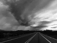
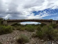
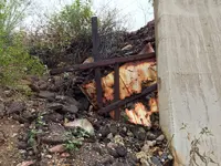
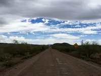
Went out to some sites after I was done with my "normal job" and took these. Got some luck with great clouds!


The large white building is the gas station that was put out of business when they slightly rerouted the 60.

The dirt road is the old section of el camino viejo.

The others are the "2nd" location that some folks believe the stone maps come from. These will all be in video 6. I left all the exif data on these images in case anyone wants to see where they are.
 

Attachments

  • image.jpg
    image.jpg
    842.4 KB · Views: 140
  • image.jpg
    image.jpg
    616.1 KB · Views: 98
  • image.jpg
    image.jpg
    1.1 MB · Views: 103
  • image.jpg
    image.jpg
    1.8 MB · Views: 116
  • image.jpg
    image.jpg
    944.9 KB · Views: 114

Top Member Reactions

Users who are viewing this thread

Latest Discussions

Back
Top