The Tumacacori Treasure Room and Mines

Most of these images are natural formations, So unless there is a map, that describes a face, then it probably is just a natural face in the rocks and nothing else.

I'm not sure why gollum would put these images on-line and not say why they are important to the tumacacori mine location. Perhaps he could let us know ?
 

Quinan Bear said:
Has the lost treasure been found in the Sierra Estrella Mountians yet ?

I believe so. There is a really old "Spanish" mine in those mountains that is being worked from what I understand.
 

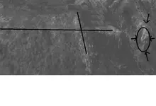
I thought that some of you might like to see this aerial photo of the cross on the cliff and the face of Christ. Sorry that it is in black-n-white. OOOPS, Sorry wrong pic LOL....
 

Attachments

  • tumacacori mine map.JPG
    tumacacori mine map.JPG
    59.9 KB · Views: 1,968
  • tumacacori mine edited.JPG
    tumacacori mine edited.JPG
    44.1 KB · Views: 1,828
Quinan,

I was only posting some pictures relevant to the area. Not trying to solve the puzzle.

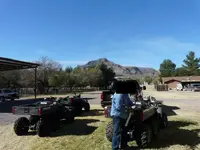
As a matter of fact, I just happen to be here in Tumacacori right now, as I type this. Real de Tayopa, I will say Hi to our friend for you. :wink: I have been up on the mountain several times in the past few days.
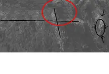
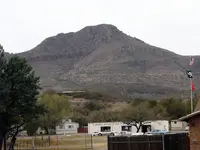
I have a little problem with your cross over the face of Christ; First, it's not a pic of Javelin or Peck Canyon, and Second, your cross was manufactured poorly in Photoshop as witnessed by the area I highlighted in Red (see attached). I have several aerial and satellite pics of the area, and your does not come close.

Best-Mike
 

Attachments

  • cross.jpg
    cross.jpg
    59.7 KB · Views: 1,768
Like I said.......................
 

Attachments

  • MtTumacacori.jpg
    MtTumacacori.jpg
    94.2 KB · Views: 1,790
  • Polaris.jpg
    Polaris.jpg
    97.1 KB · Views: 1,744
gollum said:
Quinan,

I was only posting some pictures relevant to the area. Not trying to solve the puzzle.

As a matter of fact, I just happen to be here in Tumacacori right now, as I type this. Real de Tayopa, I will say Hi to our friend for you. :wink: I have been up on the mountain several times in the past few days.
I have a little problem with your cross over the face of Christ; First, it's not a pic of Javelin or Peck Canyon, and Second, your cross was manufactured poorly in Photoshop as witnessed by the area I highlighted in Red (see attached). I have several aerial and satellite pics of the area, and your does not come close.

Best-Mike
Well I did touch up the pic to hide a few things and no its not of those places, but the point is that everyone thinks the mine is to the east of tumacacori, but I say that it's on the west. But then again, What do I know, except for the tales told to me by my grand-father. I read very little on the net about the treasure but some of it was informative.
I will say one thing though , that if two peaks were blasted away to hide the entrance. that the rubble from that blast of broken rocks, would be quite noticable, eventhough it has been many years since that day.
 

In another thread earlier this year,. Capt. Bill, {hello Capt.Bill,how ya doing}, posted some "Fantastic "photos of the Cross,the face of Christ,and a Saint with bulgeing eyes.I personally think their is a huge alter room behind the cross,with steps leading up to it inside the mountain from beginning somewhere at the bottom of the cliff. The trail could start from underneath the Saint with the blugeing eyes. Anyone with those photos please repost if you can.Thanks
 

nice pic's gollum.

great mexican food down there too.

hope you find those bells.
 

Hey Pippin,

I agree. Just got back from Wisdom"s Cafe (2ferTuesday Margaritas ;D ;D ;D ).

Best-Mike
 

What ever happened to stilldign and his post of the map? Just wondering, not trying to stir the pot or anything.
 

There is a lot of information on this in the book "Tumacacori's Yesterdays" by Earl Jackson and printed by Southwestern Monuments Assoc. Popular Series No. 6. It was printed in Santa Fe in 1951. It has a 2 page bibliography.
 

I would like to say, The letter that came with the map. Speaks about tumacacori. Well "Tumacacori" means "Flat rock" Guadalupe means "valley or river" .
as well I would like to point out that the map says to begin at the gate. that doesn't necessarily mean the gate at the mission itself, but could mean a natural gate such as a passway between two tall cliffs. On one cliff is a natural forming cross and the other with a face, Both need to be seen from atop of the cliff with the cross, through a passageway that is shown on the map opposite side of the line where it says "monumento puntos" and then shows a face. To reach this natural gate, you come from north heading south, So it is my belief that the map should be used as you see what will appear when you continue through the gate and following the map's instructions, heading from north to south.
 

Dear Quinan bear;
You wrote:
Guadalupe means "valley or river" .

In all reality, the name Guadalupe is a very old Spanish name and it literally means "Valley of the wolves". The name is derived from two distinct languages, both of which were highly influential in Spain during the late Middle Ages. First, the word "Guada" comes from the Arabic word "wadi" which means valley and the second part of the name "Lupe" comes from the Latin word "Lupus" which means "wolf".

"Tumacacori " is an old O'odham word or name and it's original meaning has been lost with time. It has been surmised that it could possibly mean a flat or rocky place, but since the early Spanish settlers attempted to spell all local native words phonetically, there exists a very high probability that the word could have originally meant anything, or it may have also been the name of a local deity or person.
Your friend;
LAMAR
 

he who does noty pack weapons may not have ever been to truely dangerous treasure hunting sites. when picking up pennies in a kiddy park you may not feel threatened. but when packing out a million bucks from mexico think again. The Eyes of San Ramon i believe is a visual star alinement i thought in the top left corner it was refering to the north star.
 

OK so you know your Spanish, Now that you know that the gate is not the one at the mission, but one made naturally. are you gonna ask where it is? or do you still think it east of the mission?
I can tell you with certainty that it is west, of the mission. I can tell you how to get there and where each of the landmarks are, as well as where the cliff is, that was blown off to hide the entrance to the mine is. I can tell you that the Opatas mine is in earth, while the Guadalupe and conception mines are in stone.
 

Top Member Reactions

Users who are viewing this thread

Back
Top