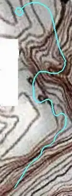
the priest map or witch map

I don't doubt that many have used older digs of various kinds, be they mines, abandoned fruit cellars or other subterranean constructs originally created as a result of, or intended for other purposes. Treasure legends and often recoveries involve such places as these, which has influenced the thinking of most THers, IMO, as to where and what they should be looking for in almost every case that does not specifically mention those details. Although the now much smaller area I find myself drawn to does not appear to show any signs of mineralization that would warrant so much as a shallow prospect, I might find such once inside. So while I can't discount your thoughts entirely, most of the maps and research which have guided me to this location speak of "treasure" and/or a "cave", rather than a mine. That it lies along an extended slip/strike fault tends to support the former, I believe.
 

With the Spanish Crown a hole is hole which equals a door symbol for both. Gold mines have been concealed in caves, one in Arkansas comes to mind. (Jim Price) Door symbols include: Open Faced "U" , Circle: O, Rectangle: [], Square, Circle in a Circle, and many others. The door symbol was very universal and included open canyons as campsites and any break in a ridge as a doorway. Whomever hid these were so good at their job they had no problem doing it right next to prospects. Even the Spanish would, according to Kenworthy, create their treasure rooms with in a quarter mile or so from the mine and the marker was a simple pile of rocks along a side wash with an arrastra carved in solid bedrock near that. They were opportunists in that regard and didn't go very far from the source. I've only found one of those small arrastra's in my life and didn't know it's purpose when I sat down in it and ate my lunch. I've never been back there since as it was in an area so remote I couldn't make it again and I was in better shape back then. The Site I just posted with the numeral "75" is verifiable. I just took another Thunter to there with me to help me remove the key stone so the other numeral would illuminate. That would be AUdigger53. This was during the Rendezvous gathering just like I said I was doing. I'm not impartial to working with other Thunters on projects. Whether mine or theirs it's all in a days work.


He can verify it's a real sun sign. He knows not where it was or how to get there as I wouldn't allow cell phones there and he's not that familiar with this area down here. But, he made the trek there and saw it with his own two eyes.
 

I don't doubt that many have used older digs of various kinds, be they mines, abandoned fruit cellars or other subterranean constructs originally created as a result of, or intended for other purposes. Treasure legends and often recoveries involve such places as these, which has influenced the thinking of most THers, IMO, as to where and what they should be looking for in almost every case that does not specifically mention those details. Although the now much smaller area I find myself drawn to does not appear to show any signs of mineralization that would warrant so much as a shallow prospect, I might find such once inside. So while I can't discount your thoughts entirely, most of the maps and research which have guided me to this location speak of "treasure" and/or a "cave", rather than a mine. That it lies along an extended slip/strike fault tends to support the former, I believe.

As always, the proof is in the pudding. Perseverance, logic and thoroughness are important assets, and you seem to have your share. Good luck.

Speaking of hidden in plain sight, an old beat up cowboy TH friend of mine (unfortunately now deceased) told me a story about his daddy, whose hobby was looking for outlaw loot in that west Texas-Oklahoma border country. The only time dad was successful was when he found a modest empty hole dug in what he was sure was the likely spot for what he was seeking. The hole was years old, knee-deep and filling up with blow sand. Just for drill, he dug out the several inches of natural fill down to natural hardpan. Frustrated, before leaving, he dug up the pathetic looking little pile of dirt that came out of the original hole. Not much of a pile, but at the bottom of it was a Mason jar half full of double eagles.
 

Another "in plain sight" idea that I once found to be quite compelling, probably invented by someone with a sense of humor a bit like my own, was that of simply piling a number of gold or silver ingots up in an irregular manner and then encasing them all in a covering of "concrete". Once shaped and colored like most of the surrounding rock, the result would be indistinguishable, except for a particular mark, shape or feature. A wood frame or an arrangement of poles covered in animal hides and skillfully plastered over in the same fashion, could also suffice for caching bulkier objects. Depending on the thickness and hardness of the coating (weather resistance), something like that could last hundreds of years. Remember the "three boulders shaped like teepees" LDM clue ?

Insofar as the 18 places is concerned, I suspect and will be searching for something I believe would present a significant hazard to the unwary.....in addition to the "deadfall" I also believe is just inside the entrance.
Despite plotting and tracing on foot several potential routes within my own area, with an eye out for anything that could be recognized and followed point to point, there doesn't appear to be any common physical mark or marker which can be said to point the way, let alone anything equidistant as appears to be the case with the "trail" stones. That is one of the reasons why I had concluded that the "trail" or "path" shown with the dotted line, is actually underground....with the exception of the part from the first dot to the wavy line. That line is where the "path" transitions from "above" to "below" ( and the maps from Spanish to Latin ) IMO, and I also believe the first dot indicates where the first sample of what's in store can be examined and duly noted. If my assumptions are correct, I will find a sealed but fragile clay vessel containing a hazardous powdered substance.... arsenic, scopolamine ( the effects of which may be related to the "cave of gold bars" stories), or even the powdered substance recently described by Injunbro on the "Apache" thread. Such a "land mine", depending on the potency and shelf life of the substance or combination of ...especially 18 of them buried just under a soft surface along a narrow and low clearance passage...would be quite an effective deterrent to any unsuspecting THer I think.
All of this might sound crazy to some folks.....but
 

Last edited:
Some hiker, my tnet buddy,any poison that would be used had to be of the quick acting type. Arsenic is not, I know since I was pisoned by Arsenic, The lab walls were coated with it and I got too careless

The idea is to stop him on the spot, not after he has recovered your treasurre
 

Last edited:
Bill :coffee2::coffee2:. Areas that were under the Spanish influence used piles of rocks as a grave site, the sumit of a paricularly mean climb, or for something they wanted to call attention to.
 

Features of acute arsenic poisoning

Overview of acute poisoning features
Symptoms usually start within 30 minutes to two hours. Acute arsenic ingestion is typically followed by a severe gastroenteritis, garlic odour and hypersalivation. There is a characteristic sequence of multi-organ failure, with neurological symptoms (within hours) and cardiac features, succeeded by adult respiratory distress syndrome
and renal/liver dysfunction. Marrow suppression develops after a few days to weeks in survivors, as does alopecia and an ascending motor neuropathy.

I don't think your experience covers all cases JC.
I only named a couple of examples of what is a longer list of possibles, if what I described proves to be the case.
And arsenic as one poison mixed with another that causes confusion and/or immediate debilitation could be very effective in preventing someone from completing what they had in mind. Not to mention the fear it might cause amongst any companions who might be superstitious.
 

Last edited:
Bill :coffee2::coffee2:. Areas that were under the Spanish influence used piles of rocks as a grave site, the sumit of a paricularly mean climb, or for something they wanted to call attention to.

Speaking of graves, could this be the final resting place of an Apache victim on the Butterfield Trail ... or a stash of valuables? Either way, it likely won't be disturbed.

W grave 1.webp
 

Another "in plain sight" idea that I once found to be quite compelling, probably invented by someone with a sense of humor a bit like my own, was that of simply piling a number of gold or silver ingots up in an irregular manner and then encasing them all in a covering of "concrete". Once shaped and colored like most of the surrounding rock, the result would be indistinguishable, except for a particular mark, shape or feature. A wood frame or an arrangement of poles covered in animal hides and skillfully plastered over in the same fashion, could also suffice for caching bulkier objects. Depending on the thickness and hardness of the coating (weather resistance), something like that could last hundreds of years. Remember the "three boulders shaped like teepees" LDM clue ?

Insofar as the 18 places is concerned, I suspect and will be searching for something I believe would present a significant hazard to the unwary.....in addition to the "deadfall" I also believe is just inside the entrance.
Despite plotting and tracing on foot several potential routes within my own area, with an eye out for anything that could be recognized and followed point to point, there doesn't appear to be any common physical mark or marker which can be said to point the way, let alone anything equidistant as appears to be the case with the "trail" stones. That is one of the reasons why I had concluded that the "trail" or "path" shown with the dotted line, is actually underground....with the exception of the part from the first dot to the wavy line. That line is where the "path" transitions from "above" to "below" ( and the maps from Spanish to Latin ) IMO, and I also believe the first dot indicates where the first sample of what's in store can be examined and duly noted. If my assumptions are correct, I will find a sealed but fragile clay vessel containing a hazardous powdered substance.... arsenic, scopolamine ( the effects of which may be related to the "cave of gold bars" stories), or even the powdered substance recently described by Injunbro on the "Apache" thread. Such a "land mine", depending on the potency and shelf life of the substance or combination of ...especially 18 of them buried just under a soft surface along a narrow and low clearance passage...would be quite an effective deterrent to any unsuspecting THer I think.
All of this might sound crazy to some folks.....but

IMO , all the " stone trail " is on the ground and not under .
Also , I believe how at the treasure site don't exist any trap . Would be unfair after a so difficult travel and after a so exhaustive brain work , to be recompensed with a death trap . More easy is to die on the trail than at the treasure site .
 

Speaking of graves, could this be the final resting place of an Apache victim on the Butterfield Trail ... or a stash of valuables? Either way, it likely won't be disturbed.

View attachment 1384728

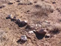
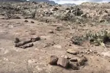
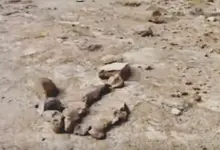
Some symbols made of rocks pile . An " U " ( mine/shaft ) symbol which shows how has something inside , and an anchor symbol . These are in the Superstitions on a very old trail .

symbols.webp anchor symbol.webp
 

Some symbols made of rocks pile . An " U " ( mine/shaft ) symbol which shows how has something inside , and an anchor symbol . These are in the Superstitions on a very old trail .

View attachment 1384772 View attachment 1384773

Nice anchor. A lot of folks identify the anchor as a KGC sign, sometimes taken to be a double J - one a mirror image - signifying Jesse James. Funny thing, some of those same folks also identify "Gotch ear" of Lost Adams Diggings fame as Jesse - as Jesse had a deformed right ear. Well, the LAD expedition supposedly started out south of Phoenix, not far from the Superstitions.
 

Some interpretations of the PH map say "I go 18 places", Other translators say, " I am 18 places". "I go" or "I am" which would it be? Big difference!
"I am" reeks of the Bible and Moses when he asked God what shall I say to the people of Israel and God said onto him: "Tell them I am hath sent me unto you". Exodus 3:14

So is the key in that biblical reference 314 places? Or 3 of 14 places? 3 goes into 18, 6 times 3+14 = 17. Of course the Spanish used "1's" and zeros as throw away numerals. What about the 14 stations of the cross in the hands of the Priest?

1-2-3-14.

18 = chet = 8, and yud = 10 = Life

God lives here!

Where?

I am Life.

Is this the way around a death trap?
 

Nice anchor. A lot of folks identify the anchor as a KGC sign, sometimes taken to be a double J - one a mirror image - signifying Jesse James. Funny thing, some of those same folks also identify "Gotch ear" of Lost Adams Diggings fame as Jesse - as Jesse had a deformed right ear. Well, the LAD expedition supposedly started out south of Phoenix, not far from the Superstitions.

Could be Steve . Actually , these symbols are on a mountain summit of the S-SW Superstitions in the SWA . Many were searching for that treasure , but they found something else instead . The luckiest have found some rich gold placers and some old rich gold mines .
 

Bill

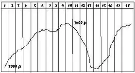
IMO , the map says " I go 18 places " . The distance between these places is about 50 meters , except between 10-11 which is about 80 meters and between 14-15 and 16-17 which is about 60 meters .

A diagram of the altitude average ( line ) on the " stone trail " map following the 18 ( upper boxes number ) " lugares "

altitude average  & lugares.webp stone trail.webp
 

Last edited:
The Priest map has nothing to do with the Trail map, that comes into play after you reach the big Triangle point on Top. At the End of the Trail. That's why there's Two ends on to the mine the other puts you at the correct vantage point to use the next map. There for the trail is first the horse is second and the Priest is last.

Wrmickel1

The only relation which has the Priest with the trail map , is because he is " talking " about the 18 places which is depicted on the trail map .
 

Markmar

The 18 dots on the Trail Map aren't places' Each third dot is a 3rd mile. The trail is set up in a 8 mile section. And your elevation grid is way off!

Wrmickel1
 

Wrmickel1,
You have the right idea, but you have the directional markers to far apart.
 

Markmar

The 18 dots on the Trail Map aren't places' Each third dot is a 3rd mile. The trail is set up in a 8 mile section. And your elevation grid is way off!

Wrmickel1

That's OK . I would like to see " your " trail in a topo map . Also , my theory is not written in stone . Could be the right one or the wrong one .
 

IMO , all the " stone trail " is on the ground and not under .
Also , I believe how at the treasure site don't exist any trap . Would be unfair after a so difficult travel and after a so exhaustive brain work , to be recompensed with a death trap . More easy is to die on the trail than at the treasure site .


But if there is a death trap , exist a way to recognized it .

If is a Spanish trap , outside of the entrance , should exist a carved heart broken in half by a thunder light . If the trap is situated at the entrance ( before enter the tunnel ) another thunder light shows to you where is situated the trap , up ( by falling rocks when you are attempting to open the entrance ) or down ( by a false floor ) . If the outside thunder light is horizontally showing the entrance or is not carved outside, then the trap is inside , and the light symbol would be just 2-3 feet before the trap . The inside symbol will show you where is situated the trap like if was outside .

Now , if the treasure is Jesuit , they used only mercury vapors as " traps " , but the game would change if they used an old Spanish treasure site . So , you should be aware of both styles of traps .

I believe in the stone maps case , the death trap is the trail itself .
 

Top Member Reactions

Users who are viewing this thread

Back
Top