The "Peralta" Stone Maps --- On Their Own

EB:

If you had been out there yesterday, you could have shown all of that to Tom K. and had his opinion as well.

Regards:SH.

Out where?

I spent the weekend in Black Canyon City with a good friend and associate who owns the Valenciana Mine. Someone had cut through the steel door with only a hacksaw blade to gain access to the mine. The BLM notified Tony of the break in and we had to run up with the stick welder and re-seal the metal door to the steel frame, but this time we used half inch plate. It must have taken them a number of hours to cut through the steel straps. I just got back today about 03:30 PM.

The three of us should get together. Give me PM if it can be arranged.

Later,

Ellie B
 

"Out where?"

Out at the Coke Ovens.

Also added some to my last post.

Regards:SH.

EB:

If you had been out there yesterday, you could have shown all of that to Tom K. and had his opinion as well.
Not sure if he has studied "Shadow Signs 101", but I know I haven't. Don't really think I lose out by not seeing a three in your arrow, since I've already seen some of what's at the end of the rainbow. I imagine it could have been seen by anyone, any time of the day or year for that matter. Just had to be standing somewhere out front, and not too far away. No digging required, since mother nature had intervened on my behalf I guess. Patience has it's rewards.

But all this talk of "architects" and precise viewing parameters sounds kind of interesting.
Who were these "architects" and how many hours/days/months (seasons) and years did they expect someone to spend in following their cleverly convoluted system of "signs" and trails ? Is that answer somewhere in the codes ?

Regards:SH.
 

Last edited:
Name yer poison Jose....would an eight ounce cuppa mescal clear yer mind ?

Just to be clear. While "shadow lines/shapes" and "sunlight spears" were definitely used by various groups as markers of time, and also likely used in rare circumstances to pinpoint other things such as caches, I doubt that any rational person would use such as a means of marking a route of travel.
Too much to go wrong, given natural and human forces at play.
 

EB:

If you had been out there yesterday, you could have shown all of that to Tom K. and had his opinion as well.
Not sure if he has studied "Shadow Signs 101", but I know I haven't. Don't really think I lose out by not seeing a three in your arrow, since I've already seen some of what's at the end of the rainbow. I imagine it could have been seen by anyone, any time of the day or year for that matter. Just had to be standing somewhere out front, and not too far away. No digging required, since mother nature had intervened on my behalf I guess. Patience has it's rewards.

But all this talk of "architects" and precise viewing parameters sounds kind of interesting.
Who were these "architects" and how many hours/days/months (seasons) and years did they expect someone to spend in following their cleverly convoluted system of "signs" and trails ? Is that answer somewhere in the codes ?

Regards:SH.

SH,

You have heard the phrase, "You cannot see the forest for the trees." That phrase applies to the codes as well. The codes are sometimes correct, but most of the time they mean nothing. They are simply there to add to the confusion. The arrow with the number 3 translates to, "Get your fanny over here now!" If the number three were not present, you would pass by the area, other wise you would be wasting your time.

A GPS can take you to an exact location where you have never been. The codes and monuments were capable of leading anyone with the knowledge of how to use them to a number of specific locations within an accuracy of 40 feet! That is incredible in IMO.

These monuments are very labor intensive as thousands of people would be required from start to finish to complete a six to eight square mile area. We can only guess at how many years it took to build these complex works of artistic history.

I have my own theory of who came here and when. I am also about 99% sure who the original artisans were and that they had trained others throughout the centuries to become masters of these unique techniques. These same techniques were used by the creators of the PSM's and the 1900-02 Florence quads as we are able to identify the the exact same art form. High level math would have also been a prerequisite for the architects themselves. Sun and moon positions had to be concise and accurate to display the desired shadow effects which required the observer to be in an exact position to properly interpret the message.

Maybe someday soon I will put together a class related to Shadow Signs 101.

This will have to do for now. More later.

Take care,

Ellie B
 

Last edited:
Name yer poison Jose....would an eight ounce cuppa mescal clear yer mind ?

Just to be clear. While "shadow lines/shapes" and "sunlight spears" were definitely used by various groups as markers of time, and also likely used in rare circumstances to pinpoint other things such as caches, I doubt that any rational person would use such as a means of marking a route of travel.
Too much to go wrong, given natural and human forces at play.

SH,

So what your saying is that it would make no sense for a rational person to replace all of the US road signs with Russian road signs. If that were the case only those who could read and understand Russian could understand and follow the signs. For those of us who cannot read or understand Russian we would have to learn. If one could learn how to recognize and interpret the sun/shadow signs then that individual would feel safe in knowing they are travelling on a well marked route.

What could go wrong other than a major earthquake?

We do not have to go to the Coke Ovens to show Tom K. how the system works. We can get together right here in Apache Junction, AZ. This week or next.

Take care,

Ellie B
 

Last edited:
Ellie how do do weed out the shadow sign from all the zillion other shadows that look like stuff?

Hi sgtfda,

I was extremely fortunate to work the primary area before starting my work with the Stone Maps. My collection of photographs grew by leaps and bounds. There were so many different signs, symbols and images that we had no idea what they meant, let alone how to use them. Many of them told stories of the past while others represented numbers (and Roman Numerals), letters, animals, demons, skeletons, etc. There are many Native America images, Hispanic people, European people, kings, queens, rulers and the religious displayed in these amazing images.

Finding the primary elements tied to the stone maps on the site was not to difficult. The two hearts were one key, a few other keys were found to take you back if you were looking in the wrong area. Eye catchers are also important as a ground guide. None of the eye catchers were eluded to by the stone maps. These landmarks were considered as a "given", a base of understanding; if you see one, go to its exact location and look around and identify the techniques used to construct the larger monuments. The larger monuments were not yet ready to display any information, but they will at a later date as we soon discovered.

The problem "when will they display the message" must be resolved before finalizing any plans to recover a cache or depository. We do have a solution in mind, but it must be tested to verify that it will work.

To answer your question only a small number of signs/symbols are needed to follow a trail to a site. Once the symbol has been determined you can ignore the rest of them. However, the problem mentioned above, relating to the exact date and time must be resolved. It took quite a few years to put this one trail together and we are now very close to locating a third cache or depository site. Study/search the hearts and study/search the maps. They were not kidding when they mentioned this point.

Have a great day,

Ellie B
 

I see. On every trail there is something that jumps out at you. Like this rock. When everyone looks at it. You know that it.

image-357989399.jpg

image-1422153938.jpg
 

sgtfda,

The example above (yours) would be considered an eye catcher. An eye catcher rock must be documented with a "witness mark". In other words, an obvious marker will be left nearby, typically within a 30' circumference of the white rock. Since I can also recognize other white rocks nearby I would also determine if the eye catcher was the same type of rock and if it was in place (native) or brought in from another location. Typically, the eye catcher rock would be a complete different classification compared to the native rocks found around it. Even if you found it to be enhanced in any way, be wary, find a witness before accepting it as a valid eye catcher. The eye catcher above serves as a perfect example of how they (the group) could throw you off of the trail, or someone else made the marker to keep you away from their claim to the cache. Rules are rules; the search and find group members knew the rules and adhered to them.

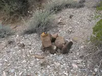
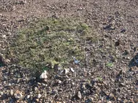
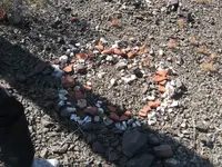
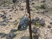
Witness m.jpg Broken glass, china and green grass.jpg Two circles different rocks.jpg Witness 3.jpg

Example of witness marks located in the field. You will know it as soon as you see them. Take GPS readings of each and every sign and share them only with your partner(s). We have found hundreds of examples.

Notice how the larger rocks were placed together to support the man made object. Sometimes a rock will look like a calling card, ie; a diamond shape (trowel), a boot, axe head (single or double) and a red brick (complete or a broken piece), china and broken glass. Pay attention to detail; the green grass within the circle of broken glass and china shares a commonality with the two large hearts located on Heart Mountain. Never destroy these markers as you may find that you will need them later due to pertinent clues that may have been hidden in their design. Take pictures from different angles to include above it with a pointer indicating your TRUE north heading. The photographs will document your witness if someone else should come along and destroy it.

If you know what to look for the journey becomes so much easier and fun too.

Ellie B
 

Last edited:
SH,

So what your saying is that it would make no sense for a rational person to replace all of the US road signs with Russian road signs. If that were the case only those who could read and understand Russian could understand and follow the signs. For those of us who cannot read or understand Russian we would have to learn. If one could learn how to recognize and interpret the sun/shadow signs then that individual would feel safe in knowing they are travelling on a well marked route.

What could go wrong other than a major earthquake?

We do not have to go to the Coke Ovens to show Tom K. how the system works. We can get together right here in Apache Junction, AZ. This week or next.

Take care,

Ellie B

Actually no. I don't believe they had to replace anything at all.
In fact, any land route, other than one across a constantly shifting landscape, could be easily plotted and followed by using natural landmarks alone, or supplemented with a few more or less natural but recognizable features at key points along the way. These would not have to be large or require a great deal of manpower to construct or modify in order to serve the desired purpose. The only "map" needed, might be as simple as a list of these landmarks, perhaps scrambled as they are on the Latin Heart.

Your "road sign" analogy is partly correct however, and I believe there was a system of common "road signs" used (analogous to a significant biblical revelation) from the beginning of the trail at the Gila, to the area at the end of the trail. This area is defined by three such markers, with a fourth within the borders, which may very well turn out to be a bullseye. If one or even a few at random were to be lost, it would only add a slight degree of difficulty to following the trail, since as a backup, one would have the descriptive notation on the "map" itself to fall back on.

While I doubt earthquakes were a primary concern, I do believe any rational person would recognize the folly of constructing large markers of any kind. These would only draw the attention of the curious and perhaps destructive inhabitants of any given area. Any invasion of their territory, as Springfield has pointed out, especially of "thousands of people" making massive alterations to the landscape as you claim, would have been a major disruption to their way of life. History has shown how they dealt with both the intruder and his architecture in similar cases.

Unfortunately, I am at present too far north for any get together with you and Tom. Perhaps later in the spring, if I can make it back down.

Regards:SH.

SH,

Look at all of the maps located in the Superstition Museum and tell me if you know how many of those maps led someone to a mine or treasure? The main reason that the Group had to invent a trail map system was to prevent it from becoming confused with other systems, and it was secretly hidden. On top of that you would not have a guide (and the Indians couldn't help) and you had never been on this trail before until now. You could not guess and make a mistake, so the monument trail actually inspired confidence. As I mentioned in an earlier post there were strict rules that must be adhered to. Just like cruising down I-10, Phoenix, AZ. Exit here.

Later and hope to see you this coming spring.

Ellie B
 

Last edited:
EB:

How many of the maps in the SMM do you think were made before the Stone Maps, and do you believe any of them are related directly ?

Personally, I believe a couple of them are good ones, which do show the location of prospects that any one of us would be happy to photograph and take some samples from. Most of the others I suspect, were made by searchers who thought they were on to something, but hadn't actually found it. Putting it down on paper did give them some satisfaction, though.

SH,

The stone maps that we are familiar with today represent a third or fourth generation of a combined group of historic maps and/or templates. Place names were brought up to date and the older and newer shadow monuments were also integrated. The current stone map templates would have been designed in the mid to late 1800's. The actual date the stone maps would have been produced would range somewhere around 1910 to 1940. This would be my best guess as this information was also handed down by the same person as mentioned below, my partner. I have seen a copy of the original templates years ago, but was not allowed to photograph or draw a rough copy. I wish that I could have, but I remembered a number of the primary differences. My partner at that time had us swear that we would never divulge the information to anyone else. It seems that only three copies of the original templates existed and our partner knew one of the men who owned a copy and he did not know who owned the third. I never learned of his name and was told later that he had passed away. At this time I became convinced that the Peraltas had nothing to do with the stone tablets due to the mounting evidence that proved otherwise.

The Templates predate any other maps that concern the Superstitions. I could be wrong on that point, however the depository that the stone maps refer to was a newly designed system that differed from a simple drawn map. Any of the maps that indicate that an "X" marks the spot would be under suspicion until a clue was found that referenced the map and the "X" referenced a clue. We would then investigate the area where the map was meant to be used. The Group never marked the entrance to a mine or cache/depository area, never. They had devised another method to direct you to the exact location. At present I cannot share any information regarding this method.

A number of the SMM maps contain a number of the Groups techniques and I had posted a few comments on one or two (Perfil). Some of the maps are useless and fraudulent IMO. Others may come into play as we learn about additional caches that the stone maps may reveal, thus requiring the information contained on certain (SSM) maps. The answer as to "which one" will unfold as the clues are gathered. They will let you know once you reach that point. The stone maps are not complete without the usage of other maps or shadow monuments. That much I can attest too.

I hope that the above information is helpful,

Ellie B
 

Ellie B

If you want , I will send you the coordinates with the place where I believe is the first X in the stone trail .
 

I wonder how 18 is related to deception?

"The number 18 is in relation, in cabalistic numerology, with emotions, the secrets, the lie, the selfishness, the criminality, the destruction, the disposition of accidents, with the difficulties, the sickness, the danger."

Good?
 

"The number 18 is in relation, in cabalistic numerology, with emotions, the secrets, the lie, the selfishness, the criminality, the destruction, the disposition of accidents, with the difficulties, the sickness, the danger."

Good?

Thanks Hal :hello:
 

In other words Somero, out of selfishness, and emotion for a relation, they may lie to you about being 18. To protect yourself from criminality, the destruction, the disposition of accidents, with the difficulties, sickness, and danger, verify it. "Comprende" now?
 

Top Member Reactions

Users who are viewing this thread

Back
Top