The "Peralta" Stone Maps --- On Their Own

gandalf-problem-solving.jpg
thCATKH7X6.jpg
 

Hal, you must keep in mind that the maps are carved in stone not painted on canvass. The images although not exact are very accurate and like you said sorta looks like it. When taken in context of indistinguishable desert they are easy to see and follow.

goldbugpr,
If you find the time will you please explain your first sentence... specifically, the importance of stone vs. canvas as it pertains to my initial question. Thank you and keep going!
 

Hal, the only thing the stepped rocks represent is a trail marker which is so different than anything in the vicinity it is impossible to miss if you are looking for the steps on the front of the robe. Although I will acknowledge that the only way to see a specific clue is to be looking for it , something that looks like the carvings is probably it. I do not believe there is any symbolism used on the maps anywhere. I did not want to be a smart ass but if you were using the maps in an unknown land and something sort of looks like the clue carved on the map and it was in the right spot based on its secquence, I went with it and they all work. Every clue is clearly visible when you are on the trail and they are in sequence.
 

Last edited:
For anyone,
Have you ever wondered why there are four maps (+one or two inserts depending on what you believe)? Here is what I have learned form placing the stones as I have done (shown in previous posts). Once one positions the individual maps correctly, (superimposed onto an aerial map of the period [circa:1940's]) one must use triangulation (between all the maps) to resolve the final location. It will not happen until one has all the maps scaled & correctly placed. Kenworthy has demonstrated this understanding of triangulation in a video lecture that cactusjumper lent me and while his attempt was clumsy and not correctly placed, he did understand the final steps in unlocking the cypher. The symbols are obvious "treasure" symbols... it is how they were used by the individual artist which is the real bugger.


I'm always interested in different possibilities for solving the Stone Maps.

However, since I have been somewhat specializing in the question of "Who was the intended reader(s) of the Stone Maps," as a probable significant clue to the meanings of the symbols and mapping style, I need to ask you: "How was the intended reader of the Stone Maps supposed to know about your "special positioning and scaling" required of these?

And then, naturally, who was the intended reader(s)?
 

The trail in the stone map , is an imaginary trail . The " lugares " are hills or top of mountains , and is very difficult to follow the exact course . The important " lugar " is not the first but the second , to know in what direction to continue and in what scale to measure . Is not necesary to follow the trail exactly , but you can go from a alternative route to reach the top of the " lugar " and to continue the trail . If you follow the trail , you can see how the turns in the map , in reality turn around hills or mountains and sometimes follow a short way of a trail .
To help you litlle , I tell you how the triangle In the stone map which looks like a indian tepee is very close to Weavers Needle ( SE ) .
 

EE there is no special positioning or scaling. Everything is based upon starting at the small cross on the horse map. None of the clues have any special meaning they are just very visible geographic features when you are on the trail. As for the intended reader, I cant speculate about that. I am sure it wasn't me but they are very precise and clear. I believe that all we will ever know about the maps is what is carved on them and where they go.
 

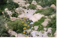
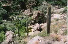
The lugares are not hill tops or mountains. As I stated earlier, all the dots or drill holes on all the maps indicate the location of water, at least seasonally. The eighteen lugares are locations where they panned for gold and if finding any they moved a few hundred yards up stream to the next likely spot and dug down in the creek bottom and repeated the process much as is done these days. The only help telling people that the teepee is near weavers needle is to mislead them. The thing you called a teepee is shown in this photo.teepee.jpg
Here are two of the lugares after a rain.Lugare 4.jpgLugare 5.jpg
 

I'm always interested in different possibilities for solving the Stone Maps.

However, since I have been somewhat specializing in the question of "Who was the intended reader(s) of the Stone Maps," as a probable significant clue to the meanings of the symbols and mapping style, I need to ask you: "How was the intended reader of the Stone Maps supposed to know about your "special positioning and scaling" required of these?

And then, naturally, who was the intended reader(s)?

This is just my opinion.
The "intended reader" is you, me, and anyone else who is beguiled by the cipher.
Think about where they were "found".
Think about the letters D - O - N.
SO, in my mind, it did not matter who discovered the stones.
It was only important that they were found and perhaps where they were "reportedly found".

Discovered in 48/9' and first (published) reported on in 64'?
It took some time (15 years+/-), but they ultimately did find their way into popular culture.
And I believe that this was the goal.

But, in the end, I believe that the cipher was a gift to the DON's.
From a DON.

edit: (I want to be clear regarding the Don's and their involvement. Halseth was an "individualist" and it is my guess that he work independent of the Don's.)

How does one know "how" to read the maps?
Well, it seems that many of the theories regarding the stones use an aerial view solution.
Is it the availability of Google Earth driving these theories or something called intuition?

Odd. Halseth is the name.
This I can say with some confidence.

View attachment 869108


Find an aerial photograph of the area, ideally one from the period.... no easy task.
For Google Earthians, play with the year and time effects... adjusting shadow and light.
I use the oldest color imagery because it has very little vegetation, the photographs being taken in the winter months.

Three of the stones offer a unique "registration" mark.
The marks for me were the hat, the knife, and the horses right ear.
Look for geographic features in your photograph that "match" these marks.
When you find a corresponding "mark", use it to determine scale and positioning.
Repeat for the remaining stones.
Now comes the difficult part.
Using the formula on the trail stone, apply triangulation to the composite map.
If the theory is correct, and if there is something to be discovered other than a lesson in greed...
well, this should get you there if there is a place to get.
 

Last edited:
Hal, the only thing the stepped rocks represent is a trail marker which is so different than anything in the vicinity it is impossible to miss if you are looking for the steps on the front of the robe. Although I will acknowledge that the only way to see a specific clue is to be looking for it , something that looks like the carvings is probably it. I do not believe there is any symbolism used on the maps anywhere. I did not want to be a smart ass but if you were using the maps in an unknown land and something sort of looks like the clue carved on the map and it was in the right spot based on its secquence, I went with it and they all work. Every clue is clearly visible when you are on the trail and they are in sequence.

goldbugpr,
Fascinating, however in my feeble mind, this is the Achilles heel of your theory.
The creative effort was far more specific than "probably".

Don't you feel that "probably" is an inefficient concept on which to base a map?
Eliminating the maps structure (its usefulness as a means to locate something) with generalities just seems illogical.
Do you address this in the work?
Anyway, thank you for taking the time to share your thoughts on the TN.
You deserve quite a bit of credit for bringing your ideas to print.
 

Last edited:
Hal there is no probably in my interpretation of the maps. They are very precise and short of including a photo of a clue the carvings are more than adequate to allow anyone to follow the trail. There was an effort to hide the clues within the horse and priest but once you enter the mountains (the horse identifies the specific mountain and the priest tells you where to enter) the trail maps contain no hidden clues. The heart insert is the security key to the maps, you carry the seventy five pounds of stone and I carry the 8 oz heart and you cannot complete the trail to its end until I insert the heart. That's pretty good security don't you agree?
 

Guys,

Lot's of true information, as well as some false, in your posts. If the maps are an aerial view of the topography of the Superstition Mountains, can either of you provide a topographical map showing a highlighted view of the Stone Maps Trail Map?

Everything must be in it's proper place and the entire map must flow, as it does on the stone. Mind you, it does not have to be perfect, but close enough to confirm the authenticity of the map. I still believe I have the only reading of the maps that meets that criteria.

Once again, the end of the Stone Map trail is the Heart. To be exact, this heart:


Here's another:


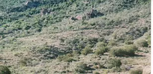
I have the USGS aerial photos used to make topographic maps from the 60'-70s. The trail, like many old trails in the Superstitions, show up as faint lines. You can see the one that comes out of West Boulder, goes over the saddle separating Little Boulder and West Boulder. It leads directly into the heart above. This is that trail just before you reach the heart:


I don't believe anyone else has ever shown this kind of, in the correct place, evidence that matches the Stone Maps. Here is one of my USGS Photos:


Notice anything familiar??? Do you know where that familiar shape is.....on the ground?
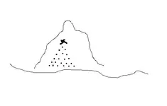
Want to see most of the trail map in person? Hike up to Superstition Peak and take a few pictures down into West Boulder. One person who has taken pictures of the Stone Map Trail, from the north side of the main mountain, while on the trail is,
Greg Davis. I don't know if he knew he was on the trail, but you can see the pictures at Greg's house, which is where I saw them.

Good luck,

Joe
 

Last edited:
:hello:

aerial photographs?
the width of that trail is what I have been interested in for a few years...those trails just don't disappear...even if over grown...

Donald,

Actually the trail does disappear in many places along the way. But it does reappear.....in line. I guess you just have to be there. I have another picture of the trail, with people standing on it. Gives you a better fix on its size.

Hope all is well,

Joe
 

goldbugpr

You said how the " lugares ' are panning holes . And maybe you mean how they had panned to find the mother lode .
My opinion is how you don't know the method to find a mother lode . To find a mother lode is necessary to take samples more of hundred times , and no only in the water course ( for beginning ) , but on the mountain side , too . On the mountain side you must to take samples of dust like in this picture

Triangulation method of samples.jpg
The first bottom line , is about 100 yards + , and the samples have to taken every 10 feet .
Maybe you must to change your theory about the " lugares " .
 

Last edited:
Joe

You can not see all the Stone Map Trail from The top of Supertition Mountain , IMO . You can see only some fragments and of course the hill where ends the trail . The trail cross four canyons until it leads to the hill near Someo Montana mine .
 

Last edited:

Top Member Reactions

Users who are viewing this thread

Back
Top