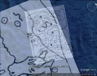
The "Peralta" Stone Maps --- On Their Own

My thoughts on suggesting this "reverse engineering" method include several aspects.

One is that the Stone Maps are often referred to as the "Peralta" Stone Maps.

Taking that as one example to look at, the question would be "Were the maps to be read only by other members of the Peralta family?" If the answer is yes, then that would mean that either all their members, or at least the major members of their family, would be readily able to read the maps.

If this is so, then the next question would be, "How unique would this code have been?" That is, would this code be readable only by members of the Peralta family? Or would the code be common to a wider group of people? This then results in two following questions---

1. What would the wider group have been? A religious group? A secred society group? A geographic group? Or some other category of group?
2. If only the Peralta family, then the map maker would need to give this unique code to each of them---and if that is the case, then why not just tell that small group of people where it is, rather than codifying it on stone maps and going to all that fuss and bother?

Obviously, somebody besides the maker would have known exactly what all the symbols meant, otherwise the maps would have no real use.

Who could possibly have known exactly what all of the symbols meant?

The more people who would have known the code, the more likely that someone outside the group would have found it out, and possibly made it public. (Also, the larger the group who could de-code the stone maps, the more likely that the knowledge would be successfully passed on, and that they would have already recovered whatever the maps lead to.)

How large of a group were the maps likely to have been directed to?

If it was a family business or just a small group. Then the boss would only need a few men who could read the map. Like a Foreman. The rest being hired hands.
Just going down the canons they were told to go down.
 

Here's something that might interest you."On Minos Del Oro map there is the word
Canon Negro . According to the online translator. The word canon has a few meanings. One is canon another is biblical law and one is priest. So it could be saying priest black ( black priest)."

The Spanish spelling of canyon is canon with a tilda over the middle n. The translation is Black Canyon.
 

johnmark & Somero---

My point is that if a very small group were the intended recipients, I mean just a few people, then why not just tell them where the map target was? Or just make a very simple map with no code symbols, and just tell them what a couple major landmarks were? I mean, since the maker would have to visit each of the intended viewers, why go to all the trouble of making up a complex secret code? That doesn't make sense to me. Also for the purpose of a small group of people, why bother with making the maps on stones, of all things?

So attributing the Stone Maps to the Peraltas just doesn't seem right. I just can't picture it. Can anyone make more sense out the "Peralta source" theory?
 

Last edited:
EE

One idea is that the Spanish often used coded maps to hide any mines or areas of importance so other European powers could not find them. Thus the creation of Standard Symbols for coding maps, but even having an understanding of the codes you would still need to be on the correct trail to locate the markers and interpret the map. Of course you could always stumble on trail markers that might lead you to something, but without a map it could be much more difficult to locate the alleged X

As for giving directions verbally to certain markers, that really has not worked out to well for the Superstitions.

My opinion is currently leaning towards the Maps being made prior to 1767, and that only a few people at that time could interpret them. I think they were made of Stone so they would last quite a long time buried or hidden in a cave, since it was uncertain how long it would be between mining trips, that may have been done seasonally and lead by a different person.

Of course my opinion could change in the next day and they are a hoax, One thing I will say for a fact, They do lead to an area in the Superstitions, hoax or not. I guess there is just not enough proof one way or the other on when the Maps were made to decide what to believe. Leap of Faith maybe.

We only assume that the stones are leading to gold. They may be nothing more than a students art project from long ago. It's the puzzle I like.
IM been looking at the possibility that the stone themselves may be early native American, they were altered my Some one else years ago. Maybe a early attempt to solve them. Then again my opion is set in stone yet.
 

Somero

All the symbols in stone tablets are ground shapes . Don't exist any cipher . As I wrote , the horse map shows five mines ( or dots , which are carved on the gold bars ) , and the three dots in line are the Xs in the trail stone map . The middle X is LDM .
The stone trail leads to the Latin heart , and there the priest shows with his Cross where is the cave with the Jesuits gold bars .
 

My opinion is currently leaning towards the Maps being made prior to 1767, and that only a few people at that time could interpret them. I think they were made of Stone so they would last quite a long time buried or hidden in a cave, since it was uncertain how long it would be between mining trips, that may have been done seasonally and lead by a different person.


With the symbols on the Stone Maps being so unique, I agree that it shows a likelyhood that only a few knew their meanings. But that presents a paradox, in my mind, as I mentioned before---and that is essentially, why make up a whole new secret code, for just a few people? I mean, why not just draw the maps, on stone if they so desired, and just tell those few where the area was? For instance, "This mark, here, is the tallest needle in the area extending X miles south of X river"?

I'm wondering why any of the symbols on the Stone Maps would represent trail markers? Why not just say, "Start on the trail here, and there are trail markers to help you stay on track"?

While not trying to make any claims of what is what, I'm just "thinking out loud," to see if anyone wants to kick around some ideas about the Stone Maps themselves. As investigators sometimes say, "The evidence is speaking to us---but are we listening?" Maybe someone else has noticed additional things which do or don't make sense of some of the theories that have been put out.

The "intended recipient(s)" aspect is justs something that has been on my mind since I first came across the Stone Maps stories. The Stone Maps appear to be a message. But every message has two important parts to it---the sender and the receiver. Knowing both would help in understanding the message.

In trying to narrow-down the possibilities for the identities of each "end" of the message, a third factor in achieving a good probability for these would be the question: Do they logically match-up?
 

Last edited:
i believe people should focus upon why these stones were left along queen creek, basicly a surface find...
when if they are treasuren maps...they should have been somewhere secure...not along an apache highway...
 

Somero

The Peralta family ancestors had contacts with Jesuits and maybe been themselves Jesuits . They owned the land in Arizona from the King of Spain with the blesses of Rome . I believe they helped Jesuits friends to hide a cache ( or more ) of gold bars in the Superstition . They were masters in survey and mining .
 

Last edited:
Somero

The Peralta family ancestors have contacts with Jesuits and maybe been themself Jesuits . They owned the land in Arizona from the King of Spain with the blesses of Rome . I believe they helped Jesuits friends to hide a cache ( or more ) of gold bars in the Superstition . They were masters in survey and mining .
one such pile of goldbars were uncovered andmade. the cover of lost treasure or one of them others. late 70s or so
 

Last edited:
My point about finding a logical recipient group, is that if there is no reasonable recipient, then the Stone Maps are an "open ended" communication. An open ended communication is aimed at nobody in particular---like a public broadcast.

In the case of a coded message, an open ended communication makes no sense, since the readers of the Maps would need to know the "secret" code. And if everyone knew the code, it would not be a secret. Therefore this scenerio of open ended nullifies itself. It is self contradictory.

So, if there is no locical recipient group, the Stone Maps are a hoax of one kind or another.

In summary, a very small recipient group makes no sense. There would be no need for a "secret code" made up of symbols, as I opined in my previous posts.

And if it were a large group of intended recipients, then why are these symbols not known? There are plenty of trail marker symbols, for example, published. Some of the published translations of these trail markers may be accurate, and some may be just wild guesses. But I have yet to see all of the Stone Map symbols listed among any of these publications. My thinking here is that, the larger the group who knows a "secret" code, the more likely that the secret will leak out, and eventually get published. But nowhere have I seen any "map codes" which contain the group of symbols used on the Stone Maps.

If there were such map codes known to have existed, then using them to translate the Stone Maps would verify the translation, if the target(s) of the Stone Maps were found---or maybe even some kind of evidence that something had been there at one time. But every guess at the meanings of the Stone Map symbols (that I have seen) has seemed to me to be totally haphazard, and has led to nothing. Well, there is one exception to this, and that is Cactus Jumper's interpretation, which is convincing on most counts, I think. The rest appear to be just wild shots in the dark, relying on mere opinions as attempted verifications of more opinions.

But even with Cactus Jumper's trail, and trail end, and several verification points matching the Stone Maps, there remains one blatently missing verification of the Stone Maps being the type of "treasure maps" which have been speculated by many treasure hunters, both amateur and professional. And that missing point is a sensable, logical identification of the recipient group. With all the studying and "boots on the ground" observations which I have seen (and realizing that there may be some that have either gone unreported or that I simply have not seen), the gusses at the identity of the intended recipients seems to be the most hazy.

Who were the Maps "written" to?

What kind of evidence is there that there were any specific "receivers" possible?

This is just something that stands out to me, concerning all of the gusses and claims that I have seen about the Stone Maps.

Again, I'm just "thinking out loud" on this. I don't claim to know anything special, or to be wiser than anyone else. It's just that I can't come up with an adequate answer to this, and if anyone else has, I haven't seen it yet.

I feel that this may be one of the most important questions about the Stone Maps, that treasure hunters should be attempting to find sound answers to.
 

EE THr

The recipients are the topographic masters , like them . All the symbols are ground shapes . The " big deal " is to find where match the horse in the surrounding area . After with topographic skills , you can find where is the location of the dots . And after , if match the three continous dots in the horse map with the three Xs in the trail maps , you can see from where starts the trail and where ends .
 

.... Who were the Maps "written" to?....

The general public, IMO.

If there are indeed hidden things of great value in the Superstitions, these stones may well be a clever deceptive ploy designed to lead the gullible away from a genuine location, if one or more exist. Misdirection.

Whether these stones were manufactured centuries ago or recently, there was (is) no reason to create them in such an enigmatic and cartoonish manner. People capable enough to control stores of great value (gold caches in the hills?) have no need to play games, except maybe to incite false interest.
 

For sure the stone tablets are not a brain exercising toy from the past . And , on the other side , if some wanted to keep the genuine place (s) , secret , was simplest to didn't made the stone maps .
 

Last edited:
...if match the three continous dots in the horse map with the three Xs in the trail maps....


I don't see any three continuous dots on the horse map that match the three Xs on the trail maps. :dontknow:

peralta stone maps

peralta stone map symbols

Also, not to be picky or anything, but it's pretty obvious that not all the symbols on the Stone Maps are "ground shapes," as you stated. I wouldn't consider either topographic lines, river and creek lines, trail lines, or silhouette lines to be "symbols." A symbol has the same, or nearly the same, meaning wherever it is used, whereas map shape lines apply only to whatever is depicted on that map.
 

Last edited:
I don't see any three continuous dots on the horse map that match the three Xs on the trail maps. :dontknow:

peralta stone maps

peralta stone map symbols

Also, not to be picky or anything, but it's pretty obvious that not all the symbols on the Stone Maps are "ground shapes," as you stated. I wouldn't consider either topographic lines, river and creek lines, trail lines, or silhouette lines to be "symbols." A symbol has the same, or nearly the same, meaning wherever it is used, whereas map shape lines apply only to whatever is depicted on that map.

The maps , in the Superstition surrounding area , match in different dimensions . You must to adapt the Xs in the stone trail maps , to the same dimension with the dots in the horse map . Something like this

2 in one.jpg
 

I suspect the stones are of more recent manufacture (20th century).

If I were to create a genuine treasure map for the benefit of my confederates, present or future, I would simply provide a set(s) of coordinates for the target(s). The coordinates wouldn't be lat/long, utm, state plane or the like, but a coded set(s) of either one of the above or, better, a user-defined set(s) of coordinates. The confederates of course would be aware of the system - easily solved when the secret is known. Security is assured, as infidels would not be able to interpret the data without proprietary information.

Why fiddle with cartoons, topo maps and enigmatic phrases? It's only the locations that are important. No overlays, or puzzles are needed - just precise coordinates, easily determined by the in-crowd. No one else matters.
 

The coordinates , are not accurate for a future searching . We know how are changing with the pass of the years .
The overlays are just a fastest way to recognize a map . You can have the same results if you try with an common method , but this will be a very slow method .
 

The coordinates, are not accurate for a future searching . We know how are changing with the pass of the years .
....

Excuse me? Are you saying that the earth's surface is changing enough to invalidate a coordinate grid system? That's big news ... does the land surveying industry know about this?
 

Top Member Reactions

Users who are viewing this thread

Latest Discussions

Back
Top