DOC NOSS-Victorio Peak OR The Caballo Mountains

Whiskeyrat, were there any references to sources for those claims of pure gold being found by the Spanish in SW New Mexico?

Nothing concrete as usual just the same legends and "old maps and weigh bill from Mexico".
But what caught my mind was the claim by the group "codebreakers" that Mel Fisher found 22 carat plus purity gold bars on the Atocha.
And that he had reason to believe they came from SW New Mexico. He, to me, is a very credible person.
It is for sure that the almost pure gold bars were found in the wreck. That is not some fairy tale.
That ship sank in 1622. Again, in my mind they did not smelt gold in 1622 to a purity approaching 24 carat.
So, im concluding that they found very pure gold in native form sometime before 1622 to make those particular gold bars.

No proof offered but some compelling real evidence at least.
 

So you disagree with SDC be my guest, : encourage it.: It is not entirely on NP lil map, although that tended to cinch it, none of the Caballo mt can be versified by conventional means, nor can Tayopa, but by using non conventional postulations I have found it, same for the general location of the three depositories of the Jesuits. Yes, you may disagree with me freely and possibly be more correctly.since we are dealing with a subject that in not verifiable by conventional means, but so far what Little evidence we have points to my postulation.+
As a matter of fact,we still do not have a verifiable source for Doc's supposed find.

But yes, I encourage fault finding in any of my statements, I am not perfect,despite ______________

I will say that I don't trust the lil map not because of NP, who posted it - I'll assume he obtained it in good faith and perhaps believes that it's "genuine." I don't trust the map's alleged source - Noss - plain and simple, end of story.

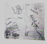
Now, as far as your "Yayopa connection", let me surprise you a bit. I have a second "ALMACEN" map that shares several of the features on NP's map, but provides much more detail. I obtained the map a year ago from a source who was told it came from Seville. I doubt that. The map features some symbology on one side that indicates to me the Caballos and is labeled "LEVANTE". The other side says "PONIENTE Sonora". East and west. That's all I'll say about what's on the map - please don't ask for more because I promised to my source not to make the chart public, and I intend to keep that pledge. I'm not going to claim that this map is "genuine", but I will say that whoever prepared it had a great deal of knowledge about SW New Mexico.

The bottom line is that my current working model shows that "ALMACEN" refers to a source of precious metal, and some of the metal may have been moved east to the Caballo Mountains area and some of it may have been moved west to Sonora. Not from Sonora, but to Sonora.
 

I am always disappointed when so little verifiable evidence is available to back up stories that sound so good. I like to turn over every stone as well, I just have yet to turn over any stones where something substantial and reality based was underneath to discover. It makes me wonder if there are any real facts left to find that have not been fictionalized or exaggerated when it comes to treasure hunting on dry land.
 

It's like detective work. Never discount a lead until you run it to ground. I have also been disappointed with little or no results from my research on other treasure leads. Whiskeyrat has gotten my juices going though. He goes in the field, post pics, conducts research. I am going to try my damnedest to contribute what I can to his pursuit. I always start with what I know. I know the authors name of the book that started this angle...New Mexico Confidential...his name is Stephen D. Clark, wrote only 1 book, lived in Silver City in the 80s. My book has a copy write year 2013. Very little exists on internet. I will contact his publisher and do a property search in Silver City for beginners. Let you know what I find.
 

I am always disappointed when so little verifiable evidence is available to back up stories that sound so good. I like to turn over every stone as well, I just have yet to turn over any stones where something substantial and reality based was underneath to discover. It makes me wonder if there are any real facts left to find that have not been fictionalized or exaggerated when it comes to treasure hunting on dry land.

It's the most frustrating aspect of looking at these treasure legends, and the reason for speculative discussions on forums such as this. If Mel Fischer had not located the Atocha and its treasure - thus verifying the evidence he used during his search - there might still be endless arguments on treasure forums about the location of the wreck, the voracity of the ship's documentation, the truth about the cargo, etc. Once a mystery is clearly solved, there's not much reason to keep debating its solution.

In the case of the Caballo/Victorio legends (and many others), there's tons of hearsay in the public domain. Some of it may be usable. IMO, most of it is "fake news." How can you tell the difference? IMO, unless you have proprietary information, you can't tell what is usable, regardless the source of the evidence. You can eliminate much of the disinformation by tracking down verifiable evidence that contradicts it, but this takes lots of time and effort. Then, all you've done is cull out bad data, not proven anything positive. I like to turn over every stone too, but you likely won't live long enough to try them all.

IMO, if a guy wants to field search for hidden loot, he ought to ignore the well-known legends and stick to those less publicized. The more that's been talked about it, the more corrupted the talk has become.
 

I found a Stephen Clark with an address and phone number in Silver City. His book was self published. PM me if you want the information. I will not divulge any private info on forum. He also is listed as owner of vacant parcel in area.
I will research other names from book later.
 

I found a Stephen Clark with an address and phone number in Silver City. His book was self published. PM me if you want the information. I will not divulge any private info on forum. He also is listed as owner of vacant parcel in area.
I will research other names from book later.

There's no more available from him that isn't in that book. He began writing it as just a memoir of an interesting adventure for his pals, who were also involved. Then it was suggested that he make it available to anyone else who was interested in the previously undocumented locations and other historical research that otherwise would have faded away.
 

Sdcfia. Thank you for your comments. I respect everyone's privacy. I will close my research on the author and discard his contact information.
 

I will reluctantly point out that even though we know about what was found on the Atocha, we still have no verifiable evidence it was mined in SW New Mexico. All we have on that is hearsay unfortunately.
 

sdcfia wrote: "The trails between Santa Rita and the Caballos were already long-existing when Emory, Kearney and others used one of them during the Mexican War days. The route is mapped and described in detail in Emory's Notes of a Military Reconnaissance. Kit Carson also used it when he used to winter in Santa Rita, coming down from Taos. These are the easiest grades crossing the lower Black Range north of Cookes Peak.

There's a second, older route that follows parts of the later Butterfield Trail south of Cookes Peak, then runs NNE to the Caballos near the Palomas Gap vicinity. The Cookes Canyon part of the trail passes some very compelling petroglyph sites. The NNE-running section is called "Camino de Retorno." I'm not aware of anyone who has traversed the Retorno route in modern times."

Assume for one minute precious metals were mined and refined on site in SW new mexico. How would you transport to civilization where the value can be realized? overland until you reach the nearest waterway, then to port and put on ship bound for europe. Trails leading to and from the mines could, and most likely went in 2 directions (easterly to ports in texas) and (westerly to ports in mexico). Mule trains are only limited to the number of mules available and men to guard/lead the pack train. Once you hit the first waterway capable of handling hte load, the metal would have to be stored until sufficient boats arrived/were built/acquired to transport down stream. Same with the port. You would have to wait for the ship to arrive.

It makes sense to me to trace the most likely path of travel (east/west) and explore along the path for areas metal may have been cached due to (1) hostile attacks (most likely places for ambush) (2) daily stops for water and sleep, (3) future transfer points (4) easy to conceal and retrieve at later date (5) traveling no further than necessary to meet my objective.
NOTE: If I was in charge of the mule train, I would cache the goodies some where on the trail between the mines and the nearest river. The Caballos is on the wrong side of the river and would be the last place I would pick.
 

Some good points! I too try to put myself in the minds of people back then and limit my thinking to what their limitations were with regard to transportation and other practical logistics.
 

Sdc, may I ask you just what do you have against my postulation ? Your map is just as verifiable as NP's , in addition it is impractical to ship to Sonora, That is the source. The one thing thath as me curious is that the region comprised of Sonors, Chihushus, Sinaloa, and Durango was called The dependencia of Durango, it wasn't knowt by the present name until after the Juarez Revelation2 , in about 18 1 They changed it:coffee2::coffee2:
 

Last edited:
sdcfia wrote: "The trails between Santa Rita and the Caballos were already long-existing when Emory, Kearney and others used one of them during the Mexican War days. The route is mapped and described in detail in Emory's Notes of a Military Reconnaissance. Kit Carson also used it when he used to winter in Santa Rita, coming down from Taos. These are the easiest grades crossing the lower Black Range north of Cookes Peak.

There's a second, older route that follows parts of the later Butterfield Trail south of Cookes Peak, then runs NNE to the Caballos near the Palomas Gap vicinity. The Cookes Canyon part of the trail passes some very compelling petroglyph sites. The NNE-running section is called "Camino de Retorno." I'm not aware of anyone who has traversed the Retorno route in modern times."

Assume for one minute precious metals were mined and refined on site in SW new mexico. How would you transport to civilization where the value can be realized? overland until you reach the nearest waterway, then to port and put on ship bound for europe. Trails leading to and from the mines could, and most likely went in 2 directions (easterly to ports in texas) and (westerly to ports in mexico). Mule trains are only limited to the number of mules available and men to guard/lead the pack train. Once you hit the first waterway capable of handling hte load, the metal would have to be stored until sufficient boats arrived/were built/acquired to transport down stream. Same with the port. You would have to wait for the ship to arrive.

It makes sense to me to trace the most likely path of travel (east/west) and explore along the path for areas metal may have been cached due to (1) hostile attacks (most likely places for ambush) (2) daily stops for water and sleep, (3) future transfer points (4) easy to conceal and retrieve at later date (5) traveling no further than necessary to meet my objective.
NOTE: If I was in charge of the mule train, I would cache the goodies some where on the trail between the mines and the nearest river. The Caballos is on the wrong side of the river and would be the last place I would pick.

It's an interesting topic for speculation. Just for the sake of discussion, let's assume there were precious metals caches near the Rio Grande during a time before there was a significant Spanish presence in the New Mexico lower Rio Grande Valley, say ca 1550-1650, more or less. If metals were moved easterly from some unidentified source to the valley for later transport downriver, then it makes no sense to me to choose the Caballo Mountains as a storage location. Logistically, it makes much more sense to me to follow the established native trail from the Cookes Canyon area to today's Mesilla or El Paso. This way would be the future route of the Butterfield Trail, chosen because of the reliable springs and the comfortable grade. Plenty of possibilities for hiding loot near the river at Mesilla or El Paso, on either side of the river. Why go 75 or 100 miles out of your way upriver, north to the Caballos?

I guess you could argue that the metal may have come from further north, which might better justify the Caballos as a storage location. But where to the north? You'd have to go all the way into southern Colorado to find such a mineral potential. If this were the case, it would have been easier to get to the gulf following the Arkansas River to the Mississippi River and then to New Orleans. Bottom line: there's something wrong with the entire basket of Caballo legends, IMO. All we really have is a hundred years of hearsay promoted by a rogue's gallery of known scammers, a bunch of old newspaper stories and some questionable maps. I've had plenty of chances to be active there, but I've never set foot in those hills.
 

Sdc, may I ask you just what do you have against my postulation ? Your map is just as verifiable as NP's , in addition it is impractical to ship to Sonora, That is the source. The one thing thath as me curious is that the region comprised of Sonors, Chihushus, Sinaloa, and Durango was called The dependencia of Durango, it wasn't knowt by the present name until after the Juarez Revelation2 , in about 18 1 They changed it:coffee2::coffee2:

I would say these maps are modern day creations, drawn by persons unknown for purposes unclear. They may be copies of older maps, they may be tools of deception and misdirection, they may be coded messages, they may be total hoaxes. My map was put together by someone with a deep knowledge of the topography, and some treasure-related buzz words, but so what? One thing about "treasure maps" - why does anyone think a real one would be so easily available to them?

Earlier, in this thread or another in the category, I listed in detail the reasons I don't support your theory, RT. It adds too much difficulty for the Jesuits when other options would be much easier.
 

I might add the Peraltas carved maps on boulders, put ax heads on the tops of cactus as directional signs, inscribed leather with directions to the X-marks the spot,pirates,outlaws,solders,Mormans,prospectors,etc. drew real maps.
Their are plenty of authenic maps out their , as their are fake maps and fake waybills...Treasure hunting ain"t easy but it can be done with success like anything else, with a real map.
 

Interesting SDC, yes it is a copy with added data up to the civil war in the US, However the original is quite valid. Basically it is not a treasure map as such, but an early route map It is quite readily the shortest means to a series of depositories to be used to accumulate materiel for the occasional Jesuit ship for transshipment to Rome,

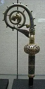
But it contains data that was unknown when Nos was active, I presume that is the period when NP acquired it. The staff is indicative of Jesuit involvement.

2.jpg

306px-Crosiere_of_arcbishop_Heinrich_of_Finstingen.jpg
 

Well, since we are in the mood for speculation I decided to check some topography and distances to see if it made any sense to take loads of silver and gold via mules up to the Caballos vs taking to El Paso, vs taking overland to the gulf at the mouth of the Rio Grande.

So first I had to find Tayopa. Which I did (hey RDT3 its not that hard to find, just a simple google search) ha ha.

Using modern roads as an indication of the easiest travel path (most modern roads follow ancient trails) I plotted my paths.

From Tayopa just from looking at the topography, the easiest route seems to be straight north and then fairly straight east slightly north to the Caballos. Avoids any major mountainous areas. This route is approx 350 miles to the Caballos.

From Tayopa going northeast and then east following current roads this route is winding thru very rough mountains for all but the last 50 to 75 miles. Looks like a difficult mountainous route. This route is approx 325 miles to El Paso.

From Tayopa going overland the entire way to the mouth of the rio grande, again following current highways, this route is very mountanous and the distance is approx 1000 miles.

So, it does seem to me, that it would make since to get to the Rio Grande as easily as possible and ship via barges downstream to the gulf. This saves about 650 miles of mountainous overland travel.
 

Per the Google Earth Pro path measuring tool, the land route/river routes to the mouth of the Rio Grande from the alleged general location of the Tayopa mine (I chose Yecora MX as a starting point). I inflated all distances by 25% to account for all the twists and turns encountered on land. I used the published length of the Rio Grande border measurement.

Option 1, easterly route. Yecora to La Junta MX (rough mountains 150 miles), then to Chihuahua MX (moderate hilly 125 miles), then to Ojinaga MX (mild desert terrain 150 miles), then by barge to the Gulf of Mexico (950 miles). 425 land miles, 950 river miles.

Option 2, northerly route. Yecora to Moctezuma MX (rough mountains 150 miles), then to Agua Prieta MX (moderate hilly 150 miles), then to El Paso TX or Mesilla NM (mild desert terrain 250 miles), then by barge to the Gulf of Mexico (1,250 miles). 550 land miles, 1,250 river miles.

Option 3, westerly route. Yecora to Tecoripa MX (rough mountains 100 miles), then to the Sea of Cortez (mild desert terrain 175 miles), then by ship to Panama (2,500 miles), then across Panama (60 miles to Gulf of Mexico). 325 land miles, 2,500 sea miles.

Option 1: Why cross Chihuahua and the Camino Real, controlled by Franciscans and Spanish? Unlikely.

Option 2: Why journey into New Mexico in the first place - no supplies available, a Franciscan stronghold, the Rio Grande controlled by the Spanish, and all of it teeming with Apaches, who were at war with all of them? In addition, why add 100 miles of land and 100 miles of river travel by continuing north to the Caballo Range? Unlikely.

Option 3: Less land travel. Sea travel is quicker and easier than river barging. More likely.

It's not impossible, but it's hard to accept that the Jesuits would move precious metal to the Caballos from Mexico. There well may be caches in the Caballos, but it seems unlikely they came from Mexico. As always, I could be wrong, but all I see that supports the idea is that suspicious map and some wishful thinking.
 

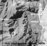
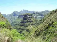
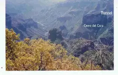
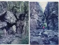
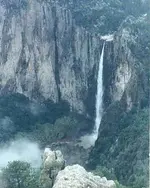
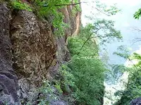
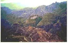
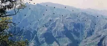
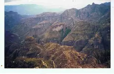
sdc/ whiskey rat "Gentlemen you have the right idea but Goole earth is absolutely useless for estimating animal travel. In the sierras I have seldom encountered an animal trail that goes straight for even 100 ft, In the remote Sierras I have spent a hard day with my mule yet that night camped within a 1/4 mile o my previous camp, The trails do not go straight up and down, they zigzag. up and sown. Incidentally here are a few pictures that may give you an idea of that country. the flat lands occur from Chihuahua on.

Incidentally why do you say alegded Sdc.?

.Aerial.jpg

.Main cuartel -  church at the tayopa complex..jpg

Cero del Cuea.jpg

Cerro del Cura, tunnel system shown.jpg

Entrance to Tayopa©@.JPG

Falls in Tayopa cpuntry©.jpg

old trail a.jpg

photo Tayopa.jpg

Showing erosion of the north side (1).JPG

Tayopa country.jpg
 

Last edited:

Top Member Reactions

Users who are viewing this thread

Back
Top