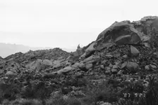
Do the Stone Tablets lead to somewhere OTHER than the Superstition Mtns?

Dear Azhiker, You are absolutely right. Have you been following this thread from the beginning? If you want to see my theory from the beginning without all the intervening discussion, you can go to DesertUSA under Gold Prospecting and Treasure Hunting, sub-heading History-Legends of the Superstition Mountains. You'll find the posts there. You can also go to my facebook page Stone Tablets Peralta. Remember to click on the thumbnail of the heart mountain to get all the photos. Please respond here as I have not yet figured out facebook. I will be glad to answer any questions you have. NP
 

What do all the 3 people and dutchman have in common?
What treasure where you looking for?
I was thinking that since your search area is far away from me, by a spirit mountain that is in another protected place, it wont do any good anyway to try and retrieve.
 

roadrunner you and every one else will find out the answer when the rest of the story comes out. what i was looking for was were the dutchman had been .and yes the area is protected by the gov,and also by the native americans and should be respected.you can drive or hike the area and enjoy the sites ,theres not going to be permits for treasure hunting on this property,but at least people can either drive and enjoythe sites or hike .
 

somehiker

Yes , the stone heart is removable , like an aztec sacrifice .

Marius
 

somehiker

Yes , the stone heart is removable , like an aztec sacrifice .

Marius

So, considering that a dagger is also shown on the same stone, what do you think it means ?
These items were placed side by side on the stone for a reason, IMO.
The Horse has an unusual cut at the approximate position of it's heart.
It also has one on it's chest. Would these marks be relevant to what lies at the heart ?

Regards:SH.
 

img126.jpg
A man named Jacob, called "the Dutchman" worked with William Hardy for a time. As Azhiker said, we know he was in this area. That's all Iim going to say for now. NP
 

Last edited:
somehiker

The dagger means a dangerous trail to a treasure . On the stone map , the dagger has an arrow in the middle which show the number 1 . That means how after the first stone map ( Don ) the trail to the trasure is very dangerous and if you are not carefull , your heart will broke and you will are an another sacrifice .
If you want to see what are under the mountain , just turn the stone heart on the other side . Are six rooms or " cities " ? Maybe the seventh is in other place or in the same but is hidden by a wall .
IMO , the mine was opened like a "service " door to a hidden treasure .
Why in the region is only a " MONETA " and none arrastras ?
Why nobody who knew about the " mine " , never claimed it ?

PS

This " mine " is not the LDM . The LDM was the source of the gold , and is lower on the mountainside . The author of the stone maps never found the source .

Marius
 

Last edited:
No Marius:
The carving of the dagger merely represents one of the things which could be seen from a small knoll by the mapmaker.
It is a very narrow and steep ravine, by which a second level of a stepped mountainside can be reached.
I've been there, and it is impassible up the center, to both man and beast.
To the left or right the cliff can be scaled without ropes (I went up the right side), and is not very dangerous at all.

"Moneta -ae f. (1) [the mother of the Muses]. (2) [a surname of Jove]. (3) [the mint; money]."

There would be no need for arrastres in the immediate area to which the stone maps apply.
Only what would be necessary to re-locate a cache or number of caches (money or "mints").

Regards:SH.
 

somehiker

OK . you are right . I will stop to talking about . If you were at the right location , you should have find the mine . Have you ?
You like the complicated research instead the logical ( for a few ) with many clues . If you believe how you found the dagger , congratulation , remains another 99 to make it 100 .

PS

" MONETA " also means " SMELTER " .

Marius
 

Last edited:
somehiker thanks for the info about moving the other site on dusa.will do that this afternoon .thanks np
 

NP:
Like I said over there.If you want people to read your stuff, you have to post it where they will look for it.
It's like shoving a book about yoga in with the ones on the history shelf. It's just gonna sit there and get dusty.

Regards:SH.
 

somehiker

OK . you are right . I will stop to talking about . If you were at the right location , you should have find the mine . Have you ?
You like the complicated research instead the logical ( for a few ) with many clues . If you believe how you found the dagger , congratulation , remains another 99 to make it 100 .

PS

" MONETA " also means " SMELTER " .

Marius

Marius:

Yes it does. And a few other things unlikely to be the subject of such maps.
"Fornax" is another latin word for smelter or furnace as well. But I don't think it would be logical to hide something valuable near one.
Every labourer who ever worked in your mine(s) or at your smelter(s) would have known their way around. Many would have come a long way to work for you.
What would stop them and their friends and family from returning to where they worked, once you were gone ?

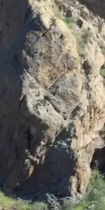
Logic would also dictate to me, that if I were to find a number of seemingly natural markings, in the same form and sequence as those shown on the Stone Maps, that I should look for others in the same area which also duplicate those on the stones.
Here is one example...

Big E.png

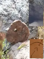
Just below I found this , made from the same kind of stone as the heart...

Marker 01.png

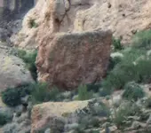
Both photos were taken about 200 m to the right of this...

100_0750 big D.png

Same with the bracketed cross above...

View attachment D with cross.bmp

But standing below the "E", and looking way up to the right, you can see this...

View attachment teepee mark.bmp

Now of course, someone being logical would say...But there should be other markings.
And there are, all of them, in line and in the correct sequence...

View attachment symbols.bmp

So you see, it's both complicated and logical.
Still got a few to get, but not quite 99...8-)

Regards:SH.
 

Attachments

  • Start Mark Boulder enl.png
    Start Mark Boulder enl.png
    220.3 KB · Views: 252
Last edited:
I was told today that my posting on DUSA was under the wrong heading "Legonds and Lore of the Superstition Mtns." I went to the DUSA Lost Dutchman site and found that I could not post pictures there. So I will post them here on this Lost Dutchman forum.
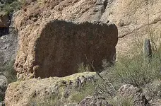
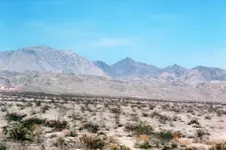
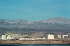
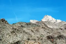
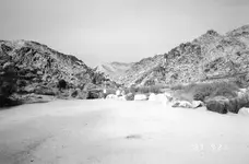
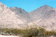
Take AZ Hwy 95 North from I40. When you get to about Mohave Valley, start looking north at the mountains.img113.jpgNotice the diamond shaped peak. This is where you will be going. When you get to the Laughlin Bridge, NV Hwy 163, turn left, cross the bridge and head west.img114.jpg Continue driving west until you reach the turn off for Christmas Tree Pass, turn right. A few miles down this dirt road, you will see a sign for Grapevine canyon. Turn left and stop and look directly west at the skyline. See the heart. img006.jpg
 

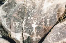
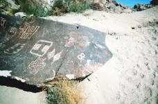
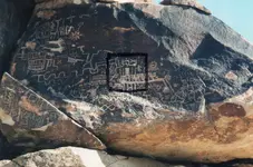
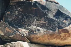
Continue driving to the end of this entry and park in the parking lot. From here it is a short walk to the petroglyphs. These markings are in the valley below the heart.img117.jpgimg119.jpgimg120.jpgimg124.jpgimg122.jpg The picture with the black square is the map to the mountain that you saw from driving up from Mohave Valley.
 

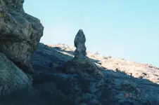
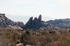
After enjoying the map-rock and leaving Grapevine Canyon, turn left when you reach the dirt road coming out of the parking area. Follow this road a few miles, look to your left. About 100 feet before you come to a sharp left in the road. There you will see the dagger rock, on the left---hiding in plain sight.img002.jpg The hasp of the dagger points into the canyon leading to Spirit Mtn.img123.jpg Continue around the left curve of the road and look to your left about 1/2 a mile. From here you'll be able to see the "3" that's on the horse map.img003.jpg Looking to the left at the mountain range, in the distance you will be able to see the "priest" rock with his hat sticking up. Binoculars will be helpful here.img025.jpg Up the canyon that the dagger rock points toward, several miles are located a "hooked arrow" from the map as well as the "5" and the squares from the tablets. These can only be viewed from above and I don't feel comfortable posting pictures from Google Earth. They can be viewed if you're up to a hike half-way up Spirit Mountain. remember these areas are protected native american spiritual sites and also protected by the park service, no metal detecting is alowed,or picking up artifacts , if you go hiking or camping please be respectfull and dont litter , enjoy yourself and have a great experience. np
 

Last edited:
somehiker, thanks for the advice on DUSA. I couldn't post pictures on their Lost Dutchman site. The files were too big.
NP
ps: The Pope has his own web-site.
 

Last edited:
NP:

For DUSA a Photobucket account works well....SH.
 

somehiker

The pictures are nice but is only a coincidence .

In the latin heart is carved " FORNIX " and not " FORNAX " . In this region the mountain has a cut like a triangle ( or arrow top ) which show directly the region of the mine ( NOTO TRIANGULUM ) .

You wrote " Every labourer who ever worked in your mine(s) or at your smelter(s) would have known their way around. Many would have come a long way to work for you.
What would stop them and their friends and family from returning to where they worked, once you were gone ? "

Them stopped the Death . In the beginning they was slaves and have sacrificed to the Gods . After they was labourers and had accidents or was " massacred " by the " warriors " ( in the best scenario ) . And , in the last attempt to protect their treasures , the owners , put there " watchers " like Waltz , the " Rifle killer " , etc. , enough to pass few of the labourers generations and to forget the location .

Good luck :find:

Marius
 

Last edited:
Marius:

Far more than coincidence, I am not finding these details by accident.
Detail is very important to my way of thinking. Any marking or combination of markings should, IMO, be a close match to what can be found on the stones.
If they are not, I have little interest in them.

The dagger is another example of the detail I seek.
And how these details, once found can make the stones easier to understand and follow:

The handle...the symbol on which is visible through the brush...
The arrow across the top of the handle is also visible, pointing to the right:

View attachment handle with D.bmp

The arrow also points to the tip of a number "1".
Just as it does on the upper trail stone.

View attachment handle arrow with 1.bmp

Above the handle is the blade section.
Although the bushes make it harder to see the outline,
it's not difficult to see what lies at the tip...

View attachment dagger blade.bmp

Not only does the upper portion of the dagger closely resemble the Priest carved on the H/P stone,
but the point of the dagger also intersects the top of a bluff, the line of which matches the line across the top of the trail stone.
And looking to the right...there is an "R" visible, matching the one on the stone map and it's position.

View attachment heartpriest1751 wi R.bmp

As a bonus, to the left of the handle is a "D" like that on the back of the lower trail stone.
Note how it is in bas relief, the same way it was done on the stone.
It IS in the correct location as well and is an important clue as to how the stones are to be used.

Regards:SH.

View attachment Don D.bmp
 

somehiker

The Priest on the map is Weavers Needle . The 1847 on the podium , are the coordinates from that era . Find what era matched those coordinates to Weavers Needle and you find when have made the stone maps
The meanings of the markings under the stone heart are " The peak at the tenth lugar from the mine is Weavers Needle . With the orientation of the stone heart ( which is carved on the Latin heart ) you can find where starts and ends the trail .

Have a nice day

Marius
 

Top Member Reactions

Users who are viewing this thread

Back
Top