Do the Stone Tablets lead to somewhere OTHER than the Superstition Mtns?

View attachment 790747markmar and cactusjumper, To a certain extent, I think you're both right. On the outside of my squared area of the map, my difference in opinion comes in where I believe the dots are the trail (and therefore not six days). The solid squiggly line is a representation of Spirit Mtn as seen from Christmas Tree Pass Road and hence could be a shamanistic interpretation. I would like to focus on the main map that markmar detailed in color in a previous post. I believe he is right in his interpretation to a point. I would appreciate any comments regarding the main map. Thank-you, NP
Hey Not Peralta, enjoy studying this map, it is a cool looking petroglyph. I'm not experienced at all in interpreting pictography, but started reading and studying the book, THE ROCKS BEGIN TO SPEAK. { desertmoons suggested I get this book, because the natives sometimes marked their cave openings with these type panels.} I see many symbols that are in the book, that is on your map. It mentions that the Indians used {rock incorporation}, that they would employ rock features to add to the meaning of a panel. They also used {symbol combination} and {symbol incorporation}. Combination-just combining 2 or more symbols together. Incorporation-blending 2 or more symbols together. ----------------------------------------- ----------------------------------------- ---------------------- ----------------------------------------- ---------------------- --------------------------------------------------- I'll list a few of the symbols found in the book and their meaning: The hands with part of the arms means: REACHING. The hands only means: DEATH {Qjibwa}. The ' T ' {the top of the ' T ' is longer} means: UNDER. The single solid 'dot' means: HERE. The 'square' means: OBJECT or PLACE. The widened ' V ' means: OPEN. The ' O ' means: HOLDING. A short 'horizontal-line' means TRAIL. A solid filled in 'bar-shape' means: SOMETHING THERE. A larger plus-sign ' + ' means: CROSSED. A diamond means: PEACE, UNISON. 'Dots forming a trail mean: FOOT-PRINTS. They are many more, 'best to get the book.' The cost of the book is about $20.00. ----------------------------------------- ----------------------------------------- ---------------------- ----------------------------------------- ---------------------- ---------------------------------------------------- Speaking hypothetically: On the bottom center, you have 2-diamond symbols combined, which may mean that 2 different Indian tribes were in peace with each other {in-unison}. Upper left on panel: the hands are reaching toward a figure that has many 'symbol-combinations'. The {' T ' under-symbol}, a curved bend {turned-symbol}, possibly a cavern/cave symbol {the vertical parallel-lines that form the ' U ' shape on bottom}, the {dot 'here-symbol'} suspended over the figure, to the right of the {' T ' under-symbol}. -- The book shows a cavern symbol will 3-parallel lines stepping down, the middle line indicates movement. In your panel, they may have emitted the middle line because they used another symbol that indicates 'downward movement'. ----------------------------------------- ----------------------------------------- ---------------------- ----------------------------------------- ------------------------------------------------- Looking at the 'symbol-combination' the lower arm is reaching toward: The {6 vertical lines with the line across the top} symbol represents-BROAD DOWNWARD MOVEMENT. This 'broad downward movement' is attached {combination} to a 'trail-symbol', on it's right. The extended 'trail-symbol' ends at the {proposed 'cavern-symbol'} Also notice the DOTS 'foot-prints' trail passes close-by the 'cavern-symbol'. -- On the right and bottom of the 'proposed' temple area. Is another cave/symbol, which runs from under or through the temple and then turns at a 90 degree bend and runs further maybe reaching the outside. If that is a temple and the 2-parallel lines represent a cave/cavern opening, the end of it could represent the entrance from the outside? ----------------------------------------- ----------------------------------------- ----------------------------------------- ---------------------- ---------------------- -------------------- The area of the proposed cave running under the temple is filled in solid {all white,carved} like the center 'enclosure' {place} of the temple. The filled in area means: SOMETHING THERE. The cave part of the cave/tunnel that is not filled in {below the 90 degree bend} passes by the 'hand-symbol' without an arm. The 'hand-symbol' means 'death'. This 'hand -symbol' may represent a 'burial-ground' for there dead. ----------------------------------------- --------------------------------------------------------------- ------------------------------------------------------------------------------------ Like solving a mystery. Not knowing if any of it is true until proven in the field. ---------- THE TRUTH IS OUT THERE
 

Last edited:
trailrider thanks for the information.np
 

View attachment 790747markmar and cactusjumper, To a certain extent, I think you're both right. On the outside of my squared area of the map, my difference in opinion comes in where I believe the dots are the trail (and therefore not six days). The solid squiggly line is a representation of Spirit Mtn as seen from Christmas Tree Pass Road and hence could be a shamanistic interpretation. I would like to focus on the main map that markmar detailed in color in a previous post. I believe he is right in his interpretation to a point. I would appreciate any comments regarding the main map. Thank-you, NP
ROCK MAP part #2 Hey Peralta, LaVan Martineau the author of the book, 'The Rocks Begin To Speak', on page 188 talks about 'rock-incorporation' {all rock features} pertaining to the panel. It includes the rock outline and the proximity of the symbols to the panels rock-edge, dips, humps, holes, cracks, and the rock angle {whether the panel face is tilted, flat or vertical -- should be noted. The location the viewer is standing, while viewing the panel should be noted, AS MANY PANELS ARE PURPOSELY ORIENTED AS TO DIRECTION -------------------- Speaking hypothetically: If this panel is oriented showing direction, it should lead you to the suspected 'entrance' area. If you can locate the suspected area that the cave/cavern is, 'you may find other directional markers leading to the exact entrance. The book showed a photo of a 'cavern-opening' with an Indian pictograph carved right over the entrance. ----------------------------------------- --------------------------------------------------------------- --------------------------------------------------------------- --------------------------------------------------- The Spaniards would have left their own directional markers that lead to the 'entrance' also. But may have messed with the Indian markers like they messed with the Indian monuments, altering them. So you be able to locate the 'entrance' without total map interpretation.
 

trailrider, glad you're enjoying looking at the map and petroglyphs. you should also read about intaglios, which are large land carvings.
America’s Nazca lines
from Peru to Spirit Mountain.
Not Peralta
 

EB

When I wrote " Look for similarities " , I meant for some similarities . I didn't wrote how are 100% the same . ???

Marius
 

trailrider,i am looking at the photo ,and looking at what your talking about.np
 

Joe,

Did you really write that statement?

Ellie B

We are many hundreds of years separated from most of the petroglyphs, those who created them, and most importantly, the process itself. While many rely on modern Natives' interpretations of the carvings, I haven't been at all convinced the natives know much more about them than you and I do. After all, they haven't been making any new ones (other than a few panels with cowboy hats and choo-choo trains) have they? Pretty hard to maintain knowledge of a lost art when that art form is dead and has been for many generations.

Pictographs are a little more modern, but not much, and the true meanings for them are also speculative.

Intaglios - same story but more so. The Superstition ground art in particular is highly suspect IMO because they are likely 'modern', white-done and proprietary to their creators' purpose, whatever that is.

There may be a few elders who have a few good ideas about it (very few, if any), but I wouldn't be surprised if they aren't keeping it to themselves. Most of our knowledge of this time period is deduced from circumstantial evidence and whitey's assumptions, which sound authoritative, but most likely isn't. Martineau's book is helpful at times, but IMO by no means is it a reliable go-to source.
 

The Pictures

Hello Marius,

A tip of the hat to you sir for recognizing the similarities between the two pictures. A great catch. Years ago I was in Mexico and had the opportunity to visit several archaeological sites, and I believe the base of the temple in your photograph is very similar to the temple base base found at Mitla, Yucatan, State of Oaxaco, thirty miles form the capital of Oaxaco. The temple in your photo resemble Israelite temples found around the world.

The original intent of the creator of the Rock Art is hard to say particularly with the subsequent graffiti but if there was a temple in those mountains what an incredible find. I believe one of the posters here made a great point when he commented that the native american`s worship this area for a reason.

Of course the picture of the temple you posted came from an artifact found in Arizona.


Tom
 

"I believe that the stone tablets were being delivered to the Mission that used to be located near the base of the Superstition Mtns off Peralta Road."

During the period of the Jesuits (ending in 1767) there were no missions or visitas north of the Gila river. During Padre Kino's time, he made 13 trips into the land called Primera Alta, with his final journey in 1702. He established visitas between the missions, where possible, about one day apart. The locations were selected and named, and they extended west from the Salt River junction with the Gila all the way to the Colorado River.

After the Franciscans began their ministry in the same area, they were unable to maintain the visitas west along the South side of the Gila with few exceptions. There may have been a Franciscan chapel or visita at the base of the Superstition mountains, but there is no record of a mission in the area with a resident priest.


i personally believe there was a visitia above the gila...at the confluence, or in the area, of the san pedro...
the padre used the Gila to cross into the pueblo areas of new mexico...fact.
still looking for the ruin.

not one anthropologist will commit to KNOWING rock art meaning..."best guess" going is the only honest answer.
if any native know the meanings, they won't give that information to anyone outside their society.
 

Last edited:
Hello Tom

The same tip of the hat to you .

Marius
 

To set out on a quest and follow in the footsteps of others, you must have a direction. You have to know the signs they left behind and why they took the time to leave them. What purpose would these signs serve to others without the knowledge and wisdom of interpretation. The light of greed will only blind your senses. You must have and possess the darkness of night. It alone will show you the light of guidance. Without the knowledge of the stars and constellations, you will be lost. Everything of great importance discovered on this earth is associated with one sign and one sign only. "Orion".
Orion's Belt is depicted in a petroglyph in Grapevine Canyon at Spirit Mountain.
NP
 

EB

When I wrote " Look for similarities " , I meant for some similarities . I didn't wrote how are 100% the same . ???

Marius

I understood your point the first time. I want to know what similarities YOU had found.

Thanx in advance,

EB
 

NP

In the past , stars or constellation in the night and sun in the daylight .
You wrote " The light of greed will only blind your senses " and I feel offended a bit . What made you to have this impression ?

Marius
 

markmar,you should not feel offended nor should any one else,this is not intented for anything anyone said.read it again try to understand the nature of what i was saying.np ps,this has nothing to do with your interpretations
 

Last edited:
markmar keep up the good work,dont get discouraged,np
 

NP

I understand what you mean , but , IMO , " light of day " match better with " darkness of night "

Marius
 

markmar,how can you travel at night in the right direction,with out the stars? If you can see the stars ,you can see the light in which to travel by.np
 

Last edited:
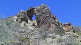
IMAG0356 (4).JPG TIME PORTAL

Hey Not Peralta, talking about the map analysis; isolating each element of the map for interpretative study. Is the map illustrating a 'temple' or some other meaning in this element? The element is the cluster of combined symbols representing the proposed temple. Are there any discoveries in all of Americas's history that a temple has every been discovered? And if no accounts of 'lost temples' have been recorded, 'does not mean that they do not exist, but maybe not, been discovered yet'? ----------------------------------------- ----------------------------------------- ---------------------- ----------------------------------------- ---------------------- ------------------------ Met several treasure hunters in the past. This one treasure hunter was from Spain, in his past a member of the foreign legion. He pasted away a few years back, God rest his soul. This treasure hunter searched this one area for 27 years here in America. His belief was that in this area was 'one of the richest gold mines' in the world. He told me the story, that somewhere in the mountain [underground} where he was searching was a temple made of solid gold. The area he was searching was an 'intrusive' area, caused from volcanic activity. And I heard from recorded accounts that there are rooms scattered through out the mountain of under ground grave yards of the bones of deceased Indians of the past. ----------------------------------------- ----------------------------------------- ---------------------- ----------------------------------------- ---------------------- ------------------------ Also heard accounts of the Indians of this present age: The guardians of the underground entrances to their ancestors burial ground. Highly guarded secret by the Indians. The area this treasure hunter was searching, was also an area where it was said that to this day certain Indians would occasionally hike this mountain range and check all the entrances, to see if anyone uncovered them. And if so, it was their job to recover them. --- The treasure hunter also had copy of a 300 year old map that he showed me, that had an illustration of the mountain he was searching and also depicting a certain gap in the mountain. This Spanish map showed a trail coming from mexico into this mountain range, this was his interpretation of the map. He knew how to interpret the Spanish writing on this map. ----------------------------------------- ----------------------------------------- ----------------------------------------- ---------------------- ------------------------------------------- The path on the map lead to the area on top of the mountain near the gap of the mountain, that's all it showed of the area. Then to the side of the map were strange looking symbols that the treasure hunter said, 'if you find these carved symbols on the mountain, you are there. He said he found one of the entrances and showed me pictures. The mine entrance was a volcanic fissure vent. The entrance of the mine had the same shape cut on the outline of it's side as one of the symbols on the map. I seen this with my own eyes, making me a believer {the truth is out there}. To the day he died he never told anyone where the entrance was. It is lost to this day, I know were the general area is, not the exact spot. ----------------------------------------- --------------------------------------------------------------- ------------------------------------------------------------------------------------------------- THE TRUTH IS OUT THERE
 

Last edited:
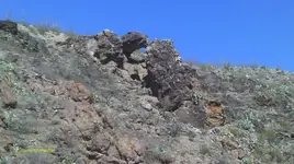
IMAG0342 (4).JPGView attachment 792546 TIME PORTAL part #2


Map analysis {element resolution}: Most of us heard of the fabled ''7 lost cities of gold that the Spanish were looking for. Just because no recorded accounts of the explorers of Spain found any lost cities of gold, does not mean that it does not exist? If any of these lost cities existed, and the Spaniards did discover any of them. Would not they be regarded as top secret and any evidence of them kept hidden to this day? ---- Speaking hypothetically: Could these lost cities be caverns underground, formed by volcanic activity? -- Caverns of huge gold veins running through them?--The reported temples of gold were built right into these huge veins of gold? ----------------------------------------- ----------------------------------------- ---------------------- ----------------------------------------- ---------------------- ------------------------ The treasure hunter form Spain told me that it was reported that some where in the mountain, that some of the veins of gold, were pure enough and large enough, that you could cut out chucks of gold with an ax. I never before heard of such a thing, of veins of gold so thick you could cut it with an ax. The question I asked is this possible? -- It would be like in the movie, 'honey I shrunk the kids', where the grasshoppers were as big as giants. ----------------------------------------- ----------------------------------------- ---------------------- ----------------------------------------- ---------------------- ------------------------ Speaking hypothetically: These stories of underground 'lost cities with temples' may exist? Now looking at the Indian Petroglyph Map:
 

Last edited:

Top Member Reactions

Users who are viewing this thread

Back
Top