Real de Tayopa Tropical Tramp
Gold Member
- Joined
- Nov 8, 2004
- Messages
- 14,582
- Reaction score
- 11,947
- Golden Thread
- 0
- Location
- Alamos,Sonora,Mexico
- Primary Interest:
- All Treasure Hunting
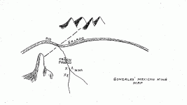
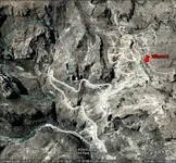
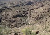
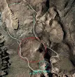
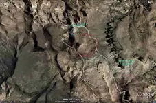
Good afternoon Ladies & Gentlemen: As I have cautioned, one must orient the Satt pictures for correct viewing.
Example #1 Satt picture corrected
" #2 " " uncorrected
" #3 " " " shaft ??
Keep it up gentlemen, I am enjoying it.
Don Jose de La Mancha
Example #1 Satt picture corrected
" #2 " " uncorrected
" #3 " " " shaft ??
Keep it up gentlemen, I am enjoying it.
Don Jose de La Mancha


")