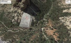
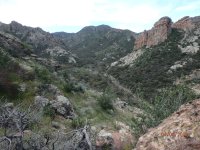
Whiskey Springs Maps

Why would you stake a claim on highgraded ore?
if Wagoner would had stolen or possessed ore from a close by mining company, then he would have to sell his ore far away from that region, maybe in another state, in regards to be not catched red handed. He would be in big trouble if someone would recognize the origin of the ore and he would not had an answer to that. Only the black market if would been possible, but big quantities is another risk which could led him to the heaven gates.
Is easy to say he had highgraded ore but hard to say where he sold his ore in regards to survive.

Not sure that's entirely correct....
 

Yes, I do know the story says it's quite purposefully quite buried now, but it is a nice refresher. I didn't remember that when I was out there and consequentially, didn't look. I wonder if thats true, or a nice little CIRCLE to keep people HERE for a loooong time. Either way, Im here and will follow all leads the best I can.... :) Another hike (besides the ones currently on the fire) is in the planning stages. Winter is short here. I need to do as much as I can, now.
Nice little circle?? No, no spinning by me.

I enjoyed the video you made, not enjoying where the talk seems to be going. Good luck to you and your efforts. 👍

Idahodutch
 

Nice little circle?? No, no spinning by me.

I enjoyed the video you made, not enjoying where the talk seems to be going. Good luck to you and your efforts. 👍

Idahodutch
Oh no I think you misunderstood or probably, I misspoke. I didn't mean to imply YOU put that circle and I apologize if thats what it sounded like.
I was trying to say whoever Originally wrote that, or said that, or "relayed the message" over a hundred years ago, maybe THEY planted a little "circle." I thought I was just making some small-time banter about the little details people place in these legends (not YOU, but the original storyteller).
Maybe too little too late, or damage done, but I honestly didnt mean to offend you, and apologize if I did. It was definately not my intent, nor was it to criticize any details you bring to the discussion, not in the slightest. Your input is valued, greatly.
Again, Im sorry for not being clearer and Im sorry if you found it offensive or took it in a way I wish you didn't.

I hope you have a Happy Thanksgiving.
 

Last edited:
Oh no I think you misunderstood or probably, I misspoke. I didn't mean to imply YOU put that circle and I apologize if thats what it sounded like.
I was trying to say whoever Originally wrote that, or said that, or "relayed the message" over a hundred years ago, maybe THEY planted a little "circle." I thought I was just making some small-time banter about the little details people place in these legends (not YOU, but the original storyteller).
Maybe too little too late, or damage done, but I honestly didnt mean to offend you, and apologize if I did. It was definately not my intent, nor was it to criticize any details you bring to the discussion, not in the slightest. Your input is valued, greatly.
Again, Im sorry for not being clearer and Im sorry if you found it offensive or took it in a way I wish you didn't.

I hope you have a Happy Thanksgiving.
Cuzimloony,
Thank you and happy thanksgiving to you as well. 👌👍
Sincerely, Idahodutch
 

Attachments

  • paintings.jpg
    paintings.jpg
    315.2 KB · Views: 23
I think they are on the hill west of Angel Basin
Interesting.
If I can pick your brain for a moment...
I see how the trails there at Angel Basin line up with Bobs map, but that can happen in a lot of places where trails intersect.
Is there something about that cryptic writing that led you to this location? I understand if you're keeping it close to the chest. I wont pry. But...... Im going to mull this over a bit and see if I deduce what brought you to this spot. Maybe it's a story I dont know....
I also know Bob wrote that he WOULDN'T go get those paintings. Do you believe him? Finally, did DeGrazie hide more on his own? If he was sore and hurt the first time, with Bob, would he go all the way to Angel Springs solo?

When I first got to AZ, I found an old bookstore in Scottsdale that was going out of business. Found this gem. It's a little treasure all in itself.
20241128_223248.jpg

20241128_223045.jpg

I wish it were personalized to me, but I hadn't been born yet so, I guess that's too much to ask.......
 

Interesting.
If I can pick your brain for a moment...
I see how the trails there at Angel Basin line up with Bobs map, but that can happen in a lot of places where trails intersect.
Is there something about that cryptic writing that led you to this location? I understand if you're keeping it close to the chest. I wont pry. But...... Im going to mull this over a bit and see if I deduce what brought you to this spot. Maybe it's a story I dont know....
I also know Bob wrote that he WOULDN'T go get those paintings. Do you believe him? Finally, did DeGrazie hide more on his own? If he was sore and hurt the first time, with Bob, would he go all the way to Angel Springs solo?

When I first got to AZ, I found an old bookstore in Scottsdale that was going out of business. Found this gem. It's a little treasure all in itself.
View attachment 2181049
View attachment 2181050
I wish it were personalized to me, but I hadn't been born yet so, I guess that's too much to ask.......
Here`s a pic I took from farther north coming down off White Mountain of Angel Basin. The white rock looks accessible to me. I was just messing around with the letters and their corresponding numbers and matched them up to some co-ordinates. I`m probably way off, but who knows.
 

Attachments

  • P4060046_2.JPG
    P4060046_2.JPG
    2.7 MB · Views: 28
Here`s a pic I took from farther north coming down off White Mountain of Angel Basin. The white rock looks accessible to me. I was just messing around with the letters and their corresponding numbers and matched them up to some co-ordinates. I`m probably way off, but who knows.
Great pic!
Is this a setup? Are you going to tell me your 70 years old or something like that? Lol

So....is that white rock on the right the area where you're thinking, or is this pic way farther north? It looks accessible to me too......
I thought I read, or heard somewhere, something about these being put in a cave. Not in Bob's book, maybe it was a youtube channel......
 

I will agree that there ARE those (whom are elderly), CAN hike incredible distances over a long period of time - without "crashing" due to the environment/weather. :icon_thumright:

With some sort of comparison - I'm 55, been hiking for years - so you could say I'm more than just a daily hiker. What many here might not know about me - is that I am a smoker (yeah, I know, shame on me). Been one for 35 years and I STILL can go out, hike for 10 to 12 hours - covering miles of wilderness all with just 2.5 liters of electrolyte water all while carrying 50lbs of gear and get back to my vehicle before dark. I'll struggle, but will complete the route. My point is, I can see the RIGHT type of elderly man (who isn't a smoker) hiking into a tough area and make it back - but to say an 80 year old packed with gear (water, suitcase etc.) - make their way through some of the toughest terrain known to anyone, proceed to, mine out some Ore, is really hard to swallow. I have to say - though there are tough ones out there - common sense overrules the exceptional though. From what I know about those who lived back then in the 1800's - were a rare breed of tough-ones that don't really exist these days, but hearing a lot of these stories of men in the late 70's - reaching sites (Mines, caves, etc.) without having issues is just so hard to believe, I have to fall back on common sense. Again, as Geoff states - there are those who are exceptionally fit in regards to endurance - allowing them to cover great distances, but that certainly isn't the average man. Of course - were those back then, average people? I have to say no. Those back then struggled just for the basics and would do ANYTHING to survive and complete their task. I think we can all agree on that.

So - as we could go back and forth (as I did above with myself), I think we can all agree, that those back then were just survivors of anything that came their way in Life. Al Senner did some incredible distances as well - though he was known to ride most of the time - there were times he had to climb up that North Western side, just to reach his camp, not to mention he did that during snow storms as well - providing you believe the story by Helen Corbin.

What I will say about all of this - is that in the end, I have to go with Joe on his assessment. He walked the path that supposedly Wagoner did take, as well as the Dutchman who did similar hikes down similar paths - as everywhere in those Supes is tough to get to. He got to see first hand the difficulties that can arise if one isn't prepared. Not to mention that Joe was on an actual trail. I don't believe those back then had the same trails as we have today. I would think, many times - those back then would have to walk "off trail" and into the thick of things - just to reach a desired location that's supposedly hidden from everyone else.

All this said - a thought comes to mind, based on all of this discussion. If most of us think these men DIDN'T walk/hike those distances like the stories would have you believe- then that leaves me to believe the Wagoner's location AND the Dutchman's location are not that far into the Wilderness. In this thinking - things would make more sense in how these men conducted their business, being able to get in there within a day - and then get out before dark. Something just isn't right about those kind of details. Once one (like Joe), gets out there - it just gets harder and harder to believe what we've all been told about these old timers.
A smoker you say? Im something of a tobacco lover myself......... A pipe or a cigar, daily.
20241128_140753.jpg
 

Last edited:
A question for the group, not necesarily related to Whiskey Springs, but to ALL of the Sups and desert areas in general.
In asking this question, I am showing a bit of ignorance...but, whatever.
What does a caliche coverd mine look like? Or any caliche covered hole......?
I read the wikipedia on caliche. I understand it's a precipitate (Im not geologist, but precipitates were covered in my "Chemistry for Engineers" class in college, plus I make my own soap so.... Im familiar with precipitates), and that it's mostly calcium blah blah blah.
Ive looked at the "caliche" images I could find online, BUT, I've never seen a caliche covered mine. Well, Ive seen the Kenworthy black and white drawing of it, but...... yeah. This material doesn't even exist where I'm originally from. If I saw one (covered mine) in the field, I might not recognize it (duh!) so, currently Im just HD filming everything and watching it back, later (drones, phones and gopros) while waiting for my knowledge to catch up to my field time. Yes yes NOT recognizing it is the point.......I know.
Does anyone have an example of a mine (or any hole) that's been covered by caliche, specifically? It can be in industry and not treasure related. ANY example would be appreciated....
 

Last edited:
Great pic!
Is this a setup? Are you going to tell me your 70 years old or something like that? Lol

So....is that white rock on the right the area where you're thinking, or is this pic way farther north? It looks accessible to me too......
I thought I read, or heard somewhere, something about these being put in a cave. Not in Bob's book, maybe it was a youtube channel......
No, no set-up. I’m only 65 and the white rocky area in the middle right where the two things are standing up, just on the other side of those. I was looking around on the other side of White Mountain and found some interesting areas to explore. There is a cave dwelling in Rough Canyon just on the other side on Cimeron Mt. I changed up my search area to Coffee Flat Mt. over by Whiskey Springs after more researching.
 

No, no set-up. I’m only 65 and the white rocky area in the middle right where the two things are standing up, just on the other side of those. I was looking around on the other side of White Mountain and found some interesting areas to explore. There is a cave dwelling in Rough Canyon just on the other side on Cimeron Mt. I changed up my search area to Coffee Flat Mt. over by Whiskey Springs after more researching.
Man...... I DO have to rethink some things..... Im impressed. I hope I'm doing that at 65 man. Truly inspirational.

I saw those 2 things standing up.....very peculiar that. I'll have to go check that out someday......I haven't been to that particular area.
I found, in the confluence of LaBarge and Whisky Canyons, a heart looking thing on a pedistal, much like the.....lion(?) I see in your pic. I don't think I "found" it as I know its been seen before, but there are some strange things out there aren't there.....?
20241118_194051.jpg


How often are you out there? It would be nice to have someone to talk to out there once in a while.....
 

A question for the group, not necesarily related to Whiskey Springs, but to ALL of the Sups and desert areas in general.
In asking this question, I am showing a bit of ignorance...but, whatever.
What does a caliche coverd mine look like? Or any caliche covered hole......?
I read the wikipedia on caliche. I understand it's a precipitate (Im not geologist, but precipitates were covered in my "Chemistry for Engineers" class in college, plus I make my own soap so.... Im familiar with precipitates), and that it's mostly calcium blah blah blah.
Ive looked at the "caliche" images I could find online, BUT, I've never seen a caliche covered mine. Well, Ive seen the Kenworthy black and white drawing of it, but...... yeah. This material doesn't even exist where I'm originally from. If I saw one (covered mine) in the field, I might not recognize it (duh!) so, currently Im just HD filming everything and watching it back, later (drones, phones and gopros) while waiting for my knowledge to catch up to my field time. Yes yes NOT recognizing it is the point.......I know.
Does anyone have an example of a mine (or any hole) that's been covered by caliche, specifically? It can be in industry and not treasure related. ANY example would be appreciated....
Caliche as a mixture used by miners and others in 19th century, is a mix of clay, lime/limestone and pebles/debris and water, until would had the proper fluidity. Sometimes they would add little dry weed for better grip.

There are two options of a caliche covered mine, one for waterproofing and the other for camouflage.

The waterproofing option is/was used for the mines which have their entrance at the ground level and going down or little inclined. After the logs and debris layers were put on the mouth of the mine, then a layer of caliche would be put on them. After the caliche was drying, they would put rocks, plants and whatever would be necessary in regards to look like the surrounding region.

The camouflage option is/was used to cover a wall in a horizontal drift/shaft/tunnel, but never at the entrance of the mine. If the region was very remote and very difficult to find, they would used only a rock wall at the entrance, but if the mine would be in a region easy to approach, then they would use the caliche camouflage.
I wrote not at the entrance, because elements and daylight would make the cover to distinguish from the other surrounding rock, so they would go deeper in the shaft where lamps would be needed, dug for few yards a fake tunnel at the same proportions with the main shaft, in a place where was not trace of gold or any precious metal, and make a stone wall at the entrance of the shaft where the rich ore existed. After that, they would mix the caliche which would be almost the same colour with the other rock, by using more clay or more lime and sometimes little ash, and adding pebles, debris or bigger rocks, in regards to look like the surrounding place. So, the camouflage would be protected from the elements and would keep its shape forever. The poor light in the deeps, would confuse others, who seeing the end of the fake tunnel, they would believe how there would be just a played out mine.
 

Last edited:
Caliche as a mixture used by miners and others in 19th century, is a mix of clay, lime/limestone and pebles/debris and water, until would had the proper fluidity. Sometimes they would add little dry weed for better grip.

There are two options of a calishe covered mine, one for waterproofing and the other for camouflage.

The waterproofing option is/was used for the mines which have their entrance at the ground level and going down or little inclined. After the logs and debris layers were put on the mouth of the mine, then a layer of caliche would be put on them. After the caliche was drying, they would put rocks, plants and whatever would be necessary in regards to look like the surrounding region.

The camouflage option is/was used to cover a wall in a horizontal drift/shaft/tunnel, but never at the entrance of the mine. If the region was very remote and very difficult to find, they would used only a rock wall at the entrance, but if the mine would be in a region easy to approach, then they would use the caliche camouflage.
I wrote not at the entrance, because elements and daylight would make the cover to distinguish from the other surrounding rock, so they would go deeper in the shaft where lamps would be needed, dug for few yards a fake tunnel at the same proportions with the main shaft, in a place where was not trace of gold or any precious metal, and make a stone wall at the entrance of the shaft where the rich ore existed. After that, they would mix the caliche which would be almost the same colour with the other rock, by using more clay or more lime and sometimes little ash, and adding pebles, debris or bigger rocks, in regards to look like the surrounding place. So, the camouflage would be protected from the elements and would keep its shape forever. The poor light in the deeps, would confuse others, who seeing the end of the fake tunnel, they would believe how there would be just a played out mine.
Wow. Excellent explanation (wikipedia didnt come close.....) and great pictures. All added to my mental files. Thank you fellas!
 

I think they are on the hill west of Angel Basin

393stroker

I too think - the De Grazia Paintings are in that general area, or at least it's ONE of the areas I believe they're potentially at. As we know they were inserted into tubes - but the question is, where would he have buried those tubes - knowing they would be safe? In my theory he would have buried them well enough - where weather erosion wouldn't be an issue and in an area where animals wouldn't be interested in. In this thinking, I would think - to hid them above ground level - keeping it clear of running/rushing water due to certain times in the year - where it not just rains, but pours down, flooding areas back there.

-SpartanOC
Angel Basin was a feint. He burned there some less worth paintings, in regards to give the impression he would hide there the more valuable. He didn't. What Robert Ward wrote was true. They hid the paintings in the same way and at the same place with another set of stone maps ( not like the known from the Museum ), in a covered up abandoned mine from another region.
 

Top Member Reactions

Users who are viewing this thread

Back
Top