I don't plan on dowsing any maps for people, to check out the Lost Dutchman area. For safety reasons, I could rate the risk factor on the scale of 1-10 as a #10. This is a very dangerous region to explore.
For completeness, I must add a story here. As once the retired Ph D scientist was returning back late, it was either already dark or soon to be. His wife called out the search and rescue team because she worried about him being late. By the time he reached the parking area, a search team had started leaving to find him. They met just outside the parking area, nothing left for them to do, so they talked a while. According to the scientist, one of the search team members had been doing this for over 30 years. So, now the dowsed maps were in the backpack and when looked at by the experienced rescue person. The GE map noticed as significant, was the one with the pin for the reference point near the heart on the shaft carving.
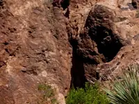
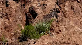
According to the retired Ph D scientist, the story he got for this pin location, apparently there used to be a rock house there on a long cave. At the time it was over 15 years since the Forest Service blew up that rock house on a cave. The original file names for the photos indicated the direction.
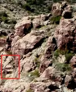
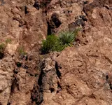
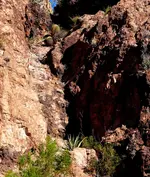
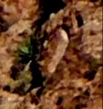
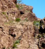
Now, the steps with the little spiral steps carving at the top, I put a red line box around them. The original file name for the photo was RH-area South. The RH-area stands for "Rock House-area". It has been cropped down, you can't see everything. I think the clues already posted are sufficient. Don't want anyone to follow them and risk their life to get there. I'd feel bad if something happened to anyone.
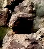
From the spiral step carving, to the cave at the top right, it looks to be a walkway.......maybe even with steps to reach it. Although the scientist tried to get up to the walkway for a look at the cave in the top right, you cannot without a ladder from the spiral carving to the cave pathway. A folding ladder is cumbersome and it might not reach, I'm sure that a tall ladder is needed.


 Please explain in Layman terms.