RG1976
Sr. Member
- Joined
- Mar 30, 2015
- Messages
- 336
- Reaction score
- 440
- Golden Thread
- 0
- Location
- Scottsdale, Arizona
- Detector(s) used
- Tesoro Lobo SuperTraq & Vaquero
Leupold BX-3 Mojave & RX1200i Rangefinder
- Primary Interest:
- Other
- #561
Thread Owner
Howdy Ryan,
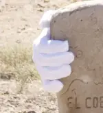
Men as honest as Mike "Gollum" are hard to come by. He picked that username because he is in search of the truth. No one has been more thural in their research, and examination of the PSM's. As you question his integrity, it makes me wonder what your next video will be like. Now you have to prove how the stone he is holding is different than the one you "examined". Gook luck with that.
Homar
Howdy to you as well, Homar!
My intention - as always - is to question everything.
He obviously edited the photo - and perhaps Deducer is correct that he was simply trying to fix a bad photo / lighting and did a poor job of it.
The map he is holding looks like the one I saw / photographed as well. However, the images he has on his website are completely different.
Sorry for not being more clear in my initial post. I was comparing "known" map samples (there are quite a few) - and started with his website, then linked back here to T-Net - and the maps are not the same....at all. Combine that with an edited photo - well, it seems worth an inquiry!
Anyone should be able to agree with that, even you =)
As to video 6 - my intention is to take an unbiased approach - just like I did in the first segment of the Stone Maps. I will admit, that the negativity towards the maps outweighs the positivity 10 / 1.
I have been given some great images that show how the trail map is pretty exacting - and these aren't google earth images. I will show where the map starts - and where it ends.
Homar - do you have any trips scheduled to come to Arizona to put your Google Earth theories on the maps to a test? You've certainly done a lot of impressive research and cant wait to see what you may find.


