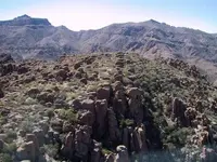
The Peralta Stones

David,

I certainly hope you have done better with Don Jose's pictures than you did with mine. On the other hand, you did manage to identify the Massacre Grounds picture. Of course, I have shown that picture here before, as well as some of the others.

I appreciate the try, but you are off base, sometimes off the field altogether, on the rest of the pictures. Asking Jose if his pictures were from the Superstitions was a hoot. :D

I also give you an A for the effort.

Take care,

Joe
 

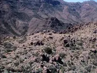
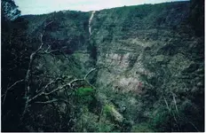
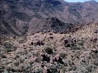
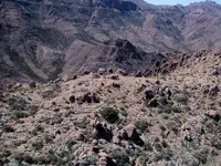
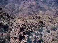
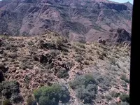
??? I am certain that those photos are of the eastern side of Malapaise Mountain and that if you follow that valley below towards the north, that you will come to Tortilla Flats... I also know that the mineralization the you see there, shows signs of copper being present.
 

Attachments

  • Air13.jpg
    Air13.jpg
    64.9 KB · Views: 343
  • Air15.jpg
    Air15.jpg
    60.6 KB · Views: 353
  • Air18.jpg
    Air18.jpg
    62.5 KB · Views: 348
good evening Bear / David: in post # 1071 you asked --> Is this the same area as that on the pics ?
*******************
Yes, on the picture #3, Tayopa, it is looking to the West. that village is our headquarters and the lumber mill.

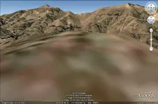
28* 00' 36.02 N 108* 57' 16 W. The google photograph is also looking to the W. Unfortunately Google doesn't give the true prospective.

# 1 --> 27* 59' 66.29 N. 108* 56' 49.54 Basically the same as Tayopa , but looking from the South.

The picture with 'this post' is looking W across the Tayopa canyon to the lumber mill and our headquarters. Far different from Google.

It gives a graphic demonstation why google cannot be trusted to give a true vertical 3 d picture, it has too many distortions and flattens out the terrain, still it is very valuable.

Don Jose de La Mancha
 

Attachments

  • Looking W across theTayopa canyon to the Saw mill ©@.jpg
    Looking W across theTayopa canyon to the Saw mill ©@.jpg
    31.6 KB · Views: 338
David,

"I am certain that those photos are of the eastern side of Malapaise Mountain...."

It's one thing to imagine what you are seeing with Google Earth pictures, and quite another to experience the reality. Before you present a single word of your conclusions, you need to spend a few years walking and climbing that reality.

Suffice it to say, you are wrong.....wrong.....wrong. You superficially know the layout of the mountains, but that's nowhere near good enough.
Malapais Mountain is almost four miles from where those pictures were taken. Not so easy to determine where you are from a picture, especially if you've never been there in person.

I didn't expect you to know. What's important here, is the word "certain" in your statement. You are also certain that you have spotted mines, vaults and numerous Stone Map markings or landmarks on the terrain in your Google Earth pictures. In some cases, that is something that can be done. However, sealed mines and buried vaults will not be seen.

This is not our first rodeo. We have all been down this trail before......many times. Using the technology and personal knowledge that you have been displaying here will convince no one. You will not be teaching or schooling very many of the members who post here. From our perspective, we have to assume you are joking, even though you may be completely serious. You would do well to take that as a gentle hint for future posts.

Beyond that, nice Google Earth pictures. :icon_thumright:

Take care,

Joe
 

Ok fine, If you are gonna post a pic and get met to show you where this place is, then say I am wrong, Well I would ask that you also show a pic from Google, that shows the same area like i did with the Massacre pic.
I still stand firm in my belief of where that pic was taken. The dark peak in the middle of this pic is at 33.30.01.12N - 111.21.20.11W. well this is the co-ords from google anyways, but I know what I'm looking at and if you don't want to believe it then don't, no problem with me on that, but don't think for one minute, that the years of study that I have done, will be abandoned just because you and perhaps a few others say that I have no clue about the Superstitions.
For your information, I do have several offers to help me in my endeavour. With my new partners we will reveal the 4 mines that in that area that the pic you gave come from. Yes I said ""4"" mines, 3 above you on the hill your on and one that is 90% to your left and on the opposite hill (the one the pic is showing). In time I will reveal all 17 mines as well as the vault,dwelling and smelting area.

Just sit back, relax, look and listen. who knows? you might just learn something new.
 

Attachments

  • Air18.jpg
    Air18.jpg
    62.5 KB · Views: 316
  • Air18.jpg
    Air18.jpg
    62.5 KB · Views: 308
Bear, while I absolutely give you credit for having the guts to take on the challenge of identifying some areas of the Superstitions from photographs, I have to agree with Joe and Oro in letting you know it's the "arrogance of certainty" in your posts that annoys me - It was the same way with Blindbowman and Santa Fe New Mexico. There's no room for discussion with any of you concerning your claims because you are 100% certain of them - and yet each of you interprets things in a different way. At the very least, 67% of you have to be incorrect, and it's even more likely that all of you are incorrect, and yet you're ABSOLUTELY certain and hold anyone who doesn't immediately nod their heads in agreement in disdain for doubting you.

That in essence is why you get the responses you get.

When you get a chance to visit the Superstitions, really take a look around you as you hike and explore all of the area. Seasoned veterans (and I'm talking folks who have litteraly spent YEARS physically exploring the mountains) even have a difficult time determining where a photograph is from since so much of the area looks so similar. Put them on the ground and I'd guess all of them could determine where they are because they have a 360 degree view to put things in perspective - you don't have ANY of that with a photograph - many times you can't even tell if you're looking N, S, E or W.

The Massacre grounds photo was easy to identify as you had houses in the distance and a much larger perspective to compare - most of the others are much more difficult to identify.

You know, I honestly do wish you luck, and a positive attitude certainly has it's place among explorers, but when you narrow your mind down so tightly that you convince yourself that you're 100% correct without ever having spent a day putting your feet on the Google Earth paths, you end up skewed in your exploration and focus only on proving your theory (facts in your case) to be true, without spending an equal amount of effort looking to prove it wrong which often can be just as valuable.

Best of luck to you though.
 

Well stated Paul,
It does boil down to a "boots on the ground" situation.
You must actually show that the initial research is correct prior to publishing.

Simply saying all dogs have fleas based on a given type of research only leaves you open to people like me,
who has at least three that don't.

Thom
 

good morning Bear my friend: first I wish to apologize to the room and you. The room for sliding a bit off subject.

David, as I mentioned, it was not a test, but a basic check on your technique of prospecting. I am satisfied, as I am sure many others in here are that it is correct. But I do have to take issue with you on being so sure with google, which tends to flatten out everything because of the vertical view losing your 3-D perspective. I tried to demonstrate this in the last 2 Tayopa pictures.

To do a good job one needs Stereographic aerial photographs, Google just cannot hack it.

By using the stereo photographs I knew exactly where the ancient trails and means of access were before even setting foot in the Area. If I had had to use basic google, Tayopa probably would still be lost.

Back to your success rate on the hidden mines, that was a loaded one since there is no evidence on the surface, and since the entire area is a mass of faults, it was useless to try to use them to find the hidden portals. There have been experienced prospectors looking for them for hundreds of years, in the case of Tayopa, 400. You would have to be a psychic to find them with the little information that I gave you.

You came the closest with Tayopa itself. That fault is the surface indication of the area where they worked, but they did not touch the external area where you suggested. They simply stopped two large vaults inside. The original entry is 'under' the Talus to the left. There is another hidden entrance, which I am not free to discuss here.

Conclusions, get stereo aerial photographs and recheck your data, don't rely upon the free Google version, too many spatial distortions. If you can afford it, get the best version.

Never lose faith, especially in yourself. I have no ideas how many theories I discarded and how many times I was proven wrong before I had success.

Don Jose de la Mancha
 

Cub;
I do understands the fact that 100s of people have made this same claim and I'm not gonna even try to defend or discredit, any of them. I know that in order for me to prove my claims is to get photos of the mine entrances themselves, perhaps some of the veins within as well, before most of you will take notice. You keep giving me all kinds of questions and tasks, of your choosing and from this, you judge me as having false claims.
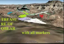
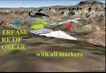
I was asked to show a map (topographical or otherwise), that showed everything that was shown on the Stone maps, so I showed you the priest map and a photo of the area that held all the points mentioned and in the exact places as on the Stone map and you just right on it and try to discredit it, Maybe you know I'm onto something that you don't want others to know. If you were more open (like others who do help), you might wanna take a trip up to the spot I showed and see for yourself, take pics of the view point and of the areas by the small cross and heart and then come on here and prove otherwise, that my statements, Photos, markers, maps and Stones are not what I claim them to be.

Like I said, I do have people who believe and have offered to help. So you can either ask questions about the area or mine, or you could ask for more information on the subject. It don't matter what you wanna do, You do as you please and I will continue to receive help and soon will prove to you, that I know alot more then I let on or that you might think I know.

I have announced my claim and have asked for help.
I have given you what you asked but you will not get enough to be able to go there without more info so you can take away what will be mine.
This discovery will be done in a legal fashion with proper papers signed and whatever Else needs to be done to make this as legit as possible. Any help or advise that would be helpfull in accomplishing this, would be more appreciated.


Toyopa;
Thank you for your reply and i did say that it would take, closer pics of certain areas to actualy find these places. I know that I must always keep in mind, that google views are only good if you keep your view looking straight down. I do tilt the view to get a better understanding of what is shown. Google just happens to be the only one that I show you, but it's not the only way that I study these mountains. Photos like those posted here, can be found in many forums and sites on the net. There are many different typres of maps as well that you can find of the Mountains.
 

David,

In asking you to look at actual terrain pictures, we are trying to gauge your abilities to do the things you claim. Unlike Don Jose, I found your ability to use Google Earth and topographic maps to match up with the visual evidence, less than impressive. Not to worry, as I wouldn't be able to do it either.......without having been there first and often.

You have, basically said that I don't know where I took those pictures, and you are certain that you do. That seems to be arrogance of the highest order and a palpable lack of respect. It's obvious that you don't know what you think you know.

You are upset that we have not shown you respect for your "finds", and how you have so cleverly used current technology to locate them. While it is possible to locate old mines, trails and other man made marks to the earth's surface using Google Earth, these particular mines would be almost undetectable.

No one is trying to change your mind. It quickly became obvious that reasoned thought and factual evidence would not be enough. You know what you know.

My pictures were taken from the ridge that separates East and West Boulder Canyons. Anyone who has researched the posts in this Forum knows that. That ridge is almost four miles from Malapais. When you have spent the time in the air and on the ground that I have, we can talk. Unfortunately, I will be long dead before you can accomplish that.

As with everyone else who has made your exact same claims, I would imagine everyone here will be looking forward to your proving yourself correct. On that day, each and every one of us will eat crow and give you the accolades you richly deserve.

Until that day, I trust you will humor us if we remain a bit skeptical.

Good luck and take care,

Joe
 

QBEAR WROTE: "(100s of people) have made """"this"""" :read2: """"SAME"""" ??? :-[ >:( :'( :help: ((((""""claim""""))))"
 

Attachments

  • stone_to_real_A.JPG
    stone_to_real_A.JPG
    135.8 KB · Views: 297
  • stone_to_real_A.JPG
    stone_to_real_A.JPG
    135.8 KB · Views: 296
  • 1b.jpg
    1b.jpg
    78.1 KB · Views: 296
CACTUS ALSO WROTE: "As with everyone else who has made your exact same claims"


[mod]Pics removed as Unacceptable
Next time the Poster gets Removed[/mod]
 

Cub;
...I know that in order for me to prove my claims is to get photos of the mine entrances themselves, perhaps some of the veins within as well, before most of you will take notice...

Correct - that's what most of us would call "proof"

You keep giving me all kinds of questions and tasks, of your choosing and from this, you judge me as having false claims.
I was asked to show a map (topographical or otherwise), that showed everything that was shown on the Stone maps, so I showed you the priest map and a photo of the area that held all the points mentioned and in the exact places as on the Stone map and you just right on it and try to discredit it, Maybe you know I'm onto something that you don't want others to know.

I assumed since you directed your response to me, that "you" in this case is myself - I suggest you look back through the posts and find where I made those requests of you and did the things you are accusing me of.

If you were more open (like others who do help), you might wanna take a trip up to the spot I showed and see for yourself, take pics of the view point and of the areas by the small cross and heart and then come on here and prove otherwise, that my statements, Photos, markers, maps and Stones are not what I claim them to be.

Once again, you are addressing this to me personally and in an earlier post I explained myself as far as helping you out is concerned and why I am unable to do so. In addition, the burden of proof is on YOU for coming here with your claims, it's not up to me to prove you wrong.

I have announced my claim and have asked for help. I have given you what you asked but you will not get enough to be able to go there without more info so you can take away what will be mine.

I once again don't recall asking for anything specific from you. I'm surprised to hear the desire in your voice to keep what is "yours," as I thought it was your purpose to do this for the people of Phoenix (most of who wouldn't have a clue about it anyways).

The only thing you've shown that I commented specifically on was your Google Earth image of the Priest Stone - my only comment was that I saw nothing on that image to convince me that your interpretation was anything more than "seeing pictures in the clouds."

You aren't understanding the gist of what I'm trying to tell you, so to make your life easier, I believe I'll step aside and simply let you carry on with your pursuit and wish you the best of luck.
 

TriDef Promotions
Google Earth in Stereoscopic 3D!


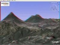
Would you like to see the world in stereo 3-D? Ever wondered what the view is like from the top of Mt. Everest? TriDef TM Visualizer for Google TM Earth is a driver that enables you to navigate around the Google Earth in real-time stereo 3-D and take full-screen 3-D screenshots. For a limited time we are offering a special free promotion on TriDef Visualizer for Google Earth.

The free trial runs in split-screen 2-D/3-D mode but enables you to screen capture full-screen 3-D images.
What do I need?
•A PC with a capable Graphics card. The higher quality your Graphics card and Display, the more you will enjoy the experience. Please Note: Just being able to run Google Earth does not mean you will be able to run Google in 3-D. Certain Graphics cards, are NOT capable of running Google Earth in 3-D. By default the Sharp RD3D has a known issue with the graphics card driver and Google Earth and TriDef Visualizer will not work. This can now be resolved.
•An internet connection
•DDD's TriDef 3-D Experience software
•Google Earth (All Version are supported, but Version 4 with textured 3-D buildings and landscapes is best)
Please Note: You will need either a 3-D display or 3-D glasses (for example, red/blue anaglyph glasses).
 

I AM WRONG !!!

I have made a mistake. I told you that those picture that I claimed were from Malapaise Mountain and I was wrong and I admit it, but I do know where this place is. Here is a pic from google of the closetest I could get to match the same view.
I knew that I had see this place before and I assumed it was from Malapais without looking into it and has stated earlier, so many pics, it hard to remember where exactly they were taken.

Forgive me for jumping the gun on that one guys ::)
 

Attachments

  • Air10-1.jpg
    Air10-1.jpg
    49.4 KB · Views: 265
  • A air 10.jpg
    A air 10.jpg
    78.1 KB · Views: 256
David,

No one is saying this can't be done. Many of us have been doing it for years. Some mines can be seen using this method. For instance, I have viewed the pit mine I believe to be the LDM from this kind of imagery.

Mines that have been sealed and hidden so that they can't be seen from the ground may actually be revealed from above. Your claims are for areas that have been searched for many, many years by some of the best Dutch Hunters in the business. Names that would be respected by anyone who knows the history of the LDM and the Superstition Mountains.

Like many who have come before you, without any time in the mountains, you believe you are better than all of them. You may be, but trying to prove it with a few posts a Google pictures is an exercise in futility.

The point I was trying to make to you, was not that you were wrong about the location, but that you were wrong about your certainty. That, IMHO, is an important point for you to pick up on. Personality wise, that may be impossible for you, but it was worth the try.

Still, it's a worthwhile project for you, and could bring you rewards beyond what you seek. I am not so sure of that, because you have been all over the board on that point.

Take care,

Joe
 

Joe;

I hear what your saying and understand all the views. I thank you and everyone else that do reply to my post. My claim is not just for one spot, I just talked about one place but there are many, there are many maps on those stones.

Not to say too much but can I ask if you have recorded and registered what you are showing in those picks ? I don't mean the mineral bearing rock that is near you while taking the photo, I see all of what is there as I'm sure you do as well and where it is? or what's left of it.

So you know how to read one of the stones but can you read the others? I will tell you that each map on the stone are in different places that are not necessarily in the Superstitions. I will also say that the "5" with the five dots around it, are the furthest North of al the maps and the Priest map is the furthest South.

What most of you fail to realise, is that i am not as foolish minded as you think. I have my reasons for going about things concerning my finds and how I am to find someone I can trust even though we never met, these methods are used to weed out the ones that just want the gold itself.
 

I have been saying for years now that the Stone Maps could be fakes. At first I was a firm believer in them, but over the years disturbing evidence kept turning up. It took me a long, long time to find that evidence.

What makes them so convincing, is the fact that whoever created them spent years in the Superstitions, and used landmarks and trails that they were familiar with to "authenticate" them. At this point in time I am "certain" that I know who created the maps.

Having walked all over that Stone Map Trail, I was looking for the heart at the end of the trail. There is a 1 with a curved line (trail) coming off of the top of it. It continues to the center of the heart and ends in a triangle.

That one is in the northern end of West Boulder Canyon. The trail curves into a small saddle leading into Little Boulder Canyon. Well over thirty years ago, I laid out the Stone Maps on a topographic map,, without having been in most of that area. No Google Earth in those days, but I did have the USGS photos used to make their topo's.

You could see the faint lines where that old trail was still visible. Most of it had disappeared decades ago. At the exact end of that trail in Little Boulder Canyon, exactly where I had placed it before ever going into the area, I found the triangle and this:

TheHeart.jpg


That heart, trail and triangle are some of the things that convinced me I had the correct layout for the maps. Don't have to have areial photographs or Google Earth to see it, just be there. Ever wonder how anyone made those maps before those things were available?

The mineral outcropping we found was in the center of the triangle. It was Magnetite. You have seen the triangle. Do you recognize it?

One of the problems you are having is, that you are miles and years behind just about everyone else. That's a fairly obvious fact to everyone but you.

Slow down and read some of the archived posts here and on the LDM Forum. There's a wealth of information that might save you some time and effort.

Take care,

Joe
 

Old Dog wrote
Simply saying all dogs have fleas based on a given type of research only leaves you open to people like me,
who has at least three that don't.

Aha! Thom, you have horses don't you amigo? We noticed that too, that our dogs just never seem to get fleas - at all - and I heard the strangest rumor, that fleas cannot stand the scent of horses, and the dogs spent a lot of time with the horses even sleeping on their saddle blankets etc which appears to be true. I wonder if it holds true with mules and burros as well?

Santa Fe NM - I have a question for you. You have said that it would be "suicide" (virtually) for anyone to approach your site in the Superstitions. Hmm, then do you not like me? You invited ME to go right up there and get some samples. Looking to get rid of me? Sheesh amigo what did I ever do to you? :o :'( ??? <sniff> :-[ :tongue3:

Quinan Bear, what about the fifth Peralta stone? Have you fit that one in with your sites as well? Thank you in advance,
Oroblanco
 

Top Member Reactions

Users who are viewing this thread

Latest Discussions

Back
Top