The Peralta Stones

OK.... you want more.......
Let me show you how to follow the Priest map, which could very well be the LDM.
First start at Weaver's needle. Head east and follow the canyon there, northward. Passing to the east then north of Black top Mesa. Just before you hit the next canyon you will be passing through the part of the canyon that is, the bottom of the priest's robe. Now heading north down the next canyon, you will come to the southern edge of Battleship Mountain. To your right as you head there, you will see the sleeve of the priest. Now cross to the other canyon that is to the east, once on this canyon, head south through the narrow winding cliffs, This part is the priest's Hat, then further south you will see the large cross that the priest is holding and just after making the turn around the hill that hold the cross, you will see Weaver's needle, this is the ring on the map after the curved line. Then the stone cross will be seen, just as you come to a side canyon on your right, then take that canyon and after turning up it and heading back northwards, you will once again see weaver's needle (second ring), on your west side, you will see a large heart shape made from the mountain's shape. On your east side, you will see a large "8" shape in the hill side, followed by a large "n" and then a "P" on the top of the last hill. By now, you should be looking north at the three red hills and beyond that, Four peaks make one....
I have added a pic that may help you out.@©
 

Attachments

  • news release priest map.jpg
    news release priest map.jpg
    313.7 KB · Views: 420
Hi QBear:
Although treasure hunting via Google Earth can be fun,nothing can compare with the experience of actually hiking the terrain and viewing/photographing the terrain that the sat views represent.Having been out there for the last six days in a row,with seven more days to go,I am doing so.Some sat views of objects on the ground are recognizable when viewed on site.Some are not.....
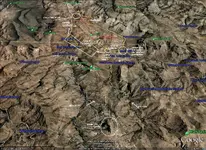
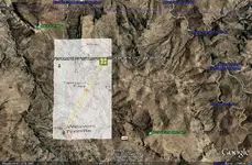
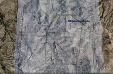
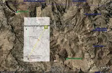
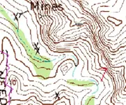
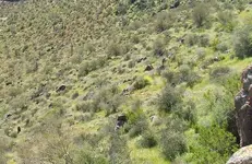
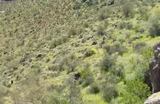
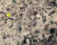
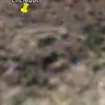
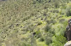
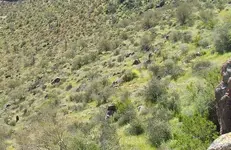
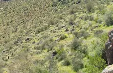
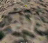
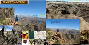
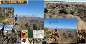
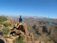
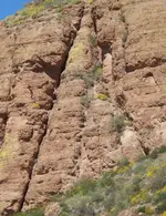
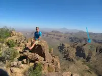
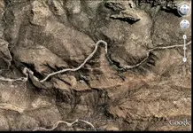
Here are a couple of pics taken this past week and some clipped bits of google earth views in the same area.The final pic is a boulder at the base of a rock face visible from the beginning of an old marked trail that ends at the heart seen in the sat view,which is a heart shaped mound of broken rock.The sat view of the heart,in the middle of the right hand lobe,features a "P".

Regards:SH
 

Attachments

  • triangle 1.jpg
    triangle 1.jpg
    34.1 KB · Views: 389
  • circledot above.jpg
    circledot above.jpg
    104.7 KB · Views: 392
  • circledot above.jpg
    circledot above.jpg
    104.7 KB · Views: 392
  • heart 1.jpg
    heart 1.jpg
    17.2 KB · Views: 391
  • trail-startmarker.jpg
    trail-startmarker.jpg
    208.8 KB · Views: 392
  • google circledot.jpg
    google circledot.jpg
    7.7 KB · Views: 382
  • circledot above.jpg
    circledot above.jpg
    104.7 KB · Views: 394
  • heart 1.jpg
    heart 1.jpg
    17.2 KB · Views: 390
  • triangle 1.jpg
    triangle 1.jpg
    34.1 KB · Views: 386
  • heart 1.jpg
    heart 1.jpg
    17.2 KB · Views: 398
  • circledot above.jpg
    circledot above.jpg
    104.7 KB · Views: 388
  • circledot above.jpg
    circledot above.jpg
    104.7 KB · Views: 388
  • trail-startmarker.jpg
    trail-startmarker.jpg
    208.8 KB · Views: 400
  • triangle 1.jpg
    triangle 1.jpg
    34.1 KB · Views: 393
  • trail-startmarker.jpg
    trail-startmarker.jpg
    208.8 KB · Views: 390
Sorry about the duplications....I might delete and redo the post later......SH.
 

Somehiker;-

Yes; I know that google earth viewer is not presice, when it comes to actually being there. This is why I had to get help from phoenix, in order to help me in my quest. With google and my friend's help, I know I am right. Soon, I will prove to you all, without question. Till then, i will answer any questions or remarks that may arise from this.

By the way.... Did you happen to go see the place that I mentioned on the priest map? No? Then don't knock it till you try it.
 

Yes; I know that google earth viewer is not presice, when it comes to actually being there.
 

Attachments

  • Quoted.jpg
    Quoted.jpg
    198.1 KB · Views: 375
  • Quoted.jpg
    Quoted.jpg
    198.1 KB · Views: 369
  • 420.jpg
    420.jpg
    64.9 KB · Views: 375
I see the spot marked on your pic, This is the place marked on the bottom part of the trail stones, this is the place between the numbers "3" and "18" on that stone, however, this is not the vault. This is just one of the mine areas, what about the others? have you found the rest? I HAVE!!!
 

Quinan Bear said:
Somehiker;-

Yes; I know that google earth viewer is not presice, when it comes to actually being there. This is why I had to get help from phoenix, in order to help me in my quest. With google and my friend's help, I know I am right. Soon, I will prove to you all, without question. Till then, i will answer any questions or remarks that may arise from this.

By the way.... Did you happen to go see the place that I mentioned on the priest map? No? Then don't knock it till you try it.

QBear:
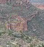
The best place to see the priest,exactly as depicted on the Priest Map,is from a place on the mountain across the historic canyon where the Priest Trail begins....at a Garmin gps altitude of 1847 feet ASL.Here is a photo,of his hat,shot last tuesday,from the center of the cross at 2119 ft. gps altitude.On Google Earth very little is visible,even when you know exactly where to look.Probably just a different priest than the one that you have discovered.
Regards:SH.
 

Attachments

  • hat crop.jpg
    hat crop.jpg
    173.7 KB · Views: 359
QB,

Sorry, but what you are calling a "hat" is a natural stream that took countless years to form. While natural landmarks were used, you are missing ALL the rest of the engraving. In this case, it is just what we call "convenient erosion."

Best-Mike
 

Hi Mike:
It's not a very good photo....but it's not a google earth view..heehee ...then again,I was doing a panoramic view at the time.Had no idea,till recently,that he might be hiding in plain sight.If you compare him with the image on the priest stone,it's pretty easy to sort it all out.
I should have a better one later this week,taken from the saddle that is closer and more to the right than where this was taken a couple of years ago.The face is visible upper left,the cross below and right,the cross in the rectangle next,and finally the wavy rockface edge that makes up the bottom of his robe.

Regards:SH.
 

Attachments

  • distant priest.jpg
    distant priest.jpg
    31.3 KB · Views: 306
Gollum;

Yes, your right, it's a stream. Like I keep telling you all, The Stone maps were made by using LANDFORMATIONS, not by marks carved on rocks.
I am not well and before I die, I will find a partner to help me and if not, then I will give my information to the museum there in phoenix and after that happens, then none of you will be able to go there, cause I'm sure once this information becomes public knowledge, then the area will become protected and blocked off till all is removed from there.
For your information. I had a person that said he would help me, So i gave him directions to one of the caves, he then went and found this cave to hold gold ingots, he sent me a letter saying thanks and telling me of what was found and that was the last i heard of him. So i Know for a fact that i know i'm right. I tried to show you all, what i have found, and none of you will even take the time to go look. I feel sorry for you all.
I am a man of god, I don't lies or tell stories of things I know nothing about. I came here looking for help to show the world what i found. Instead of help, I get people trying to disprove me. Whats funny about it, is that they themselves don't know how to read the stones, but assume that I don't know how either. AGAIN I feel very sorry for you all.

My real name is David William Muise, remember this name, I'm sure you will see it again in the near future.
 

Quinan Bear said:
These Stones show maps of mines,dwellings,smelting area and a Storage vault, as well as a treasure that was hid under an overhanging cliff, that was full of church reliquaries. All these places are north of Weever's needle.

The priest stone says, "Look for the map,Look for the land formation". The features in the map, can be seen in the land. All it is, is a big loop and ends up at a convergences of rock and two fault zones.

The Horse map, is also made from what is seen in the land formation. The ring (circle inside of circle) above the hores's mane is the location of the Vault. The line coming from head nose area, is the location of the church treasure. The "5" with the 5 dots around it, is a land formation and the dots around it are peaks, The two rings below the line and above the river line, are mines.

The Trail stones are maps, yes. but made in a way, that you need to use the bottom stone to see where to get to. The top Stone is a map that shows you what you will see around the area once you get there. The heart stones (two), each showing something else. (1) just shows the land formation that the mine is on. (2) showsall the formations,mines,dwellings,smelting area and the gold Cave. It shows a vault, 4 mines, a place where water flows over gold, a place of worship (land formation), a crater and other formations that are in that area.

What has been shown as being the trail that is seen on the two stones of the heart map. IS INCORRECT. although it does bring you to a cave and signs of a dwelling and it does take the same course like the stone trial, it fails to show ALL the other markers that are on the stones.

I have found ALL the markers, landformation, mines and dwellings...Everything.... And they are all in the exact place as shown on the Stones. So I know for a fact, that the other trail that was made to follow the stone maps, is WRONG!!!.

Awesome ! Looks like you have it all figured out.............. Congratulations David!
Hope the person cut you in on his gold find.

GG~
 

Quinan Bear said:
Gollum;

Yes, your right, it's a stream. Like I keep telling you all, The Stone maps were made by using LANDFORMATIONS, not by marks carved on rocks.
I am not well and before I die, I will find a partner to help me and if not, then I will give my information to the museum there in phoenix and after that happens, then none of you will be able to go there, cause I'm sure once this information becomes public knowledge, then the area will become protected and blocked off till all is removed from there.
For your information. I had a person that said he would help me, So i gave him directions to one of the caves, he then went and found this cave to hold gold ingots, he sent me a letter saying thanks and telling me of what was found and that was the last i heard of him. So i Know for a fact that i know i'm right. I tried to show you all, what i have found, and none of you will even take the time to go look. I feel sorry for you all.
I am a man of god, I don't lies or tell stories of things I know nothing about. I came here looking for help to show the world what i found. Instead of help, I get people trying to disprove me. Whats funny about it, is that they themselves don't know how to read the stones, but assume that I don't know how either. AGAIN I feel very sorry for you all.

My real name is David William Muise, remember this name, I'm sure you will see it again in the near future.

Interesting - so what exactly was found in the cave as it's not clear if there were gold ingots or that it was just a cave that ONCE STORED gold ingots.

You might understand many of the responses here if you were to put yourself in the shoes of a typical reader of the forums. At least several times a year someone such as yourself appears on this forum alone (not to mention all the other sites that other people post on) to claim absolutely, without a doubt and 100% positive that they have discovered the LDM and/or other such treasures in the Superstition Mountains. Each claimant shows a number of vague photos or google earth images with their own interpretation and expect everyone here to "oooh and ahhhh" over their ability to have solved the search for treasure.

The funny thing is that each person's "solved" area is different from the next, and nobody ever has any gold or factual evidence to back up their claims. There are avenues that can be taken to compare gold ore found with known (or at least strongly suspected) samples of Dutchman ore which would conclusively prove a match - to date either that's been done and kept quiet by the finder, or it's never been accomplished.

There are 2 ways the Lost Dutchman (or any other massive amount of gold ore or treasure) will ever be found in the Superstitions.

1) It will be found and illegally removed in way manner or another and outside of a few select folks, nobody will ever know. This would be done by a treasure hunter motivated by $$.

2) It will be found, photographs taken and "proven" beyond a shadow of a doubt by someone who's in it for the glory - they will likely gain little or no $$ from the venture, but their names will forever be associated with the discovery.

Good luck with whichever option you choose to take.

I'd suggest that as a man of God, you may want to look into a treasure trove permit, otherwise you and anyone else who removes something of value from within the boundaries of the Superstition Wilderness are breaking the law and would face some serious consequences.
 

Good Morning Paul,

Somehow, I don't imagine Mr. Muise has any worry's about obtaining a treasure trove permit. You would first, at least, need to enter the dreaded Superstition Wilderness Area to get the proverbial ball rolling. ::)

Perhaps you were hinting that David, as a Christian, might want to consider that he "Render unto Caesar the things which are Caesar's, and unto God the things that are God's"

I could, of course, be wrong. :dontknow:

Take care,

Joe
 

Top Member Reactions

Users who are viewing this thread

Back
Top