The Peralta Stones

The dowsing is the cold water shower he has to take in between the electro shock therapy !!!!


furness
 

The tablets take you from their burial site, onto the Salt River and up to the large main sweeping S turn. Just South of this a little ways is Black Mountain; this little peak is recognized as the "two circles one inside of the other" as viewed both on the topo and as carved on the tablets. It is also the witch hat on the dowsing witch priest who holds the power of the cross and faces East up river. A dowser of such abilities (which was common in those days) is instructed to stand on the top of Black Mountain and to aim his wand East up river to feel the pull of consecrated man made markers that were blessed with oil for that very reason; so that a man of the cloth would be drawn to them. To be divine as was John the divine; the ability to see truth amongst a myriad of illusion.
 

? ? ? ? ? ? ? ? ? ? ? ? ? ? ? ? ? ? ? ? ? ? ? ? ? ?
 

Dear Twisted Fork;
You wrote:
The tablets take you from their burial site, onto the Salt River and up to the large main sweeping S turn. Just South of this a little ways is Black Mountain; this little peak is recognized as the "two circles one inside of the other" as viewed both on the topo and as carved on the tablets. It is also the witch hat on the dowsing witch priest who holds the power of the cross and faces East up river. A dowser of such abilities (which was common in those days) is instructed to stand on the top of Black Mountain and to aim his wand East up river to feel the pull of consecrated man made markers that were blessed with oil for that very reason; so that a man of the cloth would be drawn to them. To be divine as was John the divine; the ability to see truth amongst a myriad of illusion.

Thank you my friend.
Your friend;
LAMAR
 

Every once in a while I will take a look at the different forums relating to treasure hunting. This particular forum concerning the "Peralta Stone Maps" has caught my interest and I had a few thoughts for all to ponder. The following comments are based upon actual events that took place in the field and can be verified by close friends and my partners.

The Priest Stone simply states; study the map, study the heart. We all admit that the stone maps are indeed maps. The problem that we encounter is to identify the right location where these maps were designed to be used. Study the heart? Which one? The one on the heart tablet, the stone heart insert (back and front), the recessed area which the stone heart fits into, the word coazon or the hearts found constructed by the hands of men on the actual hillsides 14 miles away on the north side of the river. Everything relating to the heart must be used in context and once you have found the heart you must study it and its surroundings carefully.

The two hearts on the hillside were very difficult to find as they were designed not to be seen accept at a certain time of the year when something that rarely happens takes place, rain. Once the area in question is hit by a good soaking rain something happens on the side of the hillside. Two bright green hearts measuring about 600 feet in height suddenly appear and stick out like sore thumbs against the subdued background colors of the hillside. It turns out that a particular type of Canadian Rye Grass was planted in the interior portions of the rock outlined hearts. Once you have seen them all lit up in green you will never forget their location, but if you try to point these hearts out to someone in the summer they will never see them. The hearts are the calling card that the the "Group" was looking for, so study your materials on monuments and eye catchers and do what they did 500 plus years ago traveling the old river trails looking for the signs. I will return to this forum and add some more of my observations to this topic so as to enlighten those who are interested.
 

Hi Ellie,welcome to the thread,and thanks for your imputs on the Peralta stones, I have never heard or read of the Canadian green grass angle. Is it possible you could ID your source imformation,like say a book,other stone tablets,old diary, archive records,,letter,etc..Thanks in advance and looking forward to your response. :laughing9: :thumbsup: :coffee2:
 

thanks ellie, looking forward to reading more of your posts. thanks much. ron
 

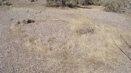
Hi Ellie:Though it's not Canadian Rye Grass,this zacate borreguero (sheep grass) has a similar appearance when it's not so dry.
This ring of grass,on a hilltop,surrounds a low pile of small stone chip which,in turn,is surrounded by a circular area of more stone chips.When you stand on the spot that I marked with a scuff of my boot,and look to the west,across the rock at the top of the ring,you will see a large geological feature that appears to be the model for the ponytail on the horse map.At dawn,other features may appear as the rising sun projects the shadows of the surrounding terrain and illuminates other more solid objects.Ears,mane,eye etc,etc.Someday I will have to do a time-lapse set of photos from this place.

Regards:SH
 

Attachments

  • 100_0156sm.jpg
    100_0156sm.jpg
    145 KB · Views: 430
The only documentation that relates to this area was written in two reports; one by an archaeologist from the Arizona State Museum in Tucson and one from a certified geologist who lived in Glendale, AZ. It cost us a little over $10,000.00 US dollars
to pay for their services and they believed we were throwing our money away chasing giant hearts and horses drawn in the desert.

I could have really used that money back then, but I was dedicated to prove out what we had found. In order to move ahead with the project we had to provide written documentation to the State of Arizona that Colonial Spain did in fact inhabit the deserts of Arizona north of the Gila River. These two reports were our proof that these colossal symbols were in fact made by the hands of men.

As we travelled to the site on some of the roughest 4 X 4 roads in the world we explained our finds to our highly educated guests,
their responses of laughter filled the air. They were truly sorry for making fun of us , but it could not be helped. As we rounded the last corner I pointed out the largest heart and the huge arrow pointing at it and they both gasped in complete amazement.
The geologist mouth dropped to the floor and the archaeologist was stunned as she stood in disbelief. For the next 3 hours the geologist walked those hills writing his report, he was convinced that the three hearts, the arrow and the horse were made by the hands of men. The same holds true for the archaeologist and to this day she believes 100% that the huge symbols were made by the hands of men. I had no doubts although I was still naive. Debbie brought a botanist friend with her on the trip and she was the one that identified the grass as a Canadian Rye. During this time we tried to raise some money by getting help from investors. Its funny in a way, no one believed us, even with the written documentation.

Will write more later.

EB
 

Springfield said:
I wouldn't be surprised if Ellie had some photos of the hillside hearts.

I have literally hundreds of photographs and will post some here shortly. I have to meet up with my partner and pan some ore that I brought home yesterday. Have a great day and stay out of trouble.

EB
 

Good morning: the one factor that bothers me is erosion, both eliminating and redepositing soil. Over a century or so, this would radically modify the terrain.

Down here, a similar climate, I have lost and re found locations, even a still closed up mine, simply because in a few years, or even one huge storm, the land was modified by the weather.

The Superstitions have terrific local storms by it's nature. any one of which can raise cain with any soil markers.

I believe that I have posted here of almost being another victim to the Super's by a terrific Cumulus Nimbus storm while flying south over Roosevelt lake.

However, I must add that up in Tayopa, they had a giant sun as a marker. Two years of searching for this final bit of physical proof failed. Even the local Indians did not know of it.

Then one day , while doing color separation on photographs of the area, I found it. It was so obvious that I felt foolish. The color separation had cut through the plant growth. It is approx. 50 meters wide and easily visible upon entering the canyon from the East.

The Jesuits had merely scraped out to bedrock on a section at the foot of the cliff, an 80* slope, a circle of approx. 50 meters in diameter. It was a ring with the ring width of perhaps 15 ft. The bare area forming the ring was probably easily visible.

Ellie, the only thing that I would like to add is that it probably was not what they planted, but what they might have done to the area. Have you had the soil in these areas checked for some type of growth inhibitor?

Incidentally , I very much like the out of the box thinking Ellie, go go.

Don Jose de La Mancha
 

Hey Don Jose,

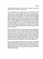
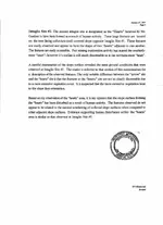
As soon as I get the geology report scanned i will attach it to a post. It will answer your question regarding erosion.

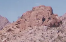
Attached is a picture of what we call the R-rock. There are a number of different symbols on this rock out crop. How many can you find?

EB
 

Attachments

  • Rrock.jpg
    Rrock.jpg
    165.6 KB · Views: 410
Oops; The previous photo posted far to large. I will have to redo this post and properly reset the photograph.

EB
 

Great imformation Elle and S-hiker, truely a eye opener, amazeing ,I always thought there was more details than I could dig up on the Superstition mountain ranges regarding there human history.Looking forward to reading your future posts... :icon_thumright:gd
 

EB,

Very interesting posts. Can't wait to see some pictures of the grass hearts.

Like Don Jose, I wonder about erosion of the hearts. Beyond that, why wouldn't they grow beyond the boundaries. An outline of rocks will not normally stop the spread of wild grass. Do you know the exact type of Canada Rye Grass that creates the image of the hearts? If they are rock outlined, why can't the hearts be seen year round?

Please share what you can.

Joe Ribaudo
 

These pictures were taken around forty years ago:

TwinButtesHeart2.jpg

TwinButtesHeart1.jpg

image0-20.jpg


I have the original 8 X 10s that were taken by my uncle, Chuck Ribaudo.

These are recent pictures of the same hillside:

Seven.jpg

SoutheastEndHorse.jpg

SouthwestEndofHill.jpg


It was not easy to refind this hill.

Joe Ribaudo
 

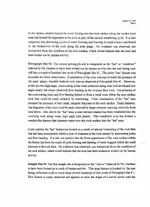
The grass will only grow within the outlines of the hearts. Some type of agent was put on the ground to inhibit any growth outside of the hearts (I will talk more about this later). The geological report will give some professional insight into these intaglios (as we have come to call them). What kind of Canadian Rye Grass I have no idea. It will stay green in color for only a few days to a week or as soon as the sun's rays of heat cause it to turn brown and die. Once that happens you can no longer see the hearts. The hearts were designed to be seen far away as the terrain allows due to your location on the river aproximately 14 miles away. Viewing is very limited in distance and angle due to the hearts position on the hillside (other ranges of hills and mountains cover the hillside which the hearts are located on). Imagine a corridor or line of sight that you look through like a spyglass. You must be located in a certain position/orientation on the ground to observe/see the hearts, this term is defined as a veiwing corridor.
 

Attachments

  • Heart Mountain Geology Report_Page_2.jpg
    Heart Mountain Geology Report_Page_2.jpg
    133.3 KB · Views: 384
  • Heart Mountain Geology Report_Page_3.jpg
    Heart Mountain Geology Report_Page_3.jpg
    87.6 KB · Views: 370
  • Heart Mountain Geology Report_Page_1.jpg
    Heart Mountain Geology Report_Page_1.jpg
    142 KB · Views: 365

Top Member Reactions

Users who are viewing this thread

Back
Top