San Diego gold

Sample Pan Dan

Bronze Member
Oct 20, 2012
1,302
934
Bostonia,Ca
Primary Interest:
All Treasure Hunting

Attachments

  • image-630902775.jpg
    image-630902775.jpg
    168.7 KB · Views: 773
  • image-278367177.jpg
    image-278367177.jpg
    122.2 KB · Views: 795
  • image-2829843014.jpg
    image-2829843014.jpg
    125 KB · Views: 722
  • image-2372194357.jpg
    image-2372194357.jpg
    44.6 KB · Views: 692
  • image-259532466.jpg
    image-259532466.jpg
    53 KB · Views: 696
  • image-4227274154.jpg
    image-4227274154.jpg
    59 KB · Views: 708
Upvote 0
Dan.... I'll give you a call in the next day or two here. I may not be in that area any more, but I've still got a few tricks up my sleeve for you guys. That map you e-mailed me is VERY incomplete on those deposit locations. BTW.... Stay away from the ones that are shown down by San Vicente Lake. That's in Kimbal Valley and the folks in that area don't take kindly to trespassers! We're talking "Shoot first, ask questions later" type of not kindly here.
 

Thanks for the heads up Jeff, and I look forward to hearing the info you have for us regarding that map.
 

Dan.... I'll give you a call in the next day or two here. I may not be in that area any more, but I've still got a few tricks up my sleeve for you guys. That map you e-mailed me is VERY incomplete on those deposit locations. BTW.... Stay away from the ones that are shown down by San Vicente Lake. That's in Kimbal Valley and the folks in that area don't take kindly to trespassers! We're talking "Shoot first, ask questions later" type of not kindly here.
Jeff, I have never prospected that stretch but it has always looked "tasty" to me. At one time, all sorts of nut bags were dug in down there( reports of growers, polygamy compounds and other nefarious characters to name a few) living on the edge or engaged in some sort of foolishness. The good news is; In the last ten years a large chunk of the drainage has been turned over to the county to manage as some sort of open space however, the county still has not organized or funded a plan for it. As for the pumpkin heads that were lurking in there, the Ceder Fire of 2003 burned them out so now just a hand full of homes.
 

The day with the Helicopter was Frickin brutal. I had already hauled down 25 gal of water on my Deercart. So I was kind of recovering from that. I heard the helicopter coming in low, and had a sinking feeling in my stomach. They were on us like white on rice. How can they legally block in BLM land like that? I am still puzzled.
 

They made us hike back up a 600 ft canyon, hike back down to pack up, then hike back up again. It SUCKED
 

Geez. Well, uh...at least you found out the cart worked! Im sure if there is an allowable way to get to that spot its going to be even harder to get water into. That hill wasn't the easiest to begin with. Still bummed out about that spot.
 

Still trying to do some research into that area. haven't been to pine valley in a while, I may go sniff around up there this weekend.
 

We were thinking of heading of heading to Pine Valley as well. Check it out for a few hours. Then maybe up to Cibbets flats to do some rockhounding. Hoping there's some water running on the PV claim as well as good clearance since ill be in a passenger car.
 

I have a quick question. I am planning on Buying 5 BLM maps of our region, but I have no clue what size they actually are. Before I go and spend $20 on maps I can't use, I was wondering if anyone here has an idea on what size they actually are? (Sorry for the off topic question!) -Cheers
 

If your looking for accuracy, the BLM/forrest service maps are not updated and reprinted annually and these entities are really into land swaps with developers. Although not as convenient, your best bet is to go through the county land and development branch if serious about parcel status. BTW, out dated USGS/BLM maps make great wall hangers in garages, sheds and man caves.
 

It seems these govt agencies don't have the time and money to keep up with changes and printing maps. Their focus seems to be more on law enforcement than helping outdoorsmen "stay legal"
 

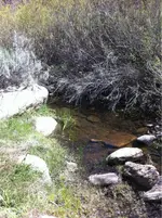
Decided to take a trip out to my original digs in pine valley today. It's a beautiful morning. The vehicles parked everywhere make me think it's turkey season in the woods. Good luck guys. Haven't left the truck yet, sitting here listening to all the birds and watching a couple little squirrels chase each other around. Didn't know if there'd be any water or not, but it looked wet where I crossed it coming in, should be enough water to pan in. The plan is to go sample the bank just above where we were digging before.
 

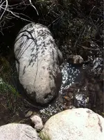
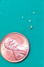
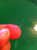
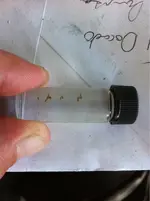
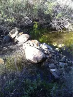
What a nice day. The dam I built last summer is working fine. Had plenty of water for panning, and enough to fall backwards into! Didn't hurt much other than my pride, but walking the 1/2 mile out in sloshing rubber boots wasn't much fun. We did find some gold though, and exactly where I thought it would be. Although it's not much, it's something. Gotta continue up the bank.
 

Attachments

  • image-376218953.jpg
    image-376218953.jpg
    137.7 KB · Views: 114
  • image-1366446552.jpg
    image-1366446552.jpg
    54.8 KB · Views: 103
Nice! I have a great history of falling in my own holes (in the creek bed) so you have my sympathy!
 

I just hope that doesn't happen when it's snowing up there Kevin!
loL, yup but that's why I usually wear chest waders in winter, make sitting down suddenly in the creek less day-ending! Anyway, it seems to happen in all seasons ;-)
 

Were headed to a couple SPMA claims in Pine Valley tomorrow by the dam off the pv exit. Should be good digs. Nice day for it. Hoping my sedan will make it to the gate since itll be our first time.
 

Top Member Reactions

Users who are viewing this thread

Back
Top