Lue Map

LOL !!

————-

While reading about the town of Ouray, CO I came across mention of the “Million Dollar Highway” legend that is the famous scenic mountain road (Hwy 550) connecting Ouray to Silverton. Supposedly 25-mile stretch of road was built by early railroad magnate Otto Mears using available quantity of gravel: gold-bearing tailings from nearby mines.
 

I showed you those pictures already. And yes - Otto Mears built the Rio Grande Southern for the sole purpose to move Silver and Gold from Ouray and Telluride to Durango.

For who? Thomas Walsh's Camp Bird (Urraca) Mine.

One has to step into the "way back" machine and realize there were NO ROADS in that area, back then.

View attachment 1672434 View attachment 1672435 View attachment 1672436 View attachment 1672437 View attachment 1672438 View attachment 1672439 View attachment 1672440 View attachment 1672449
 

Last edited:
the land owner sent numerous snapshots from throughout the property which I used for the spectral analysis

just to clarify ... you've stated several times in earlier posts that you paid for a spectral analysis of the property via drone survey, yet your quoted remark is the first mention of using photographs to confirm the presence of gold minerals. I'm confused because unless the landowner used a specialized hyperspectral imaging camera to take these "snapshot" photos, you can't generate that kind of data from a conventional or digital multispectral camera. Can you explain ? Thanks
 

Step 1: Solve Waybill
Step 2: Satellite images
Step 3: Satellite spectroscopic analysis
Step 4: Drone spectroscopic analysis
Step 5: Land owner snapshot spectroscopic analysis

Again - I told you I know "how" to do spectroscopic analysis on basic digital images. If I told you how, that will cost you! Hehehehehe

So then, Step 1 is solving the waybill or the following steps are a waste of time and money.

Right?

Can you chip in a million?


Besides - I've found another location not far the the LUE site where it looks like 500 gold coins are buried 3 feet below the surface. I'm thinking they're 1930's St. Gauden's one dollar coins, but I could be wrong.


===============

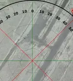
Again - it's not the "all seeing eye" with a pupil - "o" is the origin of a theodolite horizontal reiteration measurement.

Ree nembr - iym jis tri in tuh help yuz guyz uner stan dat KvM nevr fownd won spek uh duh loo. He din no sh it - so kwit reed in hiz bow sh it. An yuh aynt guna fyn it wit a frikin toy metil detektr. Les ee if yooz rokit sint ist kan figr it owt. An ifyuh wana stil tink iz spanich treshur lyk dat dum az lue hawn - yooz go ryt ahed.

An ey aynt guna tel yooz no moar.


View attachment 1674823 View attachment 1674824 View attachment 1674833
 

Last edited:
Shurrr yah did - just like Karl Von Mulehead.

Here's an idea to make this thread interesting, let's do a Einstein-like "thought experiment" and you describe how you'd go about acquiring all that gold, if I told you the site location and where the gold is cached.

And don't start the Einstein-like "thought experiment" with the notion you're going to buy a useless toy medal detector and a spade (like that poor, gullible and distraught soul, Tom Hilton whom believed KvM's BS), which is only good for finding trinkets and trash, like bottle caps, brass buttons and an occasional lost gold ear ring.

I'll watch your posts with no responses. This is my last post on T-Net. I seem to lose a few IQ points every time I post here and it's not worth the headache anymore.
 

Last edited:
It didn't take very long to find. Once you locate a certain airstrip, located near an iconic natural landmark, that is relatively close to the terminus of the old Durango railroad, go 144 miles at a NNE (25°) heading - you can see that "currare" tree sitting in a big field from an altitude of 10,000 feet. Knowing that it can be seen from Google Street View (as shown from your photo\videos) helps immensely to narrow down the area.

I'm still skeptical of your theory because there's nothing out-of-the ordinary about this property that distinguishes it from any other cattle ranching land in Colorado. All properties are divided up into geometric shapes. It makes for a neat and tidy land ownership survey. It seems like you arbitrarily pulled numbers out of the LUE Map until it pointed somewhere reasonable, and constructed an "origin story" around it, which to your credit is a good one. I've done some research into the area's history and again, nothing remarkable has turned up yet. There are several large mining companies north of the area but nothing about the ranch supports a massive underground operation that could have avoided the attention of locals.
 

Last edited:
Features of the property that you used to support your theory seem to be.... misrepresented ?

For example, the "angle" of this corral (or ditch) is supposed to be special (image is Spyro's)

View attachment 1675061

In reality, if we widen our view of the area a little bit we see that it is not so "special" after all.

View attachment 1675062
 

Last edited:
I already explained how I found it using clues or details you've laid out in your posts. The origin is an old airstrip near an iconic landmark. From there go 144 miles NNE at 25 degrees.

shiprockcompass.JPG
 

Name calling? You're all a bunch of fu cking morons - I figured out the waybill in a few weekends - in a matter of hours. Lemme gess - you morons never got past high school geometry. You're so STUPID - I'd be surprised if any of you even FINISHED high school! You MORONS couldn't finish a two dollar dot to dot coloring book!

And Ryano still has a thumb up his ass. Maybe Ryano can explain what all the projections point to. Then again - he's too fu cking stupid to know he answers his own questions.

What a bunch of dumb az holes. Now - go back and read your fu cking Karl von fu ckhead bullshit folklore and believe in bullshit "Spanish Treasure" like that other MORON Lue Hawn - while you're swinging your fu cking toy medal detectors.

And YES - I'm trying to get kicked off this fu cking T-Net and yes - Randy Bradford doesn't know CHIT!

Now - go fu ck yourselves.

The End


View attachment 1675613

We care less of your fu cking theory . Take your fu cked az out from here .
 

Last edited:
Last I saw, I have a Masters in Cybersecurity with Honors...so his hypothesis on my educational background is false, too.
 

Since Spyro has decided to knowingly break our rules AGAIN and just got off a ban he is on a long vacation and will be unable to post.
 

Last edited:
Man I would say he pushed himself over the edge with that one.
 

It's possible he doctored the photos to protect the location even though others now claim to have found it and his work is intriguing, however, I'm very confused by his hostility towards people on here and his hatred of KVM and tom. Also seems like he knows a lot of the story of them for someone who stumbled upon the lue map making me wonder if he has some personal connection. Also, wonder why not use this tech if accurate to find other treasure to pay for the land, Spyro was polite during the PMs I sent him but in the forum seems very upset. I don't understand the wanting to be banned if it was me us just stop coming to a place I didn't like. If it's all true then I wish him well on the recovery.
 

Hi neo,

There is no technology that can use normal photographs to determine the chemical composition of objects unseen. A normal photograph, digital or film, is a just reproduction of a scene in visible light. There's no information in the photograph that holds data for what's 10 feet underground. A consumer digital camera can't detect buried gold, period. Only specialized equipment like a hyperspectral camera or spectrascope can detect\measure nanometer-wavelength EM energy from objects underground. When I politely challenged Spyro on this, he avoided the question and gave a flip, non-response.

I asked Spyro why he had edited the photo of the "compass\triangle" culvert to show only the compass\triangle when, in fact, it isn't really a compass\triangle at all - he avoided the question and started the personal attacks (again). If you look at the entirety of his posts you'll see this is the remarkable physical feature of the LUE property that is supposed to lend credibility to his theory. Now that it really isn't what it seemed, it makes one wonder what else was fabricated to give him the satisfaction of "solving" the LUE Map.

When you add these up, along with the silly KVM meltdowns, personal attacks and tantrums in retort to anyone's valid questions - the common theme across his posts isn't any new, remarkable insight into the LUE legend... it's how he considers himself superior to everyone else.
 

Last edited:

Top Member Reactions

Users who are viewing this thread

Back
Top