Jesse James Was One Of His Names...Black Book Discussion

What if it is on public land in an easement? I believe that is finders keepers, isn't it? and the ones left on property that became private in a future unseen by the society??? :dontknow: There were a lot of men that died before they passed anything on to anyone, and then there were a few that prepared for that before it happened. Generations have passed and continue to pass by without any knowledge of their forefathers, and they grow farther and farther from any directives that may have been desired. Time takes a toll on everything!

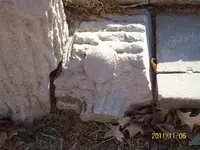
View attachment 1664336

Well, the Antiquities Act of 1906 and later amendments pretty well criminalizes attempted removal of anything on public lands - Forest Service, National Parks, National Monuments, Wilderness Areas, Military Reservations, Historic Sites, BLM Land, et al. That's a boatload of acreage in the US. Most western states started out as Federal Land territories before being gradually sold or homesteaded. https://www.nps.gov/subjects/legal/the-antiquities-act-of-1906.htm State land laws vary.

Private land? Yeah, a better path to any planned recovery, I suppose, depending on who owns the land. Don't forget the lawyers and the tax man - they'll their clients' share, which will mean they'll likely try to get it all, as is their wont. If you believe in the continued existence of the Organization and the large caches they allegedly still own, it's hard to imagine that those caches are in any way vulnerable to Joe Blow.
 

WHAT would be the REASON for the BB...? Public "need-to-know"...?

That's probably the best question anyone could ask about the BB. Same goes for the recent sanitized declassification by the CIA of the 1966 Chan Thomas book on the coming cyclical earth changes, The Garden of Eve Story. The best I can come up with is that there are three possible explanations (if not more): 1) It's all BS done as a farce; 2) It's intentional disinformation designed to create a false but believable narrative; 3) There are people in the know who do want the public to know things previously hidden from them.
 

All of the KGC sites that I have found have nothing to do with templates, maps or long distance hunting. They all tell you where something is located and where, either where the treasure is located exactly on what land, what section of the land, distance and depth and the amount of deposit and what it is contained in or cancelled with. Most give you the location of a hidden map to recover several treasures. All of this about templates is a bunch of crap.

I know of one JJ site in Arkansas and it to tells you direction, distance, depth, value of treasure and what it is contained or buried in. All the contents of the BB is nothing but useless information to sell a story.

Franklin, what does a KGC site look like? Could you please walk us through a site and tell us what would draw you to an area and what would be the first clues you would look for. Are all the sites different or are there certain monuments or carvings that have to be included at a site. Have you ever seen a decoy site and what would give that site away, if anything.
 

Oops - correction needed here. Indeed these templates are allegedly to be used with 7.5-minute quads. Thanks for catching my error, mbb - I posted that before my coffee this morning!

It was explained to me that the Organization made good use of the Public Land Survey System (Township, Range and Section land divisions), which Jefferson started in the 1780s and gradually covered most of the USA. They not only had a permanent array of legal brass cap benchmarks (section corners, quarter corners, etc) at their mapping disposal, but some claim they used all sorts of section numbers, azimuths, etc. in their coded clues to help designate secret cache locations.

However, I don't necessarily believe that. It's my suspicion that clues such as those mentioned above (in addition to various carvings, monuments, etc) were meant only as diversions to send avid searchers in circles. Having land surveyors at their disposal, it would have been easy for them to merely record a set of coordinates for cache sites - coordinates that could easily be located later by anyone with surveying skills.

Those mysterious symbols on the overlay? Just fake mojo, IMO, designed to confuse folks.

View attachment 1664244

You've been telling people, for a long time, to be aware of survey markers. Just recently I've been paying more attention to that. The spot I'm looking at has a large concentration of stone monuments and symbols on the same southwest quarter section. I found, what I think, is the quarter section marker on the west line of the section and it's a short, round cement post with a brass plate on top. It seems to be too far south, though. What spots would be marked with a cement post on a section boundary line?

Also, one of the big symbols, at this site, is a large stone heart. It's within 15 feet of the boundary line. Within the past few years, a new boundary fence post marker has been placed by the rock heart. The heart rock is part of the site and I have confirmed that by measurement. It's several hundred feet south of the concrete survey marker. Any thoughts?
 

Oops - correction needed here. Indeed these templates are allegedly to be used with 7.5-minute quads. Thanks for catching my error, mbb - I posted that before my coffee this morning!

It was explained to me that the Organization made good use of the Public Land Survey System (Township, Range and Section land divisions), which Jefferson started in the 1780s and gradually covered most of the USA. They not only had a permanent array of legal brass cap benchmarks (section corners, quarter corners, etc) at their mapping disposal, but some claim they used all sorts of section numbers, azimuths, etc. in their coded clues to help designate secret cache locations.

However, I don't necessarily believe that. It's my suspicion that clues such as those mentioned above (in addition to various carvings, monuments, etc) were meant only as diversions to send avid searchers in circles. Having land surveyors at their disposal, it would have been easy for them to merely record a set of coordinates for cache sites - coordinates that could easily be located later by anyone with surveying skills.

Those mysterious symbols on the overlay? Just fake mojo, IMO, designed to confuse folks.

View attachment 1664244

If I remember right, there was a list of cache sites in the BB. For somebody who wants to do the research, it might be interesting to know if any of these places are close to any of the principal meridians, or any other survey places of note.
 

You've been telling people, for a long time, to be aware of survey markers. Just recently I've been paying more attention to that. The spot I'm looking at has a large concentration of stone monuments and symbols on the same southwest quarter section. I found, what I think, is the quarter section marker on the west line of the section and it's a short, round cement post with a brass plate on top. It seems to be too far south, though. What spots would be marked with a cement post on a section boundary line?

Also, one of the big symbols, at this site, is a large stone heart. It's within 15 feet of the boundary line. Within the past few years, a new boundary fence post marker has been placed by the rock heart. The heart rock is part of the site and I have confirmed that by measurement. It's several hundred feet south of the concrete survey marker. Any thoughts?

The brass plate may have identifying information stamped into it. The surveying monumentation methods are quite variable and have changed with the years. Check the brass plate and see if has Township, Range and Section numbers (or something else) on it.

Here's a real useful website. https://glorecords.blm.gov/search/default.aspx On the left are blue links. You can search them all, but start out with Surveys. Under Location type in your state and county. Then under Land Description, fill in the info if you have it. If not, go down to Miscellaneous and fill in the info if you have it. If not, just hit the orange Search Surveys button and you'll get a complete listing of surveys in your county. From that list, hit the Plat Image button on the right side and you'll have the original survey plat. Often, you can also view the Field Notes, which has lots of interesting details. There is much history available on this site.
 

According to JJ3:

1) Thomas Coleman (Cole) Younger was JWJ's Brother In Law and also a Civil Engineer.

2) US Marshall Frank Dalton was JWJ's First Cousin

3) Hanging Judge Parker was JWJ's First Cousin

This Ends The Prologue. I repeated the #'s 2 and 3....The Cole Younger claim is on the first page of the first chapter of the book.

Kace

I'm TRYING to keep all the names straight, so forgive me if I'm chasing long-necked aquatic wildfowl...

1. Jesse James (outlaw) was related to the Youngers ONLY by marriage. His stepfather (Ben Simms) was uncle to a girl who married a Younger.

2. The Dalton's mother, Adeline Lee Younger Dalton, was half-sister to Henry Washington Younger (Cole, Bill, and Bob's father) making her their "half-aunt(?)" Likewise, her sons Frank, Grat, Bob, Emmett, and Bill were cousins to the Youngers - sorta. BYW, there were SEVENTEEN Dalton children, 7 boys 10 girls. Two children died young (under 12).

3. Of Judge Parker, I know nothing, other than my great-grandfather knew him. (not in a "professional" way....) Parker died the same year my grandfather was born (1897)
 

Last edited:
Franklin, what does a KGC site look like? Could you please walk us through a site and tell us what would draw you to an area and what would be the first clues you would look for. Are all the sites different or are there certain monuments or carvings that have to be included at a site. Have you ever seen a decoy site and what would give that site away, if anything.

All KGC sites differ and vary according to who buried the cache. For most of the caches around where there is a forest you will find carvings or signs with arrows and such. Most have patches with the information you will need. But they are deceptive signs and you have to figure out the cache signs and the ones that are decoy. But for the most part there will be several signs on different trees or different rocks or cliffs. After you search the area and decode the messages then you will know where the treasure is located with compass readings, depth, distance, what the treasure consist of and what it is contained in.
 

.... "spawned the 10 brothers who made up the Dalton gang"
!

Only 9 brothers lived to adulthood (Lewis died at age 7, in MO); only four were outlaws; Bob was an on-again-off-again member of the Gang, as was Bill Doolin. Neither of them lasted long after the first three went down in my hometown... Frank died in the line of duty as a Deputy US Marshal. The remaining four brothers just sort of faded away in history....
 

The brass plate may have identifying information stamped into it. The surveying monumentation methods are quite variable and have changed with the years. Check the brass plate and see if has Township, Range and Section numbers (or something else) on it.

Here's a real useful website. https://glorecords.blm.gov/search/default.aspx On the left are blue links. You can search them all, but start out with Surveys. Under Location type in your state and county. Then under Land Description, fill in the info if you have it. If not, go down to Miscellaneous and fill in the info if you have it. If not, just hit the orange Search Surveys button and you'll get a complete listing of surveys in your county. From that list, hit the Plat Image button on the right side and you'll have the original survey plat. Often, you can also view the Field Notes, which has lots of interesting details. There is much history available on this site.

Thanks, Sdcfia. I'll check this site out and let you know what I find.
 

All KGC sites differ and vary according to who buried the cache. For most of the caches around where there is a forest you will find carvings or signs with arrows and such. Most have patches with the information you will need. But they are deceptive signs and you have to figure out the cache signs and the ones that are decoy. But for the most part there will be several signs on different trees or different rocks or cliffs. After you search the area and decode the messages then you will know where the treasure is located with compass readings, depth, distance, what the treasure consist of and what it is contained in.

Thanks, Franklin. What draws you to an area to begin your search. Some type of manuscript or journal. Do you just go to the general area of a treasure legend and begin to search for clues. Or is it just by accident that you stumble across a marker and begin your search there. Thanks again.
 

All of the KGC sites that I have found have nothing to do with templates, maps or long distance hunting. They all tell you where something is located and where, either where the treasure is located exactly on what land, what section of the land, distance and depth and the amount of deposit and what it is contained in or cancelled with. Most give you the location of a hidden map to recover several treasures. All of this about templates is a bunch of crap.

I know of one JJ site in Arkansas and it to tells you direction, distance, depth, value of treasure and what it is contained or buried in. All the contents of the BB is nothing but useless information to sell a story.

From what I've read in your posts...It's appeared to me that you've done outside research on possible KGC sites other than modern books by those copying each other. Am I right about that?

I know you've mentioned going to research different events from the past, sites and people.

Kace
 

I'm TRYING to keep all the names straight, so forgive me if I'm chasing long-necked aquatic wildfowl...

1. Jesse James (outlaw) was related to the Youngers ONLY by marriage. His stepfather (Ben Simms) was uncle to a girl who married a Younger.

2. The Dalton's mother, Adeline Lee Younger Dalton, was half-sister to Henry Washington Younger (Cole, Bill, and Bob's father) making her their "half-aunt(?)" Likewise, her sons Frank, Grat, Bob, Emmett, and Bill were cousins to the Youngers - sorta. BYW, there were SEVENTEEN Dalton children, 7 boys 10 girls. Two children died young (under 12).

3. Of Judge Parker, I know nothing, other than my great-grandfather knew him. (not in a "professional" way....) Parker died the same year my grandfather was born (1897)

Dave...On your post #2...Did you mean Jim instead of Bill? I don't remember a Bill or William Younger that was a brother to Cole, Jim, John or Bob Younger.

Good Info on the Dalton-Younger and Simms-Younger ties!

Kace
 

Well, the Antiquities Act of 1906 and later amendments pretty well criminalizes attempted removal of anything on public lands - Forest Service, National Parks, National Monuments, Wilderness Areas, Military Reservations, Historic Sites, BLM Land, et al. That's a boatload of acreage in the US. Most western states started out as Federal Land territories before being gradually sold or homesteaded. https://www.nps.gov/subjects/legal/the-antiquities-act-of-1906.htm State land laws vary.

Private land? Yeah, a better path to any planned recovery, I suppose, depending on who owns the land. Don't forget the lawyers and the tax man - they'll their clients' share, which will mean they'll likely try to get it all, as is their wont. If you believe in the continued existence of the Organization and the large caches they allegedly still own, it's hard to imagine that those caches are in any way vulnerable to Joe Blow.

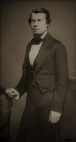
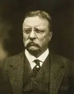
I agree with your first statement 100%. This is why. 220px-Jacob_Thompson_-_Brady-Handy.jpg AND teddy1.jpg


These two men had the largest part in that operation for the K.G.C. and then the O.A.K. Only the Government can dig in those sites......and only the members who were inside the smallest circle were also inside of the U.S. Government.

Joe Blow stood here many many thousands of times in the last 90 years and acomplished nothing further. The society was not afraid of that happening one bit.:icon_thumleft:
morton kgc turtle.jpg

P.S. I believe President Theodore Roosevelt signed the Antiquities Act on top of the table in 1906 to prevent looting of archaeological and Native American structures and objects, but under the table it was for the purpose of giving the federal government control of specific sites to try and keep Joe Blow from even looking. Interestingly, that is very similar to what one would expect a sentinel would do to ward off trespassers from lingering very long in the wrong place for any reason. :icon_thumright:
 

Last edited:
I have not read the BB. My question, hopefully relevant to this discussion, does John Newman Edwards ever appear as a member of the KGC/OAK?
 

... I believe President Theodore Roosevelt signed the Antiquities Act on top of the table in 1906 to prevent looting of archaeological and Native American structures and objects, but under the table it was for the purpose of giving the federal government control of specific sites to try and keep Joe Blow from even looking. Interestingly, that is very similar to what one would expect a sentinel would do to ward off trespassers from lingering very long in the wrong place for any reason. :icon_thumright:

Most observers speculate that many or most of the caches are now in National Parks, under reservoirs, and at other sites completely off limits to annoying treasure hunters. These hiders were no dummies. You bury a big slug of gold, you want it totally secure. No need for outdated sentinels in bib overalls.
 

From what I've read in your posts...It's appeared to me that you've done outside research on possible KGC sites other than modern books by those copying each other. Am I right about that?

I know you've mentioned going to research different events from the past, sites and people.

Kace

The KGC left their signs in plain sight. If you do not know what you are looking for you will think nothing of the sign. I saw a sign on a beech tree ten years before I ever realized it led to KGC Caches. If you ever see anything that looks like a "13" carving or the letter "B" it means treasure is in the immediate area. These two signs are for the Goddess Athena in Greek or Minerva in Roman. The KGC use these signs more than any others. Then there are carving of "snakes" or "arrows" that point the way or the number "8" If you see any of these signs look closer at them especially if they are on a tree. There will be "patches" inside of the "arrows" the "8's" or at the head of the "snakes" or at the different sections of the "snakes" bends or at the tip end of the "snake's" tail. They can use other signs but these are the most frequent. But be sure to look really really close as they are in plain site just sometimes really really small inside of the signs. The rocks or stones are a little different and the signs are different but the same principles.
 

Top Member Reactions

Users who are viewing this thread

Latest Discussions

Back
Top