Oak Island the Strange, the Bizarre, and Maybe the "Truth!

There is an excellent (and historically accurate) book by Richard Zacks titled "The Pirate Hunter: The True Story of Captain Kidd" that describes William Kidd's last few years. He got railroaded by his backers (in Parliament) and took the fall. Any treasure he had from the Quedagh Merchant was likely mainly silk, muslin, satin and spices. None of which would bury well. Certainly some silver as well.

He was not a pirate. The papers he captured were his evidence it was a French backed ship but he was not allowed to present them in his trial. They were auctioned off with the cargo in London and exist today - showing his innocence (privateer vs. pirate, anyway).
 

Wow and to think I missed all of this while I was glue to my tv watching The Curse of Oak Island. Have any of you all contacted Rick or Marty Lagina with all this information ? I am sure they would like some more theories to mull around. :occasion18:
 

Could the Royal Navy have down played what was really plundered from Quedagh Merchant

There is an excellent (and historically accurate) book by Richard Zacks titled "The Pirate Hunter: The True Story of Captain Kidd" that describes William Kidd's last few years. He got railroaded by his backers (in Parliament) and took the fall. Any treasure he had from the Quedagh Merchant was likely mainly silk, muslin, satin and spices. None of which would bury well. Certainly some silver as well.

He was not a pirate. The papers he captured were his evidence it was a French backed ship but he was not allowed to present them in his trial. They were auctioned off with the cargo in London and exist today - showing his innocence (privateer vs. pirate, anyway).

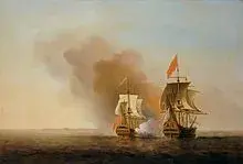
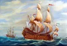
Similar ships captured with "Billion Dollar Plunders"

Olivier Levasseur Le Buse (The Buzzard) capture of the Nossa Senhora do Cabo
Nossa Senhora do Cabo.jpg
George Anson capture of the Nuestra Señora de Covadonga
Nuestra Señora de Covadonga.jpg
 

700 ton Portugese transferring the "entire wealth of the viceroyalty of Goa" and a Spanish Treasure ship

The Nossa - $400 million in todays dollars.

The Nuestra - "1743/04/15: Left Acapulco back to Filipinas with 1,313,843 pesos & 35,682 silver ounces." - neither were merchant ships. And neither worth anywhere near a billion dollars in todays' values. ("Peso is the real de la ocho - piece of eight, 29.2 g of silver, so 88,000 ounces or $1,496,000 today, plus another 35,682 ounces of silver worth $606,594 today - $2,102,594 current value. Sure, i'd take it. But it's a long way from a billion $).

We have the manifest of the Quedagh Merchant and know the cargo and value.

https://en.wikipedia.org/wiki/Quedagh_Merchant
 

Last edited:
George Anson capture of the Nuestra Señora de Covadonga
View attachment 1389378


George Anson, the creator of the Shugborough monument, on the monument is the famed Shugborough code. The carved relief depicts the "Shepherds in Arcadia" painting by Nicolas Poussin but in reverse and with a little more detail. A close up view shows one of the Shepherds clearly indicating with his finger and thumb ( albeit both have been broken off) that the word Arcadia should read Acadia, as does the Poussin. Anson and his brother were very much into navigation, even studying the science of it with a famous mathematician. The code on the monument has a D and an M carved at each end of the letters, obviously a reference to Degrees and Minutes. the letters are 8 in number which would also reference the 8 numbers creating a certain coordinate, less of course the seconds which are not indicated. Nicolas Poussin known as the keeper of secrets is much connected with the Holy Grail and Rennes Le Chateau theories. Decoding the Shugborough using a simple number for letter code but reversing it as per the relief gives a coordinate in Nova Scotia. Too simple you say, yes it is, hidden in plain site!
Cheers, Loki
 

Last edited:
Treasure comes in Many Forms!

It is hard to imagine that the British Authorities would go to this degree of Interrogation with William Kidd over what amounted to some "Silk Table Cloths and Tea Sets"!

"When Kidd arrived in New York, he was arrested, but would not reveal the location of Adventure Prize, believing that the treasure aboard the ship could be used as barter to free him.[SUP][[/SUP]Bellomont tried to get together two ships, one of which was St. Antonio, to sail back to the Caribbean to retrieve what was left of Kidd's loot. As the planning stage for this voyage was nearly completed, a sloop arrived in New York, claiming that the merchants aboard Adventure Prize had sold off most of the goods, set fire to the ship, and left the Caribbean to sail to Holland. After hearing this news, Bellomont approved Captain Nathaniel Cary, aboard St. Antonio, to return to the Caribbean to verify that the ship was indeed burned off the coast of Hispaniola, and attempt to reclaim the cargo from the local governments, including Curaçao. According to local records, the men Kidd entrusted with his ship reportedly looted it, and then set it ablaze and adrift down the Rio Dulce."

It was believed that Merchant Ships in those days did not post their True Ship`s Manifest for fear of Pirates knowing their cargo.

Is it "Not Strange" that "Some Readers" will protest for "Lack of Proof" but are willing to "Accept Anything Written Down in a History Book"!
 

Last edited:
George Anson, the creator of the Shugborough monument . . .

George financed it. His brother commissioned it and Scheemakers was the sculptor.

George Anson died in 1762. What did he use to base his "coordinates" on? Where did he place 0° longitude? Some countries used the Azores, some the Canaries. "Greenwich" wasn't adapted by England until 1765 (after Anson's death) and the rest of the world in 1851. In 1721 the Royal Observatory was N0°0" (in 1851 it was "officially" centered in Airy circle - but that didn't exist in the 1700's. It was centered on the observatory building in Anson's time). But they were all relatively close in British Fleet use so we'll call that a "gimmie".

So, to have a coordinate with just degrees and minutes? Coordinates take a pair of numbers: latitude and longitude. And also a Prefix to each of those (North or South of the Equator, East (+) or West(-) of the Prime Meridian) But just assuming it was a coordinate: eight characters in the OUOSVAVV "code". You need one to three for the degrees (0 to 360°) and two for minutes (0 to 60'). With degrees and minutes (even with the additional "gimmie" it was northern hemisphere) it will only get you to within 1/21,600th of the earth's circumference - or 1.15 miles (or 1.0 nautical mile). So you have a square mile assuming lat/long coordinates.

So, assuming Anson had a treasure - why would a British Admiral and Baron choose (Acadia - "New France") a colony of a country his country was at war with (actively when he died) to bury a treasure? Or is the assumption this was buried before it was New France (which would have been under papal decree to be Spanish territory - also not a good neighbor of Great Britain)?

Since this is an Oak Island thread: N44°31' W64°18' gets you on Oak Island with 1/4 mile of water bordering a 1 x 1 nautical mile box. Does that relate to OUOSVAVV in any way?


Or, is it an Acronym for the Latin "Orator Ut Omnia Sunt Vanitas Ait Vanitas Vanitatum" (Ecclesiastes 12:8)? "Vanity of vanities, saith the preacher; all is vanity".
 

Last edited:
Accept Anything Written Down in a History Book

Is the Internet any better? ;-)
 

George financed it. His brother commissioned it and Scheemakers was the sculptor.

George Anson died in 1762. What did he use to base his "coordinates" on? Where did he place 0° longitude? Some countries used the Azores, some the Canaries. "Greenwich" wasn't adapted by England until 1765 (after Anson's death) and the rest of the world in 1851. In 1721 the Royal Observatory was N0°0" (in 1851 it was "officially" centered in Airy circle - but that didn't exist in the 1700's. It was centered on the observatory building in Anson's time). But they were all relatively close in British Fleet use so we'll call that a "gimmie".

So, to have a coordinate with just degrees and minutes? Coordinates take a pair of numbers: latitude and longitude. And also a Prefix to each of those (North or South of the Equator, East (+) or West(-) of the Prime Meridian) But just assuming it was a coordinate: eight characters in the OUOSVAVV "code". You need one to three for the degrees (0 to 360°) and two for minutes (0 to 60'). With degrees and minutes (even with the additional "gimmie" it was northern hemisphere) it will only get you to within 1/21,600th of the earth's circumference - or 1.15 miles (or 1.0 nautical mile). So you have a square mile assuming lat/long coordinates.

So, assuming Anson had a treasure - why would a British Admiral and Baron choose (Acadia - "New France") a colony of a country his country was at war with (actively when he died) to bury a treasure? Or is the assumption this was buried before it was New France (which would have been under papal decree to be Spanish territory - also not a good neighbor of Great Britain)?

Since this is an Oak Island thread: N44°31' W64°18' gets you on Oak Island with 1/4 mile of water bordering a 1 x 1 nautical mile box. Does that relate to OUOSVAVV in any way?


Or, is it an Acronym for the Latin "Orator Ut Omnia Sunt Vanitas Ait Vanitas Vanitatum" (Ecclesiastes 12:8)? "Vanity of vanities, saith the preacher; all is vanity".

Latitude is written with two numbers, from 01 to 90 in our hemisphere it would be 'north'. True, longitude could be written with as many as three numbers but in our hemisphere only two, from 01 to up to 75 or so West and/ or 01 to 20 or so East, hence 8 numbers. For years people have tried to complicate the Shugborough Code but the clue to the system is right there, the 'D' and the 'M'. You are correct in that without seconds you cannot get extremely close, but at the time you could not get very close with Longitude anyway. What the Admiral is telling us is that what he is referring to is in Acadia, and specifically Nova Scotia.
To understand the reasoning you have to understand the Poussin which tells us the same thing. The date of Poussin's "Shepherds in Arcadia" is 1630, during the period when the most talked about thing in France would have been New France (Acadia). The Ansons were not referring to a treasure of their's but a secret hidden until a moment when it would be safe for it to be discovered.
I know you don't agree with any of this Charlie, I am only following this up for those that may.
Cheers, Loki
 

Last edited:
For years people have tried to complicate the Shugborough Code but the clue to the system is right there, the 'D' and the 'M'. You are correct in that without seconds you cannot get extremely close, but at the time you could not get very close with Longitude anyway.

Even assuming we can assume Western and Northern Hemispheres or even using just the NE portion of North America, then what degree and minute numbers do you associate with the "OUOSVAVV" that would be uncomplicated?

The coordinates of Oak Island are N44°31' / W64°18' or N44°31', -64°18' depending how you present it.

Can you back cryptograph that set of coordinates? Giant assumption it related to Oak Island and not some other spot on Earth.
 

Last edited:
Even assuming we can assume Western and Northern Hemispheres or even using just the NE portion of North America, then what degree and minute numbers do you associate with the "OUOSVAVV" that would be uncomplicated?

The coordinates of Oak Island are N44°31' / W64°18' or N44°31', -64°18' depending how you present it.

Can you back cryptograph that set of coordinates? Giant assumption it related to Oak Island and not some other spot on Earth.


Not Oak Island, but Acadia and more specifically Nova Scotia. Nicolas Poussin left us the same message leaving out the Nova Scotia.
Also well to remember the Ansons obsession with navigation, Admiral George made an around the world voyage.
btw, 44 32N 63 43W actually if you allow a few miles of longitude for mid 18th century error you can get pretty close to Oak Island by latitude.
Cheers, Loki
 

Last edited:
Don't see it. OU OS VA VV <> 44 32 63 43 :icon_scratch:
 

Don't see it. OU OS VA VV <> 44 32 63 43 :icon_scratch:

Not that hard, drink a few beers. If you have any real interest look at a closeup of the Shugborough relief, notice the broken thumb and the index finger, then go to the Poussin (his 2nd Shepherds painting) and look at the index finger. Notice where they point and what the artist is saying.
Why did the Ansons commission the relief? Why is it reversed from the Poussin? What did these men know and what is their connection?

Cheers, Loki
 

And are they pointing at coordinates? No.

Why reversed? Artistic license. Or he did a transfer and rubbed the carbon lines onto the stone to lay out the pattern.
 

And are they pointing at coordinates? No.

Why reversed? Artistic license. Or he did a transfer and rubbed the carbon lines onto the stone to lay out the pattern.

Not that accurate to have been traced. Not coordinates, but pointing at the letter "R" in the word Arcadia in the case of the Poussin. In the Shugborough pointing at the word "in" with the thumb covering the "R", but for some reason both digits have been broken off in the relief. Both artists want the works to read "in Acadia". The coded coordinates only reinforce that.

Cheers, Loki
 

Last edited:
Charlie, one thing, silver was on par with Gold then,
 

So, assuming Anson had a treasure - why would a British Admiral and Baron choose (Acadia - "New France") a colony of a country his country was at war with (actively when he died) to bury a treasure? Or is the assumption this was buried before it was New France (which would have been under papal decree to be Spanish territory - also not a good neighbor of Great Britain)?

George Anson was indeed wealthy but he didn't put any of his wealth underground in Nova Scotia. What is in Nova Scotia was put there before either the Pope or the Spanish knew of a new world. You already forgot about the dating of the coconut fibre didn't you?
Cheers, Loki


@ Lokiblossom - you seem to be right near the Lagina' Office.....? Why not go in there yourself.....they Frack all year round

The Fingers actually point to the letters RC.....for the Rosicrucian Mystery itself that birthed this romantic version of things.....the fingers were split to show that they are Islands in the Aegean Sea, where you locate a very small island called Egeo...a point of reference to locate the Oracle, as featured in the painting. They are bringing the Oracle to Delphi.....follow from the island there to the Oracle and you have the path that is also made in Acadia.

Or more simply What is in Egeo is also in Acadia.........Et In Arcadia Ego.......

The Code that was short for a Latin translation holds a double meaning..... your interpretation was one, is a clue of its mirrored imagery.....vanity being a mirror, and the painting reversed on the tombs design

.....as the second code also is called the DM Code......or the fable DOOM Code.....the person who deciphers it will unleash the Last Judgement.

D and M are at separate ends...... the OO is dropped down to spell DOOM.....Leaving USA VVV or a complete phrase.

DOOM USA 555
 

Top Member Reactions

Users who are viewing this thread

Back
Top