Yep. I think you're spot-on. I think the newspaper article is just wrong about the location. Tom K. probably was only talking about the article, and how it was claimed to be the Lost Dutchman. This explains why Tom K. says the date is 7 DEC 1901 (date of the article) while the Worser claim is dated 06 DEC 1901. Regarding the Bark/Chuning mine on the Salt (that Bark talks about in the Bark notes), he does indeed say the Mormon Flat Dam (Edit: Horse Mesa Dam, sorry) caused that particular mine to disappear under water. He also said it produced good gold at first, they floated lumber down the river for improvements, I think they built an arrastra, etc. I wonder if those pics of the arrastra after Canyon Lake was drained was in fact their arrastra? Jim
EDIT: And before I confuse the issue even farther, I should say that Bark talks about BOTH mines in the Bark notes...The Worser, which I don't believe he called by name in the notes, and then after that he talks about the mine on the Salt.
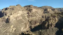
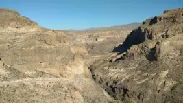
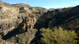
EDIT again: Appears I got my lakes/dams confused...I think....I thought it was Mormon Flat/Canyon Lake, but it was actually Horse Mesa (Thanks Paul) so I'm thinking the mine would have to be under Apache Lake

The description he gives about how hard it was to get there sure sounds like it was Apache Lake.