Undiscovered treasure galleons

Panfilo said:
Vox, interesting to know your thoughts on the 1606 Bahamas channel wrecks that are quoted as having belonged to the Cordoba fleet. As the San Gregorio, the Rosario and the San Martin which headed initially to Jamaica made it back to Spain and later the San Cristobal did indeed travel from Cartagena to Spain, which ships do you think they are referring to?
Daniel

Well, for 1605 and 1606 these events are anomalous:
1605 An almiranta sank in Florida.
1606 A frigate which was to search for four 1605's missing wrecked galleons, but do not know where because the news comes from Guatemala in 1609.
1606 A ship with payroll for Puerto Rico sank. Sailed safely through the Straits of Florida.

News shown on maps that may have been written several years later are not 100% reliable. But ........ !!
 

Chagy said:
Not sure what Duro’s was smoking but in the same page he listed the wrecks 3 times in 3 different yeas….Here it is word by word.

1604- Cuatro galeones de la flota de Luis de Cordoba en el bajo de la Serranilla

1605- Un navio de aviso de la flota de Juan Gutierrez de Garibay sobre la isla de Santo Domingo.

Otro en el canal viejo de Bahama

La nao “Trinidad” de la flota de D. Francisco del Corral en las inmediaciones de la Havana; escapo alguna gente.

Cuatro galeones de la armada de Luis de Cordoba en la costa de Cumana, cerca de la isla Santa Margarita.

1606- Cuatro naos de las flotas unidas de NE y TF con otros tantos millones y el general D. Luis de Cordoba.

Duro compiled a lot of information, but we do not know all that much about his sources.
Could it be that the galleons lost near Margarita were lost on the IDA? The ones near Serranilla in the VENIDA? Any chance of finding this information in CHAUNU?

Something that often caused confusion, is the origin of the information. For example, if a letter arrived from Margarita with the news, people would say "near Margarita such and such a thing happened". Knowledge of world geography was restricted to relatively few people.
CP
 

Panfilo said:
The picture's not mine, I've never been there, I just put it up to illustrate the fact that Zacarias description of his Misteriosa island does not agree with his declarations on record. Nor do they agree with his map. No gold veins, no mountains, no creeks, no running water...wrong dimensions, wrong measurements...

I have the highest regard for Vox Veritas' archival abilities and profound knowledge of colonial Spanish shipwrecks, a leading and proven world expert on this subject. I just happen to have spend some time researching as he has, the Misteriosa mistery and concluded, in my modest opinion, I might be wrong, that this flemish guy concocted the whole story to get out of jail and it worked for him for a while.

CP, didn't know you were in Swan island, interesting as this Misteriosa/ 1605/ Cordoba fleet story is not that old or common in folklore tales as other legends are. Or were you there for another reason?
Panfilo

Panfilo,

I admit that I have been snooping around the Carribean for some years, but not recently.
There is another legend that I spent some time investigating.
The "Far Tortuga" legend. The legend tells of Jamaica fishermen who used to sail to Pedro Bank and Serranilla for fishing and wrecking. Sometimes with a quirk of weather and currents they would come upon a reef where they found remains of shipwrecks and treasure, but they never found the reef a second time.
They called the place "Far Tortuga"
All legends have some foundation in reality, but sometimes the reality part is only 0.01%.
Anyway, talking with wreckers and fishermen most of the time pays off.

I saw a sundial in the hands of a fisherman/wrecker. He described the spot where he had found it and told of other finds. He also told of a "mysterious foreigner" who would come around the fishing ports from time to time and buy the stuff they picked up.
He would buy all copper, bronze etc. metals. Babby? metal would pay well.
I bought a modern winch off this man myself. And a sketch of where he had found the sundial.

I met fishermen/wreckers on every reef or island I ever visited in the Caribbean and the Bahamas. And I can tell you there are quite a few. But this is all many years ago.

CP
 

Chagy, Vox, Don, CP and all::
Thanks for the feedback, great help. I’m not all that sure though that I have the end chapter of this fascinating story fitting together well, there are some pieces missing in the jigsaw puzzle: Potter and Duro coincide in that in 1606 the Trinidad a 350 ton ship sank, Duro sais it was close to Cuba, Potter that it was close to the Florida Keys. This is irrelevant here. Then Potter and also Duro state that in 1606 also “three other ships attached to General Cordoba’s Tierra Firme armada sank soon after”
Now Chaunu , (volume 4) states that “the San Gregorio and the San Martin returned to Guadalquivir in October 1606 in the fleet under General Francisco del Corral”. I know that the San Cristobal, the one that ended up in Cartagena, returned to Spain in December 1606 under General Jeronimo de Portugal who succeeded Cordoba. Do any of you have any corroborating evidence that any of the “surviving” four ships of the Cordoba fleet sank the following year of 1606 on their remaining track back to Spain? Neither Chaunu nor Marx nor any of the other sources out there I’ve checked mention this.
Panfilo
 

Potter and Marx probably used Duro as source. Their books are good as starters, but then more serious sources need to be consulted.
Chaunu can be regarded as serious, but an exhaustive study of original documents can sometimes produce much more information. Chaunu's interest were the economics, not shipwrecks. He looked at the shipwrecks only as how far they influenced the economics.

I am considering what to do with this sketch of a reef and it's shipwrecks that I got from the fisherman. If there is no chance at all of being able to get an expedition going to check it out, I might just as well publish it on the Internet.

To be fair to everybody, I should make sure that the governments of Jamaica, Honduras, Nicaragua and Colombia all get the information simultaneously. Not to forget USA who also have a passive claim to the former guano islands. And Spain, as the owners of the galleons.

Then let's see what kind of reaction we see from form them, or should we say interaction?

Of course, the splash would be much greater if a handful of artifacts that could identify the galleons or at least date the shipwrecks very close to 1605 could be shown.

Let the shipwrecks be "preserved in situ" after the whole world knows where they are and what they carried!!!!!!!!!!!!

I think it would make a great reality show.

But, let's go back a bit to the fate full night of November 6, 1605.

At nightfall, the wind was fresh, the captain of the San Cristobal reduced a bit of sail at sunset. This was common practice. In the dark of the night to reduce sail is much more difficult, therefore, a seasoned captain would always judge the weather for the night and reduce sail if there was any doubt that the wind might get strong during the night.
What time is the sunset in the latitude of 16 degrees in November? About 17:50Hrs local time, in the year 1605.
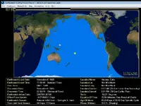
Attached is a picture of this part of the world at sunset simulated by a cute software that can be downloaded here: http://www.earthwatchprogram.com/download/EW403inst.zip
Sunset aboard a Spanish galleon sailing on the high seas was an event. Prayers, singing of "Ave Maria" etc. thanking God for a good day.
Pedro Chaves does not mention anything about bad weather.

The estimated position was somewhere East of the Serranilla.

They were sailing on a North-East course, with a South-East wind.

About 2 hours after dark, the fleet was hit by an extremely violent storm. The storm came from the West or North-West. The only way was to run before the wind.
The Capitana must have been in the lead, within sight of the San Cristobal. She fired a shot of warning and turned towards the South-East.
Turning around such a big, heavy ship, took probably at least 30 minutes. Some sails had to be reefed, other sails had to be taken down to make a safe maneuver.
The San Cristobal did not have the time for that. The extremely violent, sudden wind, broke the fore-masts and ripped the sails.
But the remaining rigging offered too much resistance to the wind, so that the San Cristobal healed way over and took a lot of water on board.
This situation must have lasted for some time, because the gun ports and hatches were certainly battened down well. It is probable that the breaking foremast damaged the deck and opened a way for the water to enter.

With the water having reached 18 hands, the captain decided to cut the main mast.

Before the order was executed, the wind shifted to the North. The San Cristobal righted and was blown in a southerly direction.

About 3 in the morning, the main topsail and the other sails were blown to pieces.

At dawn, the storm was over. The seas were much calmer. No other ship was in sight.

What happened to the Capitana?

The Capitana was seen by the San Cristobal at the beginning of the storm. She was further North-East than the San Cristobal, but then passed the San Cristobal, on her course to the South-East, while the San Cristobal was knocked down.

So the fleet was to the east of the Serranilla before the storm. Then the Storm blew the ships in a south_easterly direction first for a few hours, then in a southerly direction.

Which reef is to the east of Serranilla?

Enjoy

CP
 

Attachments

  • Sunset_11-6-1605_W.jpg
    Sunset_11-6-1605_W.jpg
    101.3 KB · Views: 1,903
Bajo Nuevo Bank
BNB has three things in common with your description:
1. Bank east of "Sarah" (about 110 klicks)
2. 'Guano' (In 1869 the US claimed the BNB in the Guana Island Act)
3. Nic., Hon., Col., Jamaica and USA all claiming ownership--at overlapping times.
And what has always interested me about BNB is the bank was not placed on a chart till about 25 years after the '1605' event; and may have been mistaken for 'Sarah' in the midst of a storm.
Don.....
 

Good theory Don but I see one problem; Baja Nuevo is EAST of Saraha and the prevailing winds were blowing West. The 1605 fleet is either on some island off Nicaragua or on Mysterioso or on the Rosario Banks. Thats just my opinion.
 

Salvor6:
The Q. asked was; What bank is east of 'Sarah' and we both seem to agree that it is Baja Nuevo. Again, what intrigues me is BN may have been unknown at the time of the incident and mistaken for "Sarah".
Don.......
 

Mackaydon said:
Bajo Nuevo Bank
BNB has three things in common with your description:
1. Bank east of "Sarah" (about 110 klicks)
2. 'Guano' (In 1869 the US claimed the BNB in the Guana Island Act)
3. Nic., Hon., Col., Jamaica and USA all claiming ownership--at overlapping times.
And what has always interested me about BNB is the bank was not placed on a chart till about 25 years after the '1605' event; and may have been mistaken for 'Sarah' in the midst of a storm.
Don.....

And on the chart above, 100 years later it is still not marked.
If you consider the position of the fleet to be east of the Viboras on the chart above, running before the wind in a southeasterly direction would run them on the shallows on the lee side of Bajo Nuevo.

Bajo Nuevo would fit the legendary "Far Tortuga story". To sail there from Jamaica the Fishermen/wreckers had to sail practically on an easterly course, due to the prevailing currents. The prevailing winds make this impossible.
However, If they set sail to Serranilla, and the currents had one of the freak spells, that do happen, they might end up on Bajo Nuevo.
Since the freak current events are not predictable and visible, they could never repeat the finding of the reef.

CP
 

I love maps like these. Thanks for sharing. I wish I could take advantage of these maps, but I live on the other side.

Jordan.

Colombiapictures said:
Huguette and Pierre Chaunu, SEVILLE ET L’ATLANTIQUE, vol. IV, p. 200
The San Martin and the San Gregorio returned to Seville in October 1606.
Two lines, but what a story.
The story of 4 ill fated galleons.
SAN ROQUE, CAPITANA
SANTO DOMINGO, ALMIRANTA
SAN AMBROSIO
NUESTRA SENORA DE BEGONA
Four of the richest galleons, shipwrecked on the first of November 1605.
Never found.
Never salvaged.
Where are they?
Below is a chart of about 100 years later. The route of the galleons is clearly marked.
Now, where on this chart did the disaster happen?
 

It has been a wile since I was there and it has been a wile since I did my last Magnetometer survey.
I am sure there are much better Mags available now.

Could the experts from the forum give an update?

It has been suggested that we could use a Girocopter to run the Mag. The Girocopter, picture blow, can not hover, but can fly very slow into the wind. It is a very simple machine compared to a Helicopter. Cheap to fly and cheap to maintain. It can not land on a Heli-platform, but can land and take off on the water on floats.

Since the wrecks are in shallow water, but buried in the sand, A Mag survey seems to be the quickest way to check them out.

CP
 

Attachments

  • giro-ani.jpg
    giro-ani.jpg
    111.8 KB · Views: 1,802
And if your mag catches a snag, Your little fly swatter goes straight into the water. :tongue3: Just use a boat with lots of fishing poles out, Looks like your trolling.
 

Excuse me Sir, I just realized that you ask'ed for expert opinion's. I am not an expert, this was just my first thought to your question.
 

You would need near perfect conditions as the gyro would move around, depending on the mag and height off water you would be faced with unstable readouts much akin to magging in rough seas, then t would be another can of worms to run a good grid and focus on being airborne, running the grids and possible targets, there are planes rigged for this already but then it boils down to airspace and budget.
Good luck
 

Dragging a mag behind a boat is the tried and true method to get accurate readings.
 

First, let's go back to post #32.

This is one example of the fantastic tools that we have available today.

We see a picture of the world. It is actually a computation of the position of the sun and the moon, at sunset of November 6, 1605 in the region where the disaster happened.
We see that the moon is over the Pacific Ocean, so it was a dark stormy night. We could even compute the tides, but I think they had very little influence on the happenings.

Sunset was at about 17:50 local time. In theses latitudes it gets dark quick once the sun is down, so we can say it was pitch dark at 18:30Hrs.

About 2 hours later, 21:30Hrs., the storm hit the fleet. We notice one thing: The witness states that the Capitana fired a warning shot and turned around. So she must have been not more than 1/2 mile away otherwise they could not have seen the Capitana's navigation lights to notice the change in course.
The warning shot must have been a signal they had arranged and knew how to interpret.

About 10 hours later, the storm was over and the seas got calmer.

We have tools at hand nowadays that can help a lot in finding the lost 1605 fleet. Tools that I could not even have dreamed of at the time I went to Bajo Nuevo.

CP
 

comfortably numb said:
Excuse me Sir, I just realized that you ask'ed for expert opinion's. I am not an expert, this was just my first thought to your question.

Very good answer nevertheless.

There are always new ideas coming up. Each idea has to be looked at, considered and then further investigated or discarded.

The Girocopter might be a good tool for a visual survey, looking for ballast piles in shallow, crystal clear water. But is it worth the hassle lugging it all the way to Bajo Nuevo? Probably not.

CP
 

OldGold1974 said:
You would need near perfect conditions as the gyro would move around, depending on the mag and height off water you would be faced with unstable readouts much akin to magging in rough seas, then t would be another can of worms to run a good grid and focus on being airborne, running the grids and possible targets, there are planes rigged for this already but then it boils down to airspace and budget.
Good luck

I notice that you talk from a position of knowledge. You probably have quite a bit of experience running a mag.
Would you be so kind and talk a bit about a state of the art mag survey for the Bajo Nuevo shoal. The area to cover is about 150 square Kilometers. The part of interest is the shallow bank.

I am sure that many members of the forum would enjoy learning about a magnetometer survey. What can be found with the mag? How would one go about finding the remains of shipwrecks going back hundreds of years, mostly buried under the sands and if not, overgrown with corals.

Below is a link to information on Bajo Nuevo.

CP
 

Salvor6 said:
Dragging a mag behind a boat is the tried and true method to get accurate readings.

Nowadays we have GPS that gives great accuracy in positioning.
The depth of water over the bank is shallow. The galleons must have hit the bottom in about 20 to 25 feet of water and then were driven towards the shallower part. To find iron cannon or anchors at that depth is real easy. Not even high resolution needed.
But a good plotting system would save an enormous amount of time. We know that the currents swirl over such banks, so to keep a steady course is not easy and with no landmarks in sight, only accurate plotting will reveal the true course navigated.

Obviously you know all that much better than I do, so, would you be so kind and explain in a bit more detail for the members of the forum, who have not had the chance to take part in a live mag survey?

http://en.wikipedia.org/wiki/Bajo_Nuevo_Bank

CP
 

By no, many members of the forum who are not "of the trade" will start wondering about these galleons of the 1605 fleet.
What is so important about them?

What could be learned about history if they were found?

Is it worth the trouble going to look for them?

And what if there were found? Who would claim ownership? Jamaica, Colombia, Spain, Honduras, Nicaragua, USA?

I think there is matter of discussion for years in the above questions. So it is no easy answer. I will just pick one tiny subject out of thousands of subjects that the archaeological excavation maybe could shed light on.

There is this matter of the Colombian Emeralds. Still nowadays, emeralds are mined in Colombia and are an important export that helps with the balance of payments.

Now, on the SAN ROQUE, the Capitana, there were at least 2 lots of emeralds.
200 pesos of "second quality" emeralds and
1500 pesos of "third quality" emeralds.

How much was a peso of emeralds?

Now, we do not know what was first, second or third quality of emeralds in 1605. There is no mention of the origin of the emeralds either.
Were the emeralds from the MUZO mines or from the CHIVOR mines?
What was the size of the stones?
Was the quality of the emeralds mined at the beginning of the 17th century better than the quality of the emeralds mined today?

How do emeralds react to immersion in salt water for 400 years?
I have heard that modern emeralds are often treated with some penetrating oil, that enhances the color. Does the prolonged submersion in the sea produce a similar effect?

There are so many questions that might find answers if these shipwrecks were excavated.

Or should the galleons of the 1605 fleet be "preserved in situ"

Well, the various owners of the galleons will have to decide that. Jointly, or each one on his own, once they have come to a conclusion of who owns the galleons.

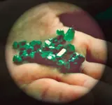
Below is a picture of a few emeralds. which category are they? second? or third? What do category # 1 look like? Were there any on this fleet?
CP
 

Attachments

  • Muzo-Emeralds.jpg
    Muzo-Emeralds.jpg
    91.3 KB · Views: 1,780

Top Member Reactions

Users who are viewing this thread

Back
Top