TWO SIGNS LEFT TO I.D. MINE, AS SPANISH, FRENCH, OR JESUIT.

Mikel, the best info that I have is because of the information contained ( EGG ) shape is that it may have been a vault, seem they had them every 5 leagues, they were near a Royal trail, rest areas every 2.5 miles because of the loads involved with carvings nearby, Oklahoma had the same setup up and including tables and with comforts of home nearby suitable for overnight stays. Seems they were copied from the old timers. Lots of houses there now ,high bluff along the banks of the Ark River, the fault line can still be seen from the south side
 

Are the houses that you spoke of built on the spot where the stone was( or is) ?
That sounds like a clear sign of something there.

I lived in the area near .Clarksville to Russelville in the early sixties. I remember watching some of the building of I-40. There has been a lot of growth since then.
There is not much telling as to what old signs and symbols got dozed under since way back then.

#/;0^/ ?¿.
 

Just a small footnote.
I think that I may have a good path to close out the site and the book closer at hand.

I need to make new arrangements.

Only a temporary setback.

More news as it developes.

More later.
MIKEL
#/:0)~
 

I have high hopes.

I'm thinking in terms of months, for the pace setter.

A good year is more realistic to put books on shelves.

That whole contract deal, going south, kinda took the air out of my sails.

BUT THAT WAS LAST YEAR!

This is a brand new year!

#/;0)~ ~(0;/#
 

Hi Mikel
Thought I would check in and see how things are. Must admit I can't imagine why someone would not want a silver mine, or let you open it. After all the work you have done... The way things are today I would say they are lucky you didn't do whatever you wanted.
Seems you are an eternal optimist about everything and I like that about you. (Need to work on this myself). Hope your new year is blessed and people realize what you are trying to do so we can all read your book soon.:BangHead:
 

Maybe not so much optimist as hard headed.

It is as it was from the first day...
All I lack is finishing.

#/;0) ~
 

One thing that would peak my interest would around the streams in Arkansas would be about 4 inches of water looking for clear rocks about fist size, hard to see but worth the time spent especially north of Russelville, perhaps a small rake to just turn over the gravel, Perhaps smaller clear stones. wish I still had legs to take me where I wanted to go.

you are talking about my stomping grounds! i have never seen any clear rocks in the creeks tho....i will have to start looking!
 

Go up 27 above bayou bluff out side of hector I've stopped several trail trees just off the highway. Snow creek is just past the grave yard on the left easy to get at from a vehicle.
 

There's a place called fort Douglas off in the forest. It's on big piney. There's there's still lots of old stuff all in there. That area just looks like it holds secrets.
 

Go up 27 above bayou bluff out side of hector I've stopped several trail trees just off the highway. Snow creek is just past the grave yard on the left easy to get at from a vehicle.

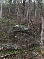
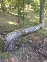
Trail Trees? One of my favorite subjects ... it helps to understand the difference between a Trail Marker Tree and a Hoot Owl Tree. Wouldn't want to destroy living history or miss something "of value" so need to learn the difference.

BTW, don't think I'm crazy, but I personally prefer finding the former to the latter. I turn over the Hoot Owl Trees to others who know what to do with them.

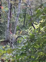
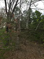
Favorite Hoot Owl Trees are the ones with faces ... like the face of Albert Pike standing twice the height of a man overlooking what appears to be a burial ground. Yep, it's on a State Park in Arkansas. Found it by accident when I stumbled upon a double pointing Hoot Owl Tree. Tree wasn't two trees together, but one tree with the bottom bend pointing to the tree and a second bent at double the height of the first pointing slightly up and in the opposite direction.

tree_zpsddc2cd3c.jpg


Followed the bottom bend, and kept an eye peeled overhead (just in case the clue still existed) and found him.

I wonder if any of those burial mounds is a fake ... or maybe I should wonder if any of them are real.
 

Last edited:
Its the mine.

There are several possible vaults on each family's land.
#/;0)

I know you're writing a book and might not want to divulge to much information but if you can... Have you ever looked for a vault? Do any appear on your map? Don't know why I never thought of the possibility of a vault. Interesting!:hello:
Henry T
 

I know you're writing a book and might not want to divulge to much information but if you can... Have you ever looked for a vault? Do any appear on your map? Don't know why I never thought of the possibility of a vault. Interesting!:hello:
Henry T

MrB.
The answer to both questions is yes.

Since I cannot rule out the possibility of K.G.C., I cannot rule out the possibility of the mine being a vault.

There several possibilities for vaults on and off the map.

One that I heard of just a few months ago could call for much more exploration.
Something that I don't know how to approach at present.

I hope to learn more about it in the next few months.

I would love to post the map that I have developed over the last thirteen years. It would explain why I have stayed with this project for so long.

It's not a cracker jack map.
Its maid out on a topo digital map with GPS details.
But that would be the undoing of everything if it were to surface.

#/;0)~
 

Top Member Reactions

Users who are viewing this thread

Back
Top