OreCart
Sr. Member
- #181
Thread Owner
Triple D, Arizau, and JonnyBravo3000...I really am not sure whether this was a former riverbed or not.
There is a stream not far away, big enough to be called a brook that is forever running. This is located in a valley at 500, feet and my gravel pit is below that, as indicated by me often digging below the water table.
The only information the Maine Geological Survey gave me was that the size of the gravel indicates how much water was moving THROUGH the soil when deposited. It must have been moving pretty good because there are not a lot of big rocks in it. Most of it is sandy, to maybe 2 inches in diameter. Occasionally I do get a big rock, but they are few and far between...very, very isolated.
Sometimes my beliefs do not match up with geologists, but in this one area they do. Geologists believe that the ocean rose to the 540 foot level in Maine, thereby putting this gravel pit under ocean water. I believe in the bible, so I believe in Noah's flood. Regardless, both proposals put this area under water at one time, but when the water ran out of the valley from either event, it would have scoured the hilltop I live on, pushing soils down into the valley, and then left the gravel behind when the glacier melted, or the water ran out leaving behind a gravel bar in a sense,
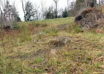
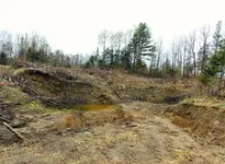
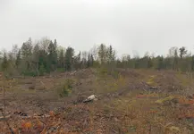
My spell checker may be spelling this wrong, but what I have here is "eskews" of gravel. Now that I have cut the trees in the pit, you can now clearly see the lay of the land originally, and where that front shovel did its work in 1969. So I am not sure if this gravel pit was the result of one big mud puddle, or a former river bed? The new acre of gravel we found, terrain wise, looks like a giant football in shape. It is tapered on each end, and rounded on the sides to form a twenty foot high hummock roughly an acre in size, split off from the rest of the gravel pit area by a stream.
I will have to take time out from my digging and get some pictures for you guys to show you what I am talking about.
One thing I did note yesterday when I was digging down there was, the clay layer is just on top of the water table. It is about a foot thick, but if I dig below that clay, the water starts bubbling up. I have no idea what that means in terms of gold. There is gorgeous gravel below the clay layer, and down under the water table by another twenty feet or more.
Oh...one more thing in this long-winded post. I am finding a crap-ton of galena-like-stuff. It is the strangest stuff. I dig it out of the gravel, but when I jump down to inspect it, the second I touch it, it crumbles into granules. Most of the time just the gravel swirling around the bucket is enough to take a chunk the size of a milk bottle and instantly turn it into dust. It is the strangest stuff, but in big form, it looks like the pages of a book, layers upon thin layers opened up like you took a book and dropped it on the floor and it fanned open. I got to have it tested just to see what the heck it is exactly. I call it galena, but it might be something else.


