Jerry,
As I have said many times, if someone can show me something that fits the Stone Maps that is better than my maps, I am open to it. If you have something better, I would love to see it. Some very good minds have placed the Stone Maps in other places.
My conclusions are based on simple map reading abilities. No secret codes, alignment of stars, Latin words or the Calalus story. I look at a map, and read it as it is. If someone can shoehorn some unknown factor in there and move the location to........Chicago, more power to them.
I started looking at the Stone Maps around forty or so years ago. At that time, I noticed the similarity of the wavy line at the bottom of the first trail map to the outline of the main mountain from the south.
Using that as a premise, and it was simply a guess, I started trying to match the bent arrow and the marked/dotted trail to a topographic map. It matched perfectly. The canyons that are shown on the Stone Maps were very familiar to me. It was child's play for me to transfer the Stone Maps to a topo.
The marks farthest to the right side/east, are on Bluff Spring Mountain. The dot, is the highest point on that mountain. You can prove the accuracy of my map by tracing the canyons and matching them to the canyons and junctions that are carved on the Stone Maps.
For instance, if you follow the direction of the triangle, which points to the X, you will see a line that comes from the north and goes directly to the X and the point of the triangle. That line is East Boulder Canyon. At the exact point on the Stone Maps where the line stops, the trail in East Boulder turns west and climbs out of the bottom of the canyon. I have been on that trail many times, so I recognized what had happened on the Stone Maps. People who have not walked that trail, and often, will not see the connection.
While you may be able to show me any number of "coowinkydinkys", and many people have, I will always return to the progression and correct placement of the physical landmarks that are shown on the Stone Maps and are matched on the actual terrain of the Superstitions.
Take out a clean topo and start drawing the Stone Maps with the bent arrow that takes you up and over the main mountain. Start that arrow in the bottom of Heiroglyphic Canyon. Follow the ravine from the top of the ridgeline as it travels down into West Boulder. Every turn on the Stone Maps is on the topo. Notice how the bottom of the canyon (West Boulder) matches the Stone Maps exactly.
Assume I am correct and place a dot on the highest point on the south end of Bluff Spring Mountain.
Place another dot on the northern peak that creates Tim's Saddle. Place another dot on the farthest hump to the east on the north end of Black Top Mountain.
Have your topo in front of you and a copy of the Stone Maps with one map on top of the other, start of the trail on the bottom. There are places where the map will become disjointed, much as it would if you were roaming through the mountains.
Place the tip of the dagger on Parker Pass. At that point, follow the trails on the topo. Using the Stone Maps as a guide, mark the topo where it follows the maps. Notice where some lines break away from the trail that continues toward the top of the heart. Find that same trail on the topo and highlight it. Notice the "W" above the trail. Look at the elevation lines on your topo at that location.
Everything on that upper map is leading you to the center of this:
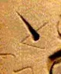
Now that's one hell of a coincidence! This is the curved trail that climbs out of West Boulder (from the top of the 1) and drops into the center of the heart in Little Boulder Canyon:
If that's not enough for anyone reading this, I will be happy to do exactly what I just suggested you do......at the Rendezvous. Tried to fit voodoo into that last line, but it just didn't work.


Take care,
Joe
map have a HUGE connection...


.webp")
.webp")


")