Curtis
Hero Member
- Joined
- Sep 3, 2008
- Messages
- 905
- Reaction score
- 1,021
- Golden Thread
- 0
- Location
- Cincinnati
- Primary Interest:
- All Treasure Hunting
Arch over the creek/river
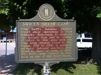
The one on/near Caney is actually on the Little Sandy, its where the line of rocks almost cross the river..I was told that it was blown up to make the river accessible to boating. Lots of interesting stuff right there..like the monument rocks and the hole thru the cliff, and if you look when the water is down..until February..you can see the remains of a rock house...a dwelling made from rocks...not a cave like structure. Also not far is the famous Crane Carving. The line of rocks and crane drawing are the start of a description of 6 Indian silver mines called out in the Indian Waybill (I have found all of them and am waiting on a TV producer to set up the initial look see-if he doesn't do it soon I will post the whole document here on how to locate each one)...The Indian Waybill starts there and the whole are is similar to what Swift writes about...I think his silver mine maybe the vein that runs under the Grayson reservoir dam.
The one on/near Caney is actually on the Little Sandy, its where the line of rocks almost cross the river..I was told that it was blown up to make the river accessible to boating. Lots of interesting stuff right there..like the monument rocks and the hole thru the cliff, and if you look when the water is down..until February..you can see the remains of a rock house...a dwelling made from rocks...not a cave like structure. Also not far is the famous Crane Carving. The line of rocks and crane drawing are the start of a description of 6 Indian silver mines called out in the Indian Waybill (I have found all of them and am waiting on a TV producer to set up the initial look see-if he doesn't do it soon I will post the whole document here on how to locate each one)...The Indian Waybill starts there and the whole are is similar to what Swift writes about...I think his silver mine maybe the vein that runs under the Grayson reservoir dam.
Last edited:


