Swift Silver??

1320 What Bushy was referring to a few posts back is part of the Indian Way bill by Chief Joseph that describes how to find the six Indian silver mines...the first locator is a crane carved on a cliff near there...then the line of rocks..then..SO Bushy was being nice and throwing a hint at something for you to check out...sorry you missed it.
 

1320 What Bushy was referring to a few posts back is part of the Indian Way bill by Chief Joseph that describes how to find the six Indian silver mines...the first locator is a crane carved on a cliff near there...then the line of rocks..then..SO Bushy was being nice and throwing a hint at something for you to check out...sorry you missed it.

No one is throwing hints at me, I'm not looking for this nonsense. If someone is throwing hints at me they are tossing them in the wrong direction. I spend a fair amount of time in the cliffs and rock shelters in my area but I'm not wasting my time chasing a freakin' fairy tale. If my knowledge of my area helps a swift searcher out I'm more than happy to lend a hand but other than that, I have zero interest.
 

That line of rocks, wanna see it before Grayson Reservoir?

Y'know I'm usually just lurking here.
Use the Historic Aerials website, they have aerial photos of that area dating all the way back to 1947 before the river was dammed.
That line of rocks is . . . still just a line of rocks in 1947.
You can see what was there before the lake though.

( link deleted by mod for rule violation)
 

Last edited by a moderator:
That line of rocks, wanna see it before Grayson Reservoir?

Y'know I'm usually just lurking here.
Use the Historic Aerials website, they have aerial photos of that area dating all the way back to 1947 before the river was dammed.
That line of rocks is . . . still just a line of rocks in 1947.
You can see what was there before the lake though.

( link deleted by mod for rule violation)

Thank you creek crawler
 

1. the rocks at the line of rock were moved to clear the way for an open channel, some were blasted. also around where the boat ramps would be. the little sandy was cleaned from the new dam to the caney boat ramp, than near to sandy hook ky. I show the large rocks and other debris at line of rock on my 1937 aerial photos. use a magnifier it shows better. it seems that their are some that thick the earth works at the line of rocks on the east side may have been done by the miners. this part is a bit tricky. yes the miners were their, but their was an iron furnace next to the line of rocks. you can see it at low water on east side. now comes another group, well two groups, john hunt Morgan and his southern cavalry chasing George Morgan and his union army, from Cumberland gap to Greenup Kentucky. both used the little sandy river during the battles. so check the areas close, try to find something that will help identify the group that was in that area.
 

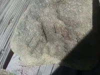
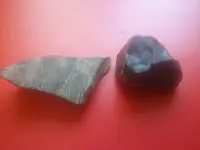
20180429_152928.jpg Found this in the area with some more black slag and an odd colored rock undeneath. 20180429_155703.jpg
 

Last edited:
Interesting stuff, wonder what significance the check marks are? They don't look natural.
 

Looks like the first one was broken at some point off a larger piece. The lighter edge along the bottom looks less weathered.
 

Just a comment on the Hebrew in ancient America stuff that was mentioned halfway thru the thread. Those ideas can be traced back to the Mormons, who obviously have a vested interest in promoting the theory.
 

Actually before the Mormons, T. Jefferson had several mounds surveyed in Ohio prior to its statehood. One mound had several Jewish features including a manora (spell check). That survey is archived in the Library of Congress.
 

I know its a different thread but when you are talking old, near Chillicothe Ohio is a fort built by the Vikings..it had stone walls 9 feet high. Its on the Smithsonian booklet of mounds and drawings of them by Squire and Davis...early 1800s.Also there were Giant skeletons found near Chillicothe. There are things that are not agreeing with History as we are taught.
 

I agree, except I heard the stone fort was build by the Welsh, like the one on Fourteen Mile Creek on the banks of the Ohio River. I posted a thread about this with a video attached... the theory is King Arthur came to KY after a comet strike in their homeland around 562AD. Total of about 70,000 migrated here to what they called the 'other world' instead of Columbus' 'new world'. Interesting stuff to consider!

http://www.treasurenet.com/forums/l...-welsh-here-ky-much-earlier-than-spanish.html
 

Last edited:
I am going by what an old farmer (who's property borders on this site) said, he had people from the Smithsonian tell him is was Vikings, they even found a helmet of the type they would use(what ever that is)..they said Indian oral tradition says that the gathered over 5,000 men to attack and wipe out the Vikings as they made Indians slaves, and ate them too-cannibalistic. The farmer has a neat giant cone shaped rock that they said fit on the end of a sapling and was launched by something like a giant crossbow. If interested, please PM as I don't want to side track this thread.
 

I am going by what an old farmer (who's property borders on this site) said, he had people from the Smithsonian tell him is was Vikings, they even found a helmet of the type they would use(what ever that is)..they said Indian oral tradition says that the gathered over 5,000 men to attack and wipe out the Vikings as they made Indians slaves, and ate them too-cannibalistic. The farmer has a neat giant cone shaped rock that they said fit on the end of a sapling and was launched by something like a giant crossbow. If interested, please PM as I don't want to side track this thread.

Interesting, but somehow I find the cannibalism aspect a little much... I am surprised the Smithsonian would admit to Vikings or any pre-Columbian European settlement in what is now the U.S.A. Sounds like the crossbow-like device would have been a ballista. Usually used in siege of a fortification, not in defense...I wonder if this site is related to Lexington, KY and Rose Island near Louisville, KY. Same peoples or different time periods? hmm...so much has been lost
 

Yes, welsh was here and I believe out west also. Wonder why dna test are not confirming that? My family looks just like paintings of the Welsh Indians. There was artifacts that suport the lost tribe(hebrew) also found in the Buckeye lake area in Ohio. As for silver, I know copper has been found north of us, where there is copper there is usually silver and gold also. I do not know the geological history or Kentucky. It would be a good start for me to locate any mines. I have found most old digs are now national parks and protected. This thread is all over the board so makes it hard to address one subject. But very good read.
 

Top Member Reactions

Users who are viewing this thread

Back
Top