Misc data and adventures of a Tayopa treasure hunter

The story continues ...

They moored in a small bay off the headland, and Percy caught some of his father’s excitement, particularly as he kept impressing on him that he had to remember the place but tell nobody of its location. In the morning, they landed near the point of the headland and the men began searching for a free-standing rock - referenced on the back of the drawing - that had an arrow carved into it.

Percy lost interest after an hour or two, and it’s clear they didn’t have specific enough instructions to locate the required spot. The men eventually met on the beach to decide on a more structured plan of action.

They had the parchment plan with them and sat a while checking the view, and it certainly looked like they were in the right place, but there seemed to be no stone, as was mentioned on the reverse, along with further observations concerning the location sought. Having found the stone, according to the text, they had to locate three more points.

Percy had seen the instructions, but was not included in the discussions of his seniors, one of whom happened to be flipping the map in agitation. Percy noted that two of the points on the reverse (which just seemed like oversized bullet points in the text) seemed to be located on the edges of islands on the other side, and the third was below the leftmost. He suggested that maybe these points might pertain to the front, and might then provide a specific reference point.

When the marks were transferred to the image, and with the points connected, it appeared they’d been looking for the rock in the wrong place - and I could see exactly what Percy meant when flipping the map, which was fairly stiff. The writing on the back included three points marked as ‘blobs’. Two of these matched up with the edges of islands, and the third provided a possible viewing point. So, once in the bay, you could see from the blobs where you had to be in order to line the islands up in that particular way. Thus, the point they were looking for was in a line with the most eastward of the islands.

They walked a considerable way along the headland until they were at the spot that seemed to be suggested, that is, north of the east island, where the fourth island could be seen between the second and third.

Within thirty minutes they found the marker stone. It didn’t have an arrow cut into it, as described in the text, it had an anchor. It seemed to me they may have taken a leap of faith by simply assuming that this was a stratagem to put off any casual observer, except that the holder of the map would know the anchor was actually an arrow. In apparent confirmation, it pointed as a continuation of the line between the two islands. So, they now had to find the three points somewhere inland.

They followed the line uphill for a hundred yards or so through rocky and stony ground, maintaining a constant bearing from the islands, then continued over the crest and into trees - and completely lost their bearings. They were forced to return to the crest and figure out a way to continue the line on the other side of the hill. They did so with timbers and rock cairns, and some trust in their compass, but this proved unsatisfactory, and they called a meeting at the top of the hill.
 

The story continues ...

They concluded they needed a transit, and determined to continue the work the following day. They marked the anchor rock to be visible from a distance, and set up a theodolite on the crest with a bearing through the islands, and swung round 180 degrees. They then marked the required line more accurately and laid down a length of white rope that might be seen from a distance (though not particularly effective because of the trees).

Thus, they were able to continue down the hill and onto the mainland, searching for some indication of the three markers, presumably rocks, but though they searched for two days they found nothing resembling what they were looking for. Dejected, they decided they’d give it one more day.

At meals, one constant topic of conversation was who these ‘pirates’ may have been (presumably buccaneers) and what it was they had gone to such trouble to conceal. Gold and silver was obviously high on the list. Many tales were recounted as to their exploits.

One of the party interrupted one such discussion to ask how the heck they had done it. After puzzled looks, he asked how on earth the pirates had done what they themselves had achieved, that is, running a perfectly accurate line from the top of the hill down the other side.

Dejection at once turned to enthusiasm. Maybe the three points weren’t on the other side of the hill! The next day, they formed a line at the anchor rock and walked up the hill, looking for any kind of marker, but arrived at the crest with nothing other than a few false indicators.

The whole thing was puzzling. It seemed they were on the right track, but they didn’t have enough information. It comes back to whether a treasure map is intended as an aide-memoire for the depositor, or as directions for someone unfamiliar with the original activity. They chose to believe it was the latter. As Percy observed, it was either that or give up.

They sat on the crest for a packed lunch. One of the party, Percy referred to him as Mr. George, began going through what they’d done, and concluded with, “and all we’ve got is that damned rock with the anchor!” After a moment’s silence, Percy’s father observed, “so, maybe that’s all we need!” adding, “we haven’t really looked at it.”

After lunch, they went down the hill to look at the rock. It was three feet high and about twelve feet in diameter. They searched all round it looking for any other markings, and dug down its sides for a foot or two to expose more of it. Finding nothing, they then just stared at the anchor.

The shank of the anchor was about four feet long, the arms were short and had stylized flukes, the ring was a hole rather than a circle, and there was no stock (cross-bar). Discussion then began as to why not. Did 17th century anchors not have stocks? Nobody knew.

It was then observed that they were not actually expecting to find an anchor, but an arrow, so, maybe they’d been wasting their time, and this wasn’t the spot. Despair invariably sets in at some time! George was set on the anchor being the right marker, but observed that the fact it had no stock certainly made it look like an arrow.

Percy’s father observed that it wasn’t an anchor in another sense, in that the flukes seemed strange, and there was further discussion as to whether this might have been a feature of 17th century anchors, except, surely, it would have been ineffectual. At this size, it would be useless. It just had to be an arrow, but who would put a ring and two flukes on an arrow? A sailor? But then a sailor would know what an anchor looked like!

George then stood up, looking from the anchor to the hill, and observed that perhaps it wasn’t an anchor, as such, the hole was not a ring, and the lines at the ends of the arms weren’t flukes. The figure may well have been two pointers. The ring of the anchor was one of the three points they were looking for, and the flukes represented the other two, but, being slits drawn as lines from the ring, pointed uphill.
 

The story continues ...

There being nothing better to do, activity then focused on taking the most accurate bearings they could from the ‘ring’ through the ‘flukes’ and following these uphill to see where they led. Another line was formed. Hopes were raised when the right hand line had been extended just over half way to the summit where a design resembling a sickle, or scythe, was found carved into a rock. Extending the line on the left revealed a similar design, but reversed.

It was assumed these were two anchor flukes, though they were not the same distance from the anchor rock. The three points did, however, form the same pattern as drawn on the back of the parchment. The problem was, the group didn’t know what to do next. They tried digging at the midpoint between the fluke rocks but the ground was stony, and had apparently not been disturbed.

It seems at this point they ran out of time, and were forced to concede defeat, at least temporarily. That’s not an unusual occurrence!

One strange event during their stay was the discovery of what Percy called ‘The Grave’. From his description, I imagine it was nothing of the sort. It was a stone lined pit about six feet by three feet, and two feet deep, that had been constructed with its top some two feet below the surface. The ground around had eroded and fallen into the ‘chamber’. This was cleared out, and in the soil at the bottom they found a small bone-carving of a fish, which was produced later for my inspection.

The structure looked either unfinished or had been robbed of some stone. There seemed to be nothing in the vicinity that could have formed a top except two large flat natural-looking rocks about four feet long.

It’s my belief that everything they needed was there, either on the map or on the ground, and that maybe someone closer to the time, familiar with the process of treasure deposits and markers, might have figured it out.

Percy’s ‘grave’ may have been a pointer to what was either done or intended, A shallow chamber such as this might be covered with natural-looking largish rocks, and who would know it was there? What’s more, who would think of moving the rocks? You’d need a lot of effort to uncover what was deposited, and this might have been one way to ensure communal recovery and the proper sharing of the loot.
---------------

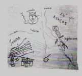
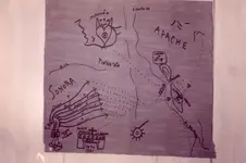
Simply having seen and felt this picture map, and hearing the tale recounted, made me a potential believer in the existence of treasure maps. It struck me that such things needn’t be just a thing of fiction. This is the jaundiced view of self-styled experts who wish to appear rational to the public, and superior to those who actually delve into this secretive world to undertake investigations that others won’t go near.

This is a world of strange people, some certainly misguided. However, digging long and hard enough can sometimes hit potential pay-dirt. The trouble is, there’s so much thereafter preventing discovery of the mother-lode. But you’re not going to get hold of that unless you try, and it may just help sometimes to believe in treasure maps, stories or legends - and if this is enough that there’s some way in which they ultimately make complete sense.

You just have to locate the right place, and hit on exactly what these things truly mean when you're there!

(That's it)
 

Last edited:
The story continues ...

There being nothing better to do, activity then focused on taking the most accurate bearings they could from the ‘ring’ through the ‘flukes’ and following these uphill to see where they led. Another line was formed. Hopes were raised when the right hand line had been extended just over half way to the summit where a design resembling a sickle, or scythe, was found carved into a rock. Extending the line on the left revealed a similar design, but reversed.

It was assumed these were two anchor flukes, though they were not the same distance from the anchor rock. The three points did, however, form the same pattern as drawn on the back of the parchment. The problem was, the group didn’t know what to do next. They tried digging at the midpoint between the fluke rocks but the ground was stony, and had apparently not been disturbed.

It seems at this point they ran out of time, and were forced to concede defeat, at least temporarily. That’s not an unusual occurrence!

One strange event during their stay was the discovery of what Percy called ‘The Grave’. From his description, I imagine it was nothing of the sort. It was a stone lined pit about six feet by three feet, and two feet deep, that had been constructed with its top some two feet below the surface. The ground around had eroded and fallen into the ‘chamber’. This was cleared out, and in the soil at the bottom they found a small bone-carving of a fish, which was produced later for my inspection.

The structure looked either unfinished or had been robbed of some stone. There seemed to be nothing in the vicinity that could have formed a top except two large flat natural-looking rocks about four feet long.

It’s my belief that everything they needed was there, either on the map or on the ground, and that maybe someone closer to the time, familiar with the process of treasure deposits and markers, might have figured it out.

Percy’s ‘grave’ may have been a pointer to what was either done or intended, A shallow chamber such as this might be covered with natural-looking largish rocks, and who would know it was there? What’s more, who would think of moving the rocks? You’d need a lot of effort to uncover what was deposited, and this might have been one way to ensure communal recovery and the proper sharing of the loot.
---------------

Simply having seen and felt this picture map, and hearing the tale recounted, made me a potential believer in the existence of treasure maps. It struck me that such things needn’t be just a thing of fiction. This is the jaundiced view of self-styled experts who wish to appear rational to the public, and superior to those who actually delve into this secretive world to undertake investigations that others won’t go near.

This is a world of strange people, some certainly misguided. However, digging long and hard enough can sometimes hit potential pay-dirt. The trouble is, there’s so much thereafter preventing discovery of the mother-lode. But you’re not going to get hold of that unless you try, and it may just help sometimes to believe in treasure maps, stories or legends - and if this is enough that there’s some way in which they ultimately make complete sense.

You just have to locate the right place, and hit on exactly what these things truly mean when you're there!

(That's it)

gjb,,,nice yarn indeed! Thanks a lot,,,pity they didn't find anything,,,
TT
 

gjb,,,nice yarn indeed! Thanks a lot,,,pity they didn't find anything,,,
TT

I couldn't get Percy to open up on whether they went back. Instead of just saying 'no' he said there were other places they went, and when I went back to the topic he just said, 'it was all a long time ago'. I think they might have figured it out, but from what I was shown, I think it was mostly weapons buried, maybe minor loot. Percy inherited a huge collection of 17th century weapons and coins from his father!

The group of which Percy's father (and ultimately Percy himself) belonged were very likely in possession of the original maps that I was trying to trace (Captain Kidd Treasure Maps: The Reality).

It's my belief that these may well pertain to Oak Island (the group was convinced otherwise), and I spent a few years trying to figure out what they mean. I reckon I may have gotten a good way there - but just try convincing the island's owners of that!
 

Last edited:
It's my belief that these may well pertain to Oak Island - but just try convincing the island's owners of that!

Just to add to this, by way of explanation, the group were convinced that the so-called Kidd maps were associated with the ‘Picture Map’ of the story, so they located this ‘Kidd’ treasure island in the Pacific - which is why two of the maps became ‘Mar Del (Sur/Zur)’ maps - and would at first not countenance the possibility that the island was in the cold northeast!

I was ultimately told that if I could convince the island’s owners of the likelihood then the group might be prepared to share the file of papers they had, on a promise of secrecy and a share of the loot. I failed.
 

Last edited:
elo JB, you mean like this ?? courtesy of NP.

Jesuit map o Tayopa oute to the Santa Fe zone.jpg
 

Attachments

  • img131.jpg
    img131.jpg
    255.1 KB · Views: 94
Last edited:
Thanks fdcfia for sharing that website.

Sent from my SM-G900T using Tapatalk
 

Ditto. What Jose said.
I'll go back thru that again, later when I'm feeling better.

Picked up a nasty bug. It's been hard to concentrate for over a week now.

I want to concentrate better when I read it next time.

That's a lot of info and cross referencing.

Thanks for posting it.

#/;0{> ~ (c)
 

A temp setback GJB.

I'd have loved to have seen all the papers in that file! Unfortunately, Percy always contacted me to arrange meetings in hotel lounges in London - and at our first meeting, would you believe, he actually gave me a password to ensure I was the right person!! Eighteen years ago I received a courtesy call from his lawyers to inform me he'd died. He didn't leave me a thing, damn it!

I've no way, now, of getting in touch with the group. Percy's greatest disappointment was that none of the families of the three remaining members of the group (sons of the original members) were at all interested in the quest. I imagine the papers are either dispersed or sitting in a box in an attic somewhere gathering dust.

I hope it's the latter, and it'll be heard of again, probably when I'm long gone! However, this was a 'one off' opportunity, and it wasn't grasped while it was there.

The attitude of the island's former owners surprised me. In a treasure hunt, you keep your mouth shut, but you keep your ears and eyes open! I understand why they alone wanted the whole of the treasure, but why on earth did they decide that they alone had the answer before knowing that they did?
 

Many, many hanks for that fascinating reading SDC. I spent almost an hour in there.

I'm glad folks are interested in the website. I found it maybe 10 years ago and became fascinated by its premise and impressed by its wealth of information. The site can be frustrating because it needs a little better organization, page navigation improvement and cross-link editing, IMO. That said, the 24 pages can surprise you for hours and give you dozens of starting points for more fun.
 

I'm glad folks are interested in the website. I found it maybe 10 years ago and became fascinated by its premise and impressed by its wealth of information. The site can be frustrating because it needs a little better organization, page navigation improvement and cross-link editing, IMO. That said, the 24 pages can surprise you for hours and give you dozens of starting points for more fun.

It is truly fascinating, but as you say, a bit disorganised. I believe I may know who the author is and, if so, I corresponded with him over the period 2003-2004, and translated two of the books he mentions from Spanish into English for him. A few images I provided have also found their way onto the web site, which makes me think it's the same guy.

I was aware of the thesis but had no real clue where it was going. I can't figure out if it's all done with tongue in cheek, as a means of pulling together a huge amount of research, because I'm really left wondering at the end what this has to do with the beginning!
 

One more for you. My Brother and I wanted to see into a valley from the backside of it, so we went into the next valley and climbed up the back of it as it was at a 90 degree angle from the one we wanted. Got so steep that I was pulling myself up by the bottom of bushes. Got to a nice rock that was standing up on the end of the drop off and wrapped myself around it to look over into the correct valley. Still couldn't see what I needed for landmarks, then I looked down and down and down. The rock I was wrapped around went down in a 30 degree reverse angle! I did a slow slide back from the rock and laying on my back was lifting my backsides, then my shoulders and repeating so I would not make any real shocks to the slope. My brother was 100-150 feet below watching me and laughing! He told me I was coming down like a broken back snake. Some where in that valley I lost my $3 fake K-Bar and never went back to look for it. BTW I got even with my brother, as he was sliding down ahead of me, he said "Watch out for the Jose Cuervo (Agave Cactus), AHHHH!" He found a second one under the leaves, little bitty only a 1/2 inch long, but a 1/4 of it the thorn.
Nasty things, anti coagulant, and burns until the blood washes it out. Had one go into my calf trying to step over it on a hill side and the dirt slipped under my foot. Made it a point to miss the "Teddy Bear Cactus", "Jumping Cactus", and the rest of the joys of going off trail in the Nation Forest.
 

I'm glad folks are interested in the website. I found it maybe 10 years ago and became fascinated by its premise and impressed by its wealth of information. The site can be frustrating because it needs a little better organization, page navigation improvement and cross-link editing, IMO. That said, the 24 pages can surprise you for hours and give you dozens of starting points for more fun.

Thanks sdcfia!
Didn't go through it yet but it seems a very insightful collection of yarns!.Where have you been in the weekend when I was calling for people with yarn?:hello: keep it coming!
TT
 

Top Member Reactions

Users who are viewing this thread

Latest Discussions

Back
Top