Rebel - KGC
Platinum Member
From the Atocha...?
Amazon Forum Fav 👍
Last edited:
sdcfia: Agreed. Look at the haul from the Atocha - she went on the reef in what, the 1640's? Hundreds of thousands of silver coins and a relative handful of gold. Gold went to Spain immediately.
I remember when KvonM was selling silver arrowheads cast from the bars he and Hammond found.
Good luck to all,
The Old Bookaroo
mdog: I'd have to root through my copies of the National Prospector's Gazette. Let me see what I can come up with - it may take a while. As I remember (sometimes memory serves; sometimes it double-faults) the ad had a sketch of the arrowhead. KvonM also sold plastercast rattlesnake ashtrays. Professional th'ers used them as a "zigafoo."
Good luck to all,
The Old Bookaroo
You are asking me to remember stuff from when I was a kid. As I recall, these locations were deduced from the map quadrant. There is really only one section of the Sangre de Christos that match the mountain outline. Karl, my father and another friend claimed to have broken part of the code. Their process was rudimentary by today's standards and would be considered shallow and some guestimation in my opinion. It also involved a slide rule. (The slide rule and 3 X 5 cards are making me sentimental. Imagine what they could have done with the tools we have at our fingertips.)
I have a bunch of these 3 X 5 cards with notes and crude maps were drawn on. Others are just reference materials like how to research basic stuff way before we had google. There is also a bunch of letters with confidential conversations and stuff. I cannot speak to the validity of any of these leads. They might be worth following up on, they might be the result of incorrect analysis? You can judge for yourself as I don't have much else to go on except the front and back of the 3X5 card.
View attachment 1391283
View attachment 1391284
It was definitely associated with the LUE based on input from KVM and my father. I am pretty sure they did not make any recovery from this location.
Edit: Just noticed the letter in the background. Its in a binder of letters. I thought of posting some of KVMs letters up but there is so much that would have to be lined out due to inappropriate comments by today's standards. Every time I read any of his letters, I hear Archie Bunker. Great sense of humor and I thought it was funny how he referred to his wife as Broom Rider. He was also very generous with his expertise and knowledge. A great role model for treasure hunters. Just don't think certain comments would be acceptable according to TOS.
If anyone is actually researching this and needs to collaborate information, I can check through the stuff. Its what Randy does and it is what Karl would have done.
Patrick


Randy Bradford,
View attachment 1580745
I saw the YouTube video of your presentation on the LUE map. You wondered what information the American Guide Series books on New Mexico and Texas have with the LUE map. The first time I found this clue was in the Treasure Hunter’s Manual (THM), 6th edition, revised 1973 (Ram Publishing Company). In addition to a “Biography of Treasure Hunting” section on page 235, the 1973 THM 6th edition includes a section (Pages 346 – 355) titled “Treasure Literature and Recommended RAM Publishing Company books.” This section was not in the earlier THM #6 1961 edition. The revised edition cites the American Guide Series, by the Federal Writers Project and states: “LUE fans will be able to find information in both the New Mexico and Texas edition.” I never saw the National Prospector’s Gazette newsletters so my only clue of “Spanish” LUE origins was the Journals of El Dorado reference to Spanish Trails to Gold by Robert O. Burch. I didn’t link the clues until I read Lost Treasures on the Old Spanish Trail by George A. Thompson and a post by PatrickD. I think KvM and other researchers believed that explorers, priests, and/or miners recovered quantities of precious metals and hauled as much as they could out of the wilderness. Portions were cached and not recovered. The reason why is still debated; I recall reading of similar caching of goods by bootleggers and international drug smugglers.
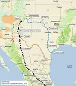
I have the New Mexico 3rd printing, Sept. 1947 edition and the Texas 1969 revised edition. The New Mexico and Texas guides have a few words about transportation of goods from New Mexico to ships harbored on the Texas Gulf coast. I believe it was KvMs’ hypothesis that contraband (precious metals, slaves, hides, etc.) was smuggled out of the Rocky Mountain region to avoid government inspection portals (towns along the El Camino Real de Tierra Adentro) that collect the Royal Fifth tax or confiscate contraband; one of the trails followed the Canadian River and the Red River to Wichita Falls, then south toward San Antonio to ships on the Gulf coast (blue dash line). To expand on this lead, a researcher would have to scrutinize the bibliography to find out where the writer sourced this piece of information. Since the 1960s and 1970s there have been many researchers writing hundreds of books of the subject. Translations of journals, diaries, letters and government documents housed in archives in Spain and Mexico may prove or disprove this theory. From the info on the 3x5-inch index cards that PatrickD posted, there is a possibility of another smuggling route into Mexico from southwest New Mexico (red dash-dot line on map).
View attachment 1580746
# 8. Montana Larry Campbell real name was Danny Zingle who had lived in Windsor Locks, Connecticut. He left his wife and kids to go out west to go treasure hunting. I had contacted one of his sons, who told me that the family never heard from him after he left and why he left. He was a Scum Bag for leaving his family and never sent the family for support from the treasures that he had recovered with Karl. Karl info me that Zingle died broke. Walter Movchuch a former treasure hunter partner of mine told that that a group of treasure hunters with him and Zingle went out west for treasure hunting, and Zingle broke away from the group and never heard from again. Not a nice guy.
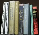
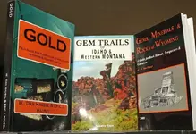
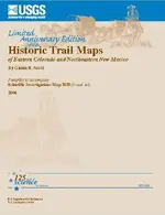
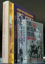
Lost Treasures on the Old Spanish Trail, by George A. Thompson (1992) contains a hand drawn map showing alleged Spanish mining activity in Wyoming (Big Horn Mines & Wind River Mines), Idaho (St. Mary Mines), Utah, and Colorado. The trails linking these mining areas lead either south to Mexico or to the Texas Gulf Coast (via Pecos River/Rio Grande River & the Little Colorado River). I recall reading that prior to the Louisiana Purchase, the Spanish were concerned that French (and British) fur trappers were sneaking into their claimed territory. The French had the opportunity to prospect and mine for mineral deposits. If the French smuggled gold and silver out of Spanish claimed territory, the most likely route (IMHO) would be along the Arkansas River to the Mississippi River and down to New Orleans.
View attachment 1582164
View attachment 1582165
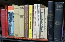
he locations of past mining areas and current mineral sources might help to find these ancient trails. (NOTE: I am not recommending any of the books. I am practicing attaching photos to my post.)
View attachment 1582166
I discovered the USGS set of historic trail maps of eastern Colorado and New Mexico (I cited the Trinidad Quadrangle in a previous post). The USGS, USFS, BLM, State Geological Agency, or State Historical Society may have already prepared maps of historic trails within the Rocky Mountains.
View attachment 1582167
The Outlaw Trail through Montana, Wyoming, and Colorado might have followed some of these ancient trails. According to the map in The Outlaw Trail by Charles Kelly (Bison Books 1996), the trail leads into Canada, passing through Landusky, MT. I was recently listening to a travel show on television about the Nez Perce Trail toward Canada. I recall the host interviewing someone on the U.S. side of the U.S./Canadian border (maybe N-NW of Landusky?), and I heard him say that during prohibition, liquor was smuggled into the U.S. at that point.
Last of the Bandit Riders…. Revisited by Matt Warner (2000), contains some exciting stories about the outlaw life. He describes how they planned the robberies, how they planned the escapes, and in one case how he buried the money (which he later recovered). He eventually was caught, served his time and later became a Justice of the Peace!
Off the topic:
View attachment 1582168
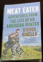
I just finished reading Meat Eater – Adventures from the life of an American Hunter, by Steven Rinella (2012). Great book with a potential treasure lead. Mr. Rinella was relating a scene from the 1972 movie Jeremiah Johnson. He quotes a line from the movie: “You can cut wood and leave it up on the Judith; riverboat captains will leave gold if you put out a pouch. Good to know, if times get hard.” A potential treasure lead for relics if this line is based on fact. I read somewhere that some bootleggers had similar arrangements with their clients when exchanging money for liquor.
View attachment 1582169
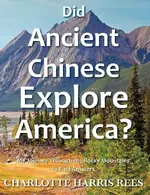
Want to read something really extreme? $2.00 will get you a copy of Pale Ink: Two Ancient Records of Chinese Exploration in America by Henrietta Mertz (1953). It’s about a fifth century Chinese report of an exploration that Ms. Mertz believes occurred in America. Based on reported observations of plants, animals, geography, etc., Ms. Mertz plotted one of exploratory expeditions traveling north to south approximately along the 107° W longitude from southern Canada to Texas. The book 1421 – The Year China Discovered America by Gavin Menzies, 2008 provides a background history to support the theory that a Chinese fleet discovered and mapped the western coast of North America. Charlotte Harris Rees wrote a travelogue/book titled Did Ancient Chinese Explore America, where she followed the trail proposed by Ms. Mertz. This story is hard to believe. But what if you could substantiate the theory that the Chinese landed and explored the Americas in the fifth century?
I found a piece of information that might be coincidental or related to the LUE in The Treasure Hunter’s Manual, 7th Edition, Chapter VI, HOW. There is a story titled New Mexican $$$ provided as an example how to research a treasure project. The project begins in Las Vegas, New Mexico and continues north to an area west of Trinidad, Colorado. The treasure lead starts with a cave discovered by kids in 1899 near Tecelote Creek, west of Las Vegas, New Mexico. The cave contained old documents believed to be related to mission activities. The cave was later investigated and apparently enough gold was removed that the discoverers agreed “to not take any more gold from the cave unless it was needed, and it was never needed.” Based on this story, a group got together to investigate the tale. Their research indicated that there were several caves in the area and the site was likely on private property. The project moved on to research three potential mission sites.
1. “Near the old town of Las Colonas (on the Rio de La Vaco fork of the Pecos river)” , “. . . at the foot of El Barro Peak.”
2. “Near Guadalupita on the old Mora Grant (north of the present city of Mora).”
3. “Near the Colorado-New Mexico state line on the old Taos-Trinidad road.” The locations of the mission/church/town sites in this area were described in relation to the former town of Catskill (platted in 1890).
The former town of Catskill was situated at the end of the Denver Texas & Fort Worth railroad spur line from Trinidad, CO to the Canadian River in New Mexico.
The description of the payoff is what really interested me. Although the group found one of seven potential sites, they still recovered 390 ounces of gold nuggets and dust! Karl von Mueller mentions that one of the sites investigated might be related to the Rutledge or Bloomington, Nebraska treasure (money, gold ingots and nuggets) discussed in The Treasure Hunter’s Manual, 6th Edition.
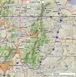
Plotting these sites on a map shows a general north-south trend in the Sangre de Cristo Mountains and potential relationship with the Continental Divide in southwest New Mexico.
View attachment 1580355
Near Salida, CO – Potential cache area (Randy Bradford’s Treasurenet.com forum post (Nov. 27, 2016): 1981 issue (Vol.? No.?) of National Prospector’s Gazette - May Lou Karsting Phillips to Karl von Mueller)
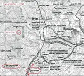
Former Spanish Fort in CO – Example of early Spanish occupation in Colorado. In the text that accompanies Historic Trail Map of Trinidad 1° x 2° Quadrangle, USGS Investigation Geologic Series I-2745 (Available online): “Fort Sangre de Cristo, Malagres Fort, built in 1819 by Governor Don Facundo Malagres about 3(?) miles northeast of Sangre de Cristo Pass.” Also see pages 30-32 of History of Upper Huerfano Valley by Jeannette F. Thach, Colorado Magazine, Vol. 38 No. 1, January 1961 (Available online).
West of Rye, CO – LUE Cave of Gold (PatrickD’s Treasurenet.com forum post): Possibly the nearest town to the Blue Lake cache near Greenhorn Mountain.
Near Conejos Peak, CO – Rock carving containing similar symbols found on the LUE map (Treasure of the Valley of Secrets, Deek Gladson, 1971)
Treasure of the Valley of Secrets – West of Trinidad, Colorado, near the headwater of Purgatoire River. I have no idea of the location and stuck a pin near the headwaters of the North fork of the Purgatoire River. (The Scarlet Shadow, Walter Hurt, 1907 and Treasure Hunter’s Manual #6, revised 1973)
San Francisco Peak, CO – Potential cache area (1981 NPG: May Lou Karsting Phillips to KvM) (Randy Bradford’s Treasurenet.com forum post (Nov. 27, 2016): Karl von Mueller in a 1981 issue (Vol.? No.?) of Western & Eastern Treasures magazine): Teasurenet member “Mdog” asked (Dec. 10, 2016) where San Francisco Peak was located. I couldn’t locate a Colorado peak, however, west of Trinidad, less than 13 miles apart from one another, are two San Francisco passes and a Francisco Peak.
San Francisco Pass – 9,150 feet. Trends north-south “From Bonita Canyon Branch of Vallejos Creek to North Fork of Vermejo River, Las Animas County.”
Location shown on Historic Trail Map of Trinidad 1° x 2° Quadrangle (Includes a pamphlet that accompany map), Glenn R. Scott, 2001, USGS Geologic Investigation Series I-274.
Lat. N37° 1’ 29.1” Long. W105° 5’ 56.5” (WGS84)
San Francisco Pass (Costilla Pass) – “Separates Ricardo Creek from San Francisco Creek, on Culebra Range of the Sangre de Cristo Mountains, Costilla County.”
Location shown on Historic Trail Map of Trinidad 1° x 2° Quadrangle, USGS Geologic Investigation Series I-2745.
Lat. N37° 1’ 20.7” Long. W105° 15’ 54.9” (WGS84)
Francisco Peak - Elevation: 13, 135 feet. Lat. N37° 10’ 56.05” Long. W105° 59’ 57.95” (WGS84)
View attachment 1580356
Potential source of the Rutledge/Bloomington Treasure - Gold ingots and nuggets buried on the Rutledge property in Bloomington, Nebraska (Treasure Hunter’s Manual #7, 1966).
Catskill, NM – Former gold camp and later a lumber camp (THM #7).
Lat. N36° 56’ 23.07” Long. W104° 48’ 25.94” (WGS84)
Elizabethtown, NM – Potential cache area (1981 NPG - May Phillips to KvM)
West side of Taos, NM – LUE cache (silver bars) recovery (PatrickD)
Black Lake, NM – LUE cache (partial recovery?) (1981 NPG - May Phillips to KvM) (KvM in 1981 W&E Treasures) (PatrickD)
Guadalupita, NM – Church site (THM #7)
Mora, NM – Potential cache area (1981 NPG - May Phillips to KvM) (KvM in 1981 W&E Treasures)
Near La Cueva, NM – Rock carving containing similar symbols found on the LUE map (TotVoS).
Near Tecolote Creek, NM – Potential church gold cache hidden in cave west of Las Vegas, NM (THM #7).
Romeroville, NM – Potential cache area (1981 NPG - May Phillips to KvM)
Los Colonas, NM – Church site (THM #7)
Carrizozo, NM – Potential cache area (KvM in 1981 W&E Treasures)
South of Black Peak, NM – Potential Spanish(?) cache site (New Mexico Confidential – 30 Years of Snooping in Obscure Places, Stephen D. Clark, 2013)
Lordsburg, NM – LUE Cave of Gold (PatrickD): Possibly cited because it is the largest commonly known town near the Hachita Peak cache and Big Hatchet Mountains cave of gold sites.
View attachment 1580357
View attachment 1580358
