BlackLine
Full Member
drones are legal in the wilderness if you launch it outside the wilderness boundry
How is it with small driving drones?
Follow along with the video below to see how to install our site as a web app on your home screen.
Note: This feature may not be available in some browsers.
drones are legal in the wilderness if you launch it outside the wilderness boundry
Bill, would you say my 1568 rock was carved by the Jesuits? Mike said they wern't there in 1568, unless 1568 is not a date?
There is also a word carved on top.
Carrol
How is it with small driving drones?
No laws on those yet so I would dare say go for it if you can afford one!
They only go about a thousand feet up so you'd have to plan your ingress and egress well. I know cars are not allowed but many have set helicopters down in there for expeditions. Only problem would be the up or down drafts.
I think the Jesuits were involved as the smart ones all new alchemy and processes for smelting and recovering metals from ores. Most regular Prospectors did not. Placer mining was what most regular Prospectors could do with ease. Complex mining and smelting not so. Jesuit Polymaths were walking Mining computers and memorized De Re Metallica and many other books page for page. They also knew Free Masonry, Astronomy, Astrology, and Witchcraft both white magic and dark. Those were all Jesuits. So for any hard rock mining being done they would absolutely have involved the Jesuit's. Just not the ones loyal to the Vatican only the Kings.
Bill, would you say my 1568 rock was carved by the Jesuits? Mike said they wern't there in 1568, unless 1568 is not a date?
There is also a word carved on top.
Carrol
Motorized and mechanized equipment are not allowed, including drones (see below), bicycles, carts, wagons, chainsaws, hang gliders and off-road vehicles and other wheeled vehicles. Landing aircraft, air dropping or picking up supplies, materials or people are prohibited.
Public use of drones (including quadcopters, model aircraft and other unmanned aerial systems) is increasing in popularity. However, drones are motorized equipment and are prohibited in wilderness. Please help us protect wilderness character by leaving your drone at home when you visit a congressionally designated wilderness area. Federal regulation 36 CFR 261 18a states that the following are prohibited in a National Forest Wildernessa) Possessing or using a motor vehicle, motorboat or motorized equipment except as authorized by Federal Law or regulation.(b) Possessing or using a hang glider or bicycle.(c) Landing of aircraft, or dropping or picking up of any material, supplies, or person by means of aircraft, including a helicopter.
US Forest Service Clarifies Drone Use - DIY Drones
No you may not launch outside Wildernees then fly into the area as all use within boundary is prohibited. However there are special use permits that can be bought by for profit companies that allow drone use.
All remote controlled vehicles that are motorized are illegal.
https://tshaonline.org/handbook/online/articles/hce05 History on El Paso Only for the dates that they quote. They don't mention the Sulphur mine at the based of the Franklins, I have been in there. Also the Lead Heads that are squeezed out of the rock layers in the Franklins by the3 road going through them. Seen those also. So Sulphur, KNO4 from horse dropping and bat caves, Charcoal, for gun powder and Lead for bullets as well as water and food from the indian tribes, makes the El Paso area prime for the Spainish Armies to go North exploring the Southwest and the Rockies. I like the 1582 date in the article for reference of "Best guess" for the Eastern side of the Rockies.
The 5 stone was found by Chuck Crawford marking what was claimed to be a Spanish mine in the Superstitions and was documented, photographed and published. Crawford filed claim on the mine and ended up loosing it to the Forest Service in Court by not having proper representation. One of the few mines that ever sold Gold ore from the interior of the Sups with proof of payment.
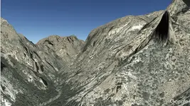
view looking due north from gold bar marker from earlier post
View attachment 1416009
Actually there is a height law of 400 feet for drones now. And you must register it with the Gov.
Motorized and mechanized equipment are not allowed, including drones (see below), bicycles, carts, wagons, chainsaws, hang gliders and off-road vehicles and other wheeled vehicles. Landing aircraft, air dropping or picking up supplies, materials or people are prohibited.
Public use of drones (including quadcopters, model aircraft and other unmanned aerial systems) is increasing in popularity. However, drones are motorized equipment and are prohibited in wilderness. Please help us protect wilderness character by leaving your drone at home when you visit a congressionally designated wilderness area. Federal regulation 36 CFR 261 18a states that the following are prohibited in a National Forest Wildernessa) Possessing or using a motor vehicle, motorboat or motorized equipment except as authorized by Federal Law or regulation.(b) Possessing or using a hang glider or bicycle.(c) Landing of aircraft, or dropping or picking up of any material, supplies, or person by means of aircraft, including a helicopter.
US Forest Service Clarifies Drone Use - DIY Drones
No you may not launch outside Wilderness then fly into the area as all use within boundary is prohibited. However there are special use permits that can be bought by for profit companies that allow drone use.
All remote controlled vehicles that are motorized are illegal. Are servos motorized? I would bet that even a remote controlled sailboat would get you fined as servos are motors. What is the fine? $1,000.oo just for being in possession, not including using it. They can even take your vehicle you used to get out there to the Wilderness area. Then Federal Court Cost are extreme, it will cost you a grand for every time you you file a motion, then court cost, jail time, Its really not worth it.
Chuck died before my search started, but I have personally reviewed the records of the estate, including the court case. I can now say after reviewing the stones that they are claim markers from the Manuel Alejandro Peralta Map which dates the map as drawn on the 4 April 1757. The map was a record of all the mines in the Salt river basin owned by Spain, and who filed the claim and when. The map came from the back cover of a Jesuit book from expulsion that was found in the Supers. It has in the cover of the book who all owned it as it had been passed down three times, along with who presented the book in Spain.(have seen the whole micro fish of the book) The Jesuit was the record keeper for the area and reported directly to the Governor of the area and says so on the map as being an official record of the Governor. The Cheryl Ann Claim was the mine lower left that has an X with Agua beside it and no date or owner, that is the #5 mine. #8 was found where? that will date your rock. The 1568 denotes it is a claim within the Govenor Peralta of Santa Fe Land Grant area, and the upper number is the claim number. Now we know there are at least 14 mines in the Salt River basin that operated as the Kings mines. Phil Reinhardt found the de la Gorge Mine filed in June of 1739, in his book Straight to the Heart. I do not think he has recovered the Mine locator stone, yet it is in the photo on the back cover of his book.
Have read all the police reports on Chuck and know about those events. I also know about the delusions of being sent by God into the wilderness. Does not change what that rock is from the Cheryl Anne claim, named for his daughter, yet turned out it was not even her name. Am not basing anything on his work but his discovery does play part in the Mines of the King of Spain. This last statement may prove to be why the government has hidden the truth from us about mining in the Salt River Basin. Mel Fisher won his case brought by the State of Florida and the Federal Government because he had a signed agreement with Jaun Carlos (King of Spain). If Mel was brought into the Superstitions Mining Fight it would then put the contracting for minerals back into the Kings Court. With proof of those mines being Spain's Mineral rights, then the Gaddson Purchase did not buy the minerals from Mexico as they were not owned by Mexico but the King of Spain. We did not fight the war against Spain but Mexico that brought about the Gaddson Purchase. If this proves to be the case then the Forest Service has no authority to regulate Foreign rights to minerals, even if the Forest Service own the surface rights.
The real reason that it was so important to have Stone Maps and the Stone Claim Markers made, TITLE TO MINERAL RIGHTS
After review of chucks estate I like him too no matter what his faults and short comings were. I am sure I would have been his friend had I made it to the area while he was alive. Besides looking north out of his house puts the Mines front and center looking towards Tortilla Pass. He was not even at his mine when the ore he sold was removed. I know I would have been there to make sure they did not rip me off.
Title to mineral rights by Spain is the real reason I believe the church has joined Ryan's camp. If under Spain's law then means no matter what the church gets 10% off the top before expenses or the King's 5th. Ryan may find he is putting himself in a tight position as the rules still apply to the area. No wheels, everything by hand, breaking big rocks into little rocks, transporting with Mules, ect.. Then on top of that you have the area falls into Apache government jurisdiction so they will want their portion of foreign operations tax. Then you have the Feds that would be mad as hornets about loosing control and would tax you as a foreign cooperation, and then fine you for every infraction. That in turn would spur the state to do the same and attempt to put you away and throw away the key. If you survive all this at the end of the line you get the fame but less money than working at Burger King, maybe even spending your own money, and worked yourself to death doing it. It is like being an artist the real money shows up after you die.