wow..someone finally posted on here?..i was beginning to think everyone died...lol
You are using an out of date browser. It may not display this or other websites correctly.
You should upgrade or use an alternative browser.
You should upgrade or use an alternative browser.
Legend of the Stone Maps
- Thread starter sgtfda
- Start date
sailaway
Hero Member
- Joined
- Mar 2, 2014
- Messages
- 623
- Reaction score
- 816
- Golden Thread
- 0
- Primary Interest:
- All Treasure Hunting
not yet, but did feel the need to make the statement. Want to thank Frank for the post of claims of the Randolph/Rogers claims area. Anyone who makes it up to the Reavis/Rogers trail head may want to visit the claim markers on the top of the mountain. To get there follow the marked trail past the sign for Pinto trail which was the location for the ore processing plant for the claims. Cross the creek on the trail and continue till you find a small wash coming from the west. Turn left and head up the wash staying in the dry creek bed as both sides are surrounded by cat-claw brush.A few hundred yards up ahead to the left you will come across a bare area of grey rock, climb this and bare to the right up and behind the two small buttes. There you will find a steep red clay path (path can be seen from the creek when you first enter the area), follow that to the very top. Up there you will find a Quartz vein that is well marked with many Quartz Monuments. There is a very large flat rock and from there is the best view of the entire western Sups.. You will clearly see Miners Needle, Weavers Needle, and wonder why anyone would want to go down there to wonder around in those endless canyons with vertical rock walls. These Quartz Monuments are the southern markers for the claims shown on Franks post.
Last edited:
Dirt1955
Full Member
- Joined
- Mar 10, 2015
- Messages
- 190
- Reaction score
- 366
- Golden Thread
- 0
- Location
- Orange County, CA
- Primary Interest:
- All Treasure Hunting
Minas Sombrero
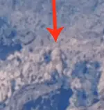
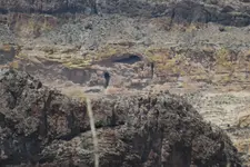
top left of pic. I see a cross inside a circle?
Frank I do not believe R stands for Rogers. I believe it is the R on Fish Creek Mountain.
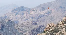
View on attachment is from White Mountain, Rogers Canyon side, looking North up Goat Canyon at South side of Fish Creek Mountain. Fish Creek Peak is the peak behind the Sombrero. (left side is part of Lost Dutch Canyon) According to Bob Ward on his map at the north end of the canyon by the Sombrero he list #44 as a "Weird Stone Structure". One must remember Spaniards are 'Ridge Runners", look at towns in Spain, towns are built on the peaks, so you will not get the view you nehttp://www.treasurenet.com/forums/attachment.php?attachmentid=&d=1487023069&thumb=1&stc=1ed staying down in the creeks.
top left of pic. I see a cross inside a circle?
EarnieP
Hero Member
- Joined
- Jul 20, 2015
- Messages
- 526
- Reaction score
- 1,062
- Golden Thread
- 0
- Primary Interest:
- All Treasure Hunting
wow..someone finally posted on here?..i was beginning to think everyone died...lol
This nasty cold I've had for almost two weeks now just might do me in! it's a dozzey!
Stay healthy friends.
Real of Tayopa
Bronze Member
MORNING, COFFEE TIME 

 Top laft ?? mm, I see two circular areas top center, below the ridge
  ?. Can you clue me in better ?


 Top laft ?? mm, I see two circular areas top center, below the ridge
  ?. Can you clue me in better ?
Backwoodsbob
Silver Member
- Joined
- Nov 12, 2013
- Messages
- 2,706
- Reaction score
- 1,935
- Golden Thread
- 0
- Primary Interest:
- All Treasure Hunting
You reckon how many years it took to do all that work on them mountains. It would definitely draw your attention to them
Sent from my SM-G900T using Tapatalk
Sent from my SM-G900T using Tapatalk
Real of Tayopa
Bronze Member
tSheesh, that is a lot of rough ground to cover.


Backwoodsbob
Silver Member
- Joined
- Nov 12, 2013
- Messages
- 2,706
- Reaction score
- 1,935
- Golden Thread
- 0
- Primary Interest:
- All Treasure Hunting
Can I ask you giys a question? Like ,can you read what they have written in all that mess of mountains. Like one phrase that says; the fate of Peter. Have you looked at your pictures up side down? Just wondering. I do like looking at your large pictures. It helped me with my small stones with all that on them. Thank you and May God Bless your hunt.
BwB
Sent from my SM-G900T using Tapatalk
BwB
Sent from my SM-G900T using Tapatalk
sailaway
Hero Member
- Joined
- Mar 2, 2014
- Messages
- 623
- Reaction score
- 816
- Golden Thread
- 0
- Primary Interest:
- All Treasure Hunting
If the 1568 stone that Crawford found is correct, and I believe it is as have spent time looking close at it, then the Spanish/Mexicans worked the area longer than than the United States has been a Country before we got the area in the Gaddson Purchase. Anyone notice the tall spires down in lost Dutch Canyon below Tortilla Ranch? those that have been back in there can spot the forest road and Tortilla Creek Cliffs on left side. The hill with the Ranch gate is silhouetted in the sky where it drops down to the pad and flat field. This area is very steep and from the ranch gate area its almost straight down and takes your breath away looking over the edge.
Am not trying to derail thread but prove link between Fish Creek, Tortilla Creek, Rogers Canyon and the Stone maps and Gold mining early in that area.
Am not trying to derail thread but prove link between Fish Creek, Tortilla Creek, Rogers Canyon and the Stone maps and Gold mining early in that area.
Last edited:
Azquester
Bronze Member
- Joined
- Dec 15, 2006
- Messages
- 1,736
- Reaction score
- 2,596
- Golden Thread
- 0
- Primary Interest:
- All Treasure Hunting
View attachment 1414596
Thought I would save you time Wayne, and show you what you are seeing. You should be able to tell where on 88 this is. Across from FR 213 before the Fish Creek hairpin.
I see a heart in there, a key hole, an "8" and other things.
It would be good to see the right time of day for the hidden shadow symbols appearing. When posting photo's it would be nice to see the time of day the snapshot was taken.
Most eye catchers appear at the same times as the shadows and pointers. But that "X" in a circle has some meaning. I believe it's conveying "Go left and around a circular mountain".
I'm just about ready for my trip back to the pit mine if anyone wants to join me. I started back on a diet and need the exercise. I think I know the trail in there from the GE.
My bronco busted a sway bar mount on the last trip I still need to weld it back to the frame. It also ripped both motor mounts during a hill climb up a very steep mountain pass, but, I replaced those. That was on the back side of the Catalina's climbing out on a steep canyon trail that borders a 800 foot drop right on the side of the trail. The road bed is falling off this cliff with a rock face on the other side of the trail it'll pretty soon be impossible and impassible!
Sheesh!
sailaway
Hero Member
- Joined
- Mar 2, 2014
- Messages
- 623
- Reaction score
- 816
- Golden Thread
- 0
- Primary Interest:
- All Treasure Hunting
Ok, now that we see there is a magical aura over this area, and makes those searching see things, I will attempt to show what I know about this area. First remember the Molina map and the text of the meeting of the priest? well look close (when I say look close does not mean zoom in, because it is the three mountains that make up the priest) and you may notice there is a dark priest looking west and a light priest looking east. The feather in the cap of the Sombrero is a cross! This cross is in the hand of the light priest that is looking the same direction as the priest on the stone map. This is what captured the eye of devout catholic Spanish when viewed the very first time and no wonder Coronado's men would have believed this spot was meant for them and given by God, and a blessing on the whole army. Now that we have noted location of the cross, start looking for the trail clues on the Priest stone. First one that lines up is the dark square with hole in it, next we look for a footprint of God. then the Squares with Crosses are both in the valley we are looking down. remember there are two of every clue, one light and one dark in the right location according to the stone trail. Now that this is pointed out maybe you could find the hearts.
With this information we now know what about the time of discovery and age of searching this area?
1. What was the date on the Molina information?
2. Stone with date of 1568 found in area
3. Would this prove a date on the stone maps?
4. Does this link the stone maps to the Sombrero?
5. Does it prove the stone maps are a title to land?
6. Coronado Mesa is centered in photo
7. Who was the Priest along with Coronado?
8. We know that Coronado was leaving a record along the trail to historically mark his route
9. Is that how the "Valley of Hearts" name came about?(Geronomo)
10. Even if Travis copied the originals onto the stones we now know of, does the information still lead to the Hearts?
11. Is there info on the stone maps that is far beyond what T.T. would have known?
Last edited:
sgtfda
Bronze Member
- #1,897
Thread Owner
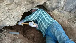
During filming Woody and I kept a eye out for things. Episode 2 near the heart stone snake bait climbed in a hole. Woody and I wanted to stay and Wayne said let's go it's a waste. Well Woody and I went back Sat. And did a little digging. I was correct when I said there was something near the heart stone. You see there is TV and there is real life. Sometimes they get a little mixed. Sometimes there are real things on reality TV. The Tesora map did lead to something after all.
Attachments
Ponchosportal
Full Member
Nice hole. 
Carl995
Hero Member
- Joined
- Apr 5, 2015
- Messages
- 665
- Reaction score
- 1,360
- Golden Thread
- 0
- Primary Interest:
- All Treasure Hunting
If the 1568 stone that Crawford found is correct, and I believe it is as have spent time looking close at it, then the Spanish/Mexicans worked the area longer than than the United States has been a Country before we got the area in the Gaddson Purchase. Anyone notice the tall spires down in lost Dutch Canyon below Tortilla Ranch? those that have been back in there can spot the forest road and Tortilla Creek Cliffs on left side. The hill with the Ranch gate is silhouetted in the sky where it drops down to the pad and flat field. This area is very steep and from the ranch gate area its almost straight down and takes your breath away looking over the edge.
Am not trying to derail thread but prove link between Fish Creek, Tortilla Creek, Rogers Canyon and the Stone maps and Gold mining early in that area.
View attachment 1415295
Azquester
Bronze Member
- Joined
- Dec 15, 2006
- Messages
- 1,736
- Reaction score
- 2,596
- Golden Thread
- 0
- Primary Interest:
- All Treasure Hunting
During filming Woody and I kept a eye out for things. Episode 2 near the heart stone snake bait climbed in a hole. Woody and I wanted to stay and Wayne said let's go it's a waste. Well Woody and I went back Sat. And did a little digging. I was correct when I said there was something near the heart stone. You see there is TV and there is real life. Sometimes they get a little mixed. Sometimes there are real things on reality TV. The Tesora map did lead to something after all.
Well, You gonna to keep us in suspense? What did ya Find? Besides an old prospector crawling out of hole that is...
Hope it was something special!
PS: If you need help pulling Woody outta that hole I'm game and looking for work. I'm great at shooting snakes and such or a cooking um if they decide to become dinner!
Last edited:
Similar threads
- Replies
- 1
- Views
- 592
Users who are viewing this thread
Total: 1 (members: 0, guests: 1)


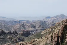
 sorry I had to convert from PNG to Jpeg because site limits size of upload