JESUIT TREASURES - ARE THEY REAL?

Oro,

You're correct about the difficulties involved with getting accurate longitude readings back in the day of the Jesuits, I guess I should have said "fairly accurate" instead of accurate. Could you please share with us how far off the reading is for Real de la Santísima Trinidad, between the two different prime meridian's, and just how you calculated it.

Sincerely,

Infosponge
 

First,

A little about the San Xavier Parish Statue. I emailed the Church saying that I was told years ago the statue was of Father Rojas SJ, and a friend just told me it was Fra Serra OFM. I asked if they could please clear up the matter for me.

I just received an email stating that the statue was of Fra Serra because of his continuing the work of the Jesuits in Mission Building in the New World.

However, I do believe the stories from the Desert USA Forum. Could it be that the whole Rojas thing was kind of on the down-low? I don't know. It wouldn't be the first secret the Jesuits have had to make up a story for to keep.

Mike

I received the same type of response.

But one must also keep this in mind: When the pope awarded the Jesuit missions to the Franciscans after the expulsion, the Franciscans erased the baroque style of the Jesuits Missions, and had them redone in the more simpler Franciscan style.

And SFX is celebrating a well-known Mission builder who probably contributed to the above? Seems to me that something else is missing from the equation- something we are not aware of, for example, the California Pious Fund, as SH has suggested.
 

Here are some questions for the group that all relate back to the subject of this thread.
1. Who is Tubal Cain? (ties Masonic )
2. Where was Tubal Cains original Temple? (Ties the Church )
3. Who was Quetzalcoatl?
4. Who were the Bavarian Illusionist?
 

... I have found record of people having calculated longitude as far back as the ancient Greeks, using rather simple clocks and sundials of their day, of course with Alexandria as the prime meridian So I am not taking the position that it was impossible for people to calculate longitude in the mid 1700s, only that it was not too accurate. The best method in use was by observing lunar eclipses, compared with a table of the predicted times for a known location, and comparing the difference which was fairly accurate but lunar eclipses are not too handy...

That's why so much work was done in the 1600's by Galileo and others to create an accurate emphemeris documenting the frequent eclipses of Jupiter's moons - every two days, more or less. With the appropriate equipment - a telescope and a sand clock, plus a proper ephemeris - an observer was able to determine longitude more or less precisely. Most of the surveying of Europe and the eastern United States in the 1600/1700's was done using this method. Jupiter observations were notoriously inaccurate at sea due to the difficulty in overcoming the ship's movement. With Harrison's clock, this became a moot point.

Interestingly, the Jupiter moons method should have been known and usable by the Jesuits, who were normally the smartest people in the room. They theoretically would have had access to the best ephemeris of the day, and certainly would have had a very accurate sand clock for local time determination. The only thing lacking would have been a suitable telescope. If you could prove they had a telescope in 17th/18th century Arizona, and a trained padre navigator, you could probably assume they were able to figure lat/lon with 'survey grade' accuracy of the day.

[By the way, by extending this theory - if the Jesuits had control of large treasure caches in today's Arizona, there would be no need for rock monuments, treasure trails, enigmatic rock carvings or maps leading to the caches. These things would, however, be handy for misdirection purposes.]
 

Here are some questions for the group that all relate back to the subject of this thread.
1. Who is Tubal Cain? (ties Masonic )
2. Where was Tubal Cains original Temple? (Ties the Church )
3. Who was Quetzalcoatl?
4. Who were the Bavarian Illusionist?

Sorry but I really don't see how those things are relevant to proving whether or not Jesuit treasure exists.

Three of those four items you bring up relate to "events" that took place many, many years before the Jesuits ever came to the New World. I have no idea how the Bavarian Illusionists could ever be related to what the Jesuits were doing in the New World.

You may want to start up a separate thread to continue your inquiries.
 

Good afternoon Deducer,there are,, there are but since they are basically locked up in the Jesuit "need to know" files in The Vatican, access is probably similar to gaining access the the NSA or CIA files for a given day. Even Congress / the Senate hasn't the authority, although theoretically they do.

I would love to access those "Need to know only " files

Don Jose de La Mancha (el 007 de treasure net )

Don't think Congress really has any authority to impose on an entity in another country except through an act of war.

Anyway, I think the biggest obstacle for anyone trying to access the Vatican archives isn't piercing the veil of secrecy, but poring through the millions of documents (which I believe anyone in the clergy can do) for that one needle in the haystack. That's probably their real defense.
 

That's why so much work was done in the 1600's by Galileo and others to create an accurate emphemeris documenting the frequent eclipses of Jupiter's moons - every two days, more or less. With the appropriate equipment - a telescope and a sand clock, plus a proper ephemeris - an observer was able to determine longitude more or less precisely. Most of the surveying of Europe and the eastern United States in the 1600/1700's was done using this method. Jupiter observations were notoriously inaccurate at sea due to the difficulty in overcoming the ship's movement. With Harrison's clock, this became a moot point.

Interestingly, the Jupiter moons method should have been known and usable by the Jesuits, who were normally the smartest people in the room. They theoretically would have had access to the best ephemeris of the day, and certainly would have had a very accurate sand clock for local time determination. The only thing lacking would have been a suitable telescope. If you could prove they had a telescope in 17th/18th century Arizona, and a trained padre navigator, you could probably assume they were able to figure lat/lon with 'survey grade' accuracy of the day.

[By the way, by extending this theory - if the Jesuits had control of large treasure caches in today's Arizona, there would be no need for rock monuments, treasure trails, enigmatic rock carvings or maps leading to the caches. These things would, however, be handy for misdirection purposes.]

They had telescopes in the America's, but more than likely not in Arizona.

The Jesuits also have a connection with the spread of telescope technology beyond Europe. The first telescope in North America was a gift presented by the Jesuits in 1646 to Jean Bourdon, an engineer in New France (modern day Quebec) [_5_] . The first telescope in China was brought there by Johannes Schreck, another Jesuit, in 1621 (his trip from Europe started in 1618) [_6_] . The Jesuit Jean Richaud is wrongly thought to be the first to use telescopes for astronomical purposes in India. That honour goes to Jeremiah Shakerley (in 1651). Regardless, the contributions to astronomy from his early use of the telescope are notable. These include observations of a comet and the discovery that the bright star in Alpha Centauri was actually a double star [_7_] . The first telescope in the American colonies was thought to have arrived in the 1660's and the first telescope in the New World was probably brought over by Portugese mariners in 1614 (a telescope was mentioned in records of the battle of Guaxanduba, Brazil).
Sant, Joseph (2014). Jesuits and the Early Telescope:Scheiner and Grienberger. Retrieved from Jesuits and the Early Telescope:Scheiner and Grienberger

Sincerely,

Infosponge
 

JEFFREY VALLANCE
is this the treasure the Jesuits are searching for?
The Sacred Spear was carried by St. Francis of Assisi on a holy mission of mercy.
 

Last edited:
G'd morning Deducer, coffee first? you posted -->

Don't think Congress really has any authority to impose on an entity in another country except through an act of war.
~~~~~~~~~~~~~~~~~~
Agreed, this is what I posted -->

access is 'probably similar' to gaining access the the NSA or CIA files for a given day. Even Congress / the Senate hasn't the authority, although theoretically they do

The days of one freely searching throughg the probable millions are now gone.

Our lovely Amy tended to confirn this

Don Jose de La Mancha
 

Astrolabes are quite effective for determining latitude - and have been for thousands of years - but not for longitude.
True but East and West can be determined along with time and large landmarks can fill in the gaps. Did Jesuits employ such devices is hinted at here.

The mystery of Champlain?s Astrolabe
They gazed at the sky and could tell time. Time can throw shadows for direction as well.

http://astro-canada.ca/_en/a2101.php

Note the 1646 gift of a telescope from a Jesuit..
 

Last edited:
I received the same type of response.

But one must also keep this in mind: When the pope awarded the Jesuit missions to the Franciscans after the expulsion, the Franciscans erased the baroque style of the Jesuits Missions, and had them redone in the more simpler Franciscan style.

And SFX is celebrating a well-known Mission builder who probably contributed to the above? Seems to me that something else is missing from the equation- something we are not aware of, for example, the California Pious Fund, as SH has suggested.

deducer,

Can you give us a source for that information? One good source for post-Jesuit events in Mexico is: "Barbaros: Spaniards and their Savages in the Age of Enlightenment" by David Weber.

Thanks in advance,

Joe
 

Last edited:
Springfield yer correct, so they used a crude noon day shot to establish that. this s easily shown in some of their established points.

Don Jose de La Mancha

p.s. for those that don't realize the importance of time it is crudely the difference of observing a celestial body in Grenwich England and your location.

The Greenwich time as indicated by your timepiece is calculated against your local time to give you your position on Earth.

A timepiece is adjusted to give you a constant 'loss or gain' of time daily. along with this, one must wind up the mechanical watch the same each day, at the same time to hold a useful point of accuracy

Today for a few dollars we have solar powered atomic time keeping, even wrist watches that wil keep accurate time within seconds, for centuries once adjusted,

Of course today we have extremely precise location ability due to sat navigation. Actually a bit of close in triangulation instead of Celestial calculation.
 

Last edited:
Sorry for wandering..
Tales here around the great lakes of natives paying tribute to monuments that they claimed were not of their placing. The black robes destroyed many in an attempt to reduce the practice. As shown in earlier link the Jesuits provided reasonable longitude and latitude to locate their missions. Close enough that a monument would confirm sites.
They backtracked out of s.w. Ontario to Quebec in a land so rough it chewed up my wool shirt in a couple hundred yards so accuracy would have been vital.Once there its easy to understand the rumors of caching things on the way when upset devote natives lose their zeal to be beasts of burden because you are leaving them.
 

True but East and West can be determined along with time and large landmarks can fill in the gaps. Did Jesuits employ such devices is hinted at here.

The mystery of Champlain?s Astrolabe
They gazed at the sky and could tell time. Time can throw shadows for direction as well.

The first astronomical observations in Canada | Observatories | AstroLab

Note the 1646 gift of a telescope from a Jesuit..

Those articles both confirm that longitude was not calculated during those days in Canada because of a lack of a reliable method. Don Jose is correct: longitude cannot be determined without knowing the exact time in Greenwich (or any other prime meridian on whatever grid you're using), and comparing it to your local time - usually a noon sun observation. You either need a very accurate timepiece set to Greenwich time, or a means of observing and timing celestial events in your location.

At 33° north latitude, a mistake of ten minutes time due to clock error or sunshot error is a ten mile error in assumed longitudinal position - very easy mistakes to make. That's why the celestial observations were preferred - less chance for timing error. It's all about the time. That all changed with the advent of the telegraph, and later with satellite technology, but that stuff is beyond our Jesuits-in-Arizona time period.
 

I guess no one thinks the Jesuits of the Catholic Church having the Holy Grail in Arizona would be a treasure? It is rumored that the ones known today are fakes. Could their greatest treasure really be the Holy Lance? I raised the question of what was their greatest treasure they would be looking for some time back. This Lance goes back to Genesis and made by Tubal Cain, and was in most of the old testament. It is rumored to be held by the Anti-Christ in the last days.
Spear of Destiny
 

Infosponge wrote
Oro,


You're correct about the difficulties involved with getting accurate longitude readings back in the day of the Jesuits, I guess I should have said "fairly accurate" instead of accurate. Could you please share with us how far off the reading is for Real de la Santísima Trinidad, between the two different prime meridian's, and just how you calculated it.

I did it in my head, which is not proposed to be 100% accurate by simply subtracting 198 from the 267 to get the degrees to subtract from 180 (west) but did not get the right number which should have been 111 degrees W NOT 126, which was also not allowing for the different meridian, anyway Nentvig's longitude for Trinidad is nearly full two degrees off the correct 109 W.


To get a better conversion, (this for our readers whom do not post as I am sure Infosponge already knows this) keep in mind that the Jesuits and Spanish of the 1700s were not using the same prime meridian we do today, which is at Greenwich (England, 0 degrees longitude) but were using the Canary islands specifically at Tenerife as their "zero" meridian; they also did not count west and east, but only easterly from Tenerife, so you can have longitude numbers as high as 359 degrees, or as we can see in the maps of that time, well over 200. Tenerife is some 18 degrees west of Greenwich - so a fair <ballpark way> of correcting longitude would be to take the longitude from the old souce (Spanish) and subtract 198 from it; the resulting number is then to be used to subtract from 180, which should give you the modern longitude West of Greenwich. This will not work for ALL medeival/colonial period maps for other countries used different prime meridians at different times, the Azores being one example - and always remember there are sixty Minutes in a Degree, and sixty Seconds in a Minute of Longitude when you are working out a conversion.


Also Kino supposedly did carry a telescope with him a small portable type of probably 10 power, which may or may not be strong enough to detect eclipses of Jupiter's moons, which would also require the tables of what the times should be for the eclipses at a known longitude.

A very good article on this topic is available on JSTOR, even for "free" type members just sign up for a free membership to read it online at:

http://www.jstor.org/discover/10.2307/40167033


The article states that Kino had NO rigorous way to determine longitude, and concludes that Kino did not make use of any lunar eclipses in determining longitude even though several (nine) would have been usable in his time in Sonora.


Good luck and good hunting amigos I hope you find the treasures that you seek.
Oroblanco
 

Last edited:
At bottom of Champlain article in a footnote(#9) and above the lower map is mention of in 1646 of a time error of less than a minute.(a minute!) using eclipse and a telescope from St. Marie in a near duplication of its being done four years earlier. That St. Marie being I believe the Sault St. Marie today at tip of lower penninsula of Michigan.
The 1672 map above it a ways demonstrates the ability to map and as a result locate .
 

Last edited:
Hi Springfield

You wrote " [By the way, by extending this theory - if the Jesuits had control of large treasure caches in today's Arizona, there would be no need for rock monuments, treasure trails, enigmatic rock carvings or maps leading to the caches. These things would, however, be handy for misdirection purposes.] "

The Jesuits had control of their treasure sites and have made maps which also had control very well . The maps were made for sefety and were very complicated to be easy decrypted . In the most cases , they didn't used a compass orientation in the maps , only landmarks . They never used rivers in their treasure maps ( maybe was considered as a vulnerable point ) . You can look at a Jesuit treasure map and to believe how the top side is the north , but in fact to be east , west , or whatever . Usually , for every treasure site , they have two ( or more ) maps and some descriptions in words . To make sense a Jesuit treasure map , must to have all the pieces . This is not a kind of control ?

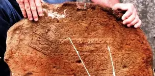
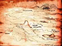
Many of these maps are incomplete , some are carved in stones by others { by friends ( Peraltas ) or by competition ( Travis Tumlinson ) } and some are painted ( Ted DeGrazia ) .

I put these names together because their copies lead to the same region ( not point ) in the Superstitions .

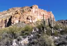
About the Peraltas stone maps , I wrote my opinion many times in the past ( in other threads ) and now I will post just a picture of the landmark " RIO " . All the pictures which I will posted now are parts of bigger pictures and have lose little of theirs clarity .

Rio1.jpg

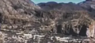
About the Treasure Chest Stone by Travis Tumlinson , the carvings show how the treasure is a galeon of gold . This is the picture of the site . A skilled eye can see the similarities . This region is just to the left of the " RIO " . Some numbers which could be seen in this picture have relation with the Peraltas stone maps .

esc.jpg TCS.jpg

Now , about Ted's painting , shows the place in a larger scale , but near ( to the left ) the " Jesuit gold " is a landmark which was drawn bigger than in reality ( like the important landmarks in the Guzman map about Langanati treasure in Ecuador ), to distract the attention . This landmark is just to the right of the Tumlinson's map .

DeGraziaJesuitTreasureMap.jpg Rock mark.jpg

These are a part of Jesuit treasure maps in Arizona .
 

Last edited:

Top Member Reactions

Users who are viewing this thread

Back
Top