You are using an out of date browser. It may not display this or other websites correctly.
You should upgrade or use an alternative browser.
You should upgrade or use an alternative browser.
JESUIT TREASURES - ARE THEY REAL?
- Thread starter gollum
- Start date
Springfield
Silver Member
- Joined
- Apr 19, 2003
- Messages
- 2,850
- Reaction score
- 1,388
- Golden Thread
- 0
- Location
- New Mexico
- Detector(s) used
- BS
Five minute walk to the Pantheon - the best building in Rome.
deducer
Bronze Member
The interior of which lies such splendor as this:
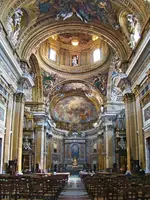
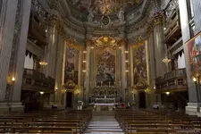
Not to be outdone by the Church of Saint Ignatius of Loyola at Campus Martius:
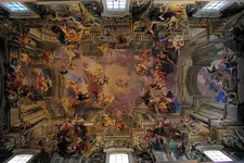
And should you look up to the ceiling, you will see this absolute perspective masterpiece (as the ceiling is curved), painted by a Jesuit lay-brother, Andrea Pozzo. Should you ever get there, look for the marble disk on the floor and stand there for the best view.
Jesuit treasures...... are they real?
Hmmm...
somehiker
Silver Member
- Joined
- May 1, 2007
- Messages
- 4,365
- Reaction score
- 6,435
- Golden Thread
- 0
- Primary Interest:
- All Treasure Hunting
Beautiful.
As is St. Peters Basilica, where amongst the Latin inscriptions you can see "O Domine tu que Omnia Nosti"
Which could be abbreviated to "DON" as an acronym.
As is St. Peters Basilica, where amongst the Latin inscriptions you can see "O Domine tu que Omnia Nosti"
Which could be abbreviated to "DON" as an acronym.
Springfield
Silver Member
- Joined
- Apr 19, 2003
- Messages
- 2,850
- Reaction score
- 1,388
- Golden Thread
- 0
- Location
- New Mexico
- Detector(s) used
- BS
Beautiful.
As is St. Peters Basilica, where amongst the Latin inscriptions you can see "O Domine tu que Omnia Nosti"
Which could be abbreviated to "DON" as an acronym.
Ironic. Enough gold on the walls there to fill an entire treasure fleet, and as 'DON' says, "O Lord, thou knowest all things". Yet the Jesuits 'forgot' where their 'huge bullion caches' are? Ha ha.
deducer
Bronze Member
I appreciate the response. So they were included in the language of the Royal decree? Are there any surviving records that list the coadjutors that were rounded up?
I'm pretty sure there are, though probably not as easily found as those of the Padres.
UncleMatt
Bronze Member
- Joined
- Jul 14, 2012
- Messages
- 2,389
- Reaction score
- 2,535
- Golden Thread
- 0
- Location
- Albuqerque, NM / Durango, CO
- Detector(s) used
- Garrett Infinium & Gold Bug II, Bazooka Super Prospector Sluice
- Primary Interest:
- All Treasure Hunting
Does any documentation exist to show exactly which priests and individuals (coadjutors) were rounded up?
somehiker
Silver Member
- Joined
- May 1, 2007
- Messages
- 4,365
- Reaction score
- 6,435
- Golden Thread
- 0
- Primary Interest:
- All Treasure Hunting
Ironic. Enough gold on the walls there to fill an entire treasure fleet, and as 'DON' says, "O Lord, thou knowest all things". Yet the Jesuits 'forgot' where their 'huge bullion caches' are? Ha ha.
Possibly not all, since they were able to bounce back rather quickly, and in less than 100 yrs a Jesuit now occupies the throne.
Lost due to circumstances beyond their control might be a better way of describing the status of any remaining caches.
The Jesuit like all other orders of Priests and Monks will have a “Mother House” in Rome that is always within walking distance to St Peters square. That is likely where they wanted communication sent.
Good Morning Don T
Would the Mother House be the same as the Parish House as noted in the search for fr. Kino's chapel, associated with fr. Kino's burial search in the 1970's?Thanks, take care and be safe. FEMF
deducer
Bronze Member
Does any documentation exist to show exactly which priests and individuals (coadjutors) were rounded up?
Yes they do, and I have my hands on one which was never meant for public viewing, but as it is related to ongoing research on one particular padre, I cannot reveal too much about it. There is a name on the small sample below that some posters should recognize, as that of a considerably skilled mapmaker who much improved the then existing map of the Pimeria Alta made by Fr. Nentvig:

Springfield
Silver Member
- Joined
- Apr 19, 2003
- Messages
- 2,850
- Reaction score
- 1,388
- Golden Thread
- 0
- Location
- New Mexico
- Detector(s) used
- BS
Possibly not all, since they were able to bounce back rather quickly, and in less than 100 yrs a Jesuit now occupies the throne.
Lost due to circumstances beyond their control might be a better way of describing the status of any remaining caches.
Being skeptical, I nonetheless concede anything is possible.
UncleMatt
Bronze Member
- Joined
- Jul 14, 2012
- Messages
- 2,389
- Reaction score
- 2,535
- Golden Thread
- 0
- Location
- Albuqerque, NM / Durango, CO
- Detector(s) used
- Garrett Infinium & Gold Bug II, Bazooka Super Prospector Sluice
- Primary Interest:
- All Treasure Hunting
I would love to research any existing family members from any names on that list of priests and coadjutors.
sailaway
Hero Member
- Joined
- Mar 2, 2014
- Messages
- 623
- Reaction score
- 816
- Golden Thread
- 0
- Primary Interest:
- All Treasure Hunting
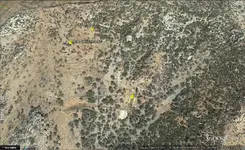
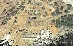
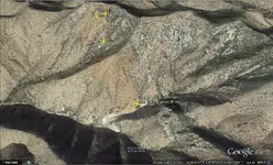
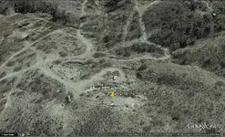
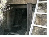
Worlds Fair Mine is at Latitude: 31.47861 Longitude: -110.73778 The pics I showed you are at Latitude 31. 284519 Longitude 110.455935, and has none of the features I see in pics of the Worlds Fair mine.
Some good Pictures of it are are here: Flux Canyon, World's Fair Mine and other Misc. Trails south of Patagonia, Az - Offroad Passport Community Forum
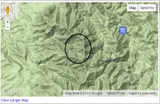
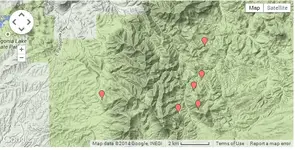 http://minedata.azgs.az.gov/map-search
location of picture to Worlds Fair Mine, Mine data shows no mine at this site
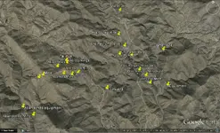
Oro Blanco District and the California Wash have many mines and the pic I posted is north of the Dos Amigos Mine, including Cramer Mine
Some good Pictures of it are are here: Flux Canyon, World's Fair Mine and other Misc. Trails south of Patagonia, Az - Offroad Passport Community Forum

 http://minedata.azgs.az.gov/map-search
location of picture to Worlds Fair Mine, Mine data shows no mine at this site

Oro Blanco District and the California Wash have many mines and the pic I posted is north of the Dos Amigos Mine, including Cramer Mine

Last edited:
somehiker
Silver Member
- Joined
- May 1, 2007
- Messages
- 4,365
- Reaction score
- 6,435
- Golden Thread
- 0
- Primary Interest:
- All Treasure Hunting
Just a suggestion, based on the nearest mines showing on minedat.
Since they are relatively close and have connecting roads, as well as visible evidence of concrete foundations and supporting structures common to post 1865 mining operations, they may be associated with these mines. There may be old maps from the late 1800's- early 1900's which can give you better information.
Other than that, I would suggest you go for a drive and have a look.
sailaway
Hero Member
- Joined
- Mar 2, 2014
- Messages
- 623
- Reaction score
- 816
- Golden Thread
- 0
- Primary Interest:
- All Treasure Hunting
some research shows this about Jesuits and the area. Mines of the Stanta Rita and Patagonia Mountains
Are you saying that the Spanish did not know how to make Concrete prior to 1865? I have personally seen concrete in Spain from the Roman times.
The Mine in question is the old Chief Mine, Big Stick Mine, West Side Mine, Domino Mine, Three-R Mine, Cox Gulch, Palmetto District, Patagonia Mts, Santa Cruz Co., Arizona, USA,
said to be originally found by one padre,
Last edited:
Oroblanco
Gold Member
- Joined
- Jan 21, 2005
- Messages
- 7,841
- Reaction score
- 9,876
- Golden Thread
- 0
- Location
- DAKOTA TERRITORY
- Detector(s) used
- Tesoro Lobo Supertraq, (95%) Garrett Scorpion (5%)
Just would add that concrete was not readily available on the frontier of the Spanish colonies; not that it was unknown to them, but it was heavy and bulky to import, making it costly.
The exact GPS coordinates for any of these reference sources like Minedat or even the USGS covering mines, are an approximation, not an exact location in many instances. Plus many mines cover extensive areas, included a number of claims as "one" mine, <the Homestake mine had hundreds of claims in one mine> so you could have a mine on one side of a mountain and another on the opposite side, which are recorded as the same mine as they were, technically and legally. (The Hilltop mine in the Chiricahuas comes to mind as an example) The GPS coordinates are intended to get you close, not exactly pinpoint the locations.
Oroblanco
Real de Tayopa Tropical Tramp
Gold Member
- Joined
- Nov 8, 2004
- Messages
- 14,582
- Reaction score
- 11,947
- Golden Thread
- 0
- Location
- Alamos,Sonora,Mexico
- Primary Interest:
- All Treasure Hunting
Hmmmm concrete n the Spanish times. When I was on the Gloria Pan campaign, I saw a square set aqueduct coming from a side arroyo. It was an Aqueduct aprox. 1 1/2 meter wide with a 'square' raceway of perhaps two ft. One must excuse my vagueness, but it was about 60 years ago.
It was exposed for perhaps 30 ft then ended where it encountered the river. The interesting thing was where it showed in the arroyo it was covered with 6 ft of coarse overburden, yet the exposed area looked as if it had been just made, it wasn't chipped or broken ??
Later a gentleman in Alamos, who claimed to be a structural engr,. told me that he was an expert in cements, so I mentioned the little aqueduct and it's almost prefect condition. He said ""It's entirely possible, we still don't know exactly how to make consistent concrete batches, except while we are using known, calibrated, materials that we can test..
Every source materiel is slightly different, hence constant testing is necessary. The old Spaniards just might have hit upon a perfect comb. of materiel's to make superb concrete.
The early Spaniards , if they needed concrete, they constructed it on the spot. There are very few example available today, that can proven to be of the Spanish exploration era.
I'll never forget the sight of that aqueduct coming out form under several ft of arroyo over burden of river rock.
Incidentally, I never did find where it ended, but it was not part of the Gloria Pan.
It was exposed for perhaps 30 ft then ended where it encountered the river. The interesting thing was where it showed in the arroyo it was covered with 6 ft of coarse overburden, yet the exposed area looked as if it had been just made, it wasn't chipped or broken ??

Later a gentleman in Alamos, who claimed to be a structural engr,. told me that he was an expert in cements, so I mentioned the little aqueduct and it's almost prefect condition. He said ""It's entirely possible, we still don't know exactly how to make consistent concrete batches, except while we are using known, calibrated, materials that we can test..
Every source materiel is slightly different, hence constant testing is necessary. The old Spaniards just might have hit upon a perfect comb. of materiel's to make superb concrete.
The early Spaniards , if they needed concrete, they constructed it on the spot. There are very few example available today, that can proven to be of the Spanish exploration era.
I'll never forget the sight of that aqueduct coming out form under several ft of arroyo over burden of river rock.
Incidentally, I never did find where it ended, but it was not part of the Gloria Pan.
Similar threads
- Replies
- 1
- Views
- 664
Users who are viewing this thread
Total: 1 (members: 0, guests: 1)

