JESUIT TREASURES - ARE THEY REAL?

lgadbois

Saw you the Gil Proctor's picture with the black stone monument CCDTD ?

No, Marius, I did not see the photo. As I pulled into the Pete Kitchen Ranch backyard, I sensed that something was wrong. I was a little unhappy that Gill had not responded to my letter.

I rang the doorbell and a young woman answered the door. I asked if Gil Proctor was home. She said no and politely asked the three of us (my wife, my friend Carl, and myself) to come in. Then she started explaining. Gil Proctor had passed away. I asked if I could speak to his wife. She was within view in a wheelchair. The woman said that she was Mrs Proctor's nurse, and due to a stroke, Mrs Proctor could not speak. I asked who was in the family was in charge. She told me that the son was working for an aerospace firm in California, and gave me his address. We thanked her for her kind responses to our inquiries and said goodbye.

We had flown into Nogales International in my friend's Cessna 172. We then rented a car to visit Gil Proctor. It was lunchtime so we decided to get some food before visiting the ranch. Right in front of a dirt road to the ranch was a nice looking Mexican restaurant. We had a great lunch, and while paying our bill we asked where the museum was located. The museum had been in the building where we just ate!

After returning to Seattle I wrote a letter to Proctor's son. I was still interested in what Proctor had concerning the Molina. I never got an answer and I never followed up. I figured that somewhere along the way, the artifacts that were in the museum would be put on display elsewhere, or that someone would claim ownership of them.
 

As a follow up to the previous post, most of the items in Gil Proctor's museum were donated to the Pimeria Alta Historical Society by Gil's daughter and son-in-law, Mr & Mrs Frank Berry. The PAHS museum was housed in the old jail building (I don't know if that is still the case) in downtown Nogales. For someone that lives in the area, it might be interesting to find out if the San Antonio bell was donated. Gil Proctor had offered the bell to the Tumacacori preservation group, and they weren't interested. They felt that there was no proof that the bell ever belonged to the Tumacacori Mission.
 

Thanks for the link Springfield! what a long video though!
 

Gil Proctor had a Molina Derrotero. I had written to him in the early 1970s, as I planned to visit him in Nogales. I was interested in seeing what he had, and if it was an original or a copy. Gil Proctor and friends had chased some of the local treasure stories, and had visited Javelina Canyon. The black CCDTD monument stone located two hundered varas from the mine was there and he photographed it. A drill hole on the back of the stone was pointed at the front of the mine.

Milton F. Rose had a Molina which he had loaned to John D. Mitchell for his 1933 book, and he also owned another interesting document that was signed by the Padres of San Ramon. The PSR document also had a map. Rose's little house in Salome was burglarized shortly after he gave some of his research material to John Lawler. Milton had already started writing a book on the Lost Adams, and Lawler was going to write a series of magazine articles. The PSR document was one of the things taken, and he told me how to recognize it, if I ever saw it.

John Mitchell was captivated by the Molina. He moved to Arivaca and made looking for the Virgen de Guadalupe his top priority. He interviewed many of the locals that lived along the Santa Cruz River, and visited some of the mine sites described in the Molina.

In 1813 an expedition from Mexico City set out to find some of the mines that were operated during the prior century. The primary target was the Old Sopori Mine, the location of which was unknown. Not much information is available on what they found, or the results of their journey. In 1891, a priest from Europe contacted Judge Barnes of Tucson for assistance in finding a small mission building in the mountains West of Tumacacori. A hole was dug in the floor of the building, and some metal boxes were removed which the priest took. It is said that Judge Barnes was given the map, but it is unknown if he made any attempts to go back to the site.

Shortly after WWI, a man from Douglas, AZ contracted with a black army veteran to do some digging at the site of the small building. While at the site the worker became very fearful for his life, and he left after seeing a goat that was watching him. He went crazy, and the site which was now managed by Frank "The Boss" Pinkley, became known as Camp Loco.

In 1932, Laura Pierson Shepley arrived at Camp Loco. She said she was a lawyer, and was funding a dig for treasure. She set up camp inside what was left of the old chapel. At one time she had a dozen workers digging to find treasure. By 1935 she was broke. She then sought funding from investors. In 1936 she married a local by the name of Bob Clark. She had two boys and two girls living at the Camp and was desperate to keep the project going. It is not known if they were her children or his. Things were really falling apart. The two girls became pregnant. While Laura was gone from the Camp, an elderly man that overseeing things died. The young people had to hike out by themselves for help.

By May of 1936, Marvin V. Saylor filed suit against Shepley. He was a major investor and he felt that he had been defrauded. Shepley did not appear at court, and the Sheriff went out to Camp Loco to arrest her. She said she couldn't come out because she was naked. She had a large gun at the entrance to her living space. The Sheriff came in a told her to get dressed, or she would be going to jail in the nude. Laura Shepley was convicted of fraud and spent two years in prison. After prison she returned to Camp Loco. She continued her search for treasure until 1939 when she fell and broke her right arm. She left Camp Loco and moved to California. She never returned. It is unknown where the old document is that she was using as the basis for her search.

There is no doubt that the mine in Javelina Canyon is the San Ramon/Virgen de Guadalupe Mine. When Frank Pinkley was given responsibility for managing the Camp Loco site in 1919, he expressed an opinion that this was an Aztec site at one time. His opinions were based on the presence of unique rock carvings that were found there. During the Spanish period 1650-1850, there has been a tremendous amount of work completed at the site. Many drill holes which were used for pointing rods are found, and the tailing pile that extends to the bottom of Javelina Canyon required a major labor effort over many years. There are foundations of at least eight buildings, a dam for water supply, and other features that support the idea that this site was very important. There are those that suggest that the shaft was not a mine at all, but a storage site for the Pimeria Alta missions.

Gary Don Oliver has done more work at this site than any other person. He has spent over thirty years of his life, and over $100k to solve the Enigma At Tumacacori Arizona (which is the name of the book he wrote). Gary is still convinced that there is something worth finding in the main tunnel. I wish him well!

lgadbois,

Great Post, just a couple of details:

The Black Veteran Story which gave Camp Loco its name. All his supplies were brought out to him every couple of weeks. While he was digging, he kept seeing this same Bighorn watching him from the top of the cliffs. He became convinced that this Bighorn was the reincarnation of a Jesuit Priest. He took a shot at the Bighorn and felt the Priest's Ghosts were going to kill him (that's the story he told to his suppliers). One time when the two guys brought out his supplies, he attacked them with a knife, and they shot him dead. His story is my absolute favorite of the entire area.

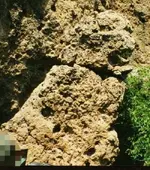
What Pinkley saw were things like this:

azteccatjt4.jpg


There is NO MINE on Tumacacori Mountain. There is no mineralization in that mountain. It has been tested time and again. What the Virgen De Guadalupe is, is a hole dug to hide a large cache. I know Gary and I agree that he has spent more time on that site than anybody, but also in the process, he has pi$$ed off the BLM Rangers and local land owners beyond mention. Gary also does not place any importance on ANYTHING other than drill holes in the rocks and when you put dowels in the drill holes, where they point to. I have a couple of copies of his book and a couple of CDs as well. Great stuff. On the flip side of what Joe said, I am completely convinced that there IS something in the area of Tumacacori Peak. I can't say for certain if it's in Peck Canyon, Rock Corral Canyon, or on the West Side of the Mt, but something is there. There are literally tons of signs. I do think that most of what people know are all false trails by the Jesuits to lead treasure seekers away from where they have actually hidden their wealth. Let me say this about that area though:

KEEP OUT! Currently, about the only people roaming through that area are illegals, drug mules, Border Patrol, and Bandits looking to rob drug mules. Remember that Border Patrol Officer Bryan Terry was murdered just at the mouth of Peck Canyon in a shootout with Mexican Cartel Members.

I have been up Ruby road from Nogales to Arivaca, and over to the 19. At the best of times, there are a bunch of very sketchy places along that road. I was told by a friend that Sasabe is pretty much only a meth cooking town. Drive through it and see if you don't get a ton of ugly stares. HAHAHA

Mike
 

Last edited:
Roy,

Igadbois - great post, yet where are those bells today?
dontknow.gif
Can we conclude that making three bells, also produced some 120 tons of slag?

Do you have a source for that figure?

Best to you, Beth.....and the beasties.:laughing7:

Joe

Yes, the US Park Service, do you not recall our in-depth, ad nauseum discussion of the slag? I posted the source some posts back.

<The post where I introduced the info here on T-net back on May 21:
http://www.treasurenet.com/forums/t...suit-treasures-they-real-134.html#post4015072
The source where I found it, US Park Service:
Tumacacori's Yesterdays (The Treasure of Tumacacori) >

Did you miss it?

I don't think that casting three bells, would create 120 tons of slag, not to mention how much more was used in decorating the missions, how much was simply lost into the earth and dumped into the river to wash away. Neither would Franciscans casting bells at Tumacacori, explain the partial mis-cast bell found at Guevavi and mounds of slag there.

I have to respectfully disagree on Camp Loco being the Virgin de Guadeloupe mine (or storage facility) however it will fit the map from the Molina document; the problem being that the info on the Molina document certainly looks to be encoded, in which case none of the locations that SEEM to fit to the Molina map, will be correct. The fact that no one found any kind of treasure there, supports this contention, as does the date on the Molina doc which is far too early for Tumacacori.

Oroblanco
 

While I was hunting up those old links, I see that Mike posted a new message;

Gollum wrote
I do think that most of what people know are all false trails by the Jesuits to lead treasure seekers away from where they have actually hidden their wealth.

I agree with this statement VERY STRONGLY; there is good reason to think this to be the case too, for all the large, easy to find markers, carved monuments etc never seem to lead to any treasure OR a mine. It only makes sense - why leave road signs to lead anyone right to their hidden cache or rich mine(s)? Real markers would logically be small, hard to find, and hard to interpret correctly.

Also have to agree about the lack of safety in the area, and Camp Loco not being a mine.

I do believe that the Molina document, and possibly the map as well, are genuine, but without knowing the key to 'unlock' the information we already know the results in the many treasure hunters whom have failed to find the treasure, and mines. <I am tempted to say something here but will not :tongue3: >

Good luck and good hunting amigos, I hope you find the treasures that you seek - even when you don't bother to read what is posted! ;D
Oroblanco
 

Roy,

[On September 19, 1948, Mr. C. W. Walker visited Tumacacori and showed the author a location about 100 yards southeast of the mission church, on a mound which is presumably part of the unexcavated east wall of the long-abandoned Indian town. Mr. Walker picked up a few small ore and slag specimens from the top of this mound, and showed them to the writer. He then explained that in 1918 he had shipped approximately 120 tons of slag from old slag dumps adjacent to three round adobe furnaces along this stretch of high ground. He says the slag contained about 8 per cent lead, 3 per cent copper, about 8 ounces in silver, and about 1/6 ounce of gold, per ton.

There is no doubt that mining has been done in this district, and that ore was reduced on the mission grounds. The point so often overlooked, however, is that neither the exploratory trenching of 1934-5 nor the earlier activity referred to by Walker has produced any proof of structural or stratigraphic tie-in between smelting structures and mission period buildings or occupational levels. It should be mentioned, also, that the trenches covered a wide enough area, and were deep enough, to definitely disprove the idea of an "escape" tunnel from the church or patio to the river.]

First, I have no idea who C.W. Walker is. Second, there is nothing in the piece that even hints that any mining done at that location was from the mission period. And no ringing condemnation of the Jesuits for kind of activity. You have much better arguments elsewhere.

Take care,

Joe

Joe; first I don't care who C.W.Walker is, this is the name given in the published account by the Park Service. If you wish to take that issue up with them, I won't stand in your way.

Second, I don't know how you got all that out of what discussion even brought up the frigging SLAG once again, which was the BELLS. I simply said that I don't buy it that making THREE BELLS resulted in 120 TONS OF SLAG. The slag as reported by mr Walker, had some eight ounces of silver per ton, which at least one expert has stated, is INDICATIVE OF SILVER SMELTING and not copper or some other metal. How you got that this was some "ringing condemnation of the Jesuits" from a simple statement I do not understand.

There is slag built into two of the missions very walls. You can sure try to paint that any way you wish, but I can't see modern American miners bringing their ore to an old mission in ruins, smelting it there and then putting pieces of slag into the walls of the mission for decoration. The padres were doing this. I also do not buy it that any American or Mexican or Spaniards were at the missions smelting and casting BELLS.

Plain facts - mounds of slag were found at Guevavi and Tumacacori, slag is built into the walls of San Xavier del Bac and Tumacacori; there are a string of silver mines (and a couple gold) located in southern Arizona, attributed to the Jesuits by virtually every OLD source. The AZ state and USGS geologists stated that the presence of the slag at the missions was solid proof of the mining activities of the Jesuits. The Jesuit Order was very wealthy up to 1767 in Mexico and owned mines (plural) openly, which mines must produce the precious metals the mines were for. Very little of that output, and I include the illicit mines in Pimeria Alta referred to by father Nentvig and specifically NOT listed as Spanish owned, likewise must have produced silver and gold, which likewise has not been accounted for. Even father Segesser made statements indicating the San Xavier mission was closely associated with its own silver mines.

You can continue to try such criminal defense lawyer type tactics, but there were mines that were for over a century known as having been owned and run by the Jesuits, there is clear evidence of smelting activities at several missions, and we can not even account for three bells much less the $40,000 worth of silver seen at San Xavier.

The only reason I had posted that extract from Mr Walker (and by extension the Park Service) was that Springfield had wanted to know exactly how much slag there was, and it is the ONLY statement that I know of which attempts to address that question, and that only for Tumacacori and does not address Guevavi with several more mounds, or San Xavier. It was not my "best" argument concerning Jesuits and their mines, nor intended to be.

So by all means, lets talk "real history" which would be the version that you find acceptable, rather than this most distasteful and filthy topic that you see as fantasy; after all your 'opponents' in this debate are just wild-eyed treasure hunters after all, not the scholastic academics whose expertise we must not question. :thumbsup:
Oroblanco

PS I can tell you how you could get 120 tons of slag while making three copper bells; most of the silver mines of the Jesuits also carry a certain amount of copper; the ore smelted to remove the silver, would also produce some copper, which logically then could be used to cast bells. Otherwise we have no copper mine to explain the smelting activity, and it would take an awful lot of jewelry to make church bells.
 

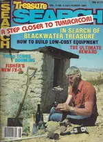
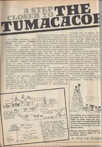
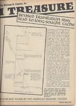
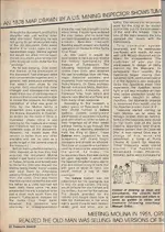
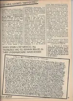
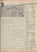
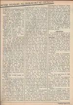
Here is an article regarding the Molina Document and Map that I found VERY interesting. It sheds a new light on why there are so many disparities between the document as we know it, and what archaeologists/anthropologists/paleographers say the document should look like, and what words should have been used.

Mike

Tuma1.jpg
Tuma2.jpg
Tuma3.jpg
Tuma4.jpg
Tuma4.jpg
Tuma5.jpg
Tuma6.jpg
Tuma7.jpg
 

Another postscript (Thank you Mike for posting that article, very interesting!) but this statement I had forgotten to address:

Cactusjumper wrote
It should be mentioned, also, that the trenches covered a wide enough area, and were deep enough, to definitely disprove the idea of an "escape" tunnel from the church or patio to the river.]

That would be to exclude the current, Franciscan church from having an "escape" tunnel to the river, correct? As the original Jesuit church location is not known, I don't know how we could prove or disprove that it had tunnels and or chambers. So you were half right.
 

... I do believe that the Molina document, and possibly the map as well, are genuine ...
Oroblanco

I'm curious, Oro - exactly why do you believe the Molina document is 'genuine'?

IMO, the 'Ortiz' revelations regarding the galeria system is by far the most useful of all the so-called 'Molina' material. There's a message there - a clear one. A question for Mike: what do we know about 'Manuel V. Ortiz'?

Thanks also to Mike for this: "There are literally tons of signs. I do think that most of what people know are all false trails by the Jesuits to lead treasure seekers away from where they have actually hidden their wealth." ​It's the name of the game. Got any ideas when all those signs first appeared?
 

Roy,

"So by all means, lets talk "real history" which would be the version that you find acceptable, rather than this most distasteful and filthy topic that you see as fantasy; after all your 'opponents' in this debate are just wild-eyed treasure hunters after all, not the scholastic academics whose expertise we must not question."
thumbsup.gif


Did I really write all of that? I have to say, I don't have that much passion in the subject. In truth, at this point in my life I see it as more of a mathematical problem. On the other hand, I hope you succeed in solving the whole thing. I have said that many times in the past.

I guess I have been posting for too many years. Everyone seems to have more understanding of what I write than I do.:dontknow:

I'm not in the habit of lying to my friends......or enemies.

Take care,

Joe
 

Last edited:
Historical El RIO Del Oro Mine, its previous name Rio do Ouro (Portuguese).This Canyon is exactly 4 miles south of the site I have posted as the Mina Virgon. The El Rio Del Oro (AMC #91856 is proof of gold in the area) is a placer mining claim and is located just south of the Superstition Mountain Wilderness. It must not be confused with the Cañada del Oro (Spanish for Canyon of Gold), in the Santa Catalina Mountains north of Tucson. However they are part of the same drainage systems.
SPANISH MAPPING
Early in 1520 the pilots who had sailed the previous year with Alonso Álvarez de Pineda dew a map. The patent relates that the voyagers had seen gold-bearing rivers and natives wearing gold ornaments on their noses and earlobes; some were giants almost eight feet tall, others like pygmies. Some of the things reported were fanciful, but others were real. Both the real and fancied soon began appearing on maps produced in Spain. In 1527 an anonymous map reflecting Álvarez de Pineda's claim of gold-bearing rivers, introduced the name Río del Oro ("River of Gold").
SPANISH MAPPING OF TEXAS | The Handbook of Texas Online| Texas State Historical Association (TSHA)

A good catalog to European mining
http://oxrep.classics.ox.ac.uk/bibliographies/mining_bibliography/
 

Last edited:
IMO , from what I have read in the last posts , only the Rock Corral Canyon is in Molina map .
 

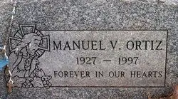
What do we know about Manuel V. Ortiz? He's dead.

ortiz.jpg

So, if you live in the Nogales area, maybe someone should find the Molina Daughter described in the story.

Mike
 

Last edited:
Gollum, if you ever want to discuss your ace-in-the-hole " fossil", I might have something that may interest you.
Sorry Buddy. That's my "Get Out of Jail Free" Card, if I ever get caught doing something I shouldn't in the park. HAHAHAMike
 

Springfield wrote
I'm curious, Oro - exactly why do you believe the Molina document is 'genuine'?

Genuine meaning a handwritten COPY of an original that is genuine, and there are several reasons; one being there is a piece of information in it, that a faker would not have known in the 1930s, other reasons I would not share as I hope to act on it myself.

Cactusjumper wrote
Did I really write all of that? I have to say, I don't have that much passion in the subject. In truth, at this point in my life I see it as more of a mathematical problem. On the other hand, I hope you succeed in solving the whole thing. I have said that many times in the past.

I guess I have been posting for too many years. Everyone seems to have more understanding of what I write than I do.

If it were a direct quote, I would have put it in a quote. It is plain to see from your past posts in this topic and related ones, what your views are.

Seriously, wouldn't you be more at ease discussing the second Battle of Tucson of 1782, or the explorations of father Garces before his being assigned to the new colony on the Colorado river? There is far less contention about this aspect of history than 'treasure legend', and even so there are some errors <few> to root out, even found one on an official US Army history site that is echoed by father Polzer (a number of Spanish troops in an expedition to punish the Apaches, which seems to have been confused due to the large number of Indian allies that were really the main part of the Spanish force, the actual Spanish troops being about one tenth of the total). As to the way I phrased that paragraph, look at the way you have phrased some of your statements, like that "ringing CONDEMNATION of the Jesuits.." as if their having run mines, is something to be condemned, rather than any kind of honors allowed for being the first Europeans to do so west of the Rockies.

Should we not also CONDEMN the padres for having brought European cattle and horses into Arizona, despite all the advantages these useful animals bring, the padres were forcing the Indians to herd the livestock! Horrors! We would have to ignore the positive aspect of the useful work done by the livestock, the regular food supply they helped make available for a people known for their improvidence (starvation was a regular feature of nearly all Indian tribal life at various times of the year) not to mention the side benefits brought by the padres like iron tools, good quality leather (from the cattle) etc. Why should mining be condemned but cattle herding lauded? The forced labor system of the padres, while more liberal than the encomiendo (and repartimento) system of the Spanish, was/is a cruel feature regardless of whether the work was mining or plowing fields; I can testify that plowing with a walking plow is indeed hard labor, I would sooner work in a mine than do that.

BTW no one called you a liar, not sure where you got that either?

I hope all is well with you folks, looking forward to seeing you this fall. :thumbsup:
Roy ~ Oroblanco

:coffee2: :coffee2: :coffee2:
 

Last edited:
What do we know about Manuel V. Ortiz? He's dead.

View attachment 1008426

So, if you live in the Nogales area, maybe someone should find the daughter described in the story.

Mike

So, per the article, Ortiz first saw a Molina-connected document in 1940. Age 12 or 13. Caught the TH bug rather early, no? Well, like swimming, skiing, etc., I guess it's best to learn things at a young age. The 'best' way to 'splain this oddity, Ricky, is that the article is wrong. We can only assume Manny is resting under the headstone ...right? Ha ha. By the way, is that an anchor on Jesus' chest?
 

Last edited:
A thank you goes out to those that have enjoyed my postings!

I want to respond to some of the comments that have been made regarding the Tumacacori Mine.

First of all, Roy: I did not say that casting three bells at Tumacacori explained the amount of slag found on the mission grounds. I do believe there was a foundry at Tumacacori during the Franciscan period (1768-1853). As well as bells, there are many other common items made out of copper and silver that were probably made at the mission site during that period. I thought the story of the San Antonio Bell was worth repeating, and made the point that the casting of bells at Tumacacori was done by the Franciscans. There is no evidence that a foundry was in operation there while the Jesuit visita was in operation.

Mike: 1) Thanks for contributing the rest of the Black Veteran story. I knew it, but I tried to condense a lot of information about Camp Loco into something a bit more compact. Those that read this forum may have more information about Camp Loco that they can share.
2)I agree that there doesn't appear to be any mineralization on Tumacacori Mountain. Of course, Javelina Canyon is not on the mountain, but west of it. There are many opinions about the shaft that was dug at Javelina. One geologist commented that there is a large silver belt that runs beneath the area, and comes to surface in Mexico at the discovery sites of the Planchas de Plata and Bolas de Plata. The site may have been mined by native peoples long before the Spanish arrived. Just because you can't find silver ore in the exposed tailing pile, you can not exclude the possibility that this mine was originally a silver producer.
3) The Treasure Search article by Bill Conley,Jr is very interesting. The story of how Manuel V. Ortiz obtained his copy of the Derrotero suggests to me that Mr Molina was not using an original document either. To make things worse, the way he transcribed the document for those who would buy it was very poor. Was it deliberate or just ignorant? I have often wondered how many versions of the document exist. There certainly is more text in Ortiz's version than in some other copies I have seen, but as it is presented in the article it doesn't make much sense to me. Mr Ortiz worked with the Robert Pate group during the middle 1980s in attempts to find the treasure at a place called "Crown Of Thorns Hill." Bill's article in the Treasure Search of November 1989 supports the idea that the Molina describes an area East of Tumacacori, and extending South through Sycamore Canyon (Janos Pass?). He wrote about the Arizona Citizen 10 Jul. 1875 article, "The Old Mine, supposed to be the Old Tumacacori, has recently been discovered by Henry Allen." He also quotes an article from the Tombstone Prospector (from Arizona Republican 5 Mar. 1911) that tells of a cave that was found in the mountains West of the Tumacacori Mission that contained gold and silver plate and old Spanish coins valued at $10,000. Also included in the article was a mention that Manuel Ortiz had located the 12 patios and 12 arrastras near the Bagby Ranch. These are located about one mile from the Patagonia Mine. Conley states (without reference) that this mine was operated by Jesuits in the 1600s using Indian labor. During the Jesuit period, most of the mining in the area was closer to the Guevavi Mission than the Tumacacori Visita. Several of the Molina transcriptions that have been printed in magazines locate the Virgen de Guadalupe at "one league commencing at the door of the Temple to the South and the Eyes of San Roman, measure to the left 1,800 varas to the North." I don't think that a priest would call a mission building a temple.

For those of us interested in the Molina Derrotero, there is much to think about. The map of the mine site in Javelina Canyon could have been created to sell the idea that this location is the mine described in the Molina. The map was supposedly taken off an engraving on a rock near the mine. I have been unable to verify the original source of the map. Is it possible that the Javelina Canyon mine was also the site of an Indian temple? What if the Javelina mine is actually the Old Sopori, and the Virgen de Guadalupe Mine is located one league to the South? Where are the Eyes of San Ramon or Waters of San Ramon? Has anyone found records on Padre Dolas or Padre Gonzales (original writers?)? The document labeled "The Year of 1548 and 1648 - Document of Temecacury" is also signed by Micaela Molina. It deals with the San Isabell, San Pedro, San Ramon Mines. It says that the trail from the Virgen de Guadalupe follows the canyon and decends South one half league to the Eyes of San Ramon Mine.

Someday this puzzle will be solved.
 

Top Member Reactions

Users who are viewing this thread

Back
Top