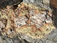
Is the Pit Mine really the Lost Dutchman mine?

Joe, Its an interesting comparison. You could well be correct.

I have long held that the comparison of the supposed Pit mine ore and the legends that just will not go away of great riches in the area are not mere coincident.

One thing is certain. The area in discussion is a far better candidate to produce such specimens than others to the west.

If one is looking for a cache it could be anywhere. But; if one is looking for a deposit in its natural form you have to look where its likely to be found. That's elementary, at least to me.

Natural deposits in the Superstitions proper are going to be deep, real deep, if they exist at all. The legends involve folks who did not have the capacity for that type of excavation. They were after near surface deposits. For those .......you'd need to be in the eastern portion of the range. At least that's my less than authoritative view.

Lynda
 

Thanks Joe, I will have to get a copy. I did a quick check online and it looks like it will have to wait until after Xmas, but looks like it will definitely be helpful. Do you know if it has the original Lt Maguire map, the one which was ordered destroyed and altered maps produced to replace it? I have found ONE image of that map but it is far too small to use for the book. There are interesting differences between the original and the one used for the court of inquiry, like the size of the Indian village as one example.

:coffee2: :coffee: :coffee2: :coffee2:

Roy,

Actually, I have another copy of the book and will be happy to send it to you. Merry Christmas!:icon_santa:

Edward Maguiire drew 8 maps, and Donahue starts his book with them. They start on page 26 and end on page 55. There is a good deal of text in those pages for only eight maps. Email me your address again. I believe I have it, but just to make sure.

Take care,

Joe

Wow Joe you are too kind to me, THANK YOU very much! I will send the address to you shortly. If you keep doing this kind of thing it will wreck your reputation for being MEAN you know! :thumbsup: :notworthy: :notworthy: :notworthy: On a serious note, the Maguire map is particularly curious (for me anyway) as there are a number of witnesses at the Reno court of inquiry that objected to it for being inaccurate. This led to investigating the matter and it is quite mysterious. I would be happy to buy the book from you, but otherwise I must find some way to start repaying you for all your help.
Roy

PS I would like to have your mail address as well, think I have it here somewhere but just to be sure, thank you again!

PPS to Real de Tayopa - not a secret, I had told you about the small quartz stringers we had found, has been a couple of years ago however. It was in that EM discussing that well hidden old mine we ran upon by accident. Nothing to get excited over, but is encouraging to keep looking. To anyone reading this, those small gold ore pieces did not come from inside that mine, at least a mile away from it in some faulting/uplifts; no gold was found inside that old mine.

:coffee2: :coffee2: :coffee: :coffee2:
 

Ive been a member here less than a month. During that month I've made 2 "fairly decent - but not amazing" videos with my cell phone - going out to areas used by "the production company" to satisfy my curious mind. When I put the videos here on Tnet - the response was good. To be honest, I was shocked - given the amount of initial criticism I received for wanting to fly a drone to check in the Jesuit Bat Cave for that silly cross.

Truth be told - Ive had some fairly decent convo's with "sarge" in PM's - he's provided me locations to shoot (not show related) - given me tips on dealing with snakes - and I feel, a concern about my safety after this silly threat. I don't have any issue with Frank - nor anyone else on the cast - after all they are "paid actors" - doing a job and earning a small financial reward. If anyone has any issue - take it up with the production company. At least that is what I have come to realize.

After my 2nd video - I became hooked on all this dutchman stuff. The stories I would read here, the people that I have talked to - both in person / via phone / via PM. I decided that it'd be fun to continue to make videos, but take things away from "the show" and attempt to focus on the lore & legend of the superstitions.

If you remember, I posted a week or two ago "does anyone have any ideas of good places to shoot" and the emails started to come in.

I listed out 3 areas that I thought would make good videos

Pit Mine
CircleStone
Native American Circle with a supposed "mine" under it.


I thought it'd be a good way for me to contribute to Tnet - continue to make some new buddies - and maybe even make a few bucks with the ads from google that now play before my videos.

At the end of the day - all this Pit Mine stuff has really turned me off. Its clearly a sensitive subject for a few people here - and still begs the question "if nothing happened at the Pit Mine - why the hidden agenda of covering things up". Sarge and Joe both deleted their posts - Joe made it seem like he was "told" to do it by someone else.

So with all that being said - I have no intention of getting involved in all this Pit Mine stuff. Something that started out "fun" has turned into something that people feel like they need to hide / cover up / threaten me / etc.

It's ridiculous that I even have to type all this out. Its like dealing with 5th graders that are trying to keep the other kids off the swing set.

If I freaked someone out by wanting to add the Pit Mine to local lore and legend in my next video - then my apologies. When the idea was submitted to me via PM here on T-Net - I had no idea it would lead to all of this.

because its all disinformation. Plus people feel that posting videos of their secret locations will bring more people into the area.

If you really knew secrets of the location of the dutchman, or peralta mines, why would you brag about where they are on this forum?
the only purpose that serves is bragging to feel important.

i absolutely disagree. had my second trip in march. 14 days of treasure hunting. i asked every person if they would help me. i'd shown samples. the people said... oh it looks like gold ore. the owner of the rock shop next to cobbs said it looks like gold ore (ask him for two german tourists). there are plenty of people who believes that you cant find anything with any map. its just a tale a story. many of them would not make the hike. this forum is my only chance to get a connection and get answers of things that i dont know. i will not recieve any advantage for my results. have a bunch of pics and vids for my thread. i will share it for nothing...

what is inside :D
17547403_1423557651029333_799273007_o.jpg
 

i absolutely disagree. had my second trip in march. 14 days of treasure hunting. i asked every person if they would help me. i'd shown samples. the people said... oh it looks like gold ore. the owner of the rock shop next to cobbs said it looks like gold ore (ask him for two german tourists). there are plenty of people who believes that you cant find anything with any map. its just a tale a story. many of them would not make the hike. this forum is my only chance to get a connection and get answers of things that i dont know. i will not recieve any advantage for my results. have a bunch of pics and vids for my thread. i will share it for nothing...

what is inside :D
View attachment 1433690
nobody can tell by looking at that rock if it has gold or not...it needs to be tested...spend a few bucks for tests and you will know once and for all
 

Here is a post by Jim Hatt from some time ago:

[Post by Jim Hatt » Tue Aug 04, 2009 11:21 am


Morning Bob,

Sounds like a pretty "Cushy" job assignment to me! Are they hiring?
icon_e_biggrin.gif


re: the "Board house" - There are two possibilities for where the Board house was during Waltz's time. Both were built by Matt Caveness. The first is the site of the Bark Ranch near the Peralta trailhead. The second is the old Milk Ranch north of Queen Valley. There are trails going north into the Superstitions from both locations. Take your pick.]
____________________________________________________


For a number of years, prior to the Pit Mine being a topic of discussion, I put forth my own theory that Waltz may have been talking about the Milk Ranch. for once, a rare occasion, I found something that Jim and I could, kinda, agree upon. Once the story behind the Pit Mine came into focus the Milk Ranch became much more viable. I believe that theory deserves discussion and debate.


Photo by Dave Leach

Anyone have some thoughts?

Good luck,

Joe Ribaudo
 

cactusjumper,

I do not believe the "Pit Mine" was the Lost Dutchman, and I have some solid reasons why I believe it isn't, but since I can't say for sure exactly where the LDM is, the "Pit Mine" will remain a contender among Dutch Hunters.

Jim Hatt was never sure exactly where the "Milk Ranch" was located but knew it was somewhere North of Queen Valley.
Al Reser, Clay and I were to the site of the old Milk Ranch and there is nothing left of it except for some scraps of boards, nails, remains of a stone water tank and a trash dump.
The Milk Ranch was nearby to where Whitlow Canyon and Milk Ranch canyon meet. There was an old road that ran East from the Cavaness/Bark ranch over to the Milk Ranch then turned South and ran down to Charles Whitlow's Ranch about where Queen Valley is today.

Jim Hatt was correct, there are trails leading North into the Superstitions from both the Cavaness/Bark board house, and the Milk Ranch house.
But there are no trails going East and that is where you have to go to get to the Pit Mine. In fact it's quite a ways over impassable terrain to try and go East. You can't get to the Pit Mine by going North from the Milk Ranch.

If Waltz was going to the "Pit Mine" he would go out of his way to go to either the Cavaness/Bark or Milk ranch board house. He could not reach the Pit Mine by going North, he would have had to backtrack and go South and then turn East where Whitlow Canyon empties into Queen Creek.

I've been to the Pit Mine and just to the east of the mine a little ways is the foundation of a rock house. Some believe that was Waltz's two room house he talked about.

Matthew

Matthew,

Your opinion is, of course, better than most. That being said, I must respectfully disagree with you on the highlighted portion of your post. I am going from memory, as I'm at work right now, but believe there is a good trail from the area of the Milk Ranch to the Pit Mine. It would lead northward to the south side of the ridge and up that south side directly above the Pit Mine.

I will check it out later.

Found it on this computer:


Nice post,

Joe
 

Last edited:
cactusjumper,

You have to remember those are Tonto National Forest trails that were put in from the 1930's through the 1960's and were not established in Waltz's time.
The Fraser ranch is the reason for the trail going east from approximately the Barkley Basin over to Fraser Ranch and that ranch wasn't there when Waltz was working his mine.
I will concede however that if someone knew how to get thru that country they could have made it to the area of the Pit Mine but it would have been a tortuous round about way to go.
It's 6-7 miles of winding around canyons and impasses. Still, it could be done if someone knew the route and had enough time and energy to try it.
One thing I've learned is you can't rule anything out or shortchange those old timers ability and determination.

Matthew
 

Matthew,

I agree the trails as they are today are not what they were in Waltz's time. Many streets, roads and trails started out as game trails, Native American trails, Military trails and go back many centuries into the past. I'm sure you and I have traveled many old.....primitive trails in the Supe's. I have pictures on request.:walk:My guess would be that a primitive trail was used to establish the trail shown on my picture/map.

Take care,

Joe
 

Matthew,

Forgot to add, one of your best friends, Greg Davis, has been on many of those old trails. One is the Stone Map trail that comes down the north side of the main mountain just below Superstition Peak into West Boulder Canyon. He once rode up that north face with Tom Kollenborn. He took pictures along the route. He once told me he thought they had gone as far as the horses could go when Tom rode around a big boulder and continued on to the top of the ridge line. I can assure you that trail was once a game trail and few people know about it.

Take care,

Joe
 

cactusjumper,

I do not believe the "Pit Mine" was the Lost Dutchman, and I have some solid reasons why I believe it isn't, but since I can't say for sure exactly where the LDM is, the "Pit Mine" will remain a contender among Dutch Hunters.

Jim Hatt was never sure exactly where the "Milk Ranch" was located but knew it was somewhere North of Queen Valley.
Al Reser, Clay and I were to the site of the old Milk Ranch and there is nothing left of it except for some scraps of boards, nails, remains of a stone water tank and a trash dump.
The Milk Ranch was nearby to where Whitlow Canyon and Milk Ranch canyon meet. There was an old road that ran East from the Cavaness/Bark ranch over to the Milk Ranch then turned South and ran down to Charles Whitlow's Ranch about where Queen Valley is today.

Jim Hatt was correct, there are trails leading North into the Superstitions from both the Cavaness/Bark board house, and the Milk Ranch house.
But there are no trails going East and that is where you have to go to get to the Pit Mine. In fact it's quite a ways over impassable terrain to try and go East. You can't get to the Pit Mine by going North from the Milk Ranch.

If Waltz was going to the "Pit Mine" he would go out of his way to go to either the Cavaness/Bark or Milk ranch board house. He could not reach the Pit Mine by going North, he would have had to backtrack and go South and then turn East where Whitlow Canyon empties into Queen Creek.

I've been to the Pit Mine and just to the east of the mine a little ways is the foundation of a rock house. Some believe that was Waltz's two room house he talked about.

Matthew

Good as any guess, but highly problematic, If waltz traveled north from his home there would be know reason to go to the milk ranch, Your lost in translation, Now heading home yeah why not stop there Sure. There is only one recorded military road going North from Waltz's house
Glover got it wrong as I said to Joe, He chose to believe Glover, Ohh Well!

Now I've never looked for the Dutchman Mine only Solving the Stone Maps, but his first five clues are sure adding up to where he was and I'm heading.

Wrmickel1

Wrm,

Interesting post! What's your source for Waltz traveling north from his house to go to his mine? You seem to be showing a lack of knowledge of the area and the stories surrounding the LDM.

Thomas Glover is one of the best researchers in the business. Of course I took his writings over yours here. Man takes his research all the way to Germany....he's a serious, respected researcher.

Good luck,

Joe
 

Wrm,

Interesting post! What's your source for Waltz traveling north from his house to go to his mine? You seem to be showing a lack of knowledge of the area and the stories surrounding the LDM.

Thomas Glover is one of the best researchers in the business. Of course I took his writings over yours here. Man takes his research all the way to Germany....he's a serious, respected researcher.


Good luck,

Joe

Your right on that Joe,

But then again there just yarns made up to polute the system. Not saying Glover did'nt do his leg work but stepped in a lot of yarn on the way. And know lack of knowledge of the area. We went over the military road thing before. There was only one military trail.

Wrmickel1
 

Your right on that Joe,

But then again there just yarns made up to polute the system. Not saying Glover did'nt do his leg work but stepped in a lot of yarn on the way. And know lack of knowledge of the area. We went over the military road thing before. There was only one military trail.

Wrmickel1

Wrm,

Sorry, you are wrong here. There are many, many military trails in Arizona. Thomas repeated the Frank Alkire (fictional) story, but it had been retold by many authors. Tell a lie often enough and it will eventually become the truth......someone said. I know where Thomas went to find his information on the military trails through the Superstitions. Care to tell us your own source?

Thanks,

Joe
 

No Joe, Glover went to a military museum, Not even close to military records, Uncle Mark spent his life in Arizona and New Mexico. Became a top high ranking officer in the military. I'll stay with his word and his maps. The trail went north of Phoenix then split east and west part of it can be seen over by fountain Hills,Wrmickel1 Even Holmes story is a yarn, most likely never even new Waltz, other wise why the confusion of the name. Yarn!
 

the Dutchmen is right before the two week camping in stronghold mountain AZ there is a road that leads to Baptiste camp you take that as you are going down that road to the left there is a mountain not the baptist camp mountain just a little bit passed that mountain well i have company look on google maps
 

between the mountains there to the left on google maps you will see an old water thing for cattle you are then on the right road next on the left you will see on old house it is just the foundation above that the switchback on google maps you can see the mines a friend said a earth quake shifted the mine he tried to pump it better things going on right above the mines it looks like Disney land with there crates i would think they found a Aztec treasure up there they call it glen valley i don't care what they call it it is Apache land that they are ripping apart the sign in the stronghold says this land is not to be touched my heart is well now good shape to fight this and being Apache i am not happy look for your selves .things are bad in Pearce arizona
 

Top Member Reactions

Users who are viewing this thread

Latest Discussions

Back
Top