El Naranjal

Hello Mr LM

Hold that mug steady, hope it's piping hot and let us make use of those freshly baked biscuits as well....

"From Cosala to Guadalupe de Los Reyes is ten leagues. After the first two league going down the Cosala stream, I began to enter on a very strong and hilly road, very worrying to the feet of the mules. After crossing some low ranges of hills, I came to the hacienda 'De Los Naranjos' or 'Ranches of Oranges', a very pretty farm in a secluded nook. Crossing a high hill toward the south, I came upon the Rio de La Habas, two leagues from Naranjos. This is a hacienda hidden in amongst the closely huddled hills towering loftily over it. It is a dependency of Guadalupe de Los Reyes. There are some very good building here for the precipitation of gold and silver ores. Twenty soldiers are stationed here for the protection of the mines. The ore is brought on the back of mules six miles from the latter mine to be crushed with a set of heavy stamps moved by water-power. The water is very plentiful for three-quarters of the year. The modus operandi is just the same at this place as at the Real de Guadalupe de Los Reyes."

And that was it as far as Naranjos was concerned. Nothing about Naranjal I'm afraid. I believe it may be linked. There is similarities to the "original" story - it seems to me that the geography, location, both gold and silver being mentioned, secluded location, other mines on the road etc., that is my balance of probabilities with Naranjos and Naranjal. My view only Mr LM.

By the way, Crow has been looking for a drink in the San Gaban thread - thinks he may have been left to find the way to the canteen by himself.

Shall we invite him over??

My dear sir let me go back and see if it makes any reference to Tayopa.

Back soon.
 

Hola Annie, UK'r ,The rio Las Habas lies sw of Cosola, El Naranjal, if it is in Durango, would be far to the SE. East of the Epinazo del Diablo.

The pass between Sinaloa and Durango is the Rio San Lorenzo. Have an interesting story on a fantastic, unexploited placer there.

Don Jose de La Mancha
 

Last edited:
Hello Mr LM

Yep, t'was but a small chance. Well lets go on.

Did check for any reference to your Tayopa as well - nothing doing, probably was already abandoned by then probably and this fella was concentrating on the operational mines in the main. Fascinating nonetheless. LOA can make sense of what there is within.

Your turn Mr LM.

We're all ears on your story about this placer. Our Crow friend has joined us as well (psst, you sure nobody's sneaking in any sugar??), the kettle's nicely brewing and we want you to regale us now....
 

First may I welcome our Oro blanco bk to the Naranjal forum with a fresh pot of his favorite sock coffee.. He is prob the best source of data on Naranjal and posseses intimate data on Tayopa which he won't release :coffee2::dontknow: .

You asked about the Rio San Lorenzo placer, frankly it is loaded from start to exit. It cuts through a large country which is highly mineralized and has many very commercial Gold Placers in it's course, still basically unexploited.

The one we will talk about is where it cuts through the mt range between Sinaloa and Durango. In doing do, it
scoured the mt to the north which subsequently had a Gold rush in it's exposed veins. It was so rich a discovery that it had hundreds of small miners working there. It even had gold buyers setting up shop at the base of the Mt.

Well since the Lorenzo had cut off perhaps 1/3 of this mt, it also collected tremendous amounts of gold, plus what it was bringing down fro Durango. As it flowed out into the relatively flat lands with a series of oxbows, it started to lose it's ability to carry the heavy gold and so started to develop the almost continuous placer deposts.

In the late30's the area was subjected to a heavy drought, and the Lorenzo almost dried up. A group of the miners, whose claims had petered out decided to explore the possibilltes of a placer being formed in the Ox bows.
They were shocked to find an almost continuous chain of extremely rich Gold Placers, running around $1 a cubic meter.

Converted crudely to todays recent Gold prices, this is equivelent to aprox. $50 a cubic meter today.

Since it would involve heavier equipment than they had, they decided to go looking for a Backer. They went to Nogales and eventually had several interested partners from the US, but just as things were jelling, due to the outbreak of the war, the US practically banned all mining except for critical needs, it was halted even though it was in Mexico..

So there it sat, but after the war it was never bought bk to life. Casual investigation found that the original party had drifted apart during the war, many had died, and for one reason or another no one ever appeared to reopen the project.

Crude investigation shows that probably all are now dead and this information was lost until I became the mill foreman / assayer up on top and became interested in where the gold went after cutting down the Mt. and becoming trapped by the San Lorenzo.

You are welcome UK'r

Don Jose de La Mancha
 

Last edited:
Wow!

Mr LM, just when I thought it couldn't get any more interesting, you pull another beauty out of the hat.

To think, even today, there is still vast unexplored regions with, quite literally, goldmines worth of resources just there for the taking....hhmmm

But of course the resources needed would be considerable (worthwhile by the sounds of it though), but out of reach for small-timers like me.

Thank you Mr LM.

Let's all keep talking and keeping these wonderful discussions going.
 

G'morning my friends Usual coffee? I will ask again, if any of you have a question on Tayopa which I haven't answered satisfactorily, post away. For example it was asked of me via PM "why do I think that Teters mine is also Los Remedios?"

Well I always did from the first since it's survey data placed it squarely where the location of Los Remedios should be. Also back measuring etc tended to completely verify the existence of the other points of Tayopa. In all, too much of a coincidence.

Originally I had assumed that he had been prospecting from the Border down, then when he found his closed up mine, he had returned to Hermosillo to bring back a surveyor through very, very dangerous country at that time. I was always curious as to why, when he had passed through some extremely rich country prospecting, why did he keep going south, until recently I found that he actually was on the trail of Tayopa itself.

When he finally reached the area, after gaining the confidence of one of the Guayijiro Indians, the Indian agreed to show him the location of a crumbling portal, Los Remedios.

After filing, he closed up the entrance and left. He never returned, it was simply too dangerous at that time.. Eventually he lost the Title due to non payment of taxes.

My original clue was in finding the old behive shaped monjonera (claim marker required by the Mexican mining law) The very basic data was still legible were it was scribed in the plaster coating, if you very carefully examined it, but since then all data has completely disintegrated now. Only I, and you know what it said. To follow up on this data up, I went to the mining office in Ocampo.

When I arrived it was to find the office closed, and asking, found that all records were boxed up for shipment to Chihuahuha in the next two days, since the office was being closed permanently. Luck or divine providence ?
--------------Second time ! -------------------

They were in cardboard boxes and so covered with fine dust that I was sneezing most of the 6 hours that I spent going through them before finally finding his documents. Naturally, it included his survey data, which allowed me to pinpoint his closed entry. Careful examination and later study proved correct, he had filed on an intrusion. It can be followed up very easily, and showed where his closed up entrance was,.

I later sent teams up there 'twice' to open and sample the mine, but despite my showing them to within 10 ft where I wished them to go, they all tried to second guess me, and never manged to get within 500 meters of where I wanted them to go. --> a shooting offense? Where is ORO ?? I need him.

So Los Remedios still sits up there, lonely but not forgotten. But it's time is coming.

Side point, but 'los Remedios' was / is responsible for forming the Paramo Placers. Also the Indians up there have sent down word that they wish to show me 2, possibly 3, other partially closed mine portals, they are afraid to enter.

Drink your coffee, that is for today, unless you have any questions.


Don Jose de La Mancha
 

Hello Don Jose

Just gotta love old dusty archives that is where the best stuff is...

Coffee...?:coffee2:

crow
 

Yep Crow, I certainly needed that coffee. Gracias.

AS I mentioned, "the second time". When I first filed on the Tayopa property, I also needed a licensed Surveyor report as to location etc within a specific period.. After having it surveyed, I patiently kept waiting for a filing report acceptance from my surveyor showing time and date of it being filed in the agency, the surveyor's responsibility..

When It became too close to cut off time, I finally called him on the telephone. He assured me that everything was ok, yet ??

When only 4 days rolled around with no legal data stating that the filing had been accepted, I again called him and finally asked do we have enough time to get that data to Chihuahuha? He appeared startled, and then said "Sheehs, I had forgotten that it had to be filed in Chihuahua, I had only thought of Hermosillo" - he lived in Hermosillo.

Chihuahuha is in another state, in those days over a two day drive. For me to go to Hermosillo and then to Chihuahuha in the time remaining was almost an impossibility. So I told him to send them by a courier - a super, special delivery, service by the Mexican Post office, generally an overnight process, and Very Expensive.

It now was Wed, and the cutoff date was on Friday, it had to be there by Friday closing time. This he did, but even so I Iost several good fingernails, then finally when I coulcln't stand it any more, I had my wife call the agency in Chihuahua on Friday about closing time. The Head of the agency answered and was very courteous.

When she explained to him our problem, he said "just a minute, some packages etc. were just delivered, but I normally do not open them until Monday". Shortly he came back on the telephone and said "Yes,you papers are here, I will stamp them received on Friday and will revise them on Monday.

So due to the extra courtesy of the Mining Agent, the Tayopa title was assured by only 5 - 10 minutes before closing time..

That was playing fate too close, so I had another cuppa of Crow's coffee to calm myself down.

As a matter of fact, this pattern occurred several time in the Tayopa search . It seems that Tayopa was / is ordained to be involved with me - a Reincarnated Jesuit?:dontknow::laughing7:

Don Jose de La Mancha

p.s. The archives were sent to Chihuahua, but never again open for the public, in fact they are still stored in the basement of a rented building, still in their original card board boxes. unopened.
 

Last edited:
Don Jose,

"The archives were sent to Chihuahua, but never again open for the public, in fact they are still stored in the basement of a rented building, still in their original card board boxes. unopened."

Can you tell us what "archives" you are referring to?

Thanks,

Joe
 

G'afternoon Joe mi buddy - even if you ate my steak !:occasion14:

when a mining claim, or Title, is requested, a file is created duly identified by an expediente no. It contains all of the appropriate data obtainable on that particular property which continues to follow the property no matter how many times it may change names or owners. In other words it is an effective history of the mining claim. Each modification requires a new title no. and expediente. In effect it is a history of that particular piece of land.

It is the legal reference archive, not a historical one.

See accompanying picture. Besides title no, in the upper left corner you will see the expediente no. Names of mining claims are actually useless, since there are tons of duplicate names. The only effective identification are the Expediente no. and the Title no.

Don Jose de La Mancha

p.s. see examples of physical data.


View attachment 832821View attachment 832822
 

Hello Don Jose

hmm I see why you like that strong coffee... I am not surprised you have had a life time on the knife edge why change?

Common on Don Jose fess up ...I think you like the thrill of sailing close to the wind. It what gives you a spring in your step.


Coffee....:coffee2:
 

Last edited:
Hello Don Jose

I was once told by an old crazy fly boy up in Papua its not the fall that kills you. Its the sudden stop.:laughing7:

So as long as you can still move along that proverbial knife edge your still alive.

Perhaps that is keep you so young??
 

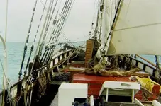
Evening my beach combing buddy: Actually it is a dream of just sailing on and on in Kanacker's ole *******ized square rig schooner. Just chasing the sun and moon beams over the Pacific Polynesia. Sigh. Lovely brown skinned maidens impatiently waiting for me on various tropical paradises. Fighting to feed me peeled and sliced Mangos etc. while I lazily lounge in a true tropical hammock. Sorta like what you, hardluck, and Kanacker do.:notworthy::hello2::hello::icon_thumleft::censored::occasion14:

Don Jose de La Mancha 'who wants to be spoiled silly'

p.s. Kancker's row boat

Kanacker's  (and my) dream boat.jpgKanacker's square rigtged schooner. 1.jpgDRUMBEAT_FORDECK.jpg
 

Last edited:
G'afternoon Joe mi buddy - even if you ate my steak !:occasion14:

when a mining claim, or Title, is requested, a file is created duly identified by an expediente no. It contains all of the appropriate data obtainable on that particular property which continues to follow the property no matter how many times it may change names or owners. In other words it is an effective history of the mining claim. Each modification requires a new title no. and expediente. In effect it is a history of that particular piece of land.

It is the legal reference archive, not a historical one.

See accompanying picture. Besides title no, in the upper left corner you will see the expediente no. Names of mining claims are actually useless, since there are tons of duplicate names. The only effective identification are the Expediente no. and the Title no.

Don Jose de La Mancha

p.s. see examples of physical data.


View attachment 832821View attachment 832822

Don Jose,

Just how far back do the legal reference's in that box go? How do you know these details?

Thanks,

Joe
 

G'morning Joe: You asked --> Just how far back do the legal reference's in that box go? How do you know these details?
~~~~~~~~~~~~~~~~~~~

Interesting question. Since a original piece of ground - mining claim - may be split or divided up many times later, each new section or change has it's own new expediente no. Which in turn can again be modified and create multiple more expedientes. So if you are dedicated some can be traced back to the original claim. One can equate it to doing genealogy work on humans. It can get complicated, but generally isn't. However it is fairly common to be able to go back in general for at least 100 years, some of the more famous ones that have been worked continuously, go back to the 1500's.

In the case of the Tayopa group, since they were clandestine mines they were never registered, one of the major pitfalls in finding them by public records. 99% of the data pertaining to Tayopa resides in the secret - need to know - files in Rome. And yes, They have looked for Tayopa also, but when they left during the Indian uprising they hid it too well, so never did reopen it to my knowledge and findings, but did work properties in the surrounding area..

One of the mines in the Tayopa complex, which by speculation could well be el Naranjal, was not worked by the Jesuits as mentioned. However, it can meet the criteria of Naranjal except for location, here again, since it has never been found where they have looked ---???

MY coffee??
:coffee2:

Don Jose de La Mancha
 

Evening my beach combing buddy: Actually it is a dream of just sailing on and on in Kanacker's ole *******ized square rig schooner. Just chasing the sun and moon beams over the Pacific Polynesia. Sigh. Lovely brown skinned maidens impatiently waiting for me on various tropical paradises. Fighting to feed me peeled and sliced Mangos etc. while I lazily lounge in a true tropical hammock. Sorta like what you, hardluck, and Kanacker do.:notworthy::hello2::hello::icon_thumleft::censored::occasion14:

Don Jose de La Mancha 'who wants to be spoiled silly'

p.s. Kancker's row boat

View attachment 835181View attachment 835182View attachment 835183


Hello Don amigo....

In days of old those dusty maidens made love to seaman for the price of rusty nail. No wonder half the sailing ships fell apart after leaving Tahiti.

Ah Tahiti the Hula hula girls in their grass skirts gently swaying those luscious hips it is good to be king yah? I got the feeling you want to stow away on Kanacki's ship of ill repute.

Nothing better than a tall ship with fair wind in its sails and a clear moon and stars to sail by with a dusty maiden hanging off me. It has if I had died and gone to heaven.


Looks like Hardluck has offered me a job I cant refuse. After all I have the code of the tropical tramp to follow.

Crow

7364057168_82d7445340_c.jpg
 

Top Member Reactions

Users who are viewing this thread

Back
Top