Basic signs and symbols you have found

Hey, Clay, you mentioned above ," All of the rocks behind it appear to be helping to prop the big rock upright. I was able to stick my arm in behind a little ways. I didn't see much."

I wonder if that rock was allowed to tilt over, would there be some hidden symbols underneath or perhaps a cache under it? I'm not suggesting destroying the sight. Is there any way the rock could be easily tilted over enough to check for hidden symbols? Maybe dig out from underneath a little bit and insert a camera to check for marks? Just a WAG. :laughing7:
 

Don Jose,
That is some SERIOUSLY rugged country you were flying over. How would those early miners operate in such country? Unless they were working solely in the deep canyons.
 

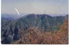
I'll do what I can when I get back out there. The terrain is tremendously steep and sandy. This hillside is loaded with decomposed granite and has a rise:run of 3.5:1. The part of the tree visible in the hoyo is at about the 10'-12' level on the tree. Hiking this little trail has been challenging. The rocky outcrop seen in these photos extends between 300-400 ft. It took us four and a half hours to safely navigate and study that short distance. If it weren't for the stumps and the duck, I wouldn't have chosen to come back to this area because of the "not fun" level.

Clay
 

Clay, My son and I have a couple of sites that are real tough to get to, then it goes almost straight up. The signs are there and like you we post what we can and ask questions, lots of them. I am very grateful to the people on this site that take time to help all of us. RH2.
 

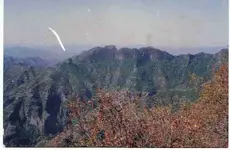
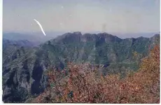
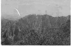
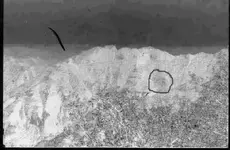
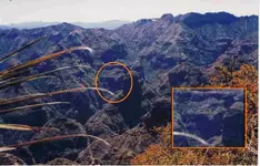
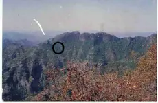
HI regarding the Sun on the actual stylized treasure map, I am including the upper part with the Sun. Remember the angle of the view is slightly different between the map and the actual view. the second demonstrates how easy it is to cut though colored over lays with color separation.

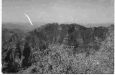
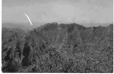
I am also including the basic picture split into the three primary colors in order to show what old dog has been talking about. Each shows a different aspect, yet the true sun marker remains the same, while eliminating the other possible points.. You can then reverse everything for an enhanced view.

As you see, the Sun is almost exactly where it is supposed to be.

Hadj, weekender, and short stack, you did good, close but ---so I will send you a coin from Tayopa when I open the deposit.

Don Jose de La Mancha
 

Attachments

  • Sun  where is it 2.jpg
    Sun where is it 2.jpg
    26.8 KB · Views: 521
  • upper small part of the deposit map©@.jpg
    upper small part of the deposit map©@.jpg
    15 KB · Views: 524
  • Example of separting colors, ©@.jpg
    Example of separting colors, ©@.jpg
    6.2 KB · Views: 516
  • Sun  where is it 2.jpg
    Sun where is it 2.jpg
    26.8 KB · Views: 519
  • red separation ©@.jpg
    red separation ©@.jpg
    23 KB · Views: 510
  • Green ©@.jpg
    Green ©@.jpg
    22.8 KB · Views: 511
  • Blue separation ©@.jpg
    Blue separation ©@.jpg
    22.8 KB · Views: 511
Hi my friends, very interesting posts. Keep them rolling.

Short stack posted -->How would those early miners operate in such country? Unless they were working solely in the deep canyons.*
***************
First the Indian lives were not a considersation. If one died, just go grab another, free for the taking. As for access in the cliffs etc. they bored holes in the cliff wall, then inserted hardwood poles, bridged the poles with smaller poles or branches, then grasses and dirt if animals were to use it.

The remains of some still exist in the remote sierras. SCARY !

Don Jose de La Mancha
 

Hola Amigo,
This area I have circled looks pretty good in my estimation.
I have watched the pictures as they progressed through the thread.
It seems to be the one place I am always drawn back to.
I am probably quite wrong But it is my shot.

Glad your travels bring you home safe old friend,

Thom
 

Attachments

  • REDSEP~1.JPG
    REDSEP~1.JPG
    32.6 KB · Views: 488
Don Jose said: As for access in the cliffs etc. they bored holes in the cliff wall, then inserted hardwood poles, bridged the poles with smaller poles or branches, then grasses and dirt if animals were to use it.


That's one of those slap-the-forehead points. NOW it makes sense. :laughing7: And it shows an excellent "outside the box" thinking and thank you for explaining that. That is another BIG bit of information to file away in the old knowledge bank. :thumbsup:
 

Don Jose have been following your pics, ive not seen the SUN sign
but i do see the heart, so the SUN sign, cant be to far away
in my second pic, what are these that i marked
 

Attachments

  • Tayopa_country_indicated_on_cave_map_©@.jpg
    Tayopa_country_indicated_on_cave_map_©@.jpg
    56.9 KB · Views: 1,095
  • sun.jpg
    sun.jpg
    77.9 KB · Views: 1,074
Now that is some rough country. The one section looks like a funnel shape...maybe a volcanic vent I would sure want to check that out! This is the kind of area no one else but the most dedicated would explore/propsect! Get in there! Can you share what mountain range or state?
 

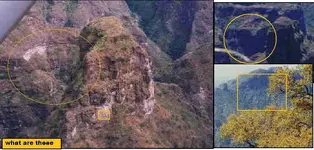
Good evening my Friends. Back from a 3 day trip. You have all shown excellent work, but unforutunately have not shown the sun's location, but came very close. See posted photo.

They formed it by simply scraping the top soil off of the bedrock some 200 ft in diameter with the ring being about 25 ft. Still effectively no new soil cover, but it is now covered by spreading plant growth,. This is why the color separation tech is so effective.

As for Curtis' question the ridge is the separation between Sonora and Chihuahua. The precise location by Lat & Long if wanted. The view point is from above Tayopa. Not exactly the same as on the map.

I have another one from southern Chihuahua that is cut on the cliff, maybe 30 ft in diameter surrounded by stars. They had to be suspended by rope some 100 ft to do it. If I can find it, I will post it. It is above a very large cave with a large treasure inside. Still there for many reasons including a Tarahuma family and their herd of goats living inside of it. They won't talk of treasures, they are afraid of distrubing them.
It can wait.

Don Jose de La Mancha
 

Attachments

  • Actual Sun site  confirmed  by visit ©@.jpg
    Actual Sun site confirmed by visit ©@.jpg
    27 KB · Views: 1,238
but came very close.

Don Jose, I'm reeeeeal glad it wasn't a handgranade! :laughing7: :laughing7:

I would suspect that one of the big problems you face in your adventures there are the superstitions many locals live with. The need to respect them must get a little bit exasperating sometimes, but........very important, too. :thumbsup: Having the patience (and trustworthiness) of Job will be returned to you many fold, eventually.

I'd sure like to read you book when you get it done.
 

It is above a very large cave with a large treasure inside. Still there for many reasons including a Tarahuma family and their herd of goats living inside of it. They won't talk of treasures, they are afraid of distrubing them.
It can wait.

Don Jose,
It becomes quite evedent why these folks love you.
 

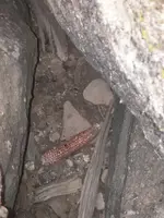
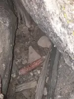
While hunting up a picture I ran across this picture.
The space is about twenty feet deep and this sits at the bottom.
I can only see part of the bottom
But it seems to be pretty protected as the mice haven't even tried for this one.
 

Attachments

  • Uc pix 2 038.jpg
    Uc pix 2 038.jpg
    36.7 KB · Views: 1,609
  • Uc pix 2 038.jpg
    Uc pix 2 038.jpg
    36.7 KB · Views: 1,608

Top Member Reactions

Users who are viewing this thread

Back
Top