Basic signs and symbols you have found

Last edited:
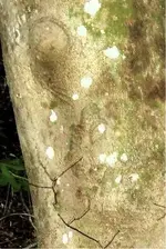
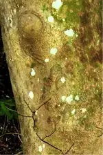
O.k. I'm new here but have this. It is driving me nuts trying to find what it is. It sits at the bend of a stream where I have found arrowheads. There are a few more arborglyphs around the area too which I do not have pics of at this time. A few arrows and what appears to be a bear. I have to kayak to get to it so I will take shots of the others if it ever stops raining here. But anyway, here are the two on this tree.

While I'm not saying for sure these are Native American keep in mind that this area is known to have been an escape route during the Trail of Tears. Plus my ancestors have been here over 150 years and they were Native American who later married Irish Freemasons. And my grandmother says that tree was like that when she was a child. The closet I have come to figuring this out is that it appears to be a lasso. Which is a native sign for captivity. But what is that wing thing? And is that a crow under it?
431366_2440993524659_1856042698_n.jpg
 

Attachments

  • 431366_2440993524659_1856042698_n.jpg
    431366_2440993524659_1856042698_n.jpg
    102.6 KB · Views: 123
Last edited:
I well like to post same pic from my android cell phone but dont now how help please
 

Thanks widomanmx, and Thanks dsty , anyhow, i'm posing more pics of the same trail, hope these more sign will make it more clear with your help and support.. ( Part 1 of 3 " 6 pics of 18 " )
20141213_142441.jpg20141213_142530.jpg20141213_142747.jpg20141213_142840.jpg20141213_143521.jpg20141213_143837.jpg
 

I don't know why anyone will not post the degrees and distances or the height, Show me a photo and ask me what it means ??????
 

Last edited:
Signs and Symbols

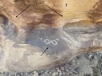
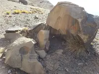
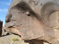
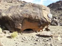
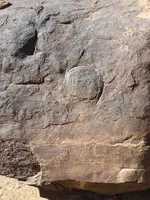
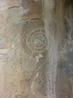
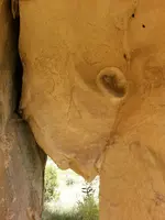
I found these two in the Malpais of New Mexico. Obviously the head means to look around here. The other one is giving the location of where to go.
 

Attachments

  • 20140828_114702.jpg
    20140828_114702.jpg
    1.1 MB · Views: 161
  • 20140828_133951.jpg
    20140828_133951.jpg
    1,018.5 KB · Views: 177
I found these two in the Malpais of New Mexico. Obviously the head means to look around here. The other one is giving the location of where to go.

The head is just a rock. The spiral is a common native american symbol, which means descend, and is likely part of a larger panel.
 

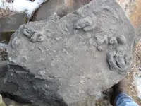
DSC01087.JPG brother found this while digging basement down to make it lower, wondered if its some sort of map and if so possibly to what? thanks
 

10310615_1388403111467706_8994569061125520298_n.jpg

1622293_1388025388172145_8885215633037335043_o.jpg

10923465_1388025418172142_6587950852174800231_o.jpg

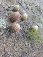
interesting how the cacti makes a triangle pointer.

I have found many markers like these and smaller ones made out of bedrock on the lower elevations
 

Last edited:
Anyone can help me to translate this kind or mark?
Is this a yamashita treasure sign or mark?
Snapshot_20150127_13.JPGSnapshot_20150127_27.JPG

Mark to be found:
1.like sun or something
2. face [two eyes, nose and mouth]
3. big footprint
4. heart
 

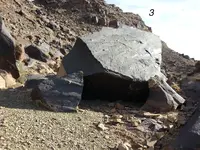
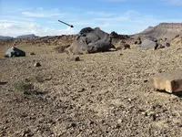
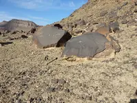
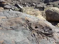
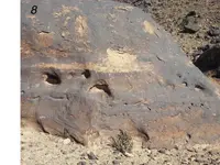
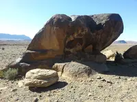
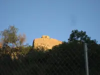
Okey, thanks for bumping this thread back to the top. I have a possible marker I would like to have a little help on, and this thread seems to have a lot of knowledgeable and helpful people following it. I am about 1/2 way through the thread, and still have a lot to learn. It appears to me to possibly be a “pointer” rock. As you can see, there appears to be an “L” or perhaps an upside down “7” on it. A little background here. The rock is only visible from a paved road for a very short section, and the road is a dead end, so it would seem unlikely that the marking is modern graffiti, but it is possible. However, there was possibly a wagon or stage road in the area in the 1880s (anecdotal, from someone whose family has been in the area from the 1900s). and, due to the location, it could be on a trail/road to either the Rancho Guejito (1845 grant, possibly earlier habitation) or the Santa Ysabel assistencia (1818). The stage road was supposed to be to Santa Ysabel, so the latter does make some sense. The rock is readily visible from much of my property, which may have been part of the original trail/road, due to the gentle slope of the lower section, however there is no trace of any trail on my property since there was quite a lot of work/traffic/brush clearance, etc in the area. I have a few difficulties here. The rock is very difficult to approach closely. I’m still working on that. The area, while semi-rural, has seen a lot of development, there is a lot of private property that I have been unable to get access to, and I have, as yet been unable to find further markers. I doubt very much that it is any kind of a treasure trail marker, but I would be just as happy if it were a simple trail marker. If any of you have any comments, I would be glad to hear of them.
IMG_3814.JPG


I have some other things to post as well, but let's start with this and go from there.

JB
 

Last edited:
Has any one ever seen this one before and/or know anything about it? Location, purpose etc.? Thanks, I'd really like to relocate this. Mileaway

untitled.png
 

Maybe it means to check out the left side of that 'dome' rock. Could be some good shade/shelter.

No, that is a very steep area, and there are much more sheltered areas and potential campsites nearby. My feeling is that the pointed rock means to "keep right" or "turn right", which is a logical direction for a trail, but the L? hook? backwards J? upside down 7? is what I'm having trouble interpreting. I suspect this is either really late Spanish or Mexican, not early Spanish/Jesuit. I found one reference to a "hook" which indicated it was a treasure mark, but I'm skeptical about that. However, water is a possibility, as there is a creek at the base of the slope to the right in the direction the pointer rock is telling you to go.

JB
 

Hello Shortfinger ( are you a retired carpenter by chance ) My thoughts are that by the height of the boulder that its a long distance marker, the boulder on top may indicate the direction ( to the left ) possibly a settlement, possibly fifteen leagues or so. May be a Royal Trail if there's a Church in the direction indicates. That's my guess anyway. The 7's limits the meaning to just a couple of things.
 

Last edited:
About how many feet away is your property from the boulder with the symbols?
 

Last edited:

Top Member Reactions

Users who are viewing this thread

Back
Top