A GUIDE TO VAULT TREASURE HUNTING (Condensed)

Thanks for the inputs and comments. Speaking of old age, my back is still tweaked from last week, but I'll run over tomorrow to it and maybe dig a little for buried markers in the clay which is drying out and probably turning to concrete quik. Anyways, I still have a few tricks up my sleeve if it's the wrong spot. But I'll try and have some updates, since again, it's private owned family land and I can do whatever I want on it without looking over shoulder very much.
 

Fair? I find things hilarious myself. And where better place for a good laugh than TNet?

View attachment 1915129

MMmm,… Alzheimer's? Yum-Yum…..

But where is your tropho-sidekick? Got the bathroom first?

Yeah, if bedbugs included, it is fair. Well done. It should leave a bit of jingle left in your pocket. There’s nothing like a sunrise over Motel 6. (or similar)
 

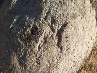
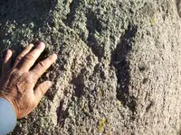
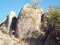
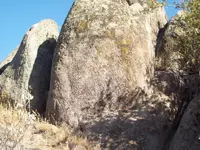
There's still things that nobody I know has ever talked about, so I take it nobody knows they exist. For example, things that line up to a spot. Some boulders/markers will have a "roof top" / a-frame type tent shaped top that you sight directly over. You may see the marker as one thing from straight away, but you go up to it and you go perpedicular to the marker on it's topline indication. You don't need 2 aligned markers to go a specific direction off a single marker all the time.

My "tictacktoe" marker a few pages back is like this. Trying to show the unknown, undisclosed things discretely. It's a direct line-up marker, but nobody knows about these apparently. Cause nobody comments specifically on them or the way they actually point. You are supposed to see something and it's gets your attention, and you go over to it, and line up a place from it's top line indication because it's topline is a straight line.

Another is the sideways square notch peepsight on a side of a monument. And I didn't show one of these here, And I don;t want them disclosed much and destroyed on sites, Nobody has ever said anything about them except me briefly and it is lost in the discussion. And I don't persue things I know exist but in way that most don't know very much about, I just let it get buried in the discussion and go along with whatever. All these are on my current site I'm posting and are on many others I know of that go to something spot on.
 

Ha, I just realized there was a triangle of boulders there that goes to the spot I'm at. I forgot that about 5 years ago, I dug under a boulder that created a triangle made by the King's head and Owl/eagle head boulder and another. The kings head looked towards the other boulder so I thought It might have been saying to dig under it at that time (which was dumb). But no, it was saying go over that boulder , it was giving the direction to shoot out of the triangle. Which is the same line I'm on anyways, the 330/150 line from the kings head. Stopped to smoke a cigar up there today and realized that. So I'm good to go still I think. Vegas Robania famosos , mmmm, yum. Nice smoke.
 

Question for Quinoa: Post 4953

So the pointed edge coming off the rock is simply a decoy?

The edge or line that points the way is--the straight line moving from left to right in the photo--and the way to the cache or cross spot is to the right along the line moving from left to right. Is this correct?

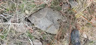
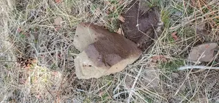
Yes and No, the pointer tip sticking out points at a place that looks kind of like a dig spot with other sign/symbol type things. It's all just off the main line down to the cross spot. You follow the right edge of the inset triangle (up and down leg) towards top of photo. You go straight towards top of photo, which is downhill.
 

Last edited:
Another marker I didn't show , I call a pac-man, it's an open mouth with no eyes or anything, kind of a generic open mouth. I've seen them at other sites. 333/153 degrees to the spot at my site. 29 cubits, 20.8inch or you can figure out the measurement they were using. I'm going with what zeros out on 90% of them along with the compass bearings off each marker in the area. Also these are the only markers in the area, there aren't many large stand out boulders or outcrops there only a few. I mapped out almost all of them, and they all zero out. The compass bearings are holy bearings by number, 123 combinations, things that make up 3 (the trinity) , as well a few 15 or 30 degree increment compasses bearings, and quadrants of 45 degrees and half quads from a mariners compass. You should familiarize yourself with them if it hasn't been beaten to death by now.
 

Well, I guess heroes often fail. But we will see...
 

Hi Sandy,
Can you help me understand this - 15 degree increment

you need to see if any of these are on a 15 degree increment/compass degree to the boulder markers from this triangle.

If you are standing on the Dig Site,
Will you see this 15 degree Line,
Aline with Stand Alone Boulders,
That are out there surrounding the Dig Spot.

View attachment 1379348
---------------------------------------

How far is the Heart etc. from the triangle?

If the area has lots of Markers,
Do they use, for a standard, some Measurements, that would stand out,
Making those Markers, the ones to use among all others.
Using a Measurement Like 111 as Conformation.

Lost Horse :coffee2: :usflag:

Thank you for presenting this.
 

LH, the 15 degree increments are only used on markers such as a triangle to a boulder or a cairn to a boulder or basically a chain trail, but that only works for the oldest markers (including some of the old alignments), The Sentinels used any degree they wanted or sometimes no degree at all just a visual alignment.


There are certain distances that are favorites (but nothing is the same from site to site) some favorites are 111 being the trinity and as I have shown they love the number 3 so many times distances are multiplied or divided by 3 Here is a great example many of the storages will have 77 feet it took me awhile to understand this, but its actually quite simple 77x3 is 231 anything with the numbers 123 has something to do with a Vault.

Here is another good example 181.5 feet from a boulder to the crisscross spot is actually 66 Varas which I have found at crisscross spots also, and then when you take the 66 and double it we get 132 Varas, so again we have this 123 in a different configuration.

We can't forget about The all Important Thirteen either.

In order to change English feet into varas here is the way to do it, (English Feet divided by 2.75 equals Varas)

From Varas to English Feet (Varas Times 2.75 equals English Feet)

The Sentinels use English Feet and the Spanish/Priests Used Both English feet and Varas.

Thank you for answering the question Sandy some real good info right here.
 

Not far away like, 40-50 feet forgot measurement... 132/312 degrees exactly, the cleft of heart facing is towards spot. Gonna be mad if it's wrong spot, lol... so much stuff going to it now. flat rocked in area at about 3 feet making a floor like place, V shaped pointer about 2 feet down pointing either down hill along 202.5/22.5 line or marking the hole exact dig spot. The tip was right on the exact spot down 2 feet. There is a place where a few markers zero out in degrees about 15-20 or so feet below, but only like 2 or 3 of the 10 or so markers. So that's my secondary if it comes up empty. I still re-measure anything new everytime I go back while resting from digging. The triangular inset rock still bugs me. Forgot to measure that to secondary spot.
 

Attachments

  • 20210317_143554.jpg
    20210317_143554.jpg
    2 MB · Views: 57
  • 20210317_143529.jpg
    20210317_143529.jpg
    1.7 MB · Views: 50
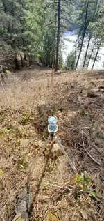
Might be hard to follow my posts on this spot I'm sharing, but my survey numbers are actually within a few inches of sandy1's measurements common distance numbers and exact on the bearing numbers. The numbers aren't coincidental. I use a non metal magnifying glass to read my compass, which is standard type transit compass mounted on a standard transit tripod (non magnetic). They aren't cheap, but they are very accurate. Whether it pays off or not is subject to the next couple months work. No guarantees, but it's somewhat promising atm, mainly due to the surveying math/geometry.20210317_154356.jpg
 

Might be hard to follow my posts on this spot I'm sharing, but my survey numbers are actually within a few inches of sandy1's measurements common distance numbers and exact on the bearing numbers. The numbers aren't coincidental. I use a non metal magnifying glass to read my compass, which is standard type transit compass mounted on a standard transit tripod (non magnetic). They aren't cheap, but they are very accurate. Whether it pays off or not is subject to the next couple months work. No guarantees, but it's somewhat promising atm, mainly due to the surveying math/geometry.View attachment 1918223

Depends on the accuracy you need. The ideal is to provide survey grade lat/long coordinates, eliminating the need for surface clues and markers. It's my opinion that the big stashes - if they exist - were likely done this way, particularly since the 1930s when many of them went into the ground. Your hand-held GPS won't do the trick - it's only good to about 25' true location on a good day.

Your challenge is different. Yeah, I can read my Brunton pocket transit to a half-degree on a tripod, but there are other factors to consider if you are looking for near-survey accuracy. 1. Magnetic declination can be increasingly unstable with the impending pole reversal - the north magnetic pole is rapidly moving and I'm not certain the online data is totally reliable nowadays. The only way to be certain is to take a sunshot like the old surveyors did. 2. If your local terrain/soil is mineralized, your needle will drift, often enough to deflect a couple degrees or more. 3. The last one - slope distance or ground distance? A ground measurement on a 10% grade throws your surveyed distance off by a couple percent. This all depends on how a hider figured things and on how you want to figure it.

IMO, line-of-sight straight line combinations trump distance and bearing if you want to hide something with the intention of recovering it later. The simpler the better, and your landmarks better damned-well be permanent and verifiable. You've located stuff on the ground that you think somebody used to mark a stash. When all is said and done, about all you can do is pick some intersecting lines and dig where they cross.
 

Last edited:
There's aligned marker sets that you can usually go off of, a couple of the strings are pulled from marker to marker across the spot I''m digging at. So you can test your compass with those. In fact when I started I was about a 1/2 degree off on my compass for an alignment and it bugged me enough to call my brother to look up the current declination for my location while I was still in the field. I couldn't figure why one marker was aligned slightly off the bearing, it seemed the correct placement was a few feet to the side of the marker with current compass setting, but when I readjusted it for the extra 1/2 degree declination it hit just right. I may have still had it set for a place I went camping at last summer.

On the slope distance you can calculate the horizontal distance with an inclinometer if you can't do a straight pull on a tape measure. I just have a right triangle calc phone app that does the calcs now from angle and distance input. There were some I couldn't pull anywhere near straight, so I didn't bother calculating them yet until I find where I stashed my suunto .

On some some sites when you measure and use a 33 inch vara, when it's a couple inches from 20, 30, 50 , and 75 varas on 5 of your measurements, well, then it's probably pretty solid. 137.5 feet = 50 varas, a pretty common one. 82.5 feet another @ 30 varas. Eleven foot increments are pretty common, 11 feet=4 varas. This is the first site that I have tried a 20.8 inch cubit, measuring from the middle of each marker. The varas could work if you used the back of some markers vs the middle. But there should be a uniform way to take the measurement. And it bugged me enough to try a 32 inch vara, and then an old royal cubit, until things worked out to a spot about the size of my hand. On many sites though , it will be a mix of feet and varas. Smaller newer placed markers in feet, older larger ones in varas. Again many of the markers here had a chipped out divot on top of them where the measurement was likely taken from, unless they had an obvious place to pull from like a pointed tip top.
 

I've read that the dog is a sign of a trap. The size of the dog depends on the trap. This is unproven. Although I see different dogs it has not been discussed much. What about the eagle in attack mode. It comes from above. That's another thing I see. Has anyone ever seen a floor trap?

Yes I have personally seen a floor trap! This one works by stepping on a flat stone they placed inside the tunnel, think of a teeter totter. This particular rock is the same way, when one places enough weight on it, the back end jacks upward and a 40 ton Boulder comes down and crushes you instantly..yep it’s real!
 

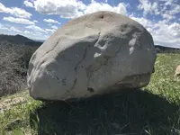
F3EC55D3-838A-4A43-AC73-0C8B0277E9BA.jpegCame across another interesting monument how they engineered to move this is totally amazing.
 

Last edited:
The Riddle of the ANGEL and the BELL ....PART ONE ........I'm breaking this up into 2 parts cause I want you to understand.
attachment.php
attachment.php
 

Attachments

  • 102_1423.JPG
    102_1423.JPG
    1 MB · Views: 117
  • 102_1424.JPG
    102_1424.JPG
    1.1 MB · Views: 120

Top Member Reactions

Users who are viewing this thread

Back
Top