A GUIDE TO VAULT TREASURE HUNTING (Condensed)

A reminder, spring equinox coming up march 21 ish, get out on your sites from noon thru afternoon. lots of stuff shows up well. My spot I posted has a hole on a monument's side for the sun to go thru it near afternoon, and it lights up eyeballs on a kings head. it's like looking at a mona lisa , the eyeballs follow you when you move , but are more apparent and specifically imaged on certain bearings like 330 degrees, or 333. It's bizarre. But all these are bizarre.
 

Excellent info Quinoa once again thank you for that. It would sure would be interesting to know how TriHarder figured that footage at 500 feet that's quite a distance to calculate.
 

btw , the neat markers, for the most part, they aren't dig spots. They are alignment markers to go to another place somewhere nearby. That part is the riddle to solve.


Prefer to earn treats; not give them away. Pearls before swine, ect... (not calling anyone a swine). The triangle monument seems to be located at a junction site, an area near (upper bank on trail) the trail or on the trail itself. This is the last spot they (spanish, th, sentinels) visit before heading towards the end point.

Most often, this monument type (triangle) provides one or more direct line of sights to its nearest end points. This triangle monument is not for pinpointing. But it will take you on a straight line directly
towards the end point it is related to. It will not tell you where to stop or how far to go. Once you get close to the end, you will then use different alignment boulders (these ones usually under 200ft from end point and for end point confirmation (plus some extras for misdirection)). Although dont
be suprised if some of those seemingly extra misdirection boulders actually lead to other nearby vaults.

In some areas I have seen single alignment boulders connect to multiple storages (added a new alignment boulder nearby a previously existing alignment boulder but pointing in a different direction).


The 500ft max came from Sandy, which I have proven in the field to be correct time and time again; for the record Sandy is the only one that i know of whos info is 100% correct. I determined that % by incorporating his info at my own private sites.
500ft is pretty common for max alignment line of sight during 1500-1600s. In some rarer cases, came across late 1700s alignment boulders (100-200lbs, smaller ones) that were related to vaults within 200ft of them but ALSO gave a direct
line of sight to a storage in the back of the canyon over 750ft away. There were other monuments and alignment boulders used closer to the storage to confirm end spot.

Now onto the Tri Monument from HT55.


Anytime I have came across a triangle monument, one leg (occasionaly 2 legs) provided a direct line of sight to its intended end point(s). The same applies to the diamond shape. The triangle is a diamond cut in half.
This principal also applies to shadow triangles and shadow diamonds that are collagued
with major monuments and/or hidden near eye catchers. Shadow triangles/diamonds are usually within 50ft max of the end point, usually much closer. Some ancient ones max 500ft.
Think hidden in plain sight or something that stands out sitting next to something that does not. After you see something, and look closer, then the other becomes visable. (same rule applies to confirmations).
example; a large obvious rock which is an alignment rock but no obvious animal or other shape from any angle, may have its confirmations in the shadows.


Confirmations are required to verify relativity!!


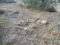
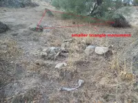
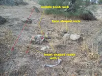
Alright, onto pic analysis. There are 2 triangle monuments, a larger and smaller one. They are each highlighted in Red. You will have to determine which of the lower legs is the correct line of sight alignment since
there is a slight deviation between the two (obviously, for confusion, misdirection)


The upper triangle monument boulder has a side face profile Shadow silhouette which looks to the left along the alignment direction. (go left confirmation) (spanish monument boulder confirmation)


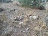
The sentinal or th triangle that makes up the pile of rocks at the lower end of pic includes an exact
copy of the spanish triangle monument alignments.

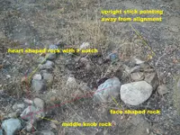
See the small heart shaped rock at the far left side of the pile, with its own > sign confirming alignment direction? That one
seems to be the most recent addition since its counter part which came before it is harder to see and located a foot to its right (also drawn in Red).
Both of these cairn alighments have a heart shaped rock at opposite ends and both rocks have a > notch which is open towards the alignment (direction confirmation) (man made heart rocks confirmations)


There is a face shaped rock (it is one of the two largest rocks in the pile, the large white rock next to it being the eye catcher to something less obvious next to it) on the lower cairn pile of rocks, it is 1 of 2 cairn alignment rocks that point to the left. The face shaped rock
also looks to the left, the same as the shadow silhouette from the upper boulder of the spanish triangle monument above. The 2 of 2 cairn alignment rock is the middle knob rock. The middle
knob rock is used to confirm both alignment directions since it connects to the heart shaped rock with > sign and the side face profile rock.

Notice how this cairn alignment pattern copies the above spanish monument alignment pattern and yet is still well hidden in plain sight.


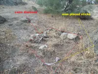
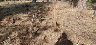
Notice the small stick someone set upright out of the ground on the far right side of the small rock pile. Turn that stick 180 degrees and it points on the alignment. It currently points away from it.
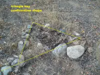
How about the larger stick at the lowest end of the small rock pile? it points in the same direction and the 2 small rocks nearest to it confirm its part of the cairn feature. Furthermore, that stick and rock make the
cairn into a diamond shape; again copying the larger monument pattern (a triangle, with an added lower point to make a diamond).


Pics added to help visualize.


Did you try hard? :dontknow: Well, TriHarder next time... :occasion14:


triangle large.JPG

triangle small.JPG

diamond.JPG

101_9038 - Copy (2).JPG

101_9038 - Copy.JPG

photo below shows the other main alignment, heading downward or towards area below photo
3 red line alignments (1 spanish on far left, 2 th or sentinel with heart > notch rock)

101_9038 (2).JPG

101_9037a - Copy.jpg

101_9037a - Copy (2).jpg
 

Last edited:
Yeah I get what your saying on the triangles, I've seen the same general stuff dozens of times over. Hard to show things in pictures, sometimes it's relative to other things on the site that's not in the photo and a viewer wouldn't understand unless he is there. Nice egg rock/boulder on the big triangle. I've seen them before too. I call the low to the ground boulder an indicator rock that goes off your A- frame boulder for a direction to shoot thru the big triangle. But yeah, I've seen alot of shooting thru the legs as well.
 

Oh , about forgot, one more thing for everyone, I mentioned the march 22 spring equinox being good for some shadow/sun signs things, but what's really good to do first thing before spring green up, is looking for all the close to the ground markers before they are covered up in vegetation, as well as looking thru the brush or trees before the leaves sprout back. March thru April should be your largest allocation to field recon.
 

Prefer to earn treats; not give them away. Pearls before swine, ect... (not calling anyone a swine). The triangle monument seems to be located at a junction site, an area near (upper bank on trail) the trail or on the trail itself. This is the last spot they (spanish, th, sentinels) visit before heading towards the end point.

Most often, this monument type (triangle) provides one or more direct line of sights to its nearest end points. This triangle monument is not for pinpointing. But it will take you on a straight line directly
towards the end point it is related to. It will not tell you where to stop or how far to go. Once you get close to the end, you will then use different alignment boulders (these ones usually under 200ft from end point and for end point confirmation (plus some extras for misdirection)). Although dont
be suprised if some of those seemingly extra misdirection boulders actually lead to other nearby vaults.

In some areas I have seen single alignment boulders connect to multiple storages (added a new alignment boulder nearby a previously existing alignment boulder but pointing in a different direction).


The 500ft max came from Sandy, which I have proven in the field to be correct time and time again; for the record Sandy is the only one that i know of whos info is 100% correct. I determined that % by incorporating his info at my own private sites.
500ft is pretty common for max alignment line of sight during 1500-1600s. In some rarer cases, came across late 1700s alignment boulders (100-200lbs, smaller ones) that were related to vaults within 200ft of them but ALSO gave a direct
line of sight to a storage in the back of the canyon over 750ft away. There were other monuments and alignment boulders used closer to the storage to confirm end spot.

Now onto the Tri Monument from HT55.


Anytime I have came across a triangle monument, one leg (occasionaly 2 legs) provided a direct line of sight to its intended end point(s). The same applies to the diamond shape. The triangle is a diamond cut in half.
This principal also applies to shadow triangles and shadow diamonds that are collagued
with major monuments and/or hidden near eye catchers. Shadow triangles/diamonds are usually within 50ft max of the end point, usually much closer. Some ancient ones max 500ft.
Think hidden in plain sight or something that stands out sitting next to something that does not. After you see something, and look closer, then the other becomes visable. (same rule applies to confirmations).
example; a large obvious rock which is an alignment rock but no obvious animal or other shape from any angle, may have its confirmations in the shadows.


Confirmations are required to verify relativity!!


Alright, onto pic analysis. There are 2 triangle monuments, a larger and smaller one. They are each highlighted in Red. You will have to determine which of the lower legs is the correct line of sight alignment since
there is a slight deviation between the two (obviously, for confusion, misdirection)


The upper triangle monument boulder has a side face profile Shadow silhouette which looks to the left along the alignment direction. (go left confirmation) (spanish monument boulder confirmation)


The sentinal or th triangle that makes up the pile of rocks at the lower end of pic includes an exact
copy of the spanish triangle monument alignments.

See the small heart shaped rock at the far left side of the pile, with its own > sign confirming alignment direction? That one
seems to be the most recent addition since its counter part which came before it is harder to see and located a foot to its right (also drawn in Red).
Both of these cairn alighments have a heart shaped rock at opposite ends and both rocks have a > notch which is open towards the alignment (direction confirmation) (man made heart rocks confirmations)


There is a face shaped rock (it is one of the two largest rocks in the pile, the large white rock next to it being the eye catcher to something less obvious next to it) on the lower cairn pile of rocks, it is 1 of 2 cairn alignment rocks that point to the left. The face shaped rock
also looks to the left, the same as the shadow silhouette from the upper boulder of the spanish triangle monument above. The 2 of 2 cairn alignment rock is the middle knob rock. The middle
knob rock is used to confirm both alignment directions since it connects to the heart shaped rock with > sign and the side face profile rock.

Notice how this cairn alignment pattern copies the above spanish monument alignment pattern and yet is still well hidden in plain sight.


Notice the small stick someone set upright out of the ground on the far right side of the small rock pile. Turn that stick 180 degrees and it points on the alignment. It currently points away from it.
How about the larger stick at the lowest end of the small rock pile? it points in the same direction and the 2 small rocks nearest to it confirm its part of the cairn feature. Furthermore, that stick and rock make the
cairn into a diamond shape; again copying the larger monument pattern (a triangle, with an added lower point to make a diamond).


Pics added to help visualize.


Did you try hard? :dontknow: Well, TriHarder next time... :occasion14:


View attachment 1910669

View attachment 1910670

View attachment 1910671

View attachment 1910672

View attachment 1910673

photo below shows the other main alignment, heading downward or towards area below photo
3 red line alignments (1 spanish on far left, 2 th or sentinel with heart > notch rock)

View attachment 1910674

View attachment 1910675

View attachment 1910676

TriHarder,
Thanks for sharing!
 

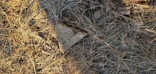
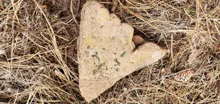
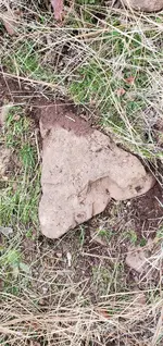
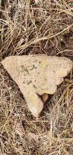
Near a cross spot. Find the carved heart on corner the side cut notch is on in the 2nd blow up pic (top corner in photo). third pic is flip side..20210313_170202.jpg20210314_163050.jpg20210314_163035.jpg
Edit: Heart is on corner up and to left of notch on 2nd photo. a little faint but visible. Crack lines.
 

Last edited:
The notch and heart actually relates very closely to a monument nearby in a certain way for confirmation. Even the flip side cut corner 3rd pic with the divot on a sort of heart shape relates. Something interesting I happened to find. May explain more in a couple weeks. It's not really conventional thought, although I've seen it a few times.
 

Keep posting btw tryhrdr, your material is correct. Pictures are harder to portray it on many sites.
 

Oh , about forgot, one more thing for everyone, I mentioned the march 22 spring equinox being good for some shadow/sun signs things, but what's really good to do first thing before spring green up, is looking for all the close to the ground markers before they are covered up in vegetation, as well as looking thru the brush or trees before the leaves sprout back. March thru April should be your largest allocation to field recon.

My favorite time for exploration is after the fall equinox, approaching the solstice - Oct/Nov optimum. Why? The sun angle is the lowest in the sky (furthest south), offering the best oblique light and exposing of details. It's like following footprints - the best human trackers (eg Border Patrol) prefer nighttime with a low-held flashlight. Also, like you say, the vegetation has mostly died off/thinned out.
 

Lining it out. About 5 more markers had lines that I just used the compass only once I had the crossing. Also found a couple things pointing, one was a very large heart with a pointy lobe nearby. Haven't measured everything yet in distances, only a couple things. It would all just be for reference now. 20210317_154141 2.jpg20210317_151758 2.jpg
 

2 of the corded lines have markers on each side of the cross spot with a few low to ground large flat ones in between along the line. So they were pretty easy to line out. Then I just went around to all the other markers with a compass and confirmed the crossing spot. Took about 2-3 hours, but I already knew about most of the prominent markers in the area from being on the site off and on for a few years. Just was never able to put it all together.
 

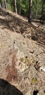
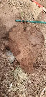
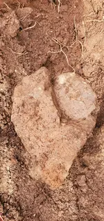
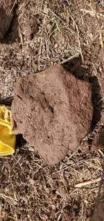
Ok. Lets talk buried markers. I can go back later and show all the other markers that go to the cross spot with bearings and distances. But this is where there is no info on what a buried marker should be like. Should it be better and not any bit abstrac and perfect? Or is it the same underground. Here is the bottom side of a medium boulder, maybe a little bigger than basketball that was mostly buried, maybe the tip of it exposed right on the side of the cross spot. The bottom is flat. It looks like a heart, another sunlit angle maybe also a snake eating an egg. Great signs, but am I seeing too much or not. I don't know the underground stuff. Is it perfect, or the same stuff that's above ground.20210318_152525.jpg20210318_152053 2.jpg
 

Under that boulder was this shield/crest looking rock, kind of perfect , but who knows what you are looking at underground20210318_152914.jpg20210318_154405 2.jpg. Under the crest looking thing, I carefully raked away more dirt and found this (2nd pic) heartish looking thing that was well rocked in and not very moveable. So what am I looking at, wishful thinking or buried markers saying to continue? I don't know yet.
 

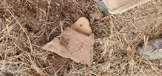
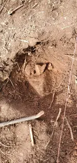
So, after contemplating all that, I walk up the hill to leave, and about 20 feet uphill I find this other triangular marker That is almost a mirrored twin of the original marker I found near the cross spot. It's inset more in the dirt though. 2nd pic is the original marker near cross spot. So does this mean the cross is not the spot, and I have more figuring to do, Or maybe the original just got popped out and slid downhill near the cross over the years20210318_160655 2.jpg20210314_163050.jpg. I don't know. These are types of things everyone will at some point have to deal with and figure out.
 

I'm going to tell you 3-5 feet left or right is gigantic digging out a spot. 10-15 feet off you won't get it. Even with a backhoe. So somehow you have to be pretty much be right on within a foot or so. I'll stick with the cross spot on mine for now, until I can figure out more or get an aura for a direction. It's not always all cut and dry, even if you are directly on it. I might be right on it, I might not be. The cross spot may be a marked out spot nearby the entrance instead of the actual entrance. I can come to terms with that. Most everything big and prominent on the hillside leads to my cross spot atm.
 

My favorite time for exploration is after the fall equinox, approaching the solstice - Oct/Nov optimum. Why? The sun angle is the lowest in the sky (furthest south), offering the best oblique light and exposing of details. It's like following footprints - the best human trackers (eg Border Patrol) prefer nighttime with a low-held flashlight. Also, like you say, the vegetation has mostly died off/thinned out.
But for the dear hunters...
 

I'm going to tell you 3-5 feet left or right is gigantic digging out a spot. 10-15 feet off you won't get it. Even with a backhoe. So somehow you have to be pretty much be right on within a foot or so. I'll stick with the cross spot on mine for now, until I can figure out more or get an aura for a direction. It's not always all cut and dry, even if you are directly on it. I might be right on it, I might not be. The cross spot may be a marked out spot nearby the entrance instead of the actual entrance. I can come to terms with that. Most everything big and prominent on the hillside leads to my cross spot atm.
Thanks for sharing...:sunny:
 

I'm going back tomorrow and trying a very old vara measurement of 32 inches. Will keep you updated. it hits the buried boulder with the heart bottom exactly at 28 varas. Will have to see if all the markers are on that measurement. I over shot the cross spot at 77 feet for 33 inch vara on measurement, so I'm recalculating to a 32 inch vara instead of 33. It's part of the process.. Nothing is all encompassing, but you have to put the time in to figure exactly.
 

Top Member Reactions

Users who are viewing this thread

Back
Top