A GUIDE TO VAULT TREASURE HUNTING (Condensed)

You mean rotated/oriented like this for a midday solstice? Your other symbol reminds me of a gunsite.
s symbol.jpg
 

Post 2326

That is a nice photo--the more I look at the photo--the more
Spanish Markers that I see. There are a lot of pointer markers too.

Barton
 

L.C., I calculated out your sun angle of 45 degrees at high noon (due south) for your area and it came up Mar 9th at 12:33 pm and again on Oct 3rd at 12:12 pm. So not really any correlation of what I was thinking in the lines of.
 

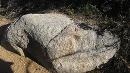
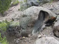
We believe the 0 above the E on its back is representing the Moon because there are no rays on it. It is obviously in the Mid-Day or Midnight position on the Summer Solstice determined by the symbol on the left indicating high noon on the Summer Solstice. at noon on that day, we have photographed the shadows and ground and studied it for quite some time. The needle's eye does not leave a dot on the ground in its shadow. We first thought it may have pointed to the spot on the ground in front of the turtle's nose.:dontknow:

L.C.

View attachment 1575023View attachment 1575024


You may need to place yourself “In the Eye of the Needle” to be able to have the correct angle.

“Ayin Meaning — 16th Letter of the Hebrew Alphabet
The Hebrew letter Ayin means eye and correspondingly, the Ayin has to do with vision and bringing forth lights that are hidden. Ayin teaches us to see beyond and relates to time. It is the aspect of the visionary, to see not just what is happening in front of us, but to envision beyond that — to know one’s direction 5, 10, 100 years ahead and beyond. “

Spiritual Meanings of the Hebrew Alphabet Letters | Walking Kabbalah

Also, as exact locator…………

"...located at the end opposite from the point. These loops are often in the shape of an eye."

https://en.wikipedia.org/wiki/Eye_of_a_needle


………and there is a distinction between “the needle’s eye” and “The Eye of the Needle” in the usage in Kabbalah, and adopted in Masonry. (your guys)


P.S. (….in my case, it was a narrow entrance to a cave, of the exact shape of ‘the eye of the needle’) and it was much older use of the ayin symbol, before it was adopted by other groups, and used in their contexts.
P.S. 2 ………….see if that is the case in your configuration
 

Last edited:
I just had another thought that if your inclination angle is actually closer to 49 degrees vs 45 degrees,(not sure if you said you did an exact measurement) then it could be on the vernal equinox, which is what your X sign with the line suggests in your original orientation , as well as the carving to the side of the turtle. Vernal equinox was on March 20th this year, with solar noon, 12:20pm, but the same sun position will again be on the fall equinox which is Sept 22 this year , with solar noon at 12:16 pm.
It would likely last an extra day before and after only around those days and correlating specific times and only for a couple minutes.

You can plug your location and dates in here to see solar noon and sun inclination angles:
https://www.esrl.noaa.gov/gmd/grad/solcalc/
Just drag the pinned location on the map to your location , and change dates you want and times for solar noon.

Thank you very much for the link and your help.

L.C.:thumbsup:
 

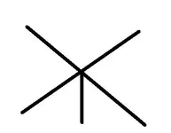
Those of you who have confirmed the Specific treasure boulders, and also confirmed the alignments that intersect at a crisscross point; have any of you used specific metal detectors or magnetometers, gradiometers, resistivity, Ground penetrating radar, at the crisscross spot and actually got a hit?

I'm not asking if you dug there or not or for any locations, but simply asking if any of you actually got an anomaly or a metal target hit with your specific equipment. If you have, would you please share what type of equipment you used?

I personally use a pulse star 2 pro. I haven't used it too much but on about 4 or 5 crisscross spots. I didn't get a hit on any of the crisscross spots but i'm assuming that if treasure is buried there, it would definitely be deeper than 6 feet. I've tested the pulse star on a stack of lead bars in the air, It will pick them up at 5 feet in the air, and at 6 feet I barely get a signal.

I haven't used the camera for catching auras method as of yet, but I think that it should be next on my to do list. What are your experiences with the different technologies on the crisscross spots and I'd definitely like to hear from those that used the camera aura method in conjunction with some type of metal detector and could verify with both, that something was buried there.
 

Last edited:
I have tried using the aura method, and the criss cross method that was so kindly put up on this thread by Sandy, and have yet to get any results. This doesn't say that they are not right, only that I have not been able to use either successfully yet. In my little heart of hearts, I believe that the KGC most likely implemented the Spanish ways of markings, and could have very likely used old spanish yards that were previously set up. With the KGC forming in the mid to late 1800's, there were still very many mexican / spanish expeditions into the southwest, (i.e. Nevada, Utah, Colorado, California, New Mexico, and Arizona). The early Mormon pioneers documented large mule trains in the mid 1800's coming out of what is now the Wasatch front in Utah. Many namesakes in Utah carry namesakes accordingly, Spanish Fork, Spanish Valley, etc. This overlap in timing of the Civil War, and still many Spanish and Mexican mule trains in the southwest could have easily influenced the KGC, and in my opinion most likely did. This is why I love Tnet, so many new ideas, non of them bad, just different. If it helps to solve this merry go round puzzle we are all so vehemently trying to figure out, then bring em' on. After decades of full time treasure hunting, all I can really say, is that I am confused! Some of the areas we have been have layer upon layer of history, from 700 years ago, right up until the mid 1950's. It is seperating these layers that will give us all the truth.....
Now if I only had the money to dig up these 54 caches that I believe are still there.....
Just a thought from an empty headed treasure hunter...
 

Bytheway....On a side note, the recent airing of the "Utah connection" in the Civil War Gold series was disheartening. I believe the tunnel they were in was one dug during the uranium boom in the Cricket range in Utah. It is visible from the main road in Headlight canyon. Now, if they really want to know where it might be......I know a strange little place with a fallen cabin, and a huge water trapped tunnel. Not visible, unless you are standing on it. Covered by massive juniper branches, cut to perfection, to perfectly conceal its whereabouts.....Just sayin, I don't believe they hid the gold in plain sight...
 

I have tried using the aura method, and the criss cross method that was so kindly put up on this thread by Sandy, and have yet to get any results. This doesn't say that they are not right, only that I have not been able to use either successfully yet.

Thanks for sharing your experience bonuntr. So you tried the camera method and didn't get any auras? Or did you get some auras and confirmed the crisscross with the aura and found nothing when you dug?

Did you find any buried capstones or boulder markers within 3 feet of the surface? If you're comfortable sharing this info it would be great for us to learn from your experience.

Thanks bonuntr.
 

I have tried using the aura method, and the criss cross method that was so kindly put up on this thread by Sandy, and have yet to get any results. This doesn't say that they are not right, only that I have not been able to use either successfully yet. In my little heart of hearts, I believe that the KGC most likely implemented the Spanish ways of markings, and could have very likely used old spanish yards that were previously set up. With the KGC forming in the mid to late 1800's, there were still very many mexican / spanish expeditions into the southwest, (i.e. Nevada, Utah, Colorado, California, New Mexico, and Arizona). The early Mormon pioneers documented large mule trains in the mid 1800's coming out of what is now the Wasatch front in Utah. Many namesakes in Utah carry namesakes accordingly, Spanish Fork, Spanish Valley, etc. This overlap in timing of the Civil War, and still many Spanish and Mexican mule trains in the southwest could have easily influenced the KGC, and in my opinion most likely did. This is why I love Tnet, so many new ideas, non of them bad, just different. If it helps to solve this merry go round puzzle we are all so vehemently trying to figure out, then bring em' on. After decades of full time treasure hunting, all I can really say, is that I am confused! Some of the areas we have been have layer upon layer of history, from 700 years ago, right up until the mid 1950's. It is seperating these layers that will give us all the truth.....
Now if I only had the money to dig up these 54 caches that I believe are still there.....
Just a thought from an empty headed treasure hunter...

bonutr,

I knew you had it. Way to go, bro. I think that you are less confused that you make it sound like. (Give it another season/shot)
 

I have tried using the aura method, and the criss cross method that was so kindly put up on this thread by Sandy, and have yet to get any results. This doesn't say that they are not right, only that I have not been able to use either successfully yet. In my little heart of hearts, I believe that the KGC most likely implemented the Spanish ways of markings, and could have very likely used old spanish yards that were previously set up. With the KGC forming in the mid to late 1800's, there were still very many mexican / spanish expeditions into the southwest, (i.e. Nevada, Utah, Colorado, California, New Mexico, and Arizona). The early Mormon pioneers documented large mule trains in the mid 1800's coming out of what is now the Wasatch front in Utah. Many namesakes in Utah carry namesakes accordingly, Spanish Fork, Spanish Valley, etc. This overlap in timing of the Civil War, and still many Spanish and Mexican mule trains in the southwest could have easily influenced the KGC, and in my opinion most likely did. This is why I love Tnet, so many new ideas, non of them bad, just different. If it helps to solve this merry go round puzzle we are all so vehemently trying to figure out, then bring em' on. After decades of full time treasure hunting, all I can really say, is that I am confused! Some of the areas we have been have layer upon layer of history, from 700 years ago, right up until the mid 1950's. It is seperating these layers that will give us all the truth.....
Now if I only had the money to dig up these 54 caches that I believe are still there.....
Just a thought from an empty headed treasure hunter...

All you have to do is find one cache, and then you can hunt the others like the big dogs with all the $. If they back you with their $ then you have to divide what you find with them. Slow and steady like the turtle and you will succeed at your own pace. Good luck to you.
 

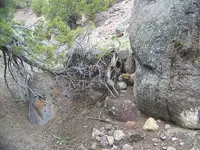
Here is a snake. Walked past him for years until one day, just happened to look at the right location, at the right time. If it had been a snake it would have bit me. IMG_2985.JPG
 

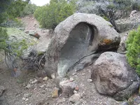
Thought I would throw up a few pics of a monument that is so full of info, it took weeks to figure out what it all meant. (I believe I have still missed alot of info that is contained in it). Just wanted to put it up for everyone to have a good time with. I am only including 9 photos as, to tell the complete story it would take several more. Tell me what ya'll see, and I will do the same. We were fortunate enough to be able to identify it as a corner to a massive yard that runs over 5 miles in the north and south directions..Have fun....
yardstart1.JPGyardstart2.JPGyardstart5.JPG
yardstart4.JPGyardstart7.JPGyardstart8.JPG

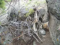
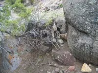
The files were just too big to keep going......This monument is MASSIVE. Notice the branches broken over the monument. I placed those there, because I had removed the originals. This monument was hidden just north of a main trail in a deep wash. It wasn't meant to be seen by many, I believe the original builders only meant it for those with a map to get to it....Just a thought...
 

This monument was a key in what has been a long journey. We had found a lot of the yard previously, but was still lacking in its set up. In the end, caches were set up as spokes on a wheel, with the center being the largest cache. (Or at least that is what we believe to date). Notice on the back side of the large rock, they have carved a face looking the opposite direction. It is almost worn away now. This face led us to another yard of massive proportions. We have yet to be able to figure out its set up, but believe it to be a diamond.
 

On another note...Every time you put a Brunton, (or any other compass), around this monument, it spins like a top. Not fast, just plenty confusing. Better quit writing before I put everyone to sleep...
 

I see the skull image.yardstart1 skull.jpg The huge boulder behind it will have a leaning heart on it at some point during the day, the big bowled out portion will make one lobe of it.
 

On another note...Every time you put a Brunton, (or any other compass), around this monument, it spins like a top. Not fast, just plenty confusing. Better quit writing before I put everyone to sleep...


Yeap,…somebody beat you to it. Could be a generation ago,…or a week before. (You’ll never know, unless you remember the age of the original “branches” that you removed and replaced.)
The “scooped” rock’s original position is Never on the ground. The rest of the Markers, are markers no more. That scooped concave boulder, used to fit like tongue-and-groove on another larger boulder, forming the Monument and the message…………..TOGETHER. If you lost the shadow given by that scoop, in the original position, then you lost the monument.
Don’t lose any more sleep on that location, as the treasure is Lost. If it hasn’t been removed already,….the position of such (intended by the builders) is lost. There is no manmade detection device available (YET) to locate it from surface, as it is buried deeper than anybody can imagine, as of yet.
They,…indeed used to build the major vaults in steep(er) sloped areas (guadals) and make them recognizable by using ………………Sdcfia’s information in post# 2401. (The only difference was that they used “surface” magnetization, instead buried magnetization detection technique)
And,…..I’m pretty sure that you have used all means of detection available to you, such as metal detectors (and/or others) resulting in more and more confusion,….at that particular location.

P.S. Try to find a virgin/untouched monument assembly, to concentrate your efforts, as you said that you have plenty others.
(IF, and only if…you found a hand arrastra in the close vicinity, it will help you understand the mystery of the magnetic monuments)
 

Last edited:

Top Member Reactions

Users who are viewing this thread

Latest Discussions

Back
Top