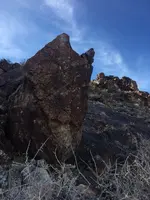
As far as reverse engineering, heh, is that kinda' like cheatin', lol.

So are you saying there is a known entrance, or you think this U shape is possibly it?
The shaft sign is a U, but the mine sign should be the squares, which there is more
than one, even if in shadows.
If the U has been poured, they used a very white material, which would've been plentiful
in a mine setting. San Bernardino Co., though not the actual mother load, is one of the
higher mineral bearing counties of "The Golden State", as well as the largest county...
I'm sticking with naturally occurring, just seen too much of it in that area & Big Bear,
all the way out to Needles, where I spotted a large club under a bush, walking down
from where I parked, going down to the Colorado R for some to do a summer swim.
Surely they wouldn't have broken 1 of their own cardinal rules, & give away exact spot,
just wouldn't be like them at all. That's why you have to be trained, to ever understand
the signs/markers, & follow the trail to even possibly get close to anythin' of substance.
Just curious, how is the U situated in relation to the cairn & possible known entrance?


