Greenapple,
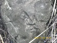
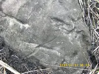
As what I have suspected, and based on your description about its location, I suspect that your rock is not originally "placed and done" in that river or creek. Let us assume for the moment that your rock is really a treasure marker, with that, we have to consider the following circumstances before doing anything or before starting a project:
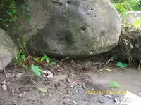
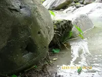
a. Since the stone is on the right side of a river,downstream and facing east, it is possible that this particular rock eroded from a higher place, in which as you have said, "farther upstream about 100meters are some very large rocks". This rock is probably part of the cluster of rocks 100 meters upstream few decades ago.
b. It is highly possible that this may be an end result of continous raging water, thus moving downward as the soil weathering is moving upward. It will happen as turbulent water underneath the rock eats up the supporting soil where it is rested. This situation is always prevalent in our country.
c. let us assume again that this "marker" was done 66 years ago, from that time to present, let us give an average of 5 tyhpoons a year (conservative estimate), multiply it by 66 years will give us 330 typhoons. If during 1 typhoon, this rock moves 1 foot from its original position, multiply it by 330 typhoons, it will give us approximately 100 meters distance from it present location. It is also possible that this rock came from higher ground.
d. Now the present location of this rock is at the creek or an area of free flowing body of water, thus, rock weathering is highly probable during the course of time, from its original place up to now.
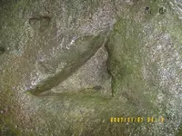
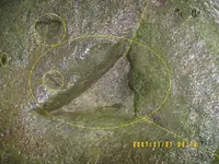
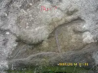
e. Although some of the cut looks like man made, say the triangle, one leg shows irregularity compared to other two legs. It may be an imbedded piece or rock, where in due course of time was washed out and leaves marking such as that.
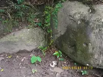
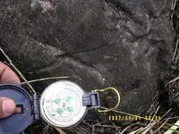
f. If it is indeed a manmade marker, you have to look for the complement marker; not on that particular place but on the higher ground.
Angel_09