The "Peralta" Stone Maps --- On Their Own

EE THr

Silver Member
Apr 21, 2008
3,979
38
Central California
The "Peralta" Stone Maps --- On Their Own

There are lots of theories about who might have made them, when they were made, where they were made, why they were made, and whether they were found or stolen.

But the only thing that is for certain, is that there are some stone maps, commonly refered to as "The Peralta Stones," and that, whatever they are, they do exist. That is the only thing, I think, that is absolutely known about them.

There seems to have been several copies made, at various times, by various people, as can be seen by the different photographs of them having stone colors, and stain colors and patterns, which are not the same.

And there are some photographs of them on a car belonging to Travis Tumlinson. These are supposedly the earliest images of them.

Beyond that, the only solid evidence is the Stones themselves. Everything else is just conjecture, and although some evidence of their origin seems very convincing, it's a mighty foggy subject.

And that is the reason for this topic title.

Do the maps, themselves, tell their own story?

It would help to have good, high resolution, photographs of the originals---but there are so many copies, how does one know which is which?
 

Re: The "Peralta" Stone Maps --- On Their Own

One question that I have wondered about for a long time, is why do the creeks on the Stones run in the wrong direction?

Some folks have, for different reasons, thought that these Stone Maps were designed by highly trained map makers, either by ariel observation or by precision surveying skills. But how can that be if they couldn't draw the creeks right?
 

Re: The "Peralta" Stone Maps --- On Their Own

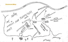
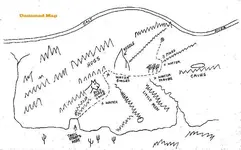
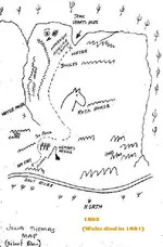
Another thing that I noticed, and mentioned in another thread, was the similarity between the symbol in the early map, below, which appears to be a copy of Julia Thomas map of 1892.

Unknown.jpg


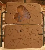
and the symbol on the Peralta Heart Stone, below.

Unknown.jpg


Although the copy is from "Unnamed," it would have had to have been made after Julia's original. And that raises the question---if it is a copy of Julia's, and if it is more than just a coincidence that the two symbols look the same, then, "Was the paper map copying the Heart Stone, or was the Heart Stone copying the paper map?---And why?

If the paper symbol is copying the Heart Stone, then that portion of the Stones, at least, was in someone's posession when the paper map was drawn, and not buried in the sand at Florence Junction. But if the Heart Stone symbol was copied from the paper map, then the Heart Stone (at least the one we all know of today) had to have been made after 1892.

Either way, it's either a million-to-one coincidence, or something ain't right!
 

Attachments

  • Heart Stone Needle.jpg
    Heart Stone Needle.jpg
    2.6 KB · Views: 7,780
Re: The "Peralta" Stone Maps --- On Their Own

And speaking of the "Needle" symbol, why is it put so far North, just below the Salt River, on the Heart Stone?

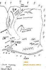
Julia Thomas - Robert Blair Map 1892.jpg


On the original (or so it says) Julia Thomas map, Weaver's Needle is represented far to the North also. Note that North is at the bottom of Julia's original map, as shown below.

Peralta Trail Maps with Heart.jpg


Julia has it labeled "Weavers Needle," and the "Unnamed" copy only says "Needle." But you can tell from the position of both needles, relative to the other landmarks on these two maps, that they are intended to represent the same needle.

With the symbol on the Heart Stone, appearing to be the same landmark as the one labeled "Weaver's Needle" on the Julia maps, and with all three showing it much further North, proportionally, than it should be, is that indicative that these three maps are somehow related?

Why else would these maps have these similarities?

:dontknow:
 

Attachments

  • Julia Thomas - Robert Blair Map 1892.jpg
    Julia Thomas - Robert Blair Map 1892.jpg
    61.6 KB · Views: 2,889
Re: The "Peralta" Stone Maps --- On Their Own

EE Thr - I do remember your earlier post about the similarities in the "needle" depiction on the map and the stones. I tucked that thought in the back of my mind and haven't really tried to process it in any way other than to remember it.

Personally I don't think it's just a coincidence - it's too unique of a shape to be just a chance occurance.

What does it mean? I haven't a clue.
 

Re: The "Peralta" Stone Maps --- On Their Own

Both the symbol on the heart insert and the "unknown source" map portray a very sharp needle-like peak.
The depiction,labelled "Weavers Needle" on Julia's map is rounded at the peak.
Assuming that Weavers was named as a "needle",rather than simply "mountain",it seems likely for "Weavers Needle" to have been a bit more pointy in the past.However,since the loss of such a sharply pointed and prominent summit is not mentioned in accounts of the Bavispe earthquake of 1887,or in any other documented accounts past or prior to that date that I am aware of,it could be that the pointed symbols refer to another peak.Some think Miners Needle a likely candidate.

Regards:SH.
 

Re: The "Peralta" Stone Maps --- On Their Own

And much closer to Queen Creek as well as many ruins,etc.
 

Re: The "Peralta" Stone Maps --- On Their Own

somehiker said:
And much closer to Queen Creek as well as many ruins,etc.


Do you think that Queen Creek might be what is at the top of the Stone Maps, rather than the Salt River?
 

Re: The "Peralta" Stone Maps --- On Their Own

Is it not possible that the pyramid shaped image on the stones was actually a pyramid structure that had its top blown off,lets say sometimes in the late 1700"s,to cover up that fact , and now may be under the Salt river,or even partially exposed,but as a flatter mounument. It makes sense that it would be near the water for many reasons,my opinon. A famous Jesuit priest was from Germany, and German fuse dated to the 1700:s was found I believe in the 20"s that dated to 1700 whatever. A pyramid is a very disctinct looking object, not a teepee,and not a needle.
Time now for beer and chilli.
 

Re: The "Peralta" Stone Maps --- On Their Own

Just checking in to see what is going on!
As you were...lol
Janiece
 

Re: The "Peralta" Stone Maps --- On Their Own

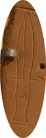
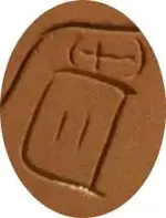
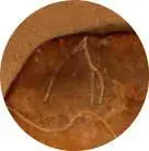
Speaking of various shapes on the Stone Maps, categorizing the markings might be interesting, especially since the "needle" previously mentioned seems to be only one of three actual drawings of objects on the "Trail Map" Stones. The other two being the dagger and the headstone-looking thingie.

Dagger.jpg Headstone.jpg Needle.jpg


The following seems to be categories of markings on the Trail Maps---

1. Drawings of objects or landmarks (as mentioned above).
2. Topo overlay markings (squiggly lines and trail).
3. Numbers and letters (possible code?).
4. Directional indicators (arrows).
5. Symbols (the trail dots, circles within circles, equal sign, hyphen or minus sign, the big bent "F," the cross and it's parenthesis-thingies above the headstone, the "Xs" if you consider they are not letters, the omega sign, and triangles of which one appears to be an arrowhead and the other has the diminishing-depth line coming out of a hole within it---which is another interesting pattern anomaly).
6. The holes, of various sizes and depths.

Of the first three objects depicted, the "needle" stands out as the only geological landmark which is an actual drawing of an object, rather than a topo overlay.

This uniqueness of the representation of the needle makes it stand out, as it doesn't fit with the pattern of any of the other markings.

The dagger and tombstone not being geological, but more symbolic depictions. The dagger seems to be strictly symbolic, while the grave marker appears to be symbolic by being merely a typical form of what it represents.

But the "needle" is a geological formation, yet it breaks the pattern of all the other geological representations, which are in a different form---that of topo map overlays.

Is there some reason that the designer of the Stone Maps would want to bring special attention to this "needle," by making it violate the other patterns of marking the Trail Maps?

:dontknow:
 

Re: The "Peralta" Stone Maps --- On Their Own

EE THr said:
somehiker said:
And much closer to Queen Creek as well as many ruins,etc.


Do you think that Queen Creek might be what is at the top of the Stone Maps, rather than the Salt River?

While I believe QC is shown on the maps,but not at the top.I do not believe that the Salt River is shown on any of the maps.
 

Re: The "Peralta" Stone Maps --- On Their Own

Somehiker---

What do you figure the wavey line at the top, with the "R" under it on the right, to be?
 

Re: The "Peralta" Stone Maps --- On Their Own

It looks a lot like I would sketch a profile view of a heart shaped mound of rubble.
The "dot" on the line is a clue,perhaps,if one thinks like a draftsman.

I have also seen something elsewhere that also appears to match,complete with a visible "R".
The overhang above has a similar profile to the wavy line.
 

Re: The "Peralta" Stone Maps --- On Their Own

Somehiker---

Well, something like that could be very convincing, especially with the "R" included.

I always thought it was the Salt River, especially with the other line on the bottom of the "lower" Stone, the one that looks very similar to the river that drops down and goes through Florence, and crosses highway 79 at Cemetary Road.

What do you think about the topo alignments on CJ's map?
 

Re: The "Peralta" Stone Maps --- On Their Own

Quite a few folks believe the lower line is the Gila River.Twin Buttes and the scrapings probably factor in that belief.

Joe has invested a lot of time on his topo theory.Others,as well,are convinced that the solution lies amongst the contours and elevations of the 1900 USGS Florence Quadrangle T-Map.I have my own theory,and view the Stone maps as being partly similar to the "Perfil" map and partly similar to the "Fish" map in concept ,though based on neither.

Regards:SH.
 

Re: The "Peralta" Stone Maps --- On Their Own

Burp, anyways, R could stand for {radians}meaning right angle 90degrees
which is square on the bottom,{ the base},the longest edge is called a "hypotenuse",it is the edge opposite the right angle. Possibly these stones were carved by a person with Masonic learnings,which means they can be de-coded by a person with the same teachings.Burp
 

Re: The "Peralta" Stone Maps --- On Their Own

Oldergoate wrote
Is it not possible that the pyramid shaped image on the stones was actually a pyramid structure that had its top blown off,lets say sometimes in the late 1700"s,to cover up that fact

Most, if not all pyramids in the Americas were built with flat tops, called a "truncated" pyramid. The flat top was used to build a temple on or a shrine, sacrificial furnishings etc and used a bit like a 'stage' so that large numbers of people would be able to watch the proceedings, which were commonly human sacrifice. So it could have had a flat top due to being built that way, instead of having a pointed top removed.
Oroblanco

:coffee2: :coffee: :coffee2:
 

Top Member Reactions

Users who are viewing this thread

Back
Top